Spaarndam - the eternal battle with the water
- Written by Portal Editor

Sure, Holland is a relatively flat country, with large parts of the land area even lying below sea level, that's what you learn in school.
It is also clear that this location repeatedly places special demands on the residents in terms of hydraulic engineering and coastal protection, which have had to be mastered for centuries. However, the absolutely flat country is almost a paradise for bicycles, our means of transport, because you don't have to face the hassle of having to face steep inclines again and again. Such an extended bike tour had also taken us to Spaarndam, a small village in the province of North Holland, about 18 kilometers from our location near Amsterdam, which is particularly related to hydraulic engineering, as it is surrounded by water without being an island .
Spaarndam and the dikes – also a traffic route
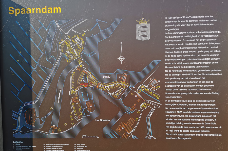
 The town of Spaarndam was initially built directly on the dyke that Count Florence V of Holland had built in 1285 at the confluence of the Spaarne and the IJ. Originally, the Spaarne formed a natural connection between the Haarlemmermeer and the IJ, then a bay of the Zuiderzee. After several storm surges in 1248, including the Allerkindleinsflut, the population built a dyke with sluices at the mouth of the Spaarne in the IJ. The Spaarndammerdijk was the most important drainage system of the water board Hoogheemraadschap van Rijnland, first mentioned in 1255. In the years that followed, the dike village of Spaarndam and other sluices and locks were built here.
 The IJdijk (IJ dike) was at times the only land connection between Haarlem and Amsterdam, also a road and trade route. We also used this dike crest as a road with our bikes. The residents of Spaarndam made their living from tolls and fishing. Between 1812 and 1927 Spaarndam was even an independent municipality.
Due to impoldering and the growing population in the outskirts, the town expanded significantly in the 19th and 20th centuries, especially in the east and south. Today, mainly commuters live in Spaarndam.
Cargo ships and a popular berth for houseboats.
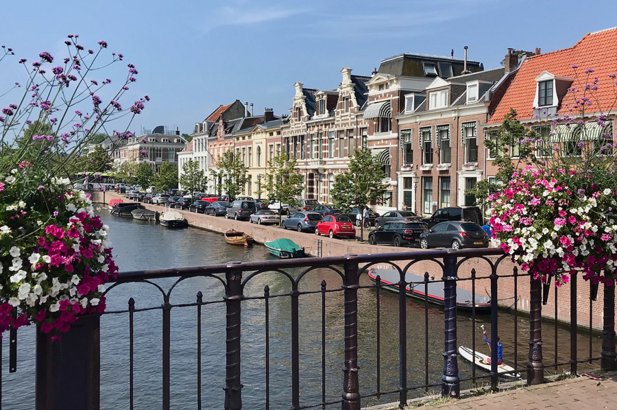
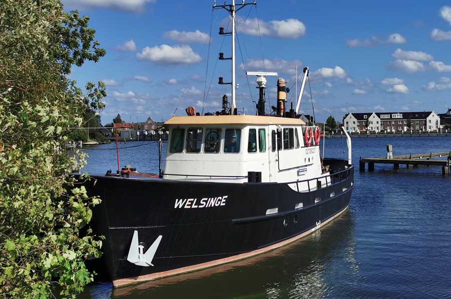 As a connection between the Ringvaart of the Haarlemmermeerpolder and the North Sea Canal, the Spaarne is still of great economic importance today. The northern section up to the centre of Haarlem can be reached via the North Sea Canal by ships in the Rhine ship category. In addition to cargo ships, the Spaarne is also used by numerous pleasure boats. The river is also a popular berth for houseboats, especially in the quieter, southern part.
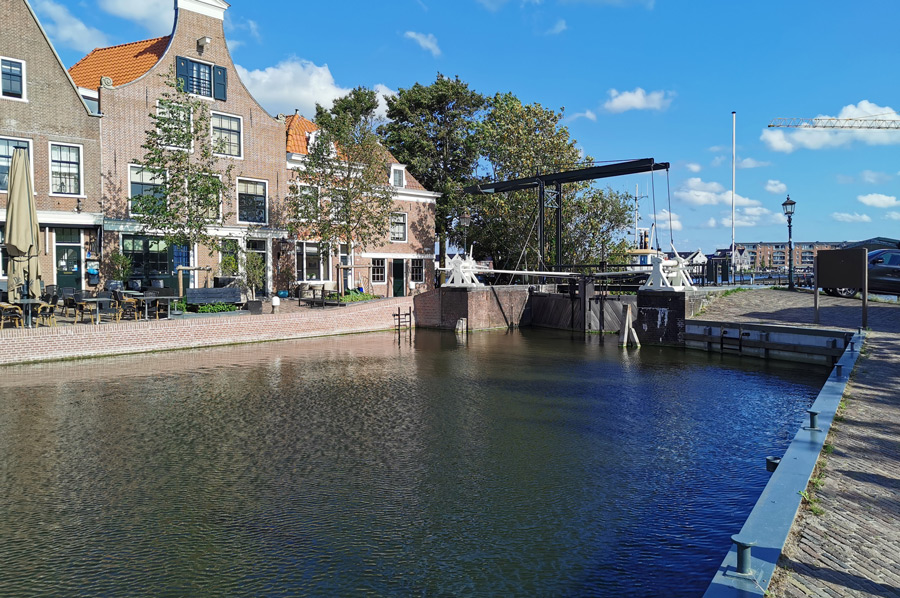
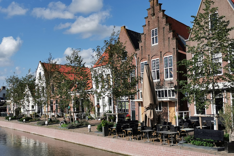
Surrounded on both sides by large areas of water, Spaarndam-West in particular shows a historic townscape worth seeing, which is one of the first protected urban cultural assets in the Netherlands, largely preserved in its original form. Here is u. a. the Old Church (Oude Kerk), rebuilt after a storm in 1627, the picturesque harbour de Westkolk, an old lock system and a traditional eel smokehouse.
 Outside the original village centre are two forts and other defences of the Amsterdam position. On the IJ dike, a still shows the character Hansje Brinker from American literature sealing a hole in the dike.
Erected by the Dutch Tourist Board, the statue symbolizes the long and arduous struggle of the Dutch people against the water.
Today, Spaarndam is a popular destination, especially for cyclists from the cities of Amsterdam and Harlem.
Pumping station creates a maximum water volume of 32 m³/s.
 In 1845 a modern steam pumping station went into operation in Spaarndam. In 1939 it was converted to diesel operation. The diesel engines installed during the renovation in 1990 with a power of 309 and 403 kilowatts each drive five chain pumps with a diameter of 5.70 and a length of 24 meters. The pumping station, which can be operated by just one person, delivers a maximum water volume of 32 m³/s. In the event of flooding, an additional 5 m³/s can be pumped out via an Archimedean screw.
After the drainage of the Haarlemmermeer, once the largest lake in the Netherlands (17,000 hectares), was completed in 1852, the amount of discharge and the depth of the Spaarne decreased significantly. In addition, after the completion of the North Sea Canal (1876), a large part of the water taken from the polder flowed off via side canal F, which was connected to the Ringvaart. After much pressure from the industrial companies based on the Spaarne, the municipality of Haarlem finally had the river bed dredged out to prevent the threat of silting up.
Please read as well: