Dağ Pazarı - Lebanon Cedars and basilica from Roman times
- Written by Portal Editor

We drove through the foothills of the Taurus over wonderful pass roads near Ermenek to the apricot town of Mut and then continued our way towards Karaman. Patrick, our paragliding friend from Strasbourg, had reported courageously about the ruins of a basilica and a wonderfully shimmering lake during a sightseeing flight in the region, which he had seen from the air near the town of Dağ Pazarı.
About 8 kilometres after leaving the town we left the district road and drove towards Dağ Pazarı higher and higher into the Taurus.
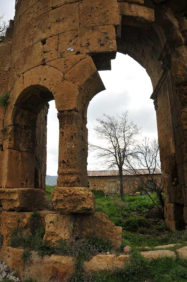
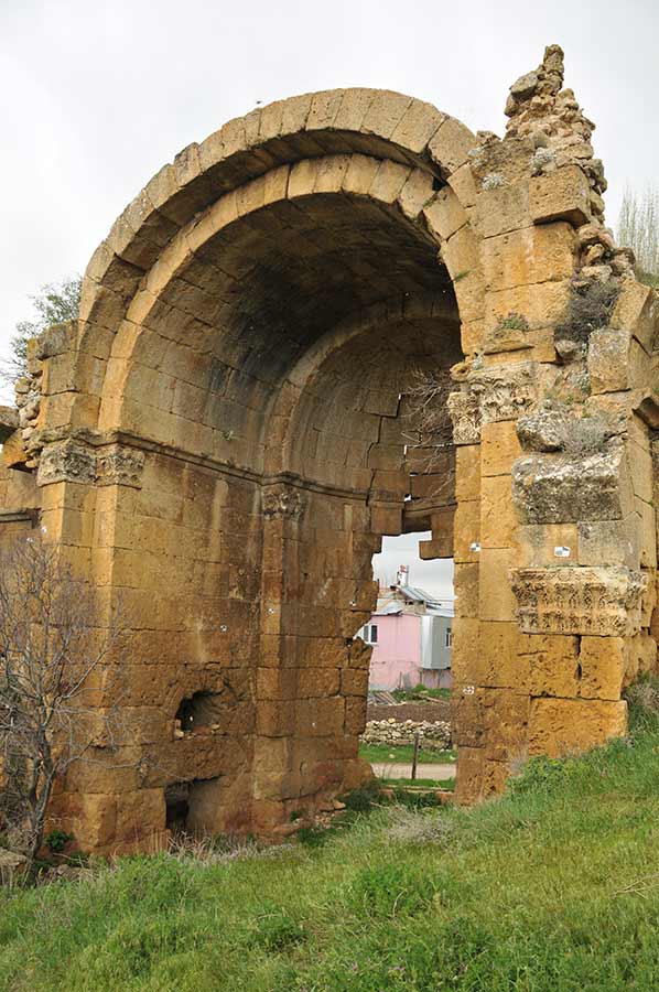
Ruins of the basilica from Roman times
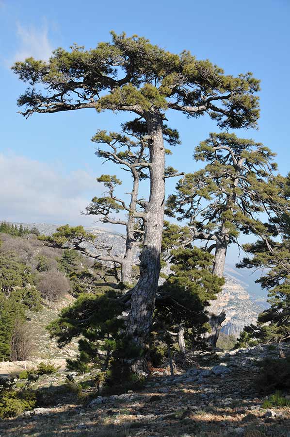
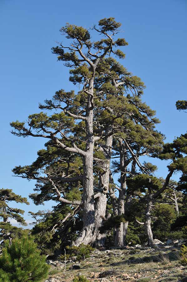 Following the road partly in narrow serpentines, it went through a wonderful forest landscape with an interesting population of trees, especially the Lebanon cedars, which were unusual to our eyes, attracted our full attention.
We finally reached the canyon where we thought the lake would be, but despite several stops and a few hikes, we weren't rewarded. The lake couldn't be found and without coordinates we were helpless. Nevertheless, we enjoyed the view into the canyon and looked at the Lebanon cedars, which are rarely found today, with great interest.
We then drove on to the village of Dağ Pazarı to look at the ruins of the basilica from Roman times, which Patrick had also reported about. The place itself is located at around 1400 meters above sea level, around 33 kilometres northeast of Mut and 48 kilometres southeast of Karaman.
Tabula Peutingeriana, also called Peutinger's table
 The "modern" town of Dağ Pazarı lies approximately on the site of an ancient city whose name was probably Koropissos.
In the Tabula Peutingeriana he is recorded as Coriopio on the road between Iconium and Seleucia on Kalykadnos. Its status as a polis is evident from an inscription from the time of Pertinax.
The Tabula Peutingeriana, also known as Peutinger's Table, is a cartographic representation that shows the Roman road network (viae publicae) in the late Roman Empire from the British Isles across the Mediterranean and the Middle East to India and Central Asia.
The road map is named after Konrad Peutinger (1465–1547) and is now a UNESCO world heritage site.
 The ancient place was protected on three sides by the sloping slopes towards the Kavak Gözü river, the north side was secured by a city wall, which, however, is hardly recognizable anymore.
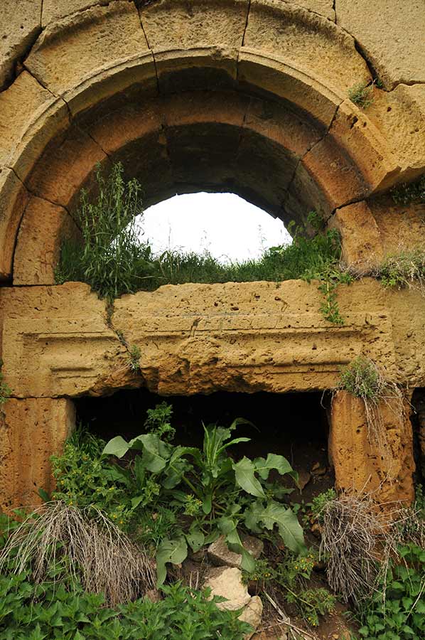
Remains of colonnaded streets, houses and cisterns can still be seen within the urban area.
During our tour of the village of Dağ Pazarı, in many houses we find segments of built-in columns and artifacts that were reused from Roman buildings here.
Similar to Mut, there is a lack of any investigation or research into the existing building structure to ensure its preservation. The residents of the village probably only saw the historically valuable buildings as a cost-effective supplier of building materials.
During its heyday it even served as the seat of a bishop
 During our tour we come across three church buildings that are still somewhat preserved: in front of the town there is a grave church extra muros, in the town there is an unfortunately poorly preserved three-aisled basilica with a baptistery, perhaps the episcopal church, as well as a still tall domed church with an ambulatory.
In late antiquity the place was the seat of a diocese.
Despite survey points still visible on the building to take inventory or just measure other buildings, the ruins of the basilica in the centre of the town were in a pitiful condition that can probably no longer be restored.
 Remains of an aqueduct that once brought fresh water to the city from the south can still be seen. After talking to villagers, we are also shown the sparse remains of a hippodrome, a horse racing track, which was built in the flatter terrain in the north of the city. Despite visiting ancient sites many times, you are always surprised at the places where you come across history. What might have once motivated the settlers to create a town here that, in its heyday, even served as the seat of a bishop.
Please read as well:
Khachapuri bread from clay oven - specialty from Georgia
Cream puffs at the Oker dam tasted delicious


https://www.alaturka.info/en/turkey-country/riviera/6349-dag-pazar-lebanon-cedars-and-basilica-from-roman-times#sigProId1ef2a30ecb