Canoe tour on the Oymapinar reservoir near Manavgat
- Written by Portal Editor

We had already made an appointment several times to meet with Ömer for a canoe tour on the Oymapinar reservoir, at the so-called "Green Canyon", but something always came up.
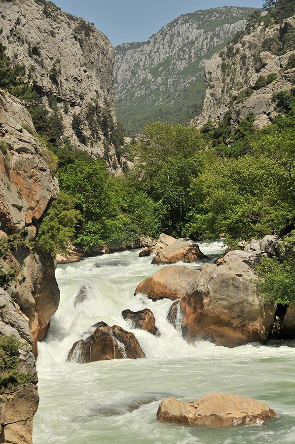
Last but not least, the weather simply didn't cooperate on some dates, because wind and rain are not good companions on the approximately 10-kilometre-long tour to the waterfalls at the confluence of the Manavgat River and the reservoir.
Water area that extends deep into the former valleys of the Taurus Mountains
 In general, spring on the Riviera this year was much cooler than usual, which we noticed during the course of the day in the water temperature near the influence of the Manavgat: only a few degrees above zero, one could speak of real ice water from the Taurus. But one after another.
Now finally the time had come and the date was set. Two other guests had come to take part and so we went up to the Oymapınar dam by jeep, canoe and our car. The concrete wall of the dam is a powerful, double-curved arch dam, i.e. H. the wall is curved horizontally and vertically. The arch dam has an impressive total height of 185.40 m. When entering the area about 3 km around the dam, you have to pay an entrance fee, but this is only mentioned in passing. For those interested, it should be noted that the Oymapinar reservoir is located about 80 km east of Antalya and 25 km inland from the coast. It is the largest dam in the region with a water surface of 470 hectares and a storage volume of 300 million m³ of water. A huge expanse of water that extends deep into the former valleys of the Taurus Mountains.
Provisions were stowed away and the camera was mounted
 A ferry and excursion service has also been set up on the reservoir for tourists from the hotel complexes on the beach, which takes you on a tour of the reservoir and into one of the canyons with a final meal in a restaurant on the lake. During our paddling tour in the canyon, however, these excursion boats were not very disruptive; the reservoir foothills are simply too large.
When we arrived at the pier, our canoe, which was kindly provided by Denk.com / Kanu-Klettern-Outdoor, had to be prepared for the premiere tour. Once "practiced" in the dry, inflating the three boat chambers and inserting the seat boards proved to be quick, so that all three canoes could be launched a short time later. Provisions were stowed away, the camera was mounted and off we went towards the canyon, first to what we named Bird Island, a breeding colony of terns that had discovered the Oymapinar reservoir. The differences between the two types of canoe quickly became clear: our inflatable canoe was much more sensitive to wind than the hard-shell boats, but you sat high and dry. As always, everything has its two sides.
At the end of the canyon we came across a small waterfall
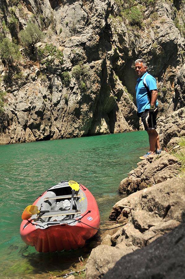 We swapped places in the boat at the "Bird Island" because both Seher and I were mostly busy taking photos and filming and therefore couldn't keep up with the others. So Seher joined Ömer in our rubber boat and Uwe joined us as “my” paddler on our hard-shell boat.
A good solution, as the photos should show later. Now things progressed much more quickly, the way was long because we really wanted to make it to the mouth of the river. A violent tour, as we discovered on the return journey in strong headwinds, not for beginners!
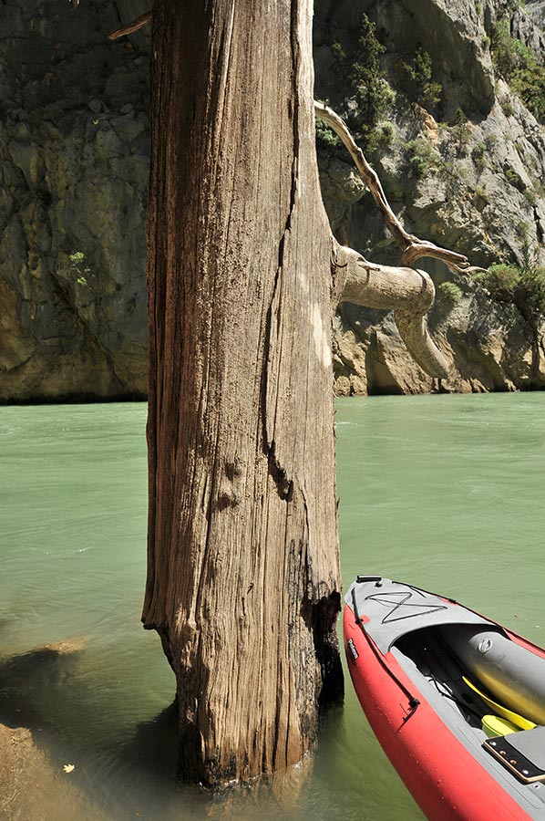
 If one can speak of a dam project as “natural,” then this choice of words was entirely accurate, at least when it came to the surrounding nature. Despite a number of dead trees that jutted far out of the water, creating a sometimes-spooky atmosphere, the banks were mostly green and covered in dense pine forest; in some places we could even make out a few cedars of Lebanon.
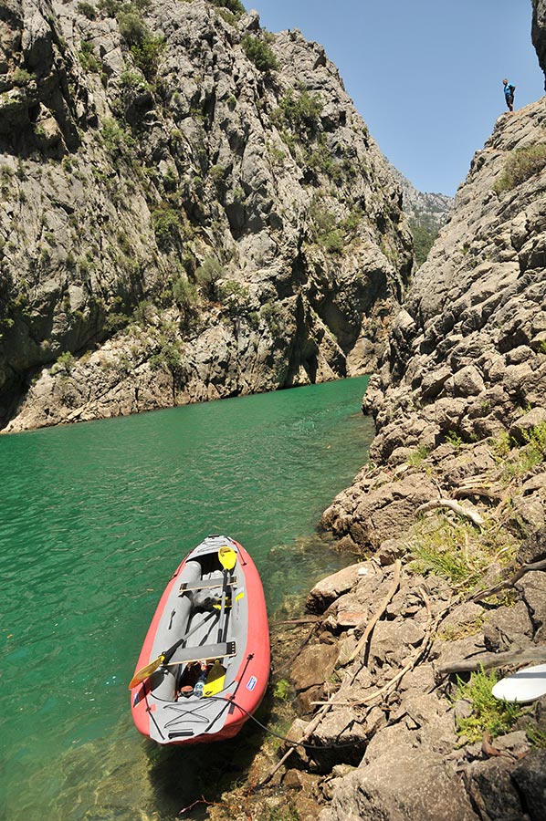
So our tour dragged on, sometimes there were bottlenecks, sometimes a steep slope that invited you to swim, sometimes there were rugged mountain overhangs and caves that invited you to explore. In short, the tour was extremely varied and we were always excited about the next flooded valley.
We swapped canoes back and forth several times, also to share mutual experiences.
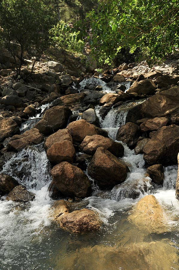 Almost at the end of the canyon we came across a small waterfall that tempted us to fill our water bottles. Delicious, really fresh spring water from the Taurus. We also used the break for a little refreshment, which involved leaving the canoes. It was an unforgettable moment and took a lot of effort to get into the really icy water. From here you could already hear the sound of the mighty Manavgat River pouring over the rocks into the reservoir.
A little later it turned out to be not easy to paddle against the strong current to the mouth of the river. We used the current shadow of a boulder in the water to get closer. No problem for our inflatable boat, a real problem for the hard-shell boats, which simply filled up too quickly and threatened to capsize. And that at a water temperature just above zero.
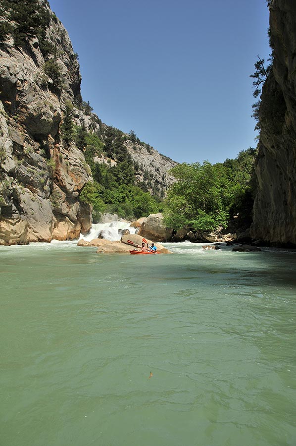 Better yet, take a few quick photos and go back. A look at the clock clearly showed that it was time to head back. With the sun now lower, it had become quite gusty and, how could it be otherwise, the wind was coming stubbornly from the front, with a surf that at least partially filled the hard-shell boat with water. It's unsinkable due to the swimming chambers, but who wants to sit up to their stomachs in water for kilometres? So “creating” was also the order of the day.
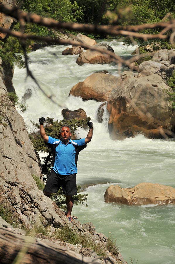
Our fight against wind and waves turned out to be a victory, albeit arduous and energy-sapping, and we reached our starting point safely shortly after the tunnel above the dam. Now it was time to stow the boats and go back to camp, where a delicious meal was waiting for us. We were exhausted but also happy that we had mastered this wonderful canyon by canoe.
Here are some more details about the Oymapinar reservoir:
 A total of around 676,000 m³ of concrete was used in the structure. The cavern power plant with four turbines, located in an underground cavern in the rock, has a maximum output of 540 MW. This is (still) around 3% of Turkey's total installed capacity.
The dam was built by the Turkish state and planned by the French engineering firm Coyne et Bellier from Paris. The main contractor was the company Bilfinger and Berger from Mannheim. Construction work on the dam was completed in February 1983.
Below the wall at the stilling basin there is a 40 m high so-called “baby dam”. This basin is used to calm the water from the bottom drain and the flood relief system. This is a double channel next to the wall, over which the water shoots spectacularly in an arc as it overflows.
Please read as well:
Cendere Köprüsü - the bridge over the Chabinas
Akseki - Silk Road invites you to go hiking


https://www.alaturka.info/en/turkey-country/riviera/6360-canoe-tour-on-the-oymapinar-reservoir-near-manavgat#sigProIdaf20956193