Breitach and Breitachklamm in Kleinwalsertal
- Written by Portal Editor

Similar to the day before, we were getting up again by the first daylight that penetrated the caravan through the skylight, as well as by the noise appearing from Breitach creek next to the campsite.
At the very end of the valley next to Baad, the waters of the various streams from the surrounding mountains are collected and then form the Breitach creek. Coming from Baad, the Breitach then flows down to Mittelberg and Riezlern, where other creeks such as Derrabach, Turabach, Bärgundbach, Gemstelbach and Wildenbach are added. The creek slowly turns into a river that has carved a deep canyon into the rock at the Walserschanz since thousands of years, the well-known Breitachklamm. The Breitachklamm was an important destination for us long before we arrived already.
Breitach - impressive valley shaped by water power
 The Breitachklamm was just formed during the last 10,000 years after the Würm Ice Age when glaciers had removed the soft rock and the hard rock remained. When the glaciers had melted, the Breitach had to drill a way of about 2.5 kilometers in length and about 150 meters deep through the hard rock through the course of thousands of years until it could arrive at the exit of the Kleinwalsertal near Tiefenbach in Allgäu. The Breitachklamm is - next to the Höllentalklamm - the deepest gorge in the Bavarian Alps.
We once again used the free Walserbus line 1 coming from Baad to the Walserschanz exit point to hike down into the gorge.
Already at the end of the 19th century there were several attempts to make the Breitachklamm accessible in order to develop a source of income for the predominantly poor local population.
 They all failed at first. The young pastor Johannes Schiebel from Tiefenbach then took the development of the gorge into his hands, looked for donors and founded the Breitachklammverein eG. He did this with the motivation to open up an additional source of income for his poor community and thus to stimulate the beginning of tourism. The first demolition was carried out on July 25, 1904 and about a year later, on July 4, 1905, the accessible Breitachklamm was inaugurated, which today attracts around 300,000 visitors a year.
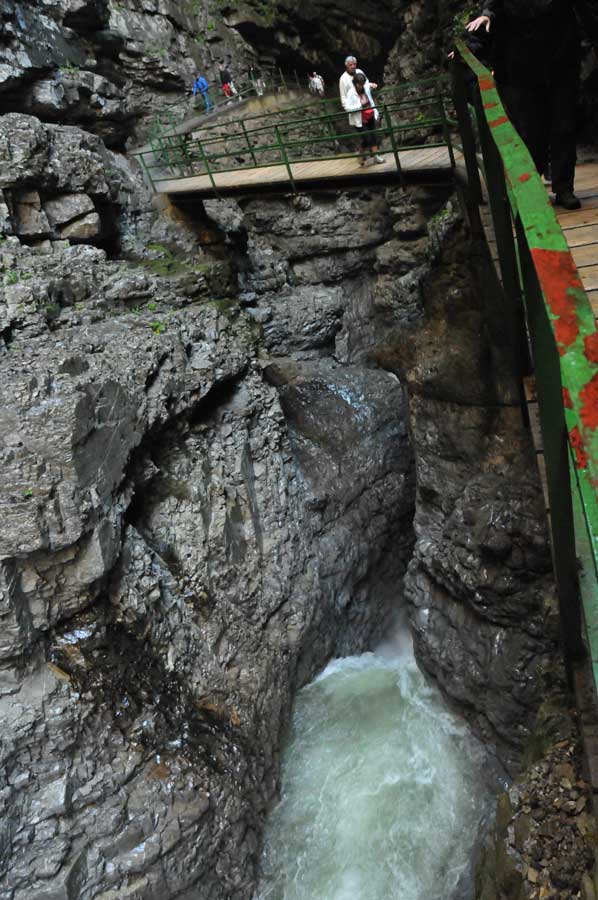
We use the hiking trail that leads down into the gorge next to the restaurant on the Walserschanz. The mighty rushing noise can be heard well before reaching the river, even when the water masses are much lower than at the time of the snowmelt.
Hiking trail leads into the gorge of Breitach
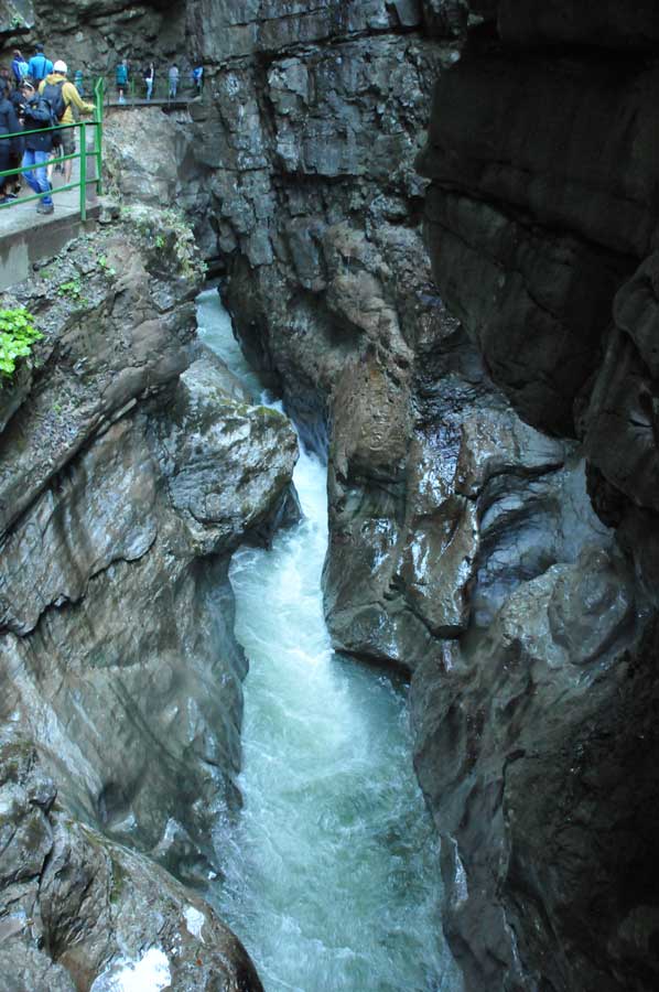
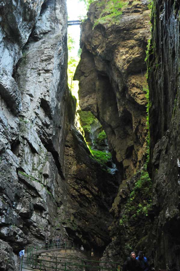 And then the bank in the gorge is reached. The rocks rise mightily on both banks. You go deeper and deeper into the gorge crossing footbridges along the rocks, some of which are really adventurous paths. Then again the narrow path has been directly carved out of the rock. Sometimes you are high above the river, then again right next to it.
Constant rushing and roaring of the water, eddies and holes into which the raging water threatens to disappear. Then again mighty dead wood that was washed down the raging river as flotsam until it becomes wedged somewhere. In between rockfalls that got caught high above the footbridge in the narrow gorge valley. An indescribable spectacle that nature has written here.
Rockfalls - dangerous event changed a lot
So there was a rock fall on September 23, 1995 at 6:00 am, as a result of which around 50,000 m³ of rock and rubble fell into the gorge. The then backing up water collected up to an amount of approx. 300.000 m³, which meant a water level in the gorge of approx. 30 m above the current water level. Unimaginable pressure must have built up by the time the water broke through this dam on March 23, 1996 at 11:30 a.m. The gorge was completely devastated by the falling water, which caused damage of around 300.000,- DM.
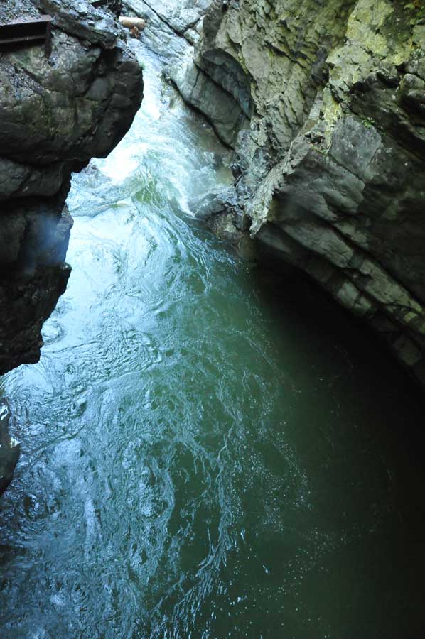 On the way we also come across a marker construction that shows some of the high water levels in the Breitachklamm. The force with which the water washes through the gorge is hard to imagine. If you then look at the tree trunks, some 10-20 meters long and 80 centimeters in diameter, wedged like huge arches, the energy output becomes clearer. It's just amazing what hydropower can do.
We also start the way back through the Klammtal, but then decide to follow the course of the Breitach back to the Kleinwalsertal. Here, too, footbridges are initially attached to the steeply rising rock faces until the valley widens. We use a flat part of the bank to take a short rest and refreshment break. Other hikers and some children have discovered this place on the bank and use the wonderfully clear water to play or to erect stone pillars, a leisure activity that we will find in many other places along the Breitach. An almost peculiar, new landscape is thus created on many gravel banks along the Breitach. Impressive small structures that sometimes show almost artistic ambitions and a variety of materials.
The upper entrance to the Breitachklamm near the Walserschanz has the following coordinates: 47 ° 23 ′ 13 ″ N, 10 ° 13 ′ 44 ″ E.
If you want to enter the gorge from below, use the access in the Oberstdorf district of Tiefenbach and the following coordinates: 47 ° 24 ′ 9 ″ N, 10 ° 13 ′ 44 ″ E
Please read as well:
Icy cold Brocken - hiking the Blocksberg
Danube Cycle Path - Vienna Region is one of the highlights
-
 Hiking the Breitachklamm at Walsertal
Hiking the Breitachklamm at Walsertal
Hiking the Breitachklamm at Walsertal
-
Hiking the Breitachklamm at Walsertal
Hiking the Breitachklamm at Walsertal
-
Hiking the Breitachklamm at Walsertal
Hiking the Breitachklamm at Walsertal
-
 Hiking the Breitachklamm at Walsertal
Hiking the Breitachklamm at Walsertal
Hiking the Breitachklamm at Walsertal
-
Hiking the Breitachklamm at Walsertal
Hiking the Breitachklamm at Walsertal
-
Hiking the Breitachklamm at Walsertal
Hiking the Breitachklamm at Walsertal
-
Hiking the Breitachklamm at Walsertal
Hiking the Breitachklamm at Walsertal
-
Hiking the Breitachklamm at Walsertal
Hiking the Breitachklamm at Walsertal
-
Hiking the Breitachklamm at Walsertal
Hiking the Breitachklamm at Walsertal
-
Hiking the Breitachklamm at Walsertal
Hiking the Breitachklamm at Walsertal
-
Hiking the Breitachklamm at Walsertal
Hiking the Breitachklamm at Walsertal
-
Hiking the Breitachklamm at Walsertal
Hiking the Breitachklamm at Walsertal
-
Hiking the Breitachklamm at Walsertal
Hiking the Breitachklamm at Walsertal
-
Hiking the Breitachklamm at Walsertal
Hiking the Breitachklamm at Walsertal
-
Hiking the Breitachklamm at Walsertal
Hiking the Breitachklamm at Walsertal
-
Hiking the Breitachklamm at Walsertal
Hiking the Breitachklamm at Walsertal
-
Hiking the Breitachklamm at Walsertal
Hiking the Breitachklamm at Walsertal
-
Hiking the Breitachklamm at Walsertal
Hiking the Breitachklamm at Walsertal
-
Hiking the Breitachklamm at Walsertal
Hiking the Breitachklamm at Walsertal
-
Hiking the Breitachklamm at Walsertal
Hiking the Breitachklamm at Walsertal
-
Hiking the Breitachklamm at Walsertal
Hiking the Breitachklamm at Walsertal


https://www.alaturka.info/en/austria/vorarlberg/5265-breitachklamm-and-kanzelwand-cable-car-in-kleinwalsertal?tmpl=component&print=1&layout=default#sigProIded4827110d