Sangerhausen waste dumps characterize the landscape
- Written by Portal Editor

Anyone who passes the motorway junction near Sangerhausen on the A 38 motorway in the direction of Berlin will be amazed at the huge rock cones in the landscape, which after many years of storage are only partially greened and can therefore still be recognized as "man-made".
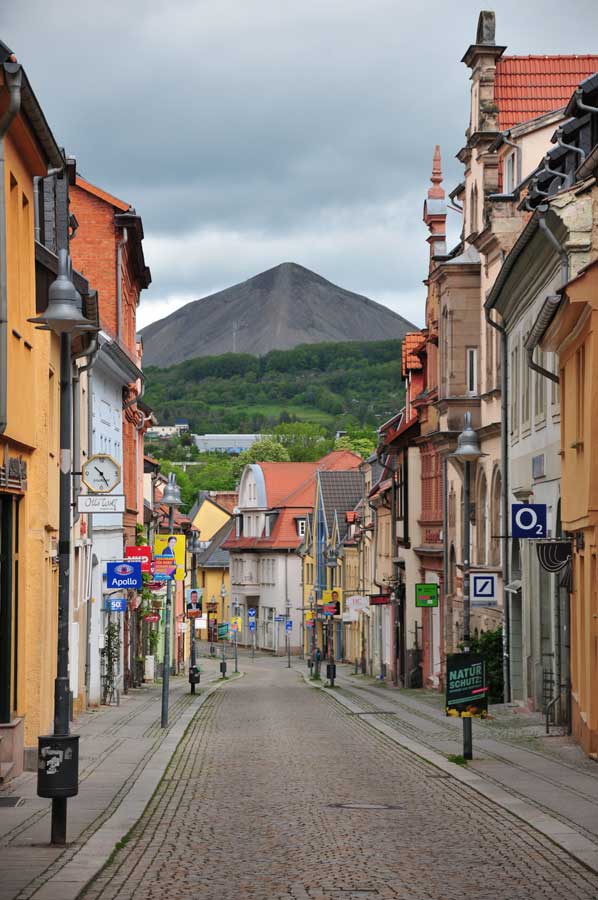
On our tour through the old town of Sangerhausen, these huge spoil heaps were even recognizable even from the inner city. These heaps are also a strong indication of the local mining past in the Sangerhausen region, where mainly copper was mined. Due to the fact that a copper slate seam came to the surface north of Sangerhausen, the mining of the raw material began very early already.
The town of Sangerhausen and its surrounding area have been shaped by mining for many centuries. Until the end of mining in 1990, Europe's largest mining area for copper was located here.
Museums and adventure worlds for copper mining
 Today you can go on a journey of discovery in numerous places and, like coal mining in the Ruhr area, immerse yourself in the world of mining - and not just in the Wettelrode mining museum. If you want to know more about the mining tradition of the region, you are in good hands on the mining educational trail. Located in a wonderful landscape, the hiking trail connects a number of testimonies to copper mining.
Starting from the Wettelrode mining museum, the nature trail, which divides into two circular routes, runs for a total of around four kilometers through the southern Harz old mining area. It combines evidence of copper mining from the 13th to the 20th century. These include pings up to ten meters deep, tunnels, heaps or an oval shaft opening with dry masonry.
More than 800 years of mining and the industrial exploitation of copper deposits in the 20th century have left a number of traces in Sangerhausen and the surrounding area, in addition to the evidence that can be seen from afar, which can sometimes not be seen at first glance.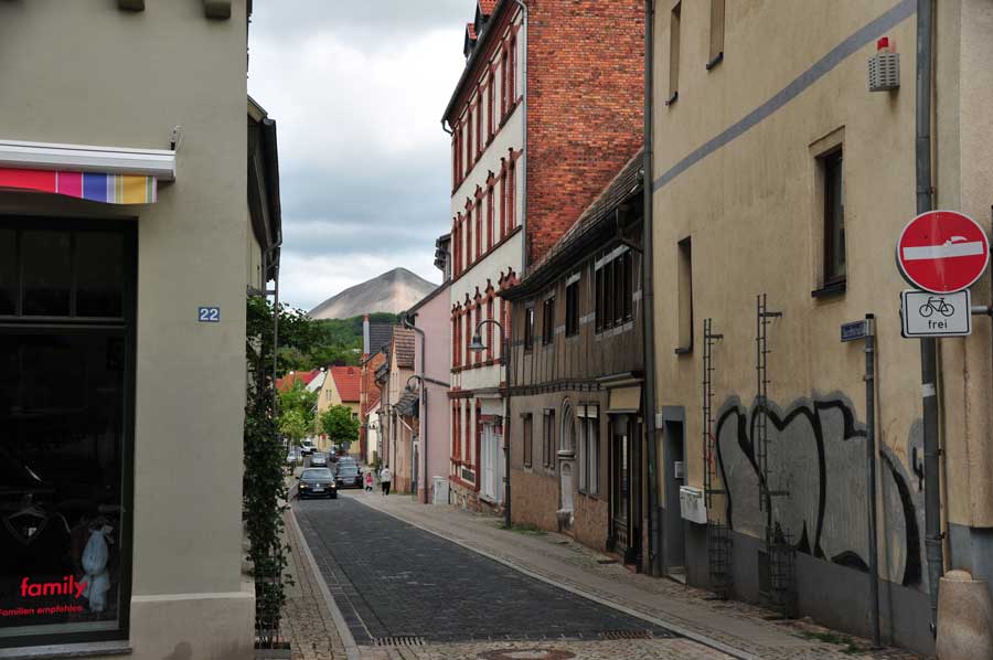 In mining, the term dump describes an artificially thrown up hill, which consists of the cleared, worthless material (deaf rock in mining terms) that arises from the mining of raw materials. Numerous such mining dumps are located in the Aachener Revier, in the Ruhr area and in the Saarland. The piles of copper slate mining can also be seen from afar in the Mansfelder Land. The white spoil heaps of the potash mining in Hesse, with the around 200 m high Monte Kali, are characteristic. In the flat lignite mining areas of the Rhineland, Lusatia and Central Germany, the spoil heaps of the opencast mines, also known as high tipping, are prominent elevations.
Many heaps reach considerable heights in some cases. Dumps that are not filled up green themselves over time. Others are specifically renatured in landscape planning measures.
On to the mining dump "Hohe Linde"
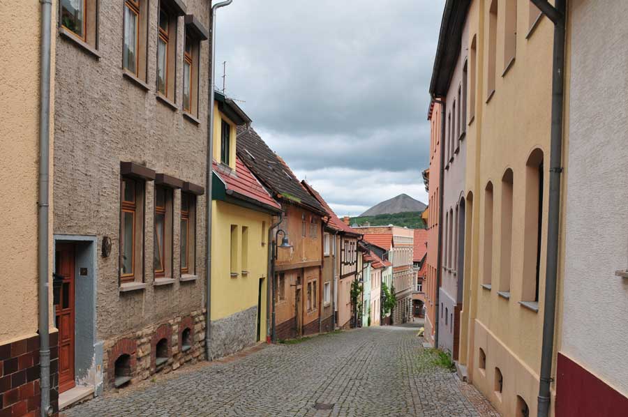 Sangerhausen's landmark, visible from afar, is the huge spoil dump on the “Hohen Linde”. At the Sangerhausen it is simply called Schachhalde. Located high above the city, more than 20 million tons of rock are stored here, piled up to form a mountain about 150 meters high.
The shaft dump is the only surviving evidence of industrial mining in the city of Sangerhausen, which began in 1944 with the depth of the Thomas-Müntzer shaft. By 1953 the shaft had reached its final depth of almost 700 meters. The overburden that was brought to the surface during the extraction of copper slate was initially deposited directly north of the mine site.
In 1956, due to lack of space, a specially built one kilometer long cable car was used to transport the rock mass over the Brühltal and Brühlberg to the “Hohen Linde”.
There the heap grew in height and width every day until mining was discontinued on August 10, 1990 and increasingly became the landmark of the town and region. Today the cone takes up an area of about 13 hectares and covers an area of the size of the Sangerhäuser Rosarium.
Since fossils that are millions of years old are often hidden in the so-called deaf rock, the dump is often the target of collectors who scramble over the scree at dizzying heights - although entry is not permitted for safety reasons.
Most hikers whose goal is the slag heap have something else in mind: the spectacular view from the top of the mountain cone, which is more than 400 meters above sea level. In good weather there is a view of more than 50 kilometers. A fantastic reward for the arduous and not entirely harmless ascent, which is also not officially allowed.
From time to time, however, a guided ascent of the heap is offered for those interested.
Other pointed cone heaps near Sangerhausen are located southeast of the city near Niederröblingen (10 km away) and Nienstedt (12 km away).
Please also read:
To the Europa-Rosarium in Sangershausen
Stolberg - the pearl of the southern Harz