Relaxing paddling on the Saale near Bad Kösen
- Written by Portal Editor

On our hikes along the Saale, we often noticed the paddlers, canoeists and boat tourists on the Saale, who particularly frequented the route from Saaleck Castle and the Rudelsburg near Bad Kösen to Freyburg, a type of leisure activity that we had wanted to do for a long time.
After all, we have had an inflatable canoe for many years, which is used far too seldom. It was finally time.
Ride on the Saale steamer to the Rudelsburg
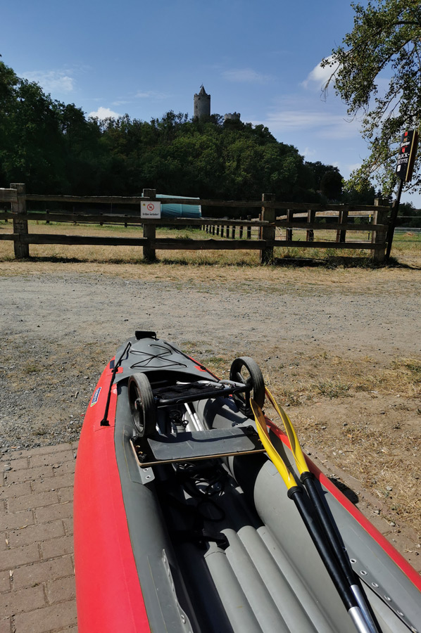 Still quite inexperienced in the local region with regard to the water routes, we chose the short route from Saaleck Castle to Bad Kösen to try out the Saale for the first time, because we wanted to use a parking lot in Bad Kösen to get there, then the ferry boat on this part of the Saale , and then use the pier below the Rudelsburg. The inflatable boat can be packed up small, but transporting it permanently over long distances in a backpack seemed too heavy to us. So we had converted a luggage trolley and used it for the rubber dinghy. This seemed to us to be a good plan for the first exploration of the Saale, and so did our experience on site. From the car park in Bad Kösen we first went to the ferry dock, then by ferry Saale up to the dock below the Rudelsburg. The canoe was set up quickly and the air blown in with a hand pump. Before leaving, one of the really delicious Thuringian sausages and off you go, first up the Saale towards Saaleck Castle.
The Saale – a brief description
 The Saale has its source in the Fichtelgebirge between Zell and Weißenstadt on the north-west slope of the Großer Waldstein. The official source of the Saale is 707 m above sea level. NN. A syenite plate with the inscription: "Source of the Saale, taken from the towns of Münchberg, Schwarzenbach, Hof, Weißenfels, Halle 1869" is attached to the former mouth of a mine tunnel, which is faced with raw granite blocks. The entire area is now a protected natural monument. The source of the Saale is also the starting point of the 427 km long Saale cycle path, which we have already explored to a large extent
Between Zell and Hof, on the Münchberg plateau, the Saale flows relatively slowly. Between the confluence of the Tannbach and the Selbitz, it forms the border between Bavaria and Thuringia, formerly part of the "Iron Curtain". The river then runs across the Thuringian Slate Mountains. The Saale is dammed up there several times, the largest reservoirs in a five-stage cascade are the Hohenwarte and Bleiloch reservoirs.
The area of the middle Saale begins at Kaulsdorf-Weischwitz with the exit of the river from the Thuringian Slate Mountains and the breakthrough through the edge plates of the Thuringian Basin. The river touches there, among others, Saalfeld/Saale, Rudolstadt and Jena. Near Naumburg, the Saale joins the Unstrut, which at 192 km is the second longest tributary of the Saale and is already planned as the next route for a more extensive canoe trip.
 After exiting the Saale-Unstrut-Triasland Nature Park in Weißenfels, the lower reaches of the Saale begin in a flat landscape through the towns of Weißenfels, Bad Dürrenberg, Merseburg and Halle (Saale).
In the Old Pleistocene, the Saale flowed from Naumburg in the direction of Zwenkau, divided at Lützen into the Leipzig and Schkeuditz-Lützener Saale arms and took in the White Elster south of Zwenkau. It merged with the Mulde north of Leipzig, but by the beginning of the Elster glacial period in the middle Pleistocene it had no longer reached the Leipzig area. Since then, it has flowed north over today's Weißenfels, while its former riverbed is used by the Weißen Elster (Leipziger Saale arm).
South of Halle is the ecologically valuable Saale-Elster-Aue, in Halle's urban area there are several islands (we have already reported on this) and rocks on the shore (Klausberge, Kröllwitzer Felsen with the Saale breakthrough) and the Giebichenstein with the castle ruins. Below Halle, the Saale passes the steep banks of the Brachwitz Alps, Wettin and the Rothenburg sandstone rocks from the Upper Carboniferous and Bernburg (Saale), until it flows into the Elbe at Barby.
Special impressions during the boat tour
 With its often towering slopes, the Saale flows, among other things, at the labyrinth ruins at Burgk Castle, at Heidecksburg near Rudolstadt, the Leuchtenburg in Seitenroda, the Kunitzburg (to Jena), the Dornburg Castles, Saaleck Castle, the Rudelsburg near Bad Kösen, Schönburg Castle, Goseck Castle, Neu-Augustusburg Castle in Weißenfels, Giebichenstein Castle at the Saale breakthrough in Halle (Saale) and Bernburg Castle.
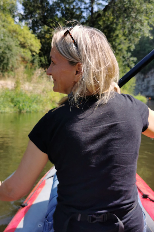
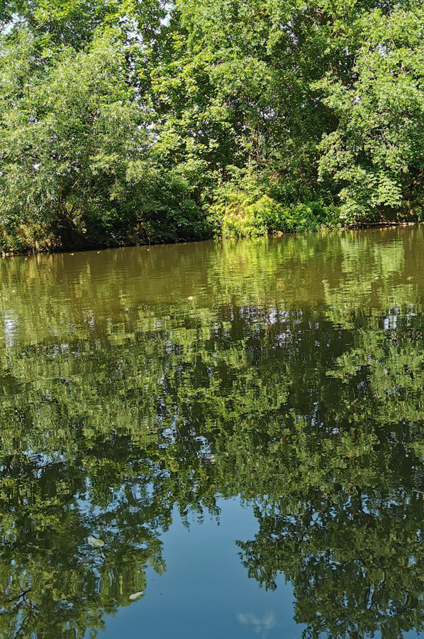
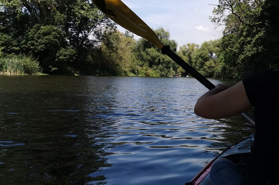
On the way back, below the mighty Rudelsburg, we were also very impressed by the towering rock face directly on the shore, and we were really enthusiastic about the still so natural shore world with its birds and insects. We were particularly taken with a dragonfly that was traveling with us because its wings seemed to glitter in the sun. A gray heron also accompanied us part of the way, so that we sometimes let ourselves drift silently. No paddle stroke should disturb the peace.
Shortly before Bad Kösen we passed the passenger ferry, which brings tourists across the Saale by rope. An unexpected attraction for "almost" every tourist. Shortly before the stone bridge we had reached the day's destination at the exit in Bad Kösen, after all we had spent a tour of two and a half hours on the Saale. Other paddlers continued their tour from here to Freyburg or Naumburg, where they were already expected.
A recommended tour on the Saale.
Please read as well:
The Saale Bridge in Bad Kösen - not just a monument?
Another hike - this time to Saaleck Castle
-
 Relaxing paddeling on Saale River at Bad Kösen
Relaxing paddeling on Saale River at Bad Kösen
Relaxing paddeling on Saale River at Bad Kösen
-
Relaxing paddeling on Saale River at Bad Kösen
Relaxing paddeling on Saale River at Bad Kösen
-
Relaxing paddeling on Saale River at Bad Kösen
Relaxing paddeling on Saale River at Bad Kösen
-
Relaxing paddeling on Saale River at Bad Kösen
Relaxing paddeling on Saale River at Bad Kösen
-
Relaxing paddeling on Saale River at Bad Kösen
Relaxing paddeling on Saale River at Bad Kösen
-
Relaxing paddeling on Saale River at Bad Kösen
Relaxing paddeling on Saale River at Bad Kösen
-
Relaxing paddeling on Saale River at Bad Kösen
Relaxing paddeling on Saale River at Bad Kösen
-
Relaxing paddeling on Saale River at Bad Kösen
Relaxing paddeling on Saale River at Bad Kösen
-
Relaxing paddeling on Saale River at Bad Kösen
Relaxing paddeling on Saale River at Bad Kösen


https://www.alaturka.info/en/germany/saxony-anhalt/5751-relaxing-paddling-on-the-saale-near-bad-koesen?tmpl=component&print=1&layout=default#sigProId9c4e30a3f4