Long-distance hiking trail Rennsteig - follow Kammweg
- Written by Portal Editor

"Rennsteig" hiking trail in the Thuringian Forest, which is now marked with a distinctive "R", has been used for many centuries by people with a wide variety of interests, whose motives could hardly be more different.
There were Celts, Thuringians, Franks and many other soldiers who marched along this path with their warlike intentions, as well as merchants, doll makers, horse herdsmen or wood carvers in the same way for economic reasons. Of course, a thirst for adventure, curiosity and love also introduced themselves to the magnificent nature along the path, and a large number of painters, poets and tourists were also drawn to the Rennsteig.
Rough route Kammweg through the Thuringian Forest
 The Rennsteig not only runs over the ridge of the Thuringian Forest, but also over the ridge of the neighboring Thuringian Slate Mountains and into the Franconian Forest in the north. It leads past the middle reaches of the Werra and the upper reaches of the Saale. A hike over the Rennsteig shows the past of the area and lets almost every hiker experience scenes of exciting historical events and magnificent monuments that are rarely found.
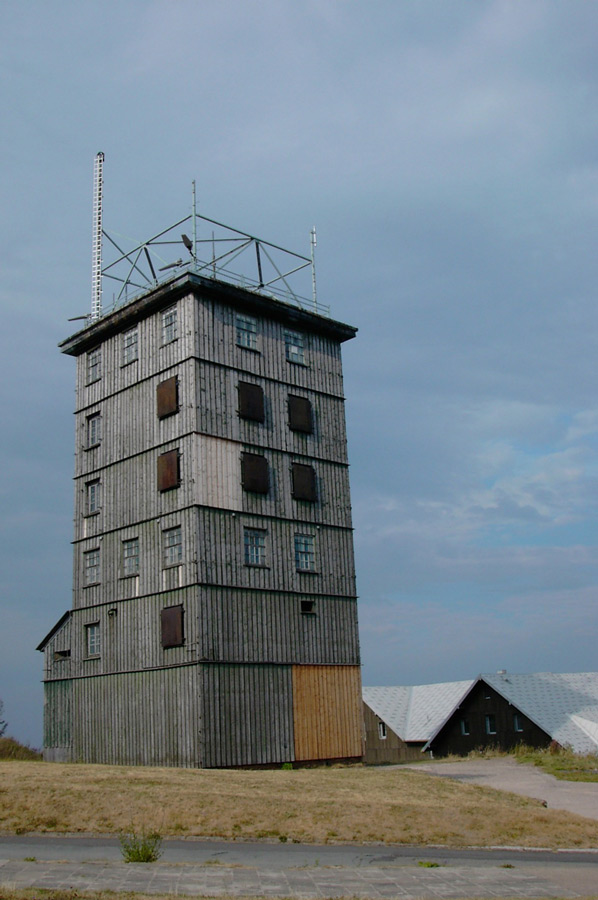
During a hike along the Rennsteig, you will be reminded that this hiking trail, with its many markers, also bears witness to German history. One notices with every step that it is one of the rare hiking trails, varied and almost untouched, with its paths dug deep into the rocks, with its climbs difficult and steep, with its position in silent forests, with its short detours on a few kilometers of asphalt roads and with its green and shapely hills that adorn the slate mountains. During a multi-stage hike through the landscape of the Rennsteig long-distance hiking trail, you should never forget that the Rennsteig is above all a hiking trail that allows hikers to rediscover things that are still unknown or have been forgotten for a long time forests, can be found again.
Whether you hike it from Hörschel to Blankenstein or vice versa... Whether in 4, 6 or 8 stages... Whether with or without luggage on your back... One thing is certain: once in a lifetime it has to be the Rennsteig, because Rennsteig hiking is - of course... iconic!
Rennsteig: Leisurely hiking with wonderful views
 The Rennsteig is a cult and a myth at the same time. If you decide to actively experience the Rennsteig by hiking, you can expect a beautiful mixture of mixed and coniferous forests, blooming mountain meadows and unmistakable views.
From a historical point of view, the Rennsteig originally connected important towns and places with each other - especially for the hasty messengers of the past. Nowadays, the ridge path wants to be experienced intensively and rewards its hikers with a wealth of picturesque impressions: Forest-crowned heights and deep valleys, magnificent views of villages, castles and palaces and much more. In order to hike the entire ridge path, you have to plan around 44 hours of pure hiking time, which means in any case a multi-day tour.
Great views are often about 200-500m away from the Rennsteig. Pay attention to the signs and hike a bit away from the Rennsteig from time to time - you will be amazed.
1st stage: From Hörschel to Hohe Sonne
2nd stage: From the Hohe Sonne to the Grenzwiese
3rd stage: From the Grenzwiese to the Grenzadler
4th stage: From Grenzadler to Allzunah
5th stage: From Allzunah to Friedrichshöhe
6th stage: From Friedrichshöhe to Spechtsbrunn
7th stage: From Spechtsbrunn to Brennersgrün
8th stage: From Brennersgrün to Blankenstein
We briefly present three stages here so that you can gain an insight:
1st stage: From Hörschel to Hohe Sonne (14.3 km)
 The Runst (a Runst is simply a Rennsteig hike) begins in Hörschel, a small district west of the city of Eisenach. Hörschel is the oldest place directly on the Rennsteig and, together with the banks of the Werra, forms the historic beginning of the Rennsteig. Please don't forget to take a stone from the Werra, which you hand over to the Selbitz in Blankenstein at the end of the Rennsteig hike.
The first stage leads through varied forests, over mountain meadows and fields steadily uphill. On the Großer Eichelberg (310 m above sea level) there is a beautiful view of the Wartburg for the first time. You pass the town of Clausberg and reach the Vachaer Stein, a historic signpost on the Via Regia Leipzig-Eisenach-Frankfurt. The pass crossing at Vachaer Stein was one of the most important historical passes in the Thuringian Forest, along with the Kalten Küche near Spechtsbrunn. Among other things, it was used by Napoleon in 1813 during his retreat from the Battle of Leipzig.
The first stage ends at the Hohe Sonne at an altitude of 434 m above sea level. NN. A sun on the tower of the former hunting lodge of Duke Ernst August of Saxe-Weimar-Eisenach (1743-1747) gave this spot its name. It is the starting point for other beautiful hikes in the neighboring region, such as the Drachenschlucht and has good public transport connections to the city of Eisenach and Bad Salzungen.
2nd stage: From the Hohe Sonne to the Grenzwiese (19.6 km)
 The 19.6 km long section leads steadily uphill from the Hohe Sonne. With a steep ascent from 434 m above sea level to 916 m above sea level and a descent to 727 m above sea level, it has a demanding profile and the greatest differences in altitude.
On this stage you will find places to rest at the Ruhlaer Häuschen, at the Auerhahn and at the Große Meilerstätte, at the Dreiherrenstein or the Brotteroder Hütte.
At the Großer Inselsberg, the Rennsteig reaches 916 m above sea level. NN a climax. The name of the prominent mountain is probably derived from the nearby Emse (1330 "Emmseberg", 1378 "Enseberg", 1505 "Enselberg", 1528 "Inselsberg"). As a border path, the Rennsteig once divided the mountain into Gotha and Hessian areas, as evidenced by the two restaurants.
Because of its view and good accessibility, the Große Inselsberg is the most frequently visited peak in the Thuringian Forest. The name "Grenzwiese" for the saddle at the end of this tour also points to an epoch in Thuringia's history characterized by small states.
Stage 3: From Grenzwiese to Grenzadler (27.8 km)
 The 27.8 km long stage runs at altitudes of 700 to 876 m above sea level. Immediately after the Grenzwiese it goes uphill to the Trockenberg (807 m above sea level) and Jagdberg (806 m above sea level). At the Possenröder Kreuz, benches and a shelter invite you to take a break.
At kilometer 44.1 you will reach the Ebertswiese. This meadow (1143 Eberhardsbruggen) was named after Eberhard, the first abbot of Georgenthal. As one of the most beautiful mountain meadows in the Thuringian Forest, it is home to a diverse flora of mat grass lawns, fresh mountain meadows and perennial and spring meadows with numerous beautiful meadow flowers. Old roads also covered the mountain ridge at the Ebertswiese and connected, among other things, the commercial metropolises and trade fair cities of Frankfurt, Nuremberg, Erfurt and Leipzig.
The milestone is the border eagle. Since 1866, when the district of Schmalkalden became Prussian and a main road crossed the Prussian border here, the border stone with an eagle marked this spot and gave it its name.
For sports enthusiasts, a short detour down the valley to the ski jumps on the Rennsteig in Kanzlersgrund is worthwhile.
Please also read:
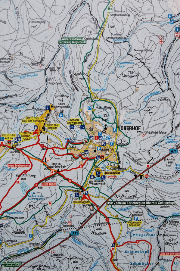
On the Rennsteig long-distance hiking trail near Oberhof
Mountain village Vevčani - rural half-timbering and ecology
-
 Long distance hiking route "Rennsteig"
Long distance hiking route "Rennsteig"
Long distance hiking route "Rennsteig"
-
Long distance hiking route "Rennsteig"
Long distance hiking route "Rennsteig"
-
Long distance hiking route "Rennsteig"
Long distance hiking route "Rennsteig"
-
Long distance hiking route "Rennsteig"
Long distance hiking route "Rennsteig"
-
Long distance hiking route "Rennsteig"
Long distance hiking route "Rennsteig"
-
Long distance hiking route "Rennsteig"
Long distance hiking route "Rennsteig"
-
Long distance hiking route "Rennsteig"
Long distance hiking route "Rennsteig"
-
Long distance hiking route "Rennsteig"
Long distance hiking route "Rennsteig"
-
Long distance hiking route "Rennsteig"
Long distance hiking route "Rennsteig"


https://www.alaturka.info/en/hiking-tours/5682-long-distance-hiking-trail-rennsteig-we-follow-the-kammweg?tmpl=component&print=1&layout=default#sigProId97d273945e