Aquileia - Roman trading town with ancient port
- Written by Portal Editor

We first got to know Aquileia in its current size as a small, provincial town far away from the sea and were accordingly amazed when during our tour we learned how important this town was, especially because of its commercial port.
Founded by around 3,000 retired soldiers a few kilometers from the sea in 181 BC, there were connections to the sea through the Natissa River, which was mighty at the time, now Natisone-Torre, and some man-made canals. A brisk trade in goods and "goods trade" quickly developed, also due to the convenient location in terms of traffic.
Transport goods of the time - slaves, livestock and wine
 Transported from the hinterland to the coast, slaves, livestock and animal hides, which were offered for sale or trade in imported products, arrived here. Olive oils, wines and various luxury goods reached the port city of Aquileia by sea. This trade with the most diverse Roman provinces brought rapid wealth and with it the rise to a powerful trading metropolis, whose port structure was one of the most modern of the time.
There were pier systems at different heights, with the help of which one could react to the different water levels of the river, there were warehouses as well as the direct connection to the Roman road system. In general, the entire urban planning was already typically "Roman", two intersecting main axes, to which the street grid of the city was then subordinated. The site plan shows the system clearly.
Decumanus maximus - main axis of orientation
 In the Roman land surveying (a basis for most new city foundations as well as for the construction of army camps) of the gromatic practice, a decumanus maximus (DM), a main axis of orientation, was laid out, which was not always based on astronomical, but also on topographical aspects. Usually the decumanus was laid out where the greatest possible expansion of a city was possible, or where there was already an existing street. The axis orthogonal to this was the cardo maximus (CM).
These two main streets were used as a guide when new cities were built. With the surveying device called groma, a coordinate system was created that served as the basis for the other streets and parcels of the city to be created. The decumanus maximus was laid out 40 Roman feet (12 meters) wide. That always corresponded to twice the width of the cardo maximus.
Technical Engineering in Roman Times
 In the interplay of the port facility and road connections, the cornerstone of the success of the port city of Aquileia lay on the 48-meter-wide Natissa River, which also made it possible to build ships in integrated dock facilities. The pier systems, which were almost entirely made of sandstone blocks, still testify to the quality of the craftsmanship of the stonemasons.
Partly connected to one another by metal brackets, the blocks also have fastening options for berthing ships, so that quick loading and unloading was possible. The picture also clearly shows the groove system in the sandstone blocks, which provided additional stability in the pier system. Due to the difference in height between the two pier systems, which is around two meters, the lower pier could also serve as a quay for unloading and transporting the goods at low tide.
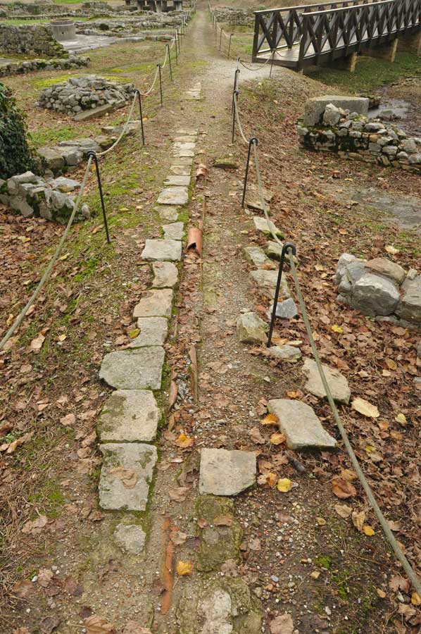
Aquileia called "Decumano di Aratria Galla"
 The main axis, here in Aquileia called "Decumano di Aratria Galla", was brought up to the port for the rapid removal of the goods. The continuation of this main axis has also been exposed in part not far from the information center on the ancient city, so that one can see a real piece of Roman road here. In general, one should take the necessary time to see all the artefacts in context when visiting the small town Aquileia, so that the former importance of the city can be taken into account. There are countless other details that make the visit very worthwhile.
The slow "fall" of the city took place, despite many warlike attacks by peoples from the north and east, more naturally through silting up, as often happens on rivers. This fact is also easy to understand if you look at the current width of the once mighty Natissa River.
Please read as well:
Camper Club Staranzano - alternative to the campsites
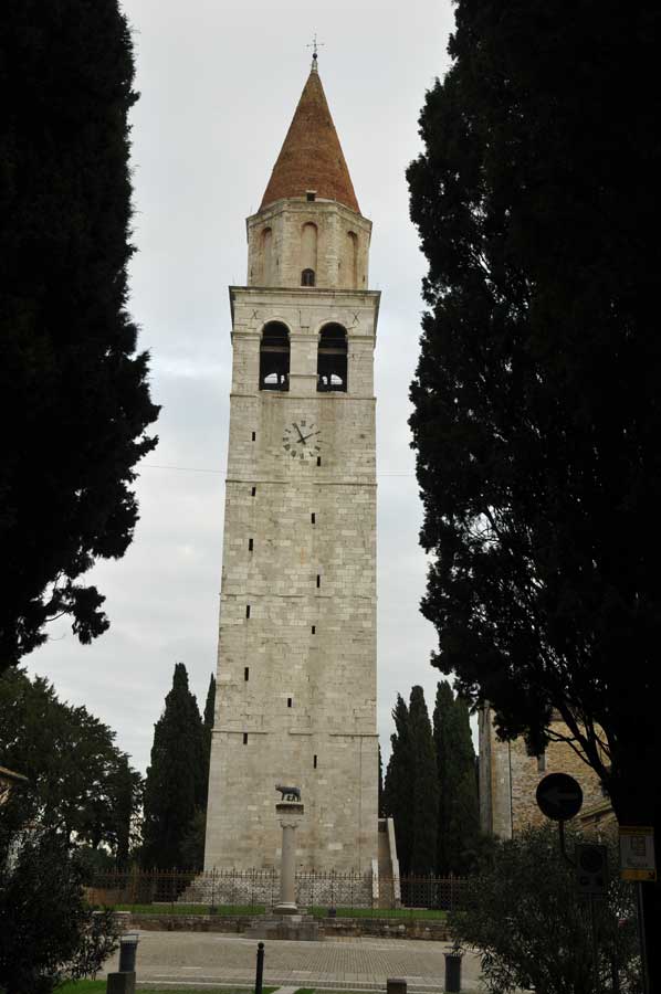
Carillon in the bell tower of Aquileia
-
 Roman harbour of ancient Aquileia
Roman harbour of ancient Aquileia
Roman harbour of ancient Aquileia
-
Roman harbour of ancient Aquileia
Roman harbour of ancient Aquileia
-
Roman harbour of ancient Aquileia
Roman harbour of ancient Aquileia
-
 Roman harbour of ancient Aquileia
Roman harbour of ancient Aquileia
Roman harbour of ancient Aquileia
-
Roman harbour of ancient Aquileia
Roman harbour of ancient Aquileia
-
Roman harbour of ancient Aquileia
Roman harbour of ancient Aquileia
-
Roman harbour of ancient Aquileia
Roman harbour of ancient Aquileia
-
Roman harbour of ancient Aquileia
Roman harbour of ancient Aquileia
-
Roman harbour of ancient Aquileia
Roman harbour of ancient Aquileia
-
Roman harbour of ancient Aquileia
Roman harbour of ancient Aquileia
-
Roman harbour of ancient Aquileia
Roman harbour of ancient Aquileia
-
Roman harbour of ancient Aquileia
Roman harbour of ancient Aquileia
-
Roman harbour of ancient Aquileia
Roman harbour of ancient Aquileia
-
Roman harbour of ancient Aquileia
Roman harbour of ancient Aquileia
-
Roman harbour of ancient Aquileia
Roman harbour of ancient Aquileia


https://www.alaturka.info/en/italy/trieste/5278-aquileia-roman-trading-town-with-ancient-port?tmpl=component&print=1&layout=default#sigProId937ea78380