")
")
")
Current cultural events are published on these pages. If you would also like to see your events, concerts or exhibitions regularly presented here with pictures and dates, please contact us at: This email address is being protected from spambots. You need JavaScript enabled to view it.
Although Pliny the Elder did not yet coin the word “culture” (cultura) as a term, he did distinguish between terrenus (belonging to the earth) and facticius (artificially produced things).
Cicero characterizes philosophy as cultura animi, that is, as the cultivation of the spirit. In addition to culture as material culture in Pliny, there is also culture as a processing of one's own personality.
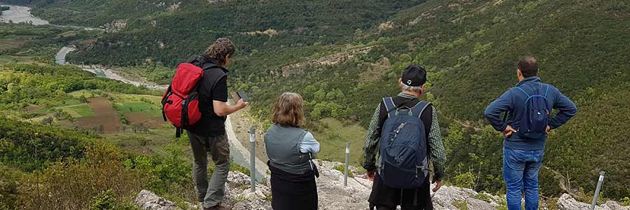
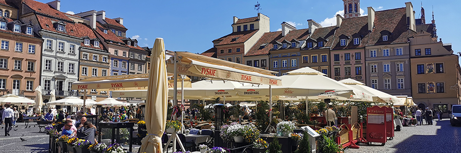
 Sometimes just local heritage is not enough to attract travelers who want to help develop local tourism. As part of our project, we develop programs that focus on the smooth growth and spread the concept of sustainable tourism.
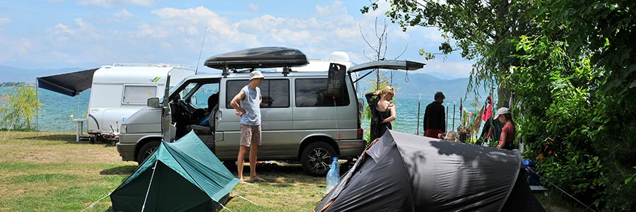
The concept of caravan and RV tourism has gained immense popularity all over the world, people who stand for freedom, tolerance and flexibility and who like discovering new things. Caravan tourism includes a wide range of hiking and cycling opportunities for youth, families, seniors and international tourists.
One of the essential requirements for Caravan Tourism is the availability of sufficient number of campgrounds or camperstops, where campers can find overnight self-selected places that offer basic or upgraded amenities and facilities, and last not least outdoor activities.
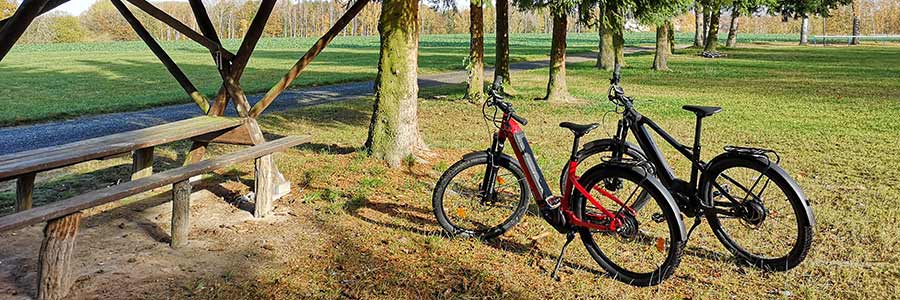 Cycling as an everyday means of transport, sport or leisure activity is possible at practically any age and can also be carried out by people with physical limitations because it is very gentle on the joints. In contrast to running, the legs, knees and hips are relieved because cycling usually involves sitting. Cycling promotes fitness and provides cardiovascular training.
Much less raw materials and energy are used to produce a bicycle compared to motor vehicles. In addition, no other fuels are required to get around by bike: cycling saves an average of 140 grams of carbon dioxide and at least 38 cents per kilometre compared to a mid-range car.
Do you still cycle or do you turtle? It was this saying that first drew our attention to the alternative bicycle motorhome or the mini caravan. It has now given rise to a new travel concept that we are happy to support, purely for ecological reasons
 In addition to routes that are suitable for day trips, the hiking organizations have also created and marked long-distance hiking trails that are divided into several daily stages. A special category of these routes are pilgrimage routes.
The motivation to hike is subject to considerable fluctuations, both among different age groups and generations, as well as in terms of the type of hiking and the trend over time. While it was still a natural professional necessity with the journeyman trade, combined with experience, adventure and personal maturation, the generation of the youth movement and the wandering bird celebrated hiking in songs and undertakings as emancipation from the encrusted adult world, as an escape from the desolate cities’ romantic discovery of nature and as an indispensable part of their special youth culture.
A study commissioned by the fitness magazine Fit for Fun from the Cologne Institute for Prevention and Aftercare (IPN) came to the conclusion that the energy expenditure when hiking is comparable to that when jogging. For example, the test subjects consumed as much food energy during a 2-hour hike in the lowlands as when jogging for 75 minutes. The gentle way is also said to be advantageous because the automatic pace adjustment rarely causes physical overstrain.
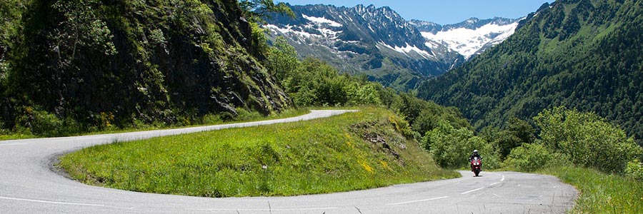
As passionate motorcyclists ourselves, we have opened this category to our friends to give you the opportunity to write your travel reports, but read for yourself:
Motorcycle trips in Turkey and the Balkans. Do you want to drive around curves, all in a breathtaking landscape, together with friends, like-minded people or just the two of you?
There are numerous hints and tips here.
And if you still have any questions, we will be happy to help you personally by phone or email.
 With almost 40 million foreign overnight guests every year, Germany is one of the seven most visited countries in the world. There are 6,135 museums, 366 theatres, 34 leisure and adventure parks, 45,000 tennis courts, 648 golf courses, 190,000 km of hiking trails, 40,000 kilometres of long-distance cycle paths as well as holiday and theme routes available for use in tourism.
Business and congress tourism is of outstanding importance; Germany is the most important international trade fair location with several world-leading trade fairs: Caravan Salon Düsseldorf, CMT Stuttgart, etc. The Internationale Tourism-Börse Berlin is the world's leading tourism trade fair. Germany also has the highest density of festivals like Wacken, Rock am Ring,
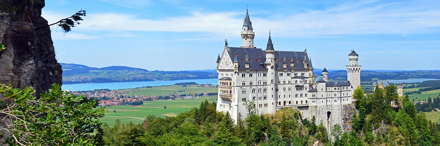
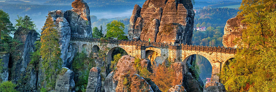
Outstanding sights: Sanssouci Castle - Brandenburg Gate - Cologne Cathedral - Saxon Switzerland National Park - Wadden Sea - Hamburg Harbor - Brocken - Old Town of Hameln - Externsteine - Wartburg - Neuschwanstein Castle - Zugspitze near Garmisch-Partenkirchen - Rothenburg ob der Tauber - Königsee in Berchtesgadener Land - Old town of Bamberg - Imperial castle in Nuremberg - Mainau Island in Lake Constance - Lichtenstein Castle - Meersburg - Ulm Minster - etc.
 Black Forest is the most important recreational region in Baden-Württemberg and the most visited holiday destination among the German low mountain ranges. It is particularly known for its romantic valleys, gorges, mills and typical farms as well as the place of origin of the cuckoo clock. It is also a popular hiking area because of its good network of long-distance hiking trails such as the Westweg. Winter sports have a long tradition around the Feldberg (1493 m), the highest mountain in the Black Forest, as well as in many other places in the Black Forest.
Lake Constance with the Alpine chain in the background is also a well-visited travel destination and also a local recreation destination for city dwellers; Here you can find evidence of a wide variety of eras with the Unteruhldingen pile dwellings and the UNESCO World Heritage monastery island of Reichenau. On the lake, the flower island of Mainau and the old towns of Konstanz and Meersburg have the highest number of visitors. Not far from the region around Lake Constance are the Danube Valley and Upper Swabia with the old imperial towns of Biberach an der Riß and Ravensburg. The Upper Swabian Baroque Road leads through this Baroque centre north of the Alps. Other major cities are Freiburg im Breisgau, Heidelberg, Ulm, Heilbronn, Pforzheim and Reutlingen.
The Allgäu in Württemberg attracts with its landscape and many hiking opportunities, as does the Swabian-Franconian Forest Nature Park further north.
The Swabian Alb is known for its small romantic towns (e.g. Bad Urach), the heathland landscapes, the extensive forests, the caves, castles and palaces (Hohenzollern Castle, Lichtenstein Castle, Sigmaringen Castle). Baden-Württemberg has around 60 spas and health resorts, especially in the Black Forest and Upper Swabia.Baden-Württemberg is the German state with the highest exports, the second lowest unemployment rate, the fifth highest gross domestic product (GDP) per capita as well as the most registered patents per capita and the absolute and relatively highest research and development expenditure.
 Lower Saxony, located in northern Germany, offers a variety of sights and activities for travellers. Whether it's a city trip to Hanover, Braunschweig, Göttingen, Hamelin or Münster and Osnabrück, whether hiking in the Harz Mountains or the Teutoburg Forest or relaxing on the coast of Friesland or on the islands - Lower Saxony has something to offer for every taste.
For travellers we have put together a selection of travel articles of culturally interesting places and locations. Here you will find all the information you need to explore the region on your own. From the most important sights to the access routes, bike tours and hiking routes.
The Harz, a low mountain range in northern Germany, offers a variety of hiking trails and nature experiences. With our hiking articles, everyone is guaranteed to find the right path and can enjoy the beauty of the Harz Mountains to the fullest.
For beach lovers, we have put together a selection of beach reports for your trip to the coast. Friesland is located on the North Sea coast and offers miles of sandy beaches and an impressive dune landscape on the islands.
We are confident that our Lower Saxony category will help you get the most out of your stay in Lower Saxony. Discover Emden, Lüneburg and the Hanseatic League, the market church in Clausthal, Dangast and the Fehn canals, Spiekeroog and Greetsiel on your own and experience unforgettable moments.
 The lowest point in Bavaria with 100 m is the water level of the Main in Kahl am Main (Lower Franconia), the highest at the summit of the Zugspitze (2962 m), the highest German mountain in the Wetterstein Mountains. All 30 of Germany's highest mountain peaks are in the Bavarian Alps, concentrated in the Wetterstein Mountains, in the Berchtesgaden Alps and the Allgäu Alps. The highest Bavarian peaks in the Berchtesgaden Alps are the Watzmann (2713 m) and in the Allgäu Alps the Hochfrottspitze (2649 m).
Already in 555 AD the older Bavarian tribal duchy was documented, which became part of the Franconian domain under the Merovingians. Under the Carolingians, a Bavarian kingship emerged for the first time, which they either ruled as kings or sub-kings, or appointed governors.
 The north and east of Hesse are part of the catchment area of the Weser, their source rivers Fulda and Werra flow through Hesse over 215 km and 95 km respectively. In contrast, the rest of the country is drained towards the Rhine, which forms the border with Rhineland-Palatinate in the southwest over a length of 107 km. Its main tributaries for Hesse are Main and Lahn, but the Neckar also flows a short distance through the extreme south of Hesse.
Frankfurt am Main Airport is by far the most important airport in Germany and one of the ten largest in the world. Not far southeast of Frankfurt Airport is the Frankfurt-Egelsbach airfield, which is frequented by smaller machines.
A network of cycle paths runs through Hesse. The nine long-distance cycle paths (R1–R9) as well as the Lahntal cycle path, the Weser cycle path and the Werratal cycle path are of national importance. There are also a number of regional routes which, like the long-distance cycle paths, are particularly important for cycle tourism, for example the Vogelsberger Südbahn cycle path or the volcano cycle path.
Hesse's only national park is the Kellerwald-Edersee National Park. Part of it has been part of the UNESCO World Heritage Site “Ancient Beech Forests and Primeval Beech Forests of the Carpathians and Other Regions of Europe” since 2011. The Messel Pit, a world-class fossil deposit, has been a World Heritage Site since 1995.
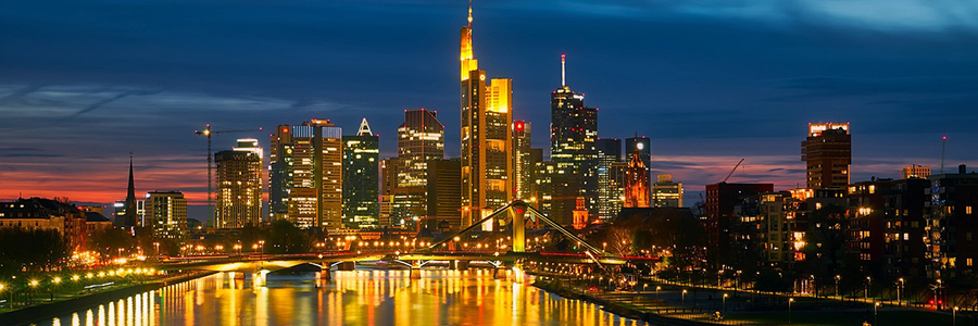
The financial centre of Frankfurt am Main is an important international financial centre. The first thing to think of is the European Central Bank and the Deutsche Bundesbank. The headquarters of the four largest German banks: Deutsche Bank, DZ Bank, the development bank KfW and Commerzbank are based in Frankfurt am Main, as well as numerous smaller banks, public and cooperative credit institutions and more than 150 branches of foreign banks
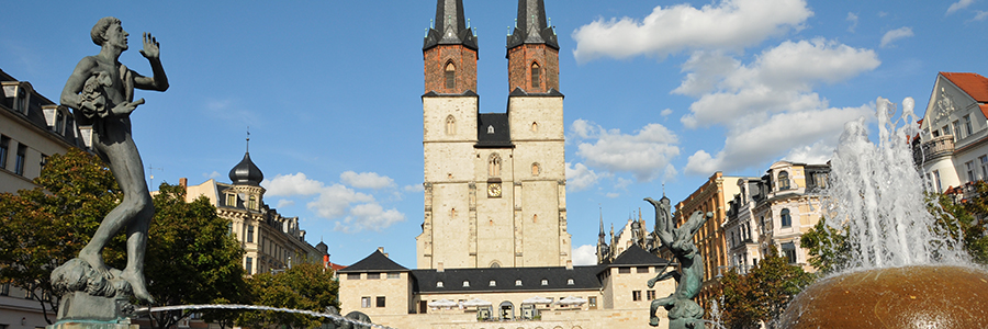 Travel to Saxony-Anhalt and immerse yourself in a fascinating mixture of history, culture and nature. This federal state in the heart of Germany has something to offer for every visitor. Start your journey in the state capital of Magdeburg, where you can marvel at the impressive millennium bridge over the Elbe.
Stroll along the picturesque cathedral square and visit the imposing Magdeburg Cathedral, one of the most important Gothic buildings in Europe. From there your path continues to Halle (Saale), a city with a rich tradition and a vibrant art scene. Visit the famous Moritzburg Art Museum or stroll through the historic old town with its charming streets and half-timbered houses.
Saxony-Anhalt also has a lot to offer culturally: Lutherstadt Wittenberg is an absolute must for those interested in history. Here you can visit the Luther House, where Martin Luther lived and worked, and admire the Castle Church, on the door of which he nailed his 95 theses - an event of great importance for the Reformation. In addition to the cities, nature also attracts numerous visitors to Saxony-Anhalt: the Harz offers breathtaking landscapes for hiking or skiing, depending on the season. Climb the Brocken - the highest mountain in northern Germany - to enjoy a spectacular view of the entire area.
 With more than 2000 years of Roman prehistory, Rhineland-Palatinate is rich in cultural treasures in Trier and Mainz. Numerous cities in the country can be traced back to Roman foundations. The Romans left some important buildings and a large number of archaeologically proven relics.
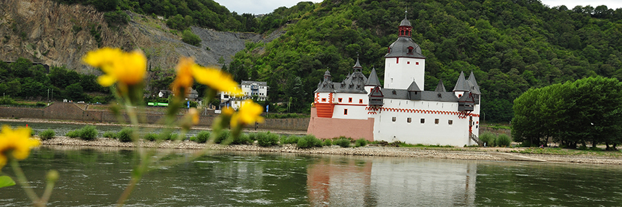
In the Middle Ages, it was German kings and emperors, archbishops and electors as well as numerous other imperial estates and castles that ruled the territory of today's state, who left behind a large number of historically important buildings, such as in Cochem, Burg Eltz, Lahneck and Ehrenbreitstein.
Rhineland-Palatinate is one of the most densely forested states in Germany, as the forests cover around 42 percent of the state area, resulting in endlessly long hiking and cycling routes, see Moselle cycle path!
Not to be forgotten: the green hell of the Nürburgring - probably one of the most famous racetracks in the world.
 The capital of the federal state of Saxony and at the same time the largest metropolitan area in the state is Dresden, the most populous city is Leipzig, and the third major city is Chemnitz.
The buildings (e.g. Residenzschloss, Zwinger and Semperoper Dresden, Pillnitz Pleasure Palace, Moritzburg and Hubertusburg hunting lodges) and collections (e.g. Green Vault, Picture Gallery of Old and New Masters, Armory) of the Saxon Electors are regarded by the people of Saxony as perceived Saxon cultural assets.
The paintings in the Dresden art galleries are being sold because the Electors i. A. counted among the Saxon culture, even if the artists only spent part of their lives in Saxony. This applies in particular to paintings with typical Saxon landscape motifs, e.g. B. the depictions of Dresden and Pirna by the Italian painter Canaletto and Saxon Switzerland by Caspar David Friedrich, who was born in Greifswald.
Several festivals are held in Saxony, with festivals such as the International Dixieland Festival Dresden, Kosmonaut Festival, Leipzig Jazz Days, Highfield Festival, Leipzig Bach Festival, Th!nk?, Nachtdigital, Dresden Guitar Festival, Dresden Days of Contemporary Music, Wave Gothic Meetings and the Endless Summer Open Air served many different styles of music. In terms of music, the performances of the world-famous Saxon State Orchestra in the Semperoper and the Kreuzchor in the Kreuzkirche should be emphasized in Dresden. The organ landscape of Saxony is characterized by the work of Gottfried Silbermann, the perfector of the Central German baroque organ.
 Most important multi-discipline theaters in the country are the German National Theater in Weimar, Theater Altenburg-Gera and the Staatstheater Meiningen. Traditional theaters are still operated today in Arnstadt, Nordhausen, Rudolstadt and Eisenach. New buildings from recent times include the Theater Erfurt and the Vogtlandhalle Greiz. The largest open-air stage is the Steinbach-Langenbach Nature Theater in the Thuringian Forest
The literary history of Thuringia is inextricably determined by the Weimar Classic. She led German-language literature in the 18th century with the circle of poets around Johann Wolfgang von Goethe and Friedrich Schiller. Johann Gottfried Herder, Karl Ludwig von Knebel and Christoph Martin Wieland can also be classified in this era. They concentrated at the Weimar court around Duke Karl August and his mother Anna Amalia. The Bach family with their most famous son, Johann Sebastian Bach, comes from Wechmar near Gotha.
In the field of fine arts, the Bauhaus in Weimar was particularly important in Thuringia. It shaped the style of the world in the 1920s and attracted painters such as Lyonel Feininger, Wassily Kandinsky, Paul Klee, Johannes Itten and Oskar Schlemmer as well as architects such as Walter Gropius, Henry van de Velde and Ludwig Mies van der Rohe to the Free State. But painters such as Lucas Cranach the Elder or Otto Dix and the sculptor Tilman Riemenschneider also worked in Thuringia.
The most famous castle in the country is the Wartburg above Eisenach, which is a UNESCO World Heritage Site. It was once the seat of the Landgraves of Thuringia and later the place where Martin Luther was hidden from the imperial authorities and translated parts of the Bible into German.
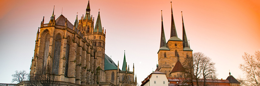
The UNESCO World Heritage includes the "Classic Weimar", the Bauhaus in Weimar, the Wartburg near Eisenach and the Hainich National Park as part of the European beech forests. The state capital Erfurt has important cultural and historical sites with the cathedral, the Krämerbrücke and the oldest preserved synagogue in Central Europe. The largest city is Erfurt, other important centers are Jena, Gera and Weimar.
 The old trading town with its historic centre around the market square exudes the flair of a young city. Look forward to Bremen's sights. There is a lot to discover!
In no other city in Germany with more than 500,000 inhabitants do more people cycle than in Bremen. The people of Bremen love their bikes! Cycling is not just everyday life in this country, but part of the special way of life. So take your bike and ride through and experience the city!
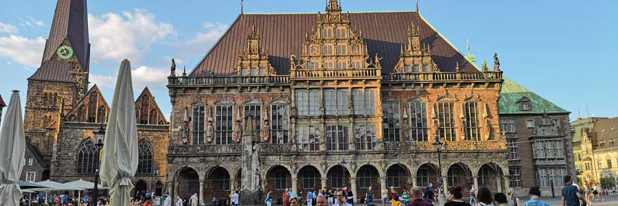
The magnificent town hall in the Weser Renaissance style and the venerable figure of Roland on the historic market square remain unmistakable. They have embodied the citizens' desire for independence since 1404. The town hall and Roland are protected by UNESCO as a unique world heritage site, but the Schnoor - Bremen's oldest district -, the unusual architecture of the traditional Böttcherstrasse and the Bremen Cathedral are also unparalleled.
Bremen and Bremerhaven together form the second largest seaport in Germany. The focus in the Bremen ports is particularly on car transshipment. The entire length of the Weser river, which characterizes the landscape, is a federal waterway and is predominantly heavily fortified on its banks within the Free Hanseatic City of Bremen. The tides in the North Sea influence the water level in the Weser, partly also the local weather conditions, and shape the fauna and flora in the state of Bremen. In the Free Hanseatic City of Bremen there are several ferry connections across the Weser.
Natural areas can be found primarily along the Wümme, Lesum, Ochtum and Geeste rivers with protected marsh meadows and oxbow lakes. The marsh and geest areas are used for agriculture and serve as local recreation areas for the city population.
 The Binnenalster with the Jungfernstieg, the Ballindamm, the Alster arcades and the colonnades are considered Hamburg's promenade. The city view is dominated by the towers of the five main churches of St. Petri, St. Jacobi, St. Katharinen and St. Michaelis ("Michel", 1648–1673), the city's landmark.
Some film festivals (Filmfest Hamburg, cinefest – International Festival of German Film Heritage, Lesbian Gay Film Days Hamburg, Fantasy Filmfest); Christopher Street Day (CSD) and the Hamburg Harley Days, one of the largest German motorcycle meetings, take place here every year with up to 40,000 participants.
Stage Entertainment maintains four larger musical theatres: the Operettenhaus, the “Neue Flora”, the Theater im Hafen and the Theater an der Elbe, as well as the “Theater Kehrwieder” in the Speicherstadt.
With the bands Blumfeld, Die Sternen and Tocotronic, the concept of the Hamburg School entered pop culture as an independent genre of German-language music from around 1990, then expanded to include alternative music by Kettcar and Tomte. The German-speaking hip-hop band Absolute Beginner also describes their attitude to life in their hometown in “City Blues”; Samy Deluxe in “Hamburg Anthem”.
The hip-hoppers from Fettes Brot are now considered veterans, and Udo Lindenberg, whose roots lie in the Hamburg scene, is also well known.
According to legend, the Hamburg greeting “Hummel, Hummel”, answered with “Mors, Mors”, comes from the water carrier Johann Wilhelm Bentz, who was nicknamed “Hummel” and lived in Hamburg until his death in 1854. When he passed by, the children mockingly called him “Bumblebee, Bumblebee.” He responded angrily with “Mors, Mors.”
A more common greeting, for example, is “Moin,” which is common in parts of northern Germany and applies at any time of day.
 The city of Cölln, which was first mentioned in a document in 1237, arose on the Spree island. In 1244 the first mention of Berlin followed, which lies on the north-eastern bank of the Spree. On October 3, 1990, the two German states were reunited as the Federal Republic of Germany and Berlin became the German capital by virtue of the Unification Treaty.
Berlin has often been the scene of world history - for example when the Wall came down, but not only there. You can also discover the traces of history in the modern settlements, which are part of the UNESCO World Heritage: the large, national festival of building culture, the Triennial of Modernism, the architecture of Berlin Modernism in focus.
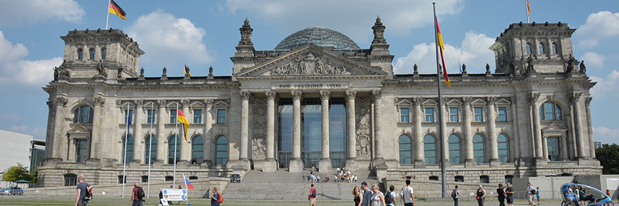
In addition to the top sights, Berlin has a lot to offer: Brandenburg Gate, Lustgarten, Berlin Cathedral, Humboldt Forum, the Neue Wache and the Gendarmenmarkt.
Berlin awaits you. Visit the great museums of Museum Island (Pergamon Museum, Alte Nationalgalerie, Bode Museum) or the Berlin State Opera, Deutsche Oper Berlin, Komische Oper Berlin, and then relax in a café. Look forward to concerts & shows on the Waldbühne, stroll through the shops and discover with us the whole variety of the most beautiful time of the year in Berlin.

The palaces, gardens and parks of the so-called "Potsdam Cultural Landscape" were added to the UNESCO World Heritage List in 1990. Since then, Sanssouci Park (the summer residence of Frederick the Great), Neuer Garten, Babelsberg, Glienicke and the Pfaueninsel with its palaces, as well as Sacrow Palace and Park with the Church of the Redeemer since 1992 and the Alexandrowka Colony since 1999 have been World Heritage Sites.
When the water is literally on your doorstep and over 3,000 lakes promise bathing fun for the whole family, then you have arrived in the holiday paradise of Brandenburg.
Stroll along the lakes by bike and really switch off, set off on water adventures on a houseboat or raft and watch herons and beavers from a canoe. Brandenburg has an excellent network of cycle paths over 7,000 km long and bed & bike accommodations that welcome cyclists.
The Berlin-Usedom cycle route has been running through northern Brandenburg since 2007.
In the so-called Media City of Babelsberg in Potsdam, next to Studio Babelsberg AG, there is the Babelsberg Film Park, a theme park with a studio tour of the site as well as exhibitions, stunt shows, sets and props from numerous well-known productions that show the world of film.
 With around 17.9 million inhabitants, North Rhine-Westphalia is the most populous federal state in Germany and the fourth largest in terms of area at around 34,100 square kilometers. 30 of the 81 major German cities are in its heavily urbanized area.
The northern part of the Rhine-Ruhr conurbation is formed by the heavily urbanized Ruhr area with the centres of Dortmund, Essen, Duisburg and Bochum. Its economic rise in the early 19th century was based on industrialization and the mining industry, particularly ore and coal mining.
The Route of Industrial Culture is a tourist themed route that leads to the most important industrial-historical sites in the Ruhr area and serves as a starting point for marketing the Ruhr area as a tourist region.
There are numerous technology and industrial museums in the Ruhr area, such as the German Mining Museum in Bochum, the Museum of German Inland Shipping in Duisburg, the Recklinghausen substation, the DASA – working world exhibition and the Hoesch Museum in Dortmund, and the Bochum-Dahlhausen Railway Museum in Bochum and the decentralized museums Westphalian Industrial Museum and Rhenish Industrial Museum. There are also several art museums in the Ruhr area, such as the Museum Folkwang in Essen, the Lehmbruck Museum and Museum Küppersmühle in Duisburg, the Ludwig Gallery in Oberhausen Castle, the Karl Ernst Osthaus Museum in Hagen and the Museum Ostwall in Dortmund. With the opening of the Capital of Culture in 2010, the Ruhrlandmuseum was reopened as the Ruhr Museum in the former coal washing plant of the Zollverein colliery. The Zollverein colliery and coking plant in Essen was declared a World Heritage Site by UNESCO in 2001. In 2010, Essen represented the European Capital of Culture region.

Saarland was characterized by a high degree of industrialization and a well-developed infrastructure, and today is shaped by its historical and geographical proximity to France.
One-third of Saarland's area is covered with deciduous mixed forest. This gives Saarland, along with Hesse and Rhineland-Palatinate, the highest percentage of forest cover in Germany.
Visitors can learn about the special significance of mining for the region at the Saarland Mining Museum in Bexbach.
Saarland is home to several archaeological and architectural monuments of European importance, such as the Celtic and Roman excavations on the Upper Moselle (in the municipality of Perl, including the districts of Nennig and Borg) and in the Bliesgau region (Bliesbruck-Reinheim and Schwarzenacker), as well as the so-called Hunnenring in Otzenhausen.
The most important festivals are Rocco del Schlacko (rock/pop), the SR Ferien Open Air St. Wendel (pop), and the Saar Music Festival (classical music).

Between Flensburg in the north, Lauenburg in the south, St. Peter-Ording in the west, and Lübeck in the east: Along the coasts and in the inland regions, you can enjoy nature, discover sights, attend events, and feel the wind in your hair.
In recent years, maritime trade with other Baltic Sea states has regained importance. The Jutland Line and the Vogelfluglinie (Bird Flight Line), including the Port of Lübeck, play a particularly important role as routes to Scandinavia, Finland, Russia, and the Baltic states.
Schleswig-Holstein has the highest percentage of cycle paths alongside roads among all German states. In 2019, 56% of all roads in the state had a cycle path.
The culture is shaped by historical and geographical factors such as its location between the North and Baltic Seas, as well as its former agrarian culture. The Scandinavian influence is particularly evident in the architecture and residential culture of the northern part of the state.

Mecklenburg-Western Pomerania is located in the north of Germany, surrounded by the federal states of Brandenburg and Schleswig-Holstein and the Baltic Sea. In the east, Mecklenburg-Western Pomerania borders Poland. The region is known for its historic seaside resorts, manor houses, castles and nature parks.
The state capital Schwerin is the second largest and oldest city in Mecklenburg-Western Pomerania. The city is located on the south-west shore of Lake Schwerin, in a forested and lake-rich area.
The Mecklenburg Lake District and the Baltic Sea islands of Usedom, Rügen and Fischland-Darß-Zingst are among the most beautiful places. The Hanseatic cities of Greifswald, Stralsund, Rostock, Schwerin and Wismar are also absolutely worth seeing.
The old towns of the Hanseatic cities of Stralsund and Wismar were lovingly renovated after reunification and in parts rebuilt true to the original. UNESCO rewarded these efforts and declared both old towns a World Heritage Site.
The seaside resort of Schönberg is not as crowded. Peaceful beach life and active experiences between Brazil, California and the Kiel Fjord and the seaside resort of Pelzerhaken. The paradisiacal beaches of the Baltic Sea's Hawaii in the Bay of Lübeck. ...
Typical dishes from the diverse region on the Baltic Sea are fish dishes such as smoked fish or herring. Game and poultry dishes such as duck, goose and wild boar are also very popular. Regional vegetables such as kale, beetroot and celery play an important role in vegetarian cuisine.
 Austria is a central European landlocked country with around 8.8 million inhabitants. The country is bordered by the Bohemian massif and the Thaya in the north, the Karawanken and the Styrian hill country in the south, the Pannonian lowlands in the east and the Rhine and Lake Constance in the west. More than 62 percent of its territory is made up of alpine high mountains.
Austria and its mountains play an important role for active holidaymakers both in winter and summer for mountain hikes, mountaineering and skiing. The highest mountains in Austria are three-thousand meter peaks and are located in the Eastern Alps. At 3,798 m, the Großglockner (Tyrol/Carinthia) is the highest mountain. Austria has numerous refuges and hiking trails that are operated by Alpine clubs and tourist associations.
Bathing tourism is particularly important on Lake Neusiedl, in the Salzkammergut and Salzburg lake areas and in the Carinthian lake area.
In general, tourism is one of the most important sectors in the Austrian economy. Tourism regions are Burgenland, Carinthia, Lower Austria, Upper Austria, Salzburg, Styria, Tyrol, Vorarlberg and Vienna.
Tourism is one of the most important economic sectors in Austria. In 2013, direct added value of 16.94 billion euros was achieved from tourism, which corresponds to 5.3% of the gross domestic product. Tourism is evenly distributed between the summer and winter seasons, although an east-west divide is visible, with the east attracting more summer tourism and the west more winter tourism. Important sectors also include cultural and city tourism as well as spa, wellness and conference tourism.
 In 15 AD, the Romans conquered the area now called Vorarlberg and built the city Brigantium on the territory of the present state capital Bregenz as an important military base and Constance harbor.
Around 260 the invasion of the Alemanni began, then from about 450 they settled here too. With the Alemanni, the area came to the Frankish Empire, 843 to the East Frankish Empire. As heirs of Udalrichinger, which have been Carolingian Count in the Lake Constance region, the Counts of Montfort gained the rule in the area of Bludenz, Bregenz and Feldkirch in 1200.
The later Nobel Prize winner Ernest Hemingway spent the two winters of 1924/25 and 1925/26 with his family in Vorarlberg, where he lived for several months in Schruns and Gaschurn. Thanks to his stories about the region in his novel Paris - A Celebration of Life, the area is well known as a winter destination, especially in the USA.
 In the 1st century AD the Romans built a military camp (castrum) on the site of today's Vienna city center near the Danube and the connected civil city Vindobona (today 3rd district) as border security of the province of Pannonia. Still today you can see from the streets of the 1st district (Inner City), the course of the wall and the streets of the camp. The Romans remained until the 5th century. The Roman legionary camp lay far to the east of the Western Roman Empire and therefore rapidly was victim the turmoil of the Germanic barbarian invasions.
Architecturally, Vienna is still characterized primarily by the buildings around the Vienna Ringstrasse from the Wilhelminian era, but also by Baroque and Art Nouveau. Through its role as the imperial capital and residential city of the Austrian Empire from 1804 onwards, Vienna became a cultural and political centre of Europe.
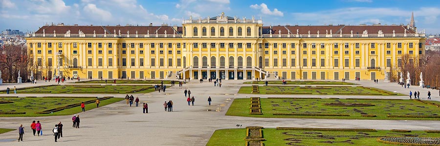
Around 1910, when Vienna was still the capital of the Habsburg Monarchy, the city had over two million inhabitants. The historic centre of Vienna and Schönbrunn Palace are now UNESCO World Heritage Sites. With around 7.5 million tourists and around 16.5 million overnight stays every year, Vienna is one of the most visited cities in Europe.
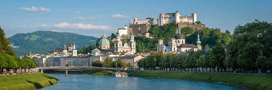 In the La Tene period Salzburg was an administrative center of the Celtic kingdom of Noricum. After the Roman invasion 15th AD, the population of the city on the hills was due to the city planning of the Roman moved into the area of todays´s old town. Since Emperor Claudius, the new city, as Municipium Claudium Iuvavum, was one of the main cities of the Roman province of Noricum. After giving up the province Noricum 488 AD, at the beginning of the mass migration, a part of Romano-Celtic population remained in the country. In the 6th century, the conquest was followed by the Bavarians. Bishop Rupert got the remains of the Roman city as a present from Duke Theodoas of Bavaria around 696 AD to evangelize the country in the east and southeast.
The city is characterized by the city mountains, the Salzach river that flows through the city area and the Hohensalzburg Fortress, which is visible from afar.
The festival has an annual economic benefit of around 276 million euros and an employment effect of around 5,000 jobs (around 220 employees on an annual average). In addition to the festivals, Mozart Weeks, Easter Festivals, Whitsun & Baroque Festivals and the Salzburg Advent Singing contribute to Salzburg's attractiveness. In addition, visitor magnets such as the Hohensalzburg Fortress (around 1.14 million visitors), Mozart's birthplace and home and Hellbrunn Palace ensure excellent results. The trade fair and congress sector is also important for tourism in the city of Salzburg; it leads to improved utilization of accommodation capacities outside of the main season.
No question, Switzerland is best known for the Alps and therefore for impressive glaciers and spectacular mountain worlds. There are also crystal-clear water, numerous natural spectacles, pristine regions and fairytale winter landscapes.
Switzerland is considered one of the wealthiest western countries in the world and is therefore one of the more popular immigration countries. In Switzerland, thanks to the free movement of people with the EU, it is possible for anyone to enter and live there. Working in Switzerland is also possible for everyone.
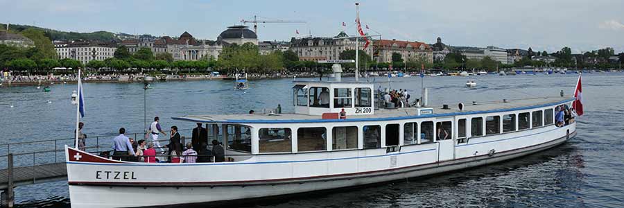
The eight largest cities and economic centres are Zurich, Geneva, Basel, Lausanne, Bern, Winterthur, Lucerne and St. Gallen.
Tourism has been an important economic sector in Switzerland for around 150 years. It was favoured by the Alps, the many lakes, the central location in Europe, stable politics, a safe society and a strong economy. The most popular destinations and most visited regions include Zurich, Lucerne, Graubünden, Bernese Oberland, Valais, Geneva, Vaud, Basel, Ticino, Eastern Switzerland and Bern.
The customs include various traditional forms of expression in music, dance, folk poetry, e.g. B. at the Basel carnival and in traditional crafts. This also includes various rites and religious festivals.
Typical Swiss dishes include cheese fondue, raclette, Älplermagronen and Rösti. This also defined the Röstigraben. East of this border, Rösti is one of the most popular national dishes, but not west of it. Birchermüesli, now known worldwide, was developed in Zurich around 1900 by a Swiss doctor, Maximilian Bircher-Benner.
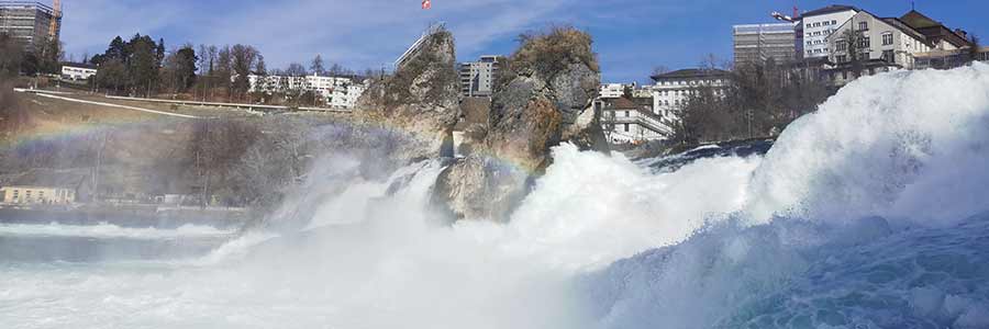
Schaffhausen is the northernmost city in Switzerland and is, next to Basel, the town of Stein am Rhein, Neunkirch and Eglisau one of the few Swiss cities north of the High Rhine. Schaffhausen is located southeast of the Randen, at the mouth of the from the north arriving Durach into the Rhine.
The old town has numerous buildings from Renaissance. The epithet Erkerstadt Schaffhausen got due to the 300 existing bay window. Outside the original city walls, now expanding in the middle of the city, is the Munot, a 16th century fortress. Southwest of the city, but no longer in the city, are the Rhine Falls, the largest waterfalls of Europe.
Embedded in a paradisiacal landscape. Characterized by the Rhine, endless vineyards, dense forests and the hills of the Randen, perfect for hiking and cycling – that is the Schaffhauserland. Or discover the 171 bay windows of the old town of Schaffhausen, feel the fine spray of the roaring Rhine Falls on your skin, enjoy the fruity, fresh wines of the Schaffhausen Blauburgunderland or stroll through the gem of Stein am Rhein and let yourself be enchanted by the medieval charm and the facade paintings.
In the surroundings of Schaffhausen, north in the hilly area of the Randen and in the vine-covered slopes of the Klettgau, you can go on beautiful hikes and bike tours and enjoy a tasty Pinot Noir wine. You can learn about the history of the wine on the Blauburgunderland Panorama Trail or in the winemaking museum in Hallau.
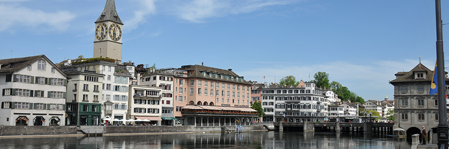
Zurich is the most important centre of the Swiss media and creative industry. With its location on Lake Zurich, its well-preserved medieval old town and a diverse range of cultural offerings and nightlife, it is also a centre of tourism.
Zurich, which emerged from the Roman base of Turicum, became a free imperial city in 1262 and a member of the Confederation in 1351. The city of the reformer Huldrych Zwingli became the second most important (after Wittenberg) centre of the Reformation in 1519. To this day it is considered the starting point of the worldwide Reformed Church and the Anabaptists.
The city of Zurich is an important centre of Swiss art and culture. Zurich owes part of its cultural upswing to numerous painters, composers and writers who stayed in the city - often as political refugees - and left their mark: including Antonio Ligabue, Max Frisch, James Joyce, Thornton Wilder, Hermann Hesse and Thomas Mann. The artistic and literary movement Dadaism emerged in Zurich in 1916 at the Cabaret Voltaire.
Art enthusiasts are recommended to visit the Kunsthaus Zurich or the Museum Rietberg.
The medieval atmosphere of the city with its numerous fountains, sandstone facades, alleys and historic towers is unique in Bern. The most beautiful view of the old town surrounded by the Aare is the elevated rose garden above the Bären Park or the platform of the 101-meter- high cathedral tower.
Bern has many museums spread throughout the city. In the center on Hodlerstrasse is the art museum, which opened in 1879 and houses works from eight centuries. In the immediate vicinity is the “Progr”, the first high school and later Progymnasium in Bern, which today serves as an exhibition and event location.
In the Kirchenfeld near Helvetiaplatz are the Historical Museum, originally planned as a state museum, which, in addition to its collection, also shows temporary exhibitions and set up the Einstein Museum in 2005, the Swiss Alpine Museum and the Kunsthalle, which shows several individual and group exhibitions dedicated to contemporary art every year. Not far away are the Museum of Communication and the Natural History Museum, which belongs to the Burgergemeinde, with its diorama show.
In 2015, cycling in Bern accounted for 15% of the choice of means of transport, measured as the share of journeys as the main means of transport. The city is planning to create a star-shaped network of main cycling routes that will connect the city centre with the agglomeration.
 The Czech Republic is composed of the historical countries Bohemia (Czech Čechy) and Moravia (Czech Morava) as well as parts of Silesia (Czech Slezsko). In the 6th century, the Slavs migrated to Bohemia, in the 7th century the area became part of the Samo Empire. At the beginning of the ninth century, the Czechs were conquered by the Franconian Empire. At the end of the century, they became a part of the Moravian empire.
In the course of the Ascension of the Habsburgs and the Thirty Years' War, the area became part of the Habsburg monarchy and remained until the end of the First World War and the fall of Austria-Hungary. The reform movement of the Prague Spring was suppressed in 1968 by Warsaw Pact troops. In 1989, after the Velvet Revolution under Václav Havel, democracy was restored.
Between January 3 and 5, 1968, the Central Committee of the Czechoslovak Communist Party KSČ deposed President Novotný. Alexander Dubček became chairman of the KSČ, General Ludvík Svoboda became president. The censorship was lifted at the beginning of March. The “Prague Spring” began, and further development was largely spontaneous. On April 5, 1968, an action program was adopted by the KSČ under Alexander Dubček. The aim was “socialism with a human face” (guaranteed freedom of assembly, small entrepreneurship, release of political prisoners).
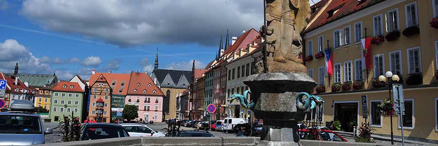 The town of Cheb is situated on the river Eger in the north-west of the Czech Republic, former name Egerland, whose historical center is the city Cheb, about 42 km west-west of Karlovy Vary.
Eight kilometers north-east of the city is the nature reserve Soos near Nový Drahov, a peat and mineral meadow moor with carbon dioxide gas of volcanic origin emanating from mofettes. Remains of the two most recent Bohemian volcanoes, which Goethe had also explored there.
Eger / Cheb was first mentioned as Egire on February 13, 1061. The castle was possibly built in the early tenth century. In 1167 Eger came into the possession of the Hohenstaufen Emperor Friedrich Barbarossa. Eger was made a city before 1179. King Frederick II signed the Gold Bull of Eger there on July 12, 1213, which strengthened the legal status of the empire's bishops and enlarged the Papal States. In 1242 Eger received Nuremberg city rights and in 1277 it became an imperial city.
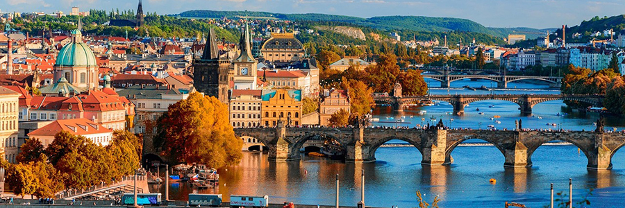
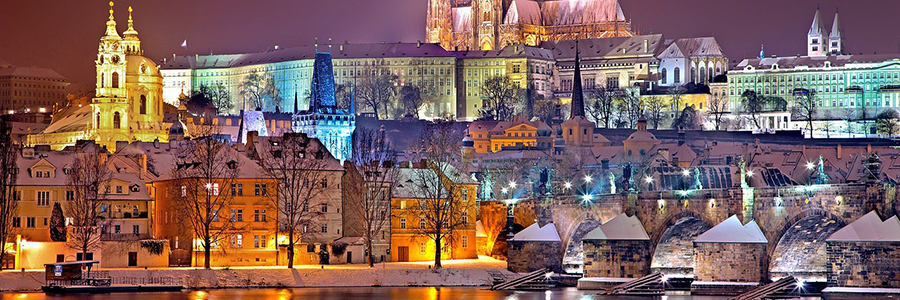 Prague is the capital and most populous city of the Czech Republic. Prague is the historical capital of Bohemia and was a significant royal and imperial residence in the Holy Roman Empire of the German Nation, especially among Luxembourgans and Habsburgs. Prague was first mentioned in the 10th century.
The historical center of Prague is recognized by UNESCO as one of the 12 World Heritage Sites of the Czech Republic. The "Golden City" today shows a closed cityscape characterized by Gothic and Baroque.
Under Emperor Charles IV and his son Wenceslaus IV, Prague, as the imperial seat of the Holy Roman Empire, flourished economically, culturally, politically and in many other areas in the second half of the 14th century.
The nickname “Golden City” refers to the sandstone towers, which shimmer in shades of gold when exposed to sunlight. Another explanation for this name is that Emperor Charles IV had the towers of Prague Castle gilded. The city was also a magnet for alchemists during the time of Rudolf II.
The name “City of a Hundred Towers” has also been known for several centuries and comes from the numerous towers that shape the historic cityscape.
In the second half of the 10th century, the merchant Ibrahim ibn Yaqub described Prague as “the city built of stone and lime” or “Stone Prague”.
In the early Middle Ages, tribes of the western Polans settled in parts of what is now national territory as part of the migration of peoples. The first documentary mention was made in 966 under the first historically attested Polish Duke Mieszko I, who opened the country to Christianity.
Having been deprived of its sovereignty by the neighboring states at the end of the 18th century, Poland regained its independence in 1918 with the Treaty of Versailles. The invasion of the German Reich and the Soviet Union at the beginning of the Second World War and their occupation rule cost the lives of millions of Polish citizens, especially Polish Jews.
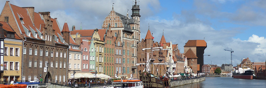
The most popular travel destination in Poland is the former capital Krakow, which has numerous architectural monuments and works of art from the Polish Golden Age of late Gothic and Renaissance. Important tourist destinations are also the cities of Warsaw, Wroclaw, Gdańsk, Poznan, Stettin, Lublin, Thorn and Zakopane. Tourism also plays an important role for the municipalities of Krynica-Zdrój, Karpacz, Szklarska Poręba, Biecz, Zamość, Sandomierz, Kazimierz Dolny, Częstochowa, Gniezno, Frombork, Malbork, Gdynia, Sopot, Kołobrzeg, Świnoujście and Międzyzdroje. Many cities offer tourist services for families with children, for example Wroclaw with the Wroclaw Dwarves, Warsaw, Kielce, Gdansk and Szczecin. Some smaller towns in Poland are members of the Cittàslow Association, which focus on balanced tourism.
Visitor magnets are: the Wieliczka salt mine, the museum in the birthplace of Fryderyk Chopin in Żelazowa Wola near Sochaczew, the memorial site of the Auschwitz-Birkenau concentration camp, the coast of the Baltic Sea, the large lakes in Greater Poland, Masuria, Kashubia and Suwalki as well as the Sudeten mountain ranges and Carpathians, especially the Tatras with the High Tatras and Western Tatras, in which the highest peak in Poland, Meeraugspitze, and the well-known Orla Perć mountain trail are located. Popular recreational areas are also the Świętokrzyskie Mountains, Beskids, Pieniny, Kraków-Częstochowa Jura and the Roztocze as well as Szczecin and Vistula Lagoon.
There are many waterways for kayaks, canoes, sailboats and houseboats on rivers and waterways, for example on the Pilica, the Krutynia or the Czarna Hańcza.
There are numerous ski resorts in the Carpathians and Sudetes, most of them in and around Zakopane in the Tatra Mountains and Szczyrk in the Silesian Beskydy Mountains and Karpacz in the Giant Mountains.
Spa holidays in the numerous spa towns such as Połczyn-Zdrój or Ciechocinek are also popular. Thermal baths, which have been opened in recent years, especially in the mountain region of Podhale near Zakopane, are often used for this purpose.
In its complex city history, Danzig was under Polish, Prussian and German rule, often interrupted by autonomy and periods as a free city-state. In the early Middle Ages, Gdansk was part of the Polish crown.
In the interwar period, not least because of its multi-ethnic composition and history, Gdansk was claimed by Germany and Poland, which caused tensions due to its location in the so-called Polish Corridor.
Together with the port city of Gdynia (Gdynia) and the seaside resort Sopot (Sopot) Danzig forms the so-called Trójmiasto (Tricity) with more than 740,000 inhabitants. More than 1.2 million people live in the entire urban Gdansk agglomeration (Aglomeracja gdańska).
The early stories of Nobel Prize winner Günter Grass, who was born in Langühr in 1927, are set in the city. In the novel “The Tin Drum” he summarized the history of Danzig as follows: “First came the Rugians, then came the Goths and Gepids, then the Kashubians, from whom Oskar is a direct descendant. Soon afterwards the Poles sent Adalbert of Prague. He came with the cross and was killed with an ax by Kashubians or Pruzzes. […] This happened in a fishing village and the village was called Gyddanyzc. Gydannyzc became Danczik, Danczik became Dantzig, which later became Danzig, and today Danzig is called Gdańsk.”
The culture of remembrance is shaped by museums. Their disunity is reflected, among other things, in the museum concepts of the Muzeum II Wojny Światowej and the Westerplatte Museum for the commemoration of the Second World War, which started in Gdansk, and are based on different political currents and historical teachings. Against the backdrop of the Polish Corridor, Donald Tusk considers his hometown of Danzig to be the central problem in German-Polish relations.
Gdansk is the starting point of the EuroVelo 9 cycle route (Baltic Sea-Adriatic Route or Amber Route, Polish Szlak bursztynowy), which leads from Gdansk through Poland, the Czech Republic, Austria and Slovenia to Pula in Croatia. The EuroVelo 10 (Baltic Sea Cycle Path or Hanseatic Route, Polish Obwód Hanzeatycki), which is built around the Baltic Sea, also runs through Gdansk.
Warsaw is located on the central Vistula, in the glacial valley of the Vistula, and on the middle masow valley at an average of 100 meters above sea level. The city spreads out on both sides of the Vistula and lies approximately in the middle between the Carpathians and the Baltic Sea – to each destination about 350 km.
The historic city centre is located on the left, west bank of the Vistula on the elongated Vistula cliff Skarpa Wiślana, which rises relatively steeply about 15 to 30 meters above the Vistula. One of the first bridges in Europe with a length of several hundred meters connected the two banks as early as the 16th century.
The Warsaw Royal Route (Królewski tract) begins at the Royal Castle and leads south for about 10 km to King Jan Sobieski's Wilanów city residence and is one of the longest representative streets in the world. It is made up of several representative streets, the Kraków Suburb, the New World (Ulica Nowy Świat) and the Ujazdowski Avenues (from north to south). The Royal Road runs along the Vistula and, together with the Saxon Axis that runs perpendicular to it, formed the main axis of Warsaw's urban development. It was built on at the beginning of the city's history and connected the former Jazdów settlement with the old town.
Since the 16th century, many magnate families moved their headquarters to Warsaw, where the Sejm met and the royal election took place. Anyone who wanted to take part in big politics had to be present on site. Although Warsaw never became the capital of the aristocratic republic, but was always “just” a royal seat and Sejm city, the politically important decisions were made here. In this respect, the capital Kraków only remained a formal capital after 1611. Many of the representative palaces were built along the main axes of the city (King's Way, Saxon Axis, Ulica Senatorska, Ulica Miodowa, Ulica Freta) in the Baroque and Classicist styles. Some of the largest palaces with extensive gardens were built just outside the main streets, such as Wilanów Palace.
Due to the city's often tragic history, there are many memorials to victims of foreign and tyrannical rule in Warsaw. These include, above all, the Tomb of the Unknown Soldier, the Warsaw Ghetto Memorial, the Warsaw Uprising Memorial, the Xth Pavilion in the Citadel, Pawiak as well as numerous smaller memorial plaques and stones that the attentive visitor encounters at almost every street intersection.
There are over 700 km of cycle paths in Warsaw (in 2010 there were only 275 km). A large bike rental system in Warsaw is called Veturilo.
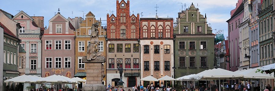
Poznań, in German Posen, is the capital of the Polish Greater Poland Voivodeship and the fifth largest Polish city with around 540,000 inhabitants. Poznan was also the capital of the Poznan Province.
In 1983 and 1997 Pope John Paul II visited the city. In 1998, as part of the Weimar Triangle, Chancellor Helmut Kohl met with the Presidents of France and Poland, Jacques Chirac and Aleksander Kwaśniewski, in Poznan.
In 1038, Bohemia invaded the Piast region, kidnapped the precious relics of St. Adalbert, and occupied Silesia. However, the invasion of the Bohemian Prince Břetislav I could not stop the economic development of Poznan, nor could the relocation of the Polish capital from Gniezno to Kraków by Casimir I the Innovator. The first castle and the oldest settlements in Poznan were on the right bank of the Warta and on the Cybina. At the turn of the 12th and 13th centuries, Posen transformed from a fortified castle and a princely seat into a city based on the Western European model. Under Przemysł I, German immigrants founded a settlement under Magdeburg law opposite the old town on the left bank of the Warta in 1253.
As part of the Second Partition of Poland, Prussian troops marched into Posen on January 30, 1793. The city then belonged to the territory of the new province of South Prussia of the Kingdom of Prussia. After more than 500 years of formal coexistence, the two parts of Poznań were united in 1793.
The old town with the Old Town Hall and the Old Market as well as the cathedral, which is located on Cathedral Island, are worth seeing. It is dedicated to Saints Peter and Paul. To the west, opposite the cathedral, is St. Mary's Church (Posen), a brick Gothic church. In the centre of the city is Stary Browar, a cultural and business centre opened in 2003 and set up in the building of a former brewery. The most famous feature of the city is the trade fair.
The Route of Kings and Emperors connects the city's most important sights.
 Tourism plays an important economic role in France. Around a million people work in the tourism sector; Around ten percent of the gross national product is generated there. The country was considered the world's most important tourist destination in 2019, with 90 million foreign visitors. Paris and its surrounding area, the Île-de-France, the Mediterranean coast (e.g. Côte d'Azur) and the French Alps are important holiday regions. As of 2019, the country had 45 UNESCO World Heritage Sites. In the World Economic Forum's 2019 Travel and Tourism Competitiveness Report, which measures a country's tourism performance, France ranks second out of 140 countries.
France does not see itself as a Grande Nation. In media policy, one's own culture and language are promoted through quotas for films and music. France is vigorously pursuing its concept of defending cultural diversity (“diversité culturelle”) in the European Union, UNESCO and the World Trade Organization (WTO): culture is not a commodity that can be freely traded without restrictions. The cultural sector is therefore an exception to the rest of the economy (“exception culturelle”).
Nationwide care and preservation of the rich material cultural heritage is viewed as a task of national importance. This understanding is effectively conveyed to the public through government-organized or sponsored measures that contribute to the formation of national cultural awareness. Days of national heritage, music or cinema, for example, which are firmly anchored in the annual cultural calendar, are very well received by the population.
French cuisine (Cuisine française) has been considered the most influential national cuisine in Europe since the early modern period. It is world-famous for both its quality and its versatility and looks back on a long tradition. In France, food is an important part of daily life and the cultivation of cuisine is an indispensable part of the national culture. The French gastronomic meal was recognized as an intangible world heritage by UNESCO.
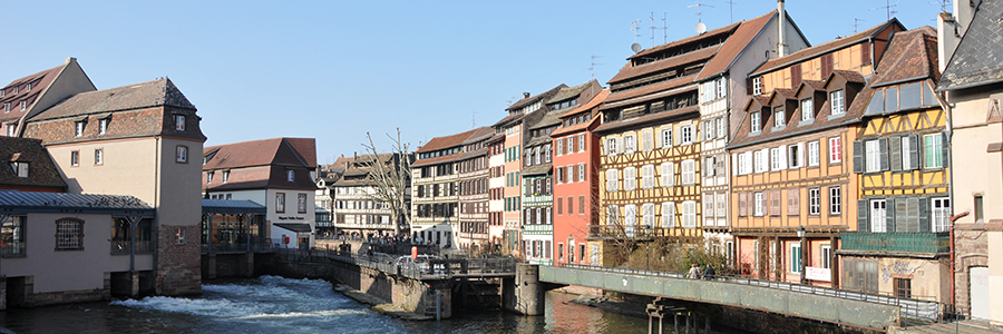
Strasbourg is a city in Alsace, a region in eastern France near the border with the Baden region of Germany. The city is the capital of the Bas-Rhin department
The Roman general Drusus founded Strasbourg in 12 BC. as a military outpost called Argentoratum in the later province of Germania superior. Under Trajan and after the fire in 97, Argentoratum had reached its greatest extent and strongest fortifications
Strasbourg's well-preserved historic old town Grande Île, which was declared a World Heritage Site in 1988, is surrounded by the Ill, a tributary of the Rhine. The Cathédrale Notre-Dame (Strasbourg Cathedral) is the city's landmark, built between 1176 and 1439 in the Romanesque and Gothic styles.
The former tanners' quarter (Quartier des Tanneurs) in the La Petite France district on the banks of the Ill and several of its canals with its picturesque half-timbered houses, small streets and typical dormers is very popular with tourists. The former use of the tanneries, which have now been converted into apartments, can still be recognized today by their typical roof trusses, for example at 12 Rue des Dentelles.
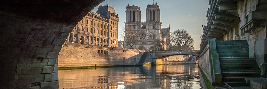
Today's Paris developed from the 3rd century BC. from the Celtic settlement “Lutetia” on the Île de la Cité. The Romans later built a city on the Seine, which initially became a main residence of the Frankish Empire in the 6th century. Paris experienced a heyday of art and culture in the 16th century under Francis I. Through absolutism, especially under Louis XIV.
Names like Heinrich Heine and Karl Marx point to the importance that Paris had as a refuge for politically persecuted people from Germany in the 19th century. The city “was considered a place of revolutionary ideas and became a gathering place for political activists from all over Europe.”
The French capital is home to a variety of church and secular buildings, streets, squares and parks worth seeing, around 160 museums, around 200 art galleries, around 100 theatres, over 650 cinemas and more than 10,000 restaurants. The range of cultural events is extensive with numerous concerts, exhibitions, music and film festivals, fashion shows and sporting competitions. The Seine waterfront in Paris was added to the UNESCO World Heritage List in 1991.
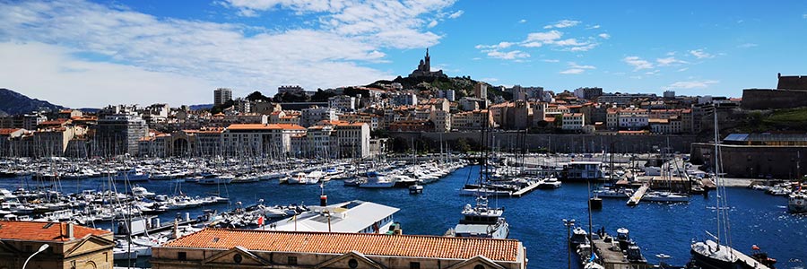
According to ancient legend, the city was founded when Greek sailors from Phocaia explored the Mediterranean coast. They landed on the coast of what is now Marseille on the day when a Celtic king named Nann was looking for a husband for his daughter Gyptis. Gyptis was to give a cup to the one she wished to marry from among all the young men gathered. Surprisingly, it was Protis, the leader of the newcomers, to whom she gave the vessel. The two married, and Greeks and Celts founded the settlement of Massalia together.
South of the city center is the Notre-Dame de la Garde, designed by Henri-Jacques Espérandieu in the neo-Byzantine style and built between 1853 and 1864 on the site of a medieval pilgrimage chapel. It is located on a 147 m high limestone cliff and, along with the Château d'If in front of the harbor, is the landmark of Marseille. “La Bonne Mère”, as it is popularly known, contains a monumental collection of votive images. The viewing platforms offer a spectacular view of the city.
In the center of the city lies the old harbor Vieux Port. There is a fish market at the Quai des Belges. Approximately halfway along the route to the Cours Saint-Louis is the Stock Exchange (Palais de la Bourse), where the Musée de la Marine et de l'Économie de Marseille is housed. The Musée des Docks Romains housed the harbor facilities from the first century of our era. The Musée d’Histoire de Marseille was built around some of the remains of the ancient port. From the Old Port, small transport ships and tourist boats sail to the Frioul Islands, consisting of the islands of Ratonneau, Pomègues and If with the Château d'If. Some ships sail past the Calanques to Cassis, about 15 kilometers away, with Europe's highest cliff.
 Many world-famous painters were Dutch. One of the most famous early artists was Hieronymus Bosch. The heyday of the Republic in the 17th century, the so-called Golden Age, produced great artists such as Rembrandt van Rijn, Jan Vermeer, Frans Hals, Carel Fabritius, Gerard Dou, Paulus Potter, Jacob Izaaksoon van Ruisdael and Jan Steen. During the Golden Age, around 700 painters worked in the Netherlands, completing around 70,000 paintings a year. Famous painters of later eras were Vincent van Gogh and Piet Mondrian. M. C. Escher and Otto Heinrich Treumann were well-known graphic artists.
The most famous Dutch rock band Golden Earring had their biggest hit with Radar Love in the 1970s. The classic rock bands Ekseption around Rick van der Linden and Focus as well as Shocking Blue with their hit Venus were also world-famous in the 1970s. Eddie Van Halen and Alex Van Halen, band members of the American hard rock band Van Halen, were also born in the Netherlands.
Anne Frank wrote her world-famous diary between 1942 and 1944 while she and her family were in hiding in Amsterdam to avoid arrest or deportation to an extermination camp.
In motorsport, the motorcycle world championship Grand Prix race track in Assen (Dutch TT), the Formula 1 Grand Prix race track in Zandvoort and the De Bonte Wever ice stadium in Assen with its ice speedway world championship races are known worldwide.
The best known for Holland are frieten or patat, Dutch for French fries, with various sauces, the most famous combination being mayonnaise and peanut sauce (with onions), the patatje oorlog. Other specialties include Goudse kaas (Gouda cheese) and Hollandse Nieuwe; These matjes are young, not yet sexually mature herring. Due to the Netherlands' past as a maritime power, culinary influences from the former colonies came to the country, for example the nasibal or bamibal. These are Nasi Goreng or Bami Goreng in the shape of meatballs.
England covers most of the southern section of the island of Great Britain, bordered by Scotland to the north and Wales and the Irish Sea to the west. The country borders the North Sea in the east, the English Channel in the south and the Atlantic in the southwest.
London is the capital of England and the entire United Kingdom. In terms of the number of inhabitants, it is the third largest city in Europe (after Moscow and Istanbul).
The Romans fell under the leadership of Caesar in 55 and 54 BC. BC invaded England in two campaigns, but then withdrew before the end of the year and did not remain as conquerors. It was not until almost a century later, during the reign of Emperor Claudius, that the Romans began a permanent conquest of England. Scottish ethnic groups repeatedly invaded the power vacuum that emerged after the Romans withdrew around 410 AD. In the period that followed, groups of Angles, Jutes and Saxons immigrated.
According to Henry VIII's rules of succession and also after the assurances that Mary I had made to the magnates when she married, Elizabeth I ascended the throne in 1558. The new, Protestant queen was enthusiastically received by the people. From the beginning of her reign, the queen's possible marriage was the dominant issue. Parliaments called on them to do so several times, with the aim of having a male heir to the throne. She was responsible for implementing the Reformation, but also for the worsening relations with Spain.
Examples of traditional English cuisine include the Sunday roast, fish combined with chips, and the full English breakfast, which generally consists of bacon, sausages, tomatoes, bread, beans, mushrooms and eggs. Some popular cheeses include Cheddar, Red Leicester and Wensleydale. Traditional English desserts include apple pie and other fruit cakes, as well as pudding and, more recently, caramel pudding. A classic drink is tea, whose popularity was increased by Catherine of Braganza.
In pre-Roman times, the higher part of what is now Norfolk was particularly populated. There are large deposits of flint there. The oldest artifacts are over 600,000 years old; Mining has been documented for over 4,000 years. In the Bronze Age the region was a centre of metal processing. What is now Norwich was already an important place in Celtic times.
After the Roman conquest, the Celtic Iceni revolted against the occupiers in AD 47 and 60/61.
In the 5th century the Angles invaded, settled along the rivers and founded the kingdom of East Anglia, which also included Suffolk and neighbouring lands. Viking raids began in the 9th century and destroyed Norwich and Thetford in 1004.
Wool processing developed in the Middle Ages, leading to great prosperity and the founding of numerous churches through the export of Norfolk Horn sheep's wool to the continent, until the plague partially depopulated the region in 1349.
In the Middle Ages, peat was mined in the boggy region along the east coast of Norfolk around Great Yarmouth and used as heating material. As the coastline slowly sank, a system of canals and lakes emerged that was declared a national park. The approximately 200 km of navigable waterways are now popular tourist destinations.
In the north, the county of Kent is bordered by the Thames Estuary and the North Sea, and in the south the English Channel and the Strait of Dover form a natural border. To the west, Kent borders Surrey and East Sussex.
The continent, within sight when the weather was good, was both a trading partner and a threat to invasion. Accordingly, the ports of Kent, grouped together as Cinque Ports in the Middle Ages, had a prominent position for all rulers in London, securing the coast alongside the ports with numerous castles. At the same time, Kent, with the ancient cathedrals in Canterbury and Rochester, were bridgeheads for the spread of Christianity to Britain.
Kent has three universities: Canterbury Christ Church University with several campuses in the east of the county, the University of Kent with campuses in Canterbury and Medway, and the University of Greenwich with campuses in Woolwich, Eltham and Medway,
Many writers and artists have been inspired by Kent. Canterbury's position as a religious centre led to Geoffrey Chaucer's Canterbury Tales, a landmark in English literature. Author Charles Dickens' father worked on the Chatham docks. That's why you can find impressions of Chatham and the surrounding area in many of Dickens' novels.
The painter William Turner spent parts of his childhood in Margate and often returned there later. The East Kent coast inspired many of his works including some of his seascapes.
The musician Kate Bush comes from Bexleyheath and the musician and poet David Sylvian from Beckenham.
Roman influence in Buckinghamshire is particularly noticeable in the Roman roads that cross the county. Watling Street and Akeman Street run east-west through Buckinghamshire and were important trade routes connecting London with other parts of the Roman Empire in Britain. The Icknield Way along the Chiltern Hills was used by the Romans as a defensive line; It is probably an extension of a much older road.
The Industrial Revolution and the construction of the railroad changed the landscape in various parts of the county. Wolverton in the north (now part of Milton Keynes) became the national centre of wagon building; Furniture and paper industries settled in the south. Lace-making businesses emerged in the centre of the county and grew rapidly, providing work for the women and children of poor families.
Buckingham still has good rail connections to London, Birmingham and Manchester; Furniture manufacture is still one of the major industries in the south of the county.
A severe cholera epidemic was rampant in the early Victorian era; Agriculture suffered from significant crop failures. At this time many residents left Buckinghamshire and settled in the surrounding towns. Landowners take advantage of the opportunity to purchase the land they left behind cheaply. As a result, the Rothschilds, one of the most influential families in the country, gained considerable importance in Buckinghamshire.
The county of Derbyshire lies in a mountainous landscape. Most of the Peak District National Park lies within Derbyshire. The northern part of the county overlaps with the Pennines, a famous range of hills and mountains. The county is part of the National Forest and borders the counties and areas of Greater Manchester, West Yorkshire, South Yorkshire, Nottinghamshire, Leicestershire, Staffordshire and Cheshire.
Those who are good on foot can hike through the national park along the 431-kilometer-long Pennine Way. The low mountain ranges of the Pennines extend to the north of Derbyshire. Bizarre sandstone formations, winding cave systems and wildly romantic moorland landscapes are waiting to be discovered by you. From the summit of the 517-meter-high Mam Tor there are magnificent views of the picture-perfect Derbyshire landscape.
A stay in Derbyshire offers active holidaymakers and individualists the opportunity to discover a still relatively unknown region for themselves. The Peak District National Park is of incomparable scenic beauty, regardless of whether you explore it on a black horse, on horseback or by bike.
If you're planning to explore the national park, it's a good idea to stay overnight in a cozy hotel in Derby. The city is known for its porcelain factory and the production of the luxury Rolls-Royce car. The cathedral rises above the roofs of the city, where you can view important tombs.
The city museum shows fragile beauties from the local manufacturer. Historical flair can be felt when strolling through the Market Place.
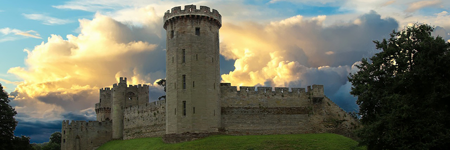
Because of its location between the borders of two kingdoms, Warwickshire had to create a defence against the threat of Danish invasion. This task was carried out by Ethelfleda, “Lady of the Mercians” and daughter of King Alfred, who was responsible for building the first parts of Warwick Castle. Defences against the Danes were also built in Tamworth (Tamworth Castle).
Historically, much of western Warwickshire, including areas now part of Birmingham and the West Midlands, was covered by the Forest of Arden. For this reason, many place names in the north-western part of Warwickshire end in the ending “-in-Arden”. Most of this forest was cut down from the 17th to 19th centuries to provide fuel for industrialization.
The Forest of Arden is a former woodland and culturally defined area in the English West Midlands, which in ancient times and into the early modern period covered large parts of Warwickshire and parts of Shropshire, Staffordshire, the West Midlands, and Worcestershire. It is associated with William Shakespeare as the territory of his youth and the setting for some of his plays.
The Forest of Arden area was initially mapped using the Roman roads that conceptually bounded it: to the west by Icknield Street, to the south by the Salt Road (today's Alcester to Stratford Road), to the east by the Fosse Way, and in the North on Watling Street.
During the 18th and 19th centuries Warwickshire became one of the leading industrial counties. The coal mines of northern Warwickshire were among the most productive in the country and fuelled the industrial growth of Coventry and Birmingham.
At the end of the 19th century, Birmingham and Coventry were large industrial cities, so the administrative boundaries had to be changed. In 1889 the administrative county of Warwickshire was formed and Coventry and Birmingham became county boroughs.
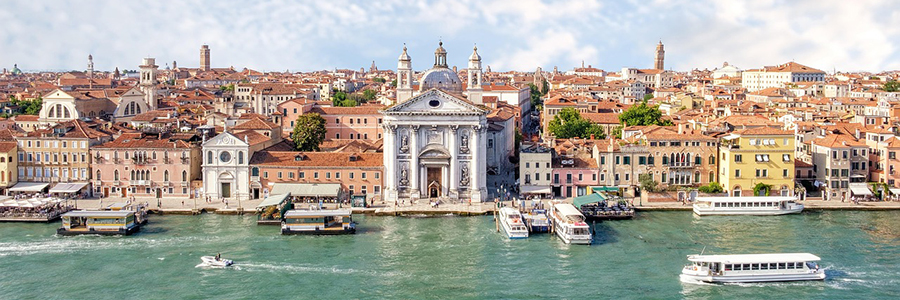
In Italy there are numerous historical and folkloric traditions of various kinds, which are also internationally known and famous. Worth mentioning here are the Palio di Siena horse race, the Calcio storico in Florence and the Regata storica in Venice. The carnival festivals in Venice, Viareggio, Ivrea, Mamoiada, Acireale, Sciacca, Florence and Rome.
UNESCO has counted the processions with shoulder tower shrines (Macchina di Santa Rosa in Viterbo, Varia di Palmi in Palmi, Gigli di Nola in Nola and Faradda di li Candareri in Sassari) since 2013 and the Sicilian Marionette Theater since 2001 as intangible cultural heritage of humanity.
Italian cuisine (Cucina italiana) is considered one of the most influential national cuisines in the world. Internationally known products include Italian olive oil, pesto, ice cream, panettone, tiramisu, various types of cheese such as Parmesan, mozzarella or Gorgonzola, sausage and meat products such as mortadella, salami, San Daniele ham or Parma ham and of course pasta and pizza. There is also a wide range of local wines such as Chianti and Barolo. Italian cuisine was recognized as an intangible world cultural heritage by UNESCO in 2010.
Italian fashion has a long tradition. Milan is Italy's most important fashion metropolis, Rome, Turin, Naples, Genoa, Bologna, Venice and Vicenza are also important centers. The major Italian fashion brands include: Armani, Benetton, Brioni, Dolce & Gabbana, Ermenegildo Zegna, Fendi, Ferragamo, Gucci, Max Mara, Missoni, Moschino, Prada, Valentino and Versace.
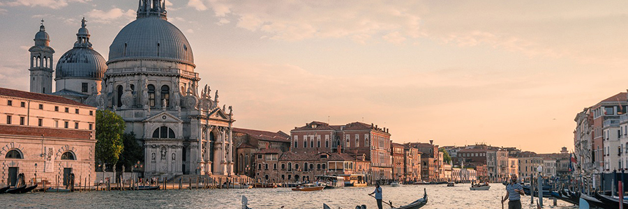
Venice was the capital of the Republic of Venice until 1797 and with more than 180,000 inhabitants one of the largest European cities. Until the 16th century, it was one of the largest trading cities which traded between Western Europe and the eastern Mediterranean. Venice engineered most commercial and warships.
Venice and its lagoon have been on the UNESCO World Heritage List since 1987. They especially inspired artists and Venice became one of the most visited tourist destinations.
The influx of tourists led to an unusual action by the city administration in 1999: posters warned about Venice. This campaign was aimed at day-trippers who bring little to the city other than being a burden. This poster campaign by Oliviero Toscani warned of the ugly side of Venice with graphic photos of rats, polluted canals and decaying palaces in order to deter those visitors who expected a postcard idyll. In 2015, Mayor Brugnaro considered restricting access to St. Mark's Square and also giving locals special access to the clogged vaporetti. Because while mass tourism and especially day-trip and cruise tourism continue to increase, the number of inhabitants in the lagoon city is continually falling, second home ownership is increasing sharply, local supplies are collapsing and quality tourism is reporting vacancies.
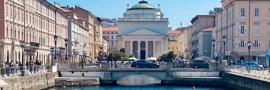
From 1382 to 1918 Trieste belonged to the Habsburg monarchy not to say to Austria-Hungary. It was its most important trading port, one of the bases of k.u.k. Kriegsmarine and seat of the governor of the Austrian coastal country.
Trieste, like Berlin, lies on the fault line between East and West, or in other words between democracy and communism, found itself in a marginal position in the transport sector for decades due to the East-West conflict.
What makes Trieste so special is not just its numerous sights. The city's unique flair lies more in the attitude to life that the people of Trieste carry with them. This warm, Mediterranean atmosphere can be felt particularly in the Piazza unita d'Italia.
The old town consists of a small number of narrow streets and narrow passages. Antique meets relics of the KuK monarchy and the present with modern fashion shops. For an Italian city, Trieste is also very clean and tidy.
You should definitely try the typical Jota, a soup made from beans, potatoes and sauerkraut, served with lard, bacon, smoked sausage, herbs and spices and which fully expresses the style of local gastronomy.
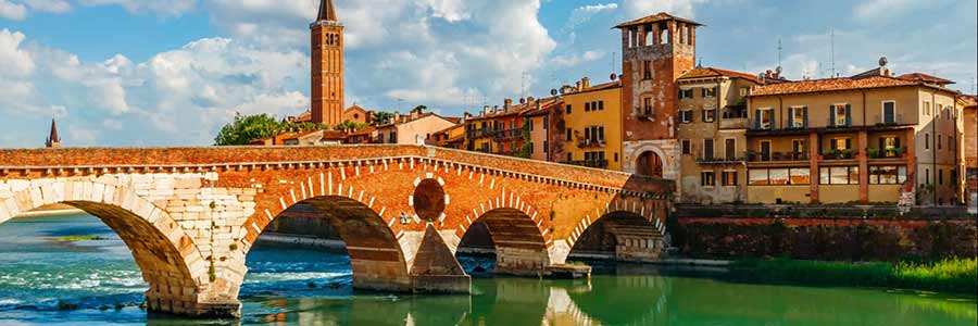 Verona is an Italian city in Veneto in the northeast of Italy, the city is located on the Adige about 59 m above sea level at the outlet of the so-called Brenner line in the Po Valley. Since 2000, the old town of Verona has been a World Heritage Site.
Verona was a founding of the Räter and Euganeer tribes around 550 BC. It was conquered by the Gallic tribe of the Cenomans in the 3rd century BC and was a Roman colony from 89 BC onwards. The well-preserved amphitheater - the Arena - was built more than a century later.
Verona is more than just the setting for Shakespeare's Romeo and Juliet. The city on the Etsch is rich in sights from the Middle Ages and Roman times. Particularly worth mentioning is the arena - the amphitheatre, where operas and concerts are regularly performed in the summer.
The historic old town of Verona was added to the UNESCO World Heritage List in 2000. The city was founded in the 1st century BC. Built in the 1st century BC, the most famous building is the arena. How much does entry to the Arena Verona cost? The arena is open on Mondays from 1:30 p.m. to 7:30 p.m. and from Tuesday to Sunday from 8:30 a.m. to 7:30 p.m.
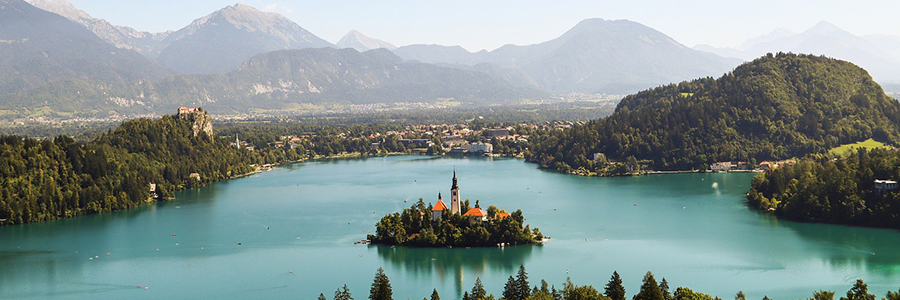 As a traveller you can experience breathtaking nature with waterfalls, the Alps and gorges - but also chilled out cities like Ljubljana. Slovenia is one of the EU states with the greatest biodiversity: one in every 50 known mainland animal and plant species in the world occurs here.
Ljubljana is a cool but at the same time relaxed and small capital. Only around 280,000 residents live there and enjoy life along the Ljubljanica River, over which more than twelve bridges lead in the city.
Bled, a small town near the Austrian border - travellers will find perhaps the most photographed object in the country: St. Mary's Church on the small island in the lake.
The Vipava Valley stretches between the Alps and the Adriatic Sea, a real insider tip! Travelers can explore picturesque stone villages and taste local wines there. Other regional delicacies are also served, such as the air-dried raw ham Vipaski Prsut, fruit and other delicious dishes.
The Postojna cave system is world-famous and huge: it winds a total of 24 kilometres underground, five of which can be visited. This means that Slovenia has the second largest stalactite caves in the world that have been developed for tourism.
Whether rafting, kayaking, climbing, hiking or camping in the countryside: outdoor fans on vacation in Slovenia definitely have to go to the Bovec community in the Soča Valley, through which the mountain river of the same name runs.
 The city of Ljubljana has a very special vibe with Mediterranean influences - which can be traced back to the fact that in history Ljubljana sometimes belonged to Italy and sometimes to Austria. In 1991 Slovenia became independent.
As in the rest of the country, there is a lot of greenery in Ljubljana - numerous gardens and parks invite you to linger or take a long walk. Tivoli Ljubljana is ideal for this with a total size of 500 hectares, which is a good 30 percent more than Central Park in New York City has to offer! The site features exhibition areas, forest and even a ski jump. By the way: Ljubljana has already held the title of “Europe’s greenest city”.
The central promenade is lined with hip cafés and restaurants in pastel-coloured houses.
Things are more colourful on Metelkova Street, a centre of alternative culture with lots of street art and events. It developed from a squat – an empty barracks complex that was occupied by artists and activists.
Also worth seeing are the listed old town and the Ljubljana Castle towering above it. From there you have a panoramic view of the entire capital towards the mountains.
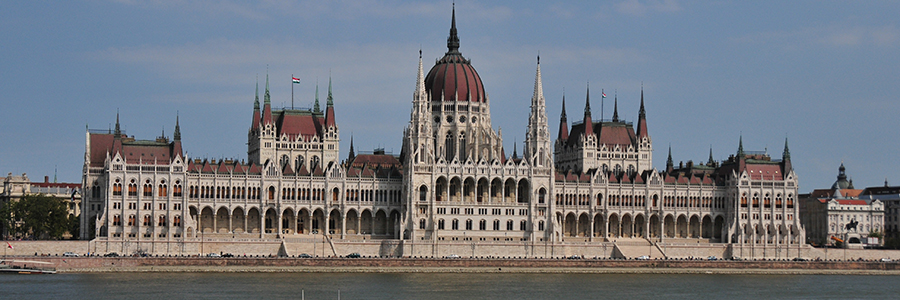
In most of the languages of the world identical names are used for the country Hungary and its inhabitants; They originate from the Latin term hungarus. This, in turn, is due to the name of a late-riding cavalry of the Black Sea, that of the Onogurians who, in the Middle Ages were, perhaps erroneously, mistaken with the Magyars.
The longest river in Hungary is the Danube (Duna), which is home to the entire Hungarian territory. The main cities of Komárom (Komorno), Esztergom (Gran), the capital Budapest, Dunaújváros, Baja and Mohács.
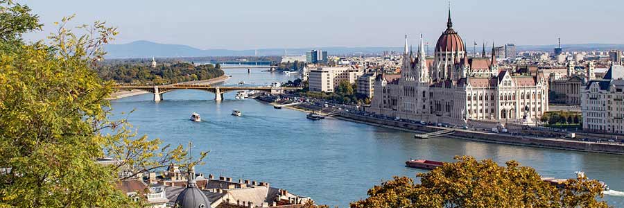 Budapest is situated on the Danube river, which at this point leaves the Hungarian middle range and flows into the Hungarian lowland. The highest elevation in Budapest is the 527 meter high János mountain (Hungarian János-hegy), which belongs to the mountains of Buda.
The Danube is the actual main attraction of Budapest and is spanned by nine bridges that shape the cityscape. The most important, because it is the oldest and also the city's landmark, is the Chain Bridge.
Other Buda mountains are the Gellért Hill, the Várhegy Hill, the Rosenberg, the Sashegy, the Martinsberg, the Svábhegy and the Széchenyi Mountain (Széchenyi hegy). Geotectically speaking, the town is situated on a break site, so Buda is particularly rich in thermal springs.
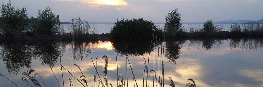 Lake Balaton (Lake Balcsi), located in western Hungary, is the largest inland lake and the most important steppe lake in Central Europe. It is 79 km long and on average 7.8 km wide. The area is about 594 km² (14 km² more than Lake Geneva and 58 km² more than Lake Constance) in 2018.
The Romans called Lake Balaton Pelso. In Hungarian, the lake is colloquially called the “Hungarian Sea”. Its beaches and the spas and thermal springs on the lake attract bathing tourists. The capital Budapest and Lake Balaton are the most important tourism destinations in Hungary. Wine growing and fishing on or in the lake are also of economic importance.
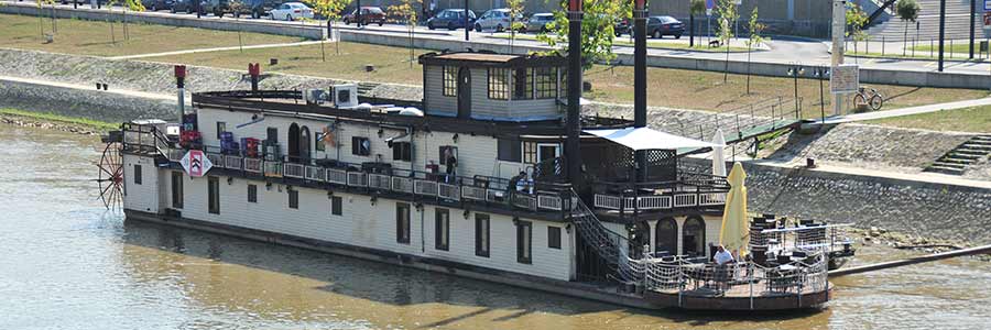 Győr / Raab was one of the last outposts in a distance to Vienna during the Turkish wars and therefore had invaluable military significance. After the Battle of Mohács (1526) Raab played a key role in the Turkish defense.
Maria Theresa (1740-1780) raised the city to a royal free city in 1743 and during the Hungarian popular uprising of 1956 Györ played a significant role, too.
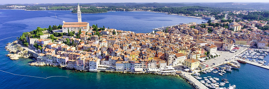 Croatia, officially the Republic of Croatia, is a sovereign state at the crossroads of Central Europe, Southeast Europe, and the Mediterranean. Its capital city is Zagreb, which forms one of the country's primary subdivisions, along with its twenty counties. The region was settled by Liburnians and Illyrians, while the first Greek colonies were established on the islands of Korčula, Hvar and Vis. In 9 AD the territory of today's Croatia became part of the Roman Empire. Emperor Diocletian built a large palace in Split when he retired in AD 305.
During the 5th century, one of the last Emperors of the Western Roman Empire, Julius Nepos, ruled his small empire from the palace. The period ends with Avar and Croat invasions in the first half of the 7th century and destruction of almost all Roman towns. Roman survivors retreated to more favourable sites on the coast, islands and mountains. The city of Dubrovnik was founded by such survivors from Epidaurum.
The name of the Croats is first documented in a source from the 9th century. The name “Hrvat” itself has no Slavic roots, but most likely arose as a foreign name for Slavs from Iran (Sarmatians). It is believed that the “Hrvati” people come from the area of the Persian river (in the Sarmatian language) “Harahvaiti”, which is now called “Sarasvati” due to the sound shift (“h” to “s”).
In addition to the content articles, we publish blogs on many topics. Follow the links indicated. Please click here to our theme-related blog articles with more pictures about our explorations to Croatia.
The ancient amphitheatre of Salona
Boat tour on Cetina River next to Omis
New contacts in Shkoder, Omis and Salona
Arrival at Omis and first exploration hike
Exploration hike Omis - reverse trail
Adventure on the Zip Line high above Cetina River
New archaeological concepts in Siculi
Narona - Roman colony and trading town at Neretva River
Hike to the medivial fortress of Starigrad
Descent from Starigrad passing old stone houses
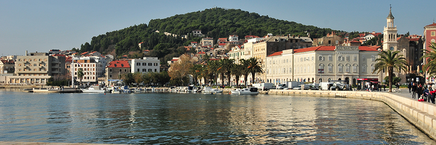
Split is the second-largest city of Croatia and the largest city of the region of Dalmatia, it lies on the eastern shore of the Adriatic Sea. Spread over a central peninsula and its surroundings, Split's greater area includes the neighbouring seaside towns as well.
Split was founded in the 4th or 3rd century BC. Founded as the Greek colony of Aspalathos in the 1st century BC. The settlement took place from Issa, today's Vis, which has been inhabited since 367 BC had gained autonomy from the mother city of Syracuse and now founded its own colonies.
The Roman settlement of Salona is located in the north of the city. The most important building there is the arena, which is now unfortunately almost destroyed.
Diocletian's Palace is incorrectly considered to be the nucleus of today's city of Split. Emperor Diocletian had it built around 300. After his death around 312 and that of his wife Prisca (probably 315), the Roman Empire used the palace as an administrative headquarters, barracks and as a production facility (textile production in a gynaeceum) for the military apparatus, which was increasingly switching to self-sufficiency in the face of the ailing economy.
Split is one of the oldest cities in the area. While traditionally considered just over 1,700 years old, counting from the construction of Diocletian's Palace in 305 CE, the city was in fact founded as the Greek colony of Aspálathos in the 4th century BC. It became a prominent settlement around 650 CE, when it succeeded the ancient capital of the Roman province of Dalmatia, Salona: as after the Sack of Salona by the Avars and Slavs, the fortified Palace of Diocletian was settled by the Roman refugees.

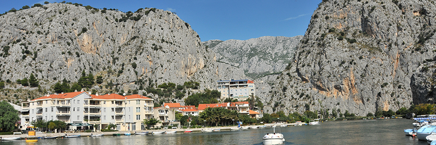
Omis in Croatia is a small Central Dalmatian town and harbour located between Split and Makarska, situated in the mouth of the Cetina river, surrounded with massive gorges. The evidences of proud and turbulent Omis history can be found on every corner of the Omis Riviera.
The old town complex, which was built in the Middle Ages, is located right in the centre of Omis. Worth seeing are the remains of the historic city walls, old stone houses, the "Happy Man's House" and much more.
The Mosor is a high karst mountain range that dominates the area between Split and Omiš. It is separated from Kozjak by the deep Klis gorge. In the southeast it extends to the Cetina River. Its highest peak is the 1339-meter high Veliki Kabal.
During this period, Omiš became a pirate nest. Along with Senj, which is located in the northern Adriatic, the city became a centre for piracy in the Adriatic, which particularly endangered the Venetian maritime trade. At times even Venice had to pay very high pass fees to buy free travel. Afterwards, various rulers quickly alternated until Venice finally managed to conquer the city in 1444. The Serenissima remained mistress of Omiš until the end of the Venetian Republic.
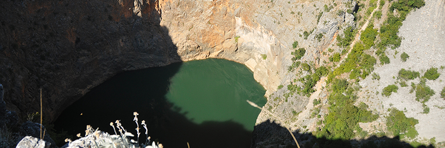 Imotski is a small town situated on the northern side of Biokovo massif, Dalmatian Hinterland, Croatia. The town is located close to the border with Bosnia-Herzegovina, by the towns of Posušje and Grude. The nearest coastal town is Makarska.
Imotski is known for its medieval fortress on the rocks of Blue Lake. Another phenomenon is the Red Lake which looks like an eye in the scenery. Both lakes are said to be connected with underground channels to the Adriatic Sea. The town was first mentioned as Imotski in the 10th century. It was held by the Turks from the fall of Bosnia in 1492 until 1717 when it was captured by the Venetians.
The Topana Fortress fell into disrepair after it was abandoned by the Austrians, who had taken it over from the Venetians. It was used as a quarry by the residents of the growing town of Imotski. The remains are preserved today. At the entrance is the Church of the Holy Madonna of the Angels, built in 1718 after the withdrawal of the Turks. Due to its exposed location, the fortress offers a great view over the city and the Imotsko Polje. Topana lies at the top of a nearly 300-meter-deep collapse sinkhole filled by the Blue Lake. A comfortable path leads down into the karst basin to a viewing platform right on the lake.
 Vid is a small town about 3 km northwest of Metković on the road that leads from Metković to Ljubusko, Bosnia and Herzegovina. The place was built on the remains of the ancient city Narona. It developed at the foot of the hill were the little river Norin flows, which is also called Norilj by locals.
After the fall of Narona (probably in the 7th century.) there is no written evidence of the settlement of this place. It is believed that this place is named due to the holy Vid from the 14th century, which is frequently mentioned in historical sources.
Narona was an ancient trading town and Roman colony located on the Naro River in ancient Dalmatia in southern Croatia.
The first systematic excavations were carried out at the end of the 19th century by the Austrian archaeologist Carl Patsch. He identified the location of the forum and the city walls and found a number of coins, amphoras and inscriptions. After the Second World War, experts from the Split Archaeological Museum carried out excavations again. They discovered a mosaic near the forum. In 1978, Cambi found a white limestone head of the Roman Emperor Vespasian from 75 AD.
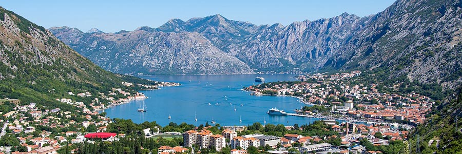 The Balkan state of Montenegro is one of the smaller states in Europe with around 616,000 inhabitants and an area of 13,812 square kilometres. The capital and most populous city is Podgorica, the second largest city is Nikšić. The main economic sectors are the service sector and tourism, with the city of Budva and the city of Kotor mainly on the Montenegrin coast.
According to the World Travel & Tourism Council (WTTC), Montenegro has been one of the three fastest-growing travel destinations worldwide for years.
The German mark was introduced as the currency in 1999. As a result of the conversion of the German mark to the euro, the euro has been used as the national currency since 2002. Since the country does not participate in the European Monetary Union, it does not have the right to mint its own euro coins.
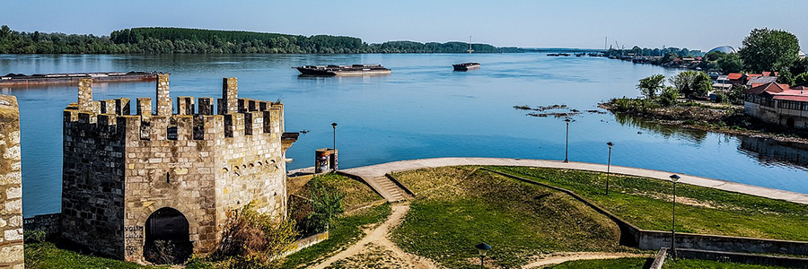 The main tourist destinations in Serbia are primarily the capital Belgrade and the other major cities of Novi Sad, Niš, Kragujevac and Subotica, but also smaller towns such as Jagodina, Užice, Požarevac and numerous health resorts, including Vrnjačka Banja and Sokobanja, or the Kopaonik and Zlatibor mountains as well as the Danube, which is used by cruise ships and boats.
In the past, Serbia was often a borderland of important empires. The border between Western and Eastern Rome once ran along the Drina through Serbian areas. There were several important Roman legionary camps (Singidunum), large cities (Sirmium, Viminatium) and imperial residences (Sirmium, Naissus, Mediana, Felix Romuliana) of late antiquity on the Sava, Danube and along the Via militaris.
The architecture in Serbia is as diverse as the country's history. Byzantine architecture is important, especially in the numerous Serbian monasteries, some of which have been included in the UNESCO World Heritage List.
The most important patrons of architecture were the members of the Nemanjid ruling dynasty. Since the construction of the Church of the Holy Sepulcher by the dynastic founder Stefan Nemanja in the Studenica Monastery, all other Serbian kings have acted as patrons of the arts and, in particular, of religious architecture.
From this, the fresco painters developed a special style and a certain content, which is visibly different from both the subject matter in the Serbian churches of the 13th century and the iconographic content of those large ensembles that were created around the middle of the 14th century. In the Milutin school of painting, which belonged to the so-called Palaiological Renaissance, a whole army of painters, of whom the names of the Greek court painters Mikhail Astrapas and Eutychios have come down to us, worked on the fresco design of Milutin's numerous foundations in Serbia, Thessaloniki, Constantinople, the Holy Mount Athos and Jerusalem.
There is also a rich “independent” music scene in Serbia, which can be linked to the youth scenes in the former Yugoslavia, which were suppressed during the time of the Milošević regime. These include electronica acts like Darkwood Dub or indie rock combos like the Partibrejkers. Well-known popular Serbian singers of various genres include Đorđe Balašević, Lepa Brena, Neda Ukraden, Željko Joksimović, Mile Kitić, Aca Lukas, Marija Šerifović, Zdravko Čolić and Ceca.
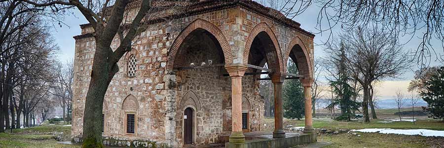 On the eastern edge of today's city centre of Niš is the Roman ruin Mediana, once a suburb of ancient Naissus. The inner district of Niš was named after Mediana.
To the east of Niš city centre is the Ćele Kula skull tower. The tower was built by the Ottomans from skulls of 952 Serbs who died in the Battle of Čegar in 1809.
Northeast of Niš is the monument to the Battle of Čegar with a lookout tower.
In the southern part of the city of Niš, in the district of the same name, there is the Staro Groblje cemetery, which covers several hectares. The cemetery with over 3,000 gravestones dates back to the early 18th century. It was closed to funerals in 1971 and is now in disrepair.
Niš Fortress was built by the Ottomans on the remains of a Roman military camp in the 18th century. With the park in it, it is now a popular meeting place. The fortress contains an ancient mosque, an ancient hammam and a modern amphitheater used for cultural activities.
The annual Nisomnia rock festival takes place here in September.
Behind the fortress is the vegetable and fruit market and a little further on February 12th Boulevard is the memorial to the Crveni Krst concentration camp from the Second World War. Between 1941 and 1944, 10,000 prisoners of this camp were shot on Bubanj Hill. The Bubanj monument is dedicated to them.
The Romans conquered the city 75 BC. Navissos was renamed to Naissus and became one of the most important castles of the Roman Balkans. The strategic road Via Militaris was passing Naissus, coming from Constantinople and Adrianopel - Philippopolis - Serdica - Naissus across the Balkan Peninsula to Singidunum (today Belgrade) and the former European Route 5 (now part E 75, part E 80).
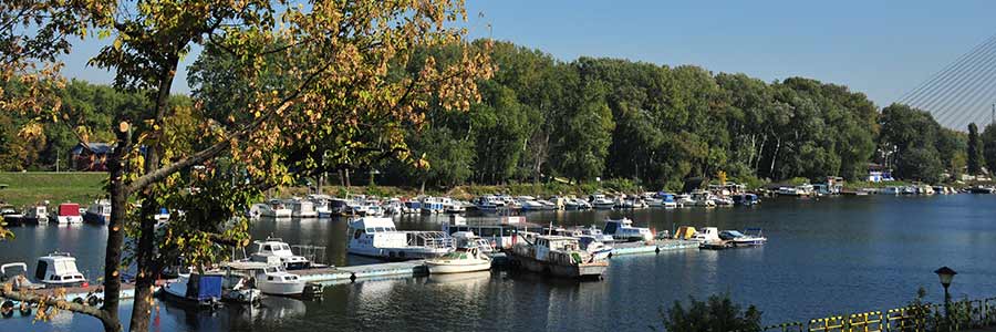 Thanks to its location at the confluence of the Sava and the Danube on the southeastern edge of the Pannonian Plain and along the northern border of the Balkan Peninsula Belgrade is linchpin for traffic between Central and Southeastern Europe and the Middle East. Therefore, Belgrade is often called the gateway to the Balkans. Most important landmarks of Belgrade is, towering over the Sava flows into the Danube, the often in history fought fortress of Belgrade.
The Romans Latinized the name Singidun to Singidunum, which probably means round fortress or round town. In the 1st century BC the Romans conquered the territories to the Danube. Besides Sirmium and Viminacium, Singidunum was an important strategic point on the Via Militaris and the Danubian limes. By 86 AD, to reinforce the frontiers at Singidunum, the Roman moved experienced Legio IV. Flavia Felix to the town, which won even more importance by the Emperor Hadrian in the appointment as Municipium and later also in the rank of a Colonia by the settlement of veterans.
After successfully repelling the Turks from Vienna in 1683, the Holy League was able to push the Ottomans back beyond Belgrade in the Great Turkish War. The siege of Belgrade under the command of Max Emanuel ended on September 6, 1688 with the capture of the city. The imperial troops were able to conquer Belgrade three times (1688–1690, 1717–1739, 1789–1791), but were unable to hold it permanently. Because of this constant fighting, the Ottomans gave Belgrade the name Dar Ul Jihad (House of War).
In Ottoman times, Belgrade was an important trading city on the caravan route between Buda and Constantinople, where merchants and traders of different origins (Turks, Armenians, Greeks and Roma) lived. According to Evliya Çelebi, Belgrade had 98,000 inhabitants in 1660, of which 21,000 were of non-Islamic faith.
Sremska Mitrovica is a Serbian city in the Vojvodina on the north bank of the Sava River, which lies on the settlement of the ancient Byzantine city of Sirmium. The former Sirmium during the Middle Ages in Hungarian was "city of Saint Demetrius on the Sava".
The ancient period ends with the conquest of Sirmium by the Avars in 582 and is also an important turning point in the history of southeastern Europe, as the Slavic conquest of land took place with the Avars.
In the Middle Ages, the city was fought over between Byzantium and Hungary for a long time. Methodius of Salonika had his seat as Archbishop of Pannonia and Great Moravia in Sirmium/Sremska Mitrovica in the 9th century. Around 1180 Sremska Mitrovica finally came under Hungarian rule. The city's common medieval name was Civitas Sancti Demetrii, the City of St. Demetrius, which still exists today in the Hungarian Szávaszentdemeter.

Albania is on only a few tourists' wish lists for their next vacation - and wrongly so. The small Balkan country has fantastic coastlines and untouched beaches along the Ionian and Adriatic Seas, offering perfect conditions for a relaxing beach holiday.
Half of the Albanian territory is of mountainous terrain with altitudes of over 600 m above sea level. A small proportion of these are high-mountain regions. From Skadar Lake in the north to the south in Vlora a few kilometers wide alluvial soils partly extend along the coast, which expand to large Myzeqe level in central Albania. There are numerous lagoons and wetlands on the coast.
At about 1000 BC the Illyrians settled in the Western Balkans. Residential cities were Scodra and Rhizon. After the Illyrian wars in late 3rd century BC, the Western Balkans came under Roman influence and the Romanization of the Illyrians began. With the division of the Roman Empire 395th BC, today Albania came under Byzantine rule. In 591 the Slavs from the north penetrated into the area, followed by looting allover the Balkans.
Next to our content articles we publish blogs to certain topics. Please follow the given links to get to our topic relevant blog articles with couple of additional pictures about Albania.

The area around Tirana has been inhabited since the Paleolithic period. The oldest finds in the city come from Roman times: walls and a mosaic from a Roman villa from the 2nd or 3rd century that was converted into a church. In the 6th century, the Roman Emperor Justinian I had a fortress built, the walls of which can still be seen in the city centre today.
Tirana is the cultural, political and economic center of the centrally organized state Albania and is the seat of several institutions, organizations and parties. So there are the parliament and the country's government.
Tirana was first mentioned in Venetian documents in the present name form in the years 1372 and 1418. For the first time in 1431/32 the Ottomans did a registry of soils and residents. Consequently, there were 60 villages with around 1000 houses and 7300 residents in this region.
The Mullet originating local landowners Sulejman Pasha Bargjini built the Sylejman Pasha Mosque, a caravanserai (Han), a bakery and a hammam at its present location in 1614, and because of that deemed to be the city founder of Tirana.
Bicycle lanes are being set up on more and more streets. The Ecovolis bike rental system was launched in 2011. Bicycles are rented at several stations for a small fee.
The Labeatic Kingdom had long been a thorn in the side of the Romans; they began in 229 BC. The first time a Roman army was sent to Illyria in the 4th century BC. The First Illyrian War began, and Queen Teuta's Illyrian armies had to admit defeat to the Romans before Scodra. The Labeatic kingdom collapsed, and the dynasty only ruled over the city area. 168 B.C. It was also taken by the Romans in 400 BC and the then king Genthios was interned in Iguvium in Italy.
In 1479, Shkodra was conquered by the Ottomans after a long siege of Rozafa Castle, and Shkodra became the capital of the vilâyet of the same name. To the extent that the residents had survived the siege and had not already fled the city, they left the city with the withdrawing Venetian troops and were settled in the remaining Venetian territory.
Skadar lies between the Skadar Lake and the rivers Kir, Drin and Buna. The border with Montenegro is only 34 kilometers away. The 2400 years old city has always been regional administrative center. Today Shkodra is Headquarters Bashkia (township) and capital of Qarks Shkodra.
The first historical settlers of the area were the Illyrians, who arrived in the 2nd century BC. The first homes were built in the 1st century BC. In 2010, two Illyrian graves were found and excavated near the city wall. After the end of the Third Macedonian-Roman War in 168 BC. In the 4th century BC, all of Illyria came under Roman protectorate. 146 B.C. In the 4th century BC, the Romans laid out the Via Egnatia trade route, which served as a continuation of the Italian Via Appia in the Balkans and provided a direct connection between Rome and Byzantium. It began at the two port cities of Dyrrhachium and Apollonia on the Adriatic and united west of Elbasan on the Genusus River. At this point there was a Roman trading center called Mansio Scampa. Scampa is the Illyrian word for “rock”
Elbasan is a city in central Albania. It is the headquarters of a Bashkia and the capital of Qarks Elbasan. The stronghold of the industrial town located north of the river Shkumbin. 146 BC the Romans built the trade route Via Egnatia, which served as a sequel to the Italian Via Appia on the Balkans and established the direct connection between Rome and Byzantium. It commenced with the two port cities Dyrrhachium and Apollonia on the Adriatic and united west of Elbasan at the Riverfront Genusus. There was a Roman trading post, which was called Mansio Scampa.
Elbasan is located in a wide valley, an extension of the coastal plain inland to around 150 m above sea level. A few kilometers east the Shkumbin enters from its rocky valley and enabled here in history-yield agriculture. To the north and south of the city high mountains rise up to 1.000 and 1.800 meters.
The shores of Lake Ohrid have been inhabited since the Neolithic period (6000 BC). The first historical settlers were the Illyrian Encheleans (8th and 7th centuries BC), who left many traces around Pogradec. So on the hill above the city, which they built in the 5th century BC. It was first fortified in the 6th century BC and existed until the Slavs invaded in the 6th century. Several Illyrian royal tombs were found near the village of Selca e Poshtme, dating between the 4th and 1st centuries BC. Date. They belonged to the ancient city of Pelion, which was destroyed by the Slavs in 547/548 AD.
During the 18th century, the town of Pogradec became an administrative center of the region under Ottoman rule. Because of the many wars - including the two Balkan Wars, the First World War and the Second World War - the city's old buildings were largely destroyed. Nevertheless, some of the region's characteristic buildings were able to survive and were declared cultural monuments.
The name Pogradec is of Slavic origin and is formed from the two words pod (under) and gradec (small town) and thus refers to the location of the new town, which lies below the “small (old / Illyrian) town”.
Vlora is a port city in southern Albania on the Strait of Otranto, the strait at the transition between the Adriatic and Ionian Seas. The Bay of Vlora and the beaches near the city are popular tourist destinations.
Roman sources from the 2nd century AD mention a stopover on the trade route along the coast between Dyrrhachium and Buthrotum. Since parts of a city fortification from the 4th century AD were excavated near the Muradie Mosque in the old town in 1988, this Roman Aulon is suspected to be on the site of today's city. In the 5th century, Aulon became a bishop's seat within these fortress walls. The walls were reinforced under Emperor Justinian (527–565). Immigration came from Apollonia, which was abandoned in the 6th century.
Notably Albanian Declaration of Independence was proclaimed here on November 28 in 1912. Culturally and economically it is one of the most significant cities of southwestern Albania. Vlorë is home to Albania's second largest port, the Port of Vlorë.
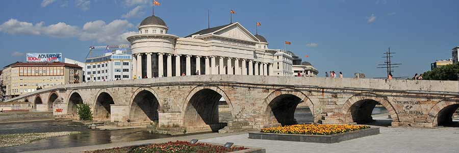
Macedonia is a landlocked country and is centrally located on the Balkan Peninsula. It borders on Serbia, to the east by Bulgaria, Greece to the south, Albania to the west and the northwest of Kosovo. The western mountains of Macedonia are foothills of Dinara, the main mountain range of the Western Balkans. The highest peaks are 2.764 m high Golem Korab on the border with Albania and the 2.747 m high Titov Vrv in the massif of Šar Planina. Other mountains are located in the southwest of the country Jablanica Mountains, which forms partially the border with Albania, the Osogovo Mountains to Bulgaria, the Galičica massif between Ohrid and Prespa and Pelister massif between Prespa and Bitola.
North Macedonia is characterized by a beautiful, almost untouched landscape and is a real paradise for active holidaymakers. The many mountains and the beautiful Lake Ohrid should make the heart of every nature lover beat faster. I'll bring you closer to the most beautiful places in the country.
From hiking holidays to winter sports, North Macedonia is a very diverse holiday destination and a popular travel destination all year round. Hiking holidays and active trips are recommended from spring to autumn.
Next to our content articles we publish blogs to certain topics. Please follow the given links to get to our topic relevant blog articles with couple of additional pictures about Macedonia.
Sources of Lake Ohrid - Sveti Naum at Green Oasis
Museum Complex Museum on the Water at Lake Ohrid
Diving paradise next to pile-dwelling Museum on the Water
An afternoon stroll through the old town of Ohrid
The Historical Beauty of Macedonia’s Ancient City of Stobi
Skopje is the capital and largest city of the Republic of Macedonia. It is the country's political, cultural, economic, and academic centre. It was known in the Roman period under the name Scupi. The territory of Skopje has been inhabited since at least 4000 BC; remains of Neolithic settlements have been found within the old Kale Fortress that overlooks the modern city centre. On the eve of the 1st century AD, the settlement was seized by the Romans and became a military camp. When the Roman Empire was divided into eastern and western halves in 395 AD, Scupi came under Byzantine rule from Constantinople.
The Romans conquered during the Macedonian-Roman Wars in 168 BC. The Dardan Empire also came into power in the 1st century BC, but for decades they were only able to sparingly assert their rule in Macedonia and Illyria. At the beginning of his reign, the Roman Emperor Domitian (81 to 96 AD) settled veterans of the legions I Italica, III Augusta, IV Macedonica, V Macedonica, V Alaudae, IIII Flavia and VII Claudia in the settlement of Scupi, which resembled a military camp.
On January 19, 1392, Skopje came under Ottoman rule for more than 500 years. As the Yugoslavian orientalist Hasan Kaleshi reports, the first Ottoman margrave to live in Skopje was called Paşayiğit Bey, who perhaps built the city's oldest Islamic building, the Meddah Baba Mosque, around 1397. He was followed by his adopted son Ishak Bey, who built a hospice (later converted into a Friday mosque, which became known as the Colourful Mosque) and also donated a madrasa and library.
Bitola is a city in the south western part of the Republic of Macedonia. It is located in the southern part of the Pelagonia valley, surrounded by the Baba, Nidže and Kajmakčalan mountain ranges, 14 kilometres (9 miles) north of the Medžitlija-Níki border crossing with Greece. Bitola is one of the oldest cities on the territory of the Republic of Macedonia, having been founded as Heraclea Lyncestis in the middle of the 4th century BC by Philip II of Macedon. The city was the last capital of Ottoman Rumelia, from 1836–1867. It has been known since the Ottoman period as "the city of the consuls", since many European countries had consulates in Bitola.
South of today's city was the ancient Heracleia Lyncestis, significant parts of which have been excavated in recent decades. In Roman times, Heracleia was an important stop on the Via Egnatia and a suburb of the Lyncestis countryside. The city was already the seat of a bishop in the 4th and 5th centuries, and its metropolitans are attested as participants in the ecumenical councils. As a result of the Slavic conquest from the 7th century, the region was plundered several times.
The city centre is characterized by historical buildings from the Ottoman era. In addition to the many mosques, Bitola has a number of Orthodox churches as well as the Catholic Co-Cathedral of the Sacred Heart. The Covered Market (Besistan), Isak Mosque, White Mosque, Jeni Mosque and Jahdar Kadi Mosque remain from the Ottoman era. These structures were built in the 16th century. The Jahdar Kadi Mosque was built by Sinan, the most famous Ottoman architect of the era.
Ohrid is a city in the Republic of Macedonia and the seat of Ohrid Municipality. It is the largest city on Lake Ohrid and the eighth-largest city in the country with over 42,000 inhabitants as of 2002. Ohrid is notable for once having had 365 churches, one for each day of the year, and has been referred to as a "Jerusalem (of the Balkans)". In antiquity the city was known under the ancient Greek: Lychnidos and Latin: Lychnidus, probably meaning "city of light". By 879 AD, the town was no longer called Lychnidos but was referred to by the Slavs as Ohrid, possibly from the Slavic words "vo hrid", meaning "on the hill", as the ancient town of Lychnidos was at the top of the hill.
The citadel of Tsar Samuil, as the city castle is usually called today, stands on the highest point in the city, the city hill Gorni Saraj. It was part of the fortifications that surrounded the city. The first traces of a fortification, which was possibly further expanded by Philip II of Macedon, come from the Illyrians in the 4th century BC. BC
On the foundations of an early Christian church, a three-aisled cathedral with three apses, a mighty dome over the central part and a bell tower in front of the western facade was built in the 11th century under the Greek Archbishop Leo (1036–56).
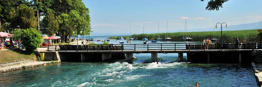
Struga is a town and popular tourist destination situated in the south-western region of the Republic of Macedonia, lying on the shore of Lake Ohrid. In the late 19th and early 20th century, Struga was part of the Manastir Vilayet of the Ottoman Empire. The Ohrid Lake is the largest lake in Macedonia, one of the largest on the Balkan Peninsula and one of the oldest on earth. The water level is 695 m above sea level and has a maximum depth of 287 meters. On Macedonian banks are the major cities Ohrid and Struga, in Albania it is Pogradec. Overall, more than 200,000 people living around the lake.
The Poetry Evenings, which have been held since 1962, are one of the oldest and largest poetry festivals and have won awards for Pablo Neruda, Allen Ginsberg and Mahmud Darwisch.
Since 1962, poets, authors and poetry lovers have met every year at the Poetry Evenings in the city on the Drin. The six-day poetry festival is one of the oldest and largest of its kind in the world. During the Cold War, the festival played an important cultural role as it was able to unite artists from West and East in a "neutral" location - Yugoslavia, as a "non-aligned" state, was not in any camp belonging.
Struga, Ohrid and the surrounding towns are connected by a good bus route network. In addition, bus connections lead to many regional cities (especially Skopje and Bitola), to foreign holiday resorts (Durrës, Vlora, Thessaloniki, Istanbul and Burgas), to Western Europe (Zurich, Vienna, Munich, Cologne, Berlin and Copenhagen) and to other major European cities (Belgrade, Sofia, Sarajevo, Athens and Tirana).
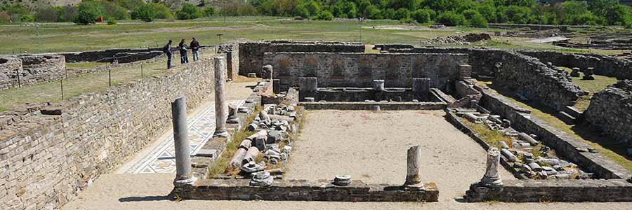
Stobi was an ancient town of Paeonia, later conquered by Macedon, and later turned into the capital of the Roman province of Macedonia Salutaris (now near Gradsko in the Republic of Macedonia). It is located on the main road that leads from the Danube to the Aegean Sea and is considered by many to be the most famous archaeological site in the Republic of Macedonia. Stobi was built where the Erigón River (mod. Crna) joins the Axiós River (mod. Vardar), making it strategically important as a centre for both trade and warfare.
Philip II conquered Paionia around 350 BC. BC and incorporated the country into his empire. However, this was a limited dependency, as there were still Paion kings in Stobi who ruled as Philip's governors. In the 4th and 3rd centuries, the population of Stobi was already largely Hellenized.
After the Roman victory over Macedonia in 167 BC. BC was 148 BC. The Roman province of Macedonia was formed in the 1st century BC, to which Stobi belonged. The city played no role in the administrative organization of the Romans. However, several Roman roads, branches of the Via Egnatia and the Via Militaris, intersected in the city.
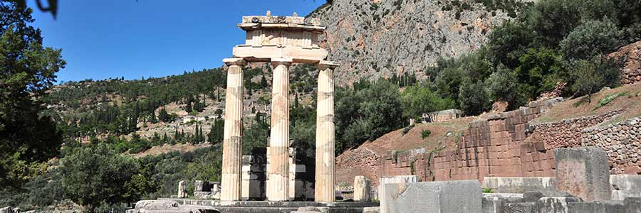 Greece, since 1981, is member of the European Union and, together with 18 other EU member states a monetary union, the euro zone. It is a member of the United Nations, the OECD, NATO, the OSCE and the Council of Europe. The Human Development Index ranks Greece among the highly developed countries.
The Greeks of modern times call themselves Hellenes, but they had many different names throughout history. However, Homer (8th century BC) did not use the term "Hellene" in his epics. In classical antiquity, the Greeks hardly lay a point to present ithemselfves as a unified nation. The own home instead, be it a polis or a kingdom, was up to a few exceptions far more important. The participants in the Olympic Games were summarized as Hellenes. Perhaps it was this name later, in the first centuries of Christianity, being used as synonymous with paganism. From late antiquity until the end of the Middle Ages (1453), the Greeks even called themselves Rhomaioi (ancient Greek for, Romans').
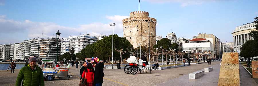
Thessalonica is the second-largest city in Greece and the capital of Greek Macedonia, the administrative region of Central Macedonia and the Decentralized Administration of Macedonia and Thrace. Its nickname literally is "the co-capital", a reference to its historical status as the "co-reigning" city of the Eastern Roman (Byzantine) Empire, alongside Constantinople.
The city's landmark is the White Tower, which dates back to the Venetian or early Ottoman period and was probably built by Venetian builders.
Buildings from the Roman period are the remains of the imperial palace with an octagon, the Arch of Galerius with relief depictions of scenes from the battles of Galerius against the Persians in 296/297, a rotunda, built in the 4th century perhaps as a mausoleum of Galerius, then an Orthodox church and later Mosque (remains of a minaret), now a museum.
Buildings from the Ottoman period include the Besesteni, a six-domed covered market that housed mainly cloth merchants and goldsmiths, Turkish baths (Hamama) such as the Giachounti Hamam, Bey Hamam, Pasha Hamam (Phoenix Hamam), the Hamsa-Bey-Tsami mosques, Alatsa-Imaret-Tsami and Yeni Cami (from 1902), the White Tower, Greek Lefkós Pýrgos, the birthplace of Atatürk and the Konak.
The name is derived from the Peloponnesus mythological figure Pelops, the son of the legendary King Tantalus. The second part of the name is the Greek word for "island". Literally so, the name means "Island of Pelops".
In the Middle Ages instead of Peloponnesus there was the Italian name Morea (probably "mulberry") familiar with a term that referred to in the 10th century only to the western Peloponnese, but was extended to the peninsula from the beginning of the 13th century.
To reach the Peloponnesus from the mainland you need to pass the Isthmus of Corinth, which is about 6.3 km wide at it's greatest widths, broken by the Corinth Canal in 1893, nevertheless, the Peloponnesus is not deemed as an Island because the canal is an artificial construction.
The city of Edessa was for a time at the centre of ancient Macedonian culture. The country was already inhabited by people in prehistoric times and experienced a period of prosperity during the rule of the Macedonians.
Edessa was inhabited until the 6th century BC. The first capital of the Kingdom of Macedonia. The remains of the ancient city can be found southeast of the current city. The capital of the Kingdom of Macedonia was later moved to Vergina. With the Macedonian defeat against the Roman Empire in 168 BC. In the Battle of Pydna, Edessa, like the rest of Macedonia, lost its independence.
In the 4th century BC the city became part of the Roman province of Macedonia.
The shape of the Edessa waterfalls changed over time. Until the end of the 14th century, the water collected in a small lake to the west of the city. After an earthquake or a strong storm, the water poured through the city to a precipice where today's waterfalls were formed. Many visitors in the 17th and 18th centuries described the city as a high cliff with many waterfalls cascading down it. In 1963, construction work by the Greek Electricity Company on the Agras hydroelectric power station on the Edessa River west of the city meant that the waterfalls were in danger of drying up. The citizens of Edessa protested violently and on August 19, 1963, significant protests forced the construction work to be stopped.
Thessaly is a historical landscape in northern Greece between Macedonia, Epeiros and Central Greece. Thessaly was once the settlement area of the tribe of Thessaloi.
It is bounded by the mountain ranges of Olympos in the north, the Pindos in the west, the Othrys in the south, and the Ossa in the east. In between, the fertile Thessalian plain stretches. The main rivers through the Thessalian plain are the Titarisios and the Pinios.
Larisa, which is not mentioned in Homer's ship catalogue, probably took part around 590 BC. BC under Eurylochus in the First Holy War. At that time, Thessaly was ruled by the Aleuades, who often held the high military office of Tagos. When the Persian king Xerxes in 480 B.C. BC moved against Greece, they went over to him to secure their position. After the failure of the Persian campaign, they were able to repulse a punitive expedition undertaken against them
The Ostrogoth king Theodoric the Great thoroughly plundered Larisa during his war against the Byzantine Emperor Zeno in 482. Emperor Justinian had Larisa strongly fortified. Nevertheless, the Bulgarian Tsar Samuil was able to temporarily take the city around 986. At that time he also moved the relics of Saint Achilles to his residence in Prespa. Vigorously defended by the Byzantines, Larisa withstood a siege in 1084 by the feared Apulian Normans under Robert Guiscard's son Bohemond. This general was then severely defeated near Larisa by Emperor Alexios I Komnenos in the summer of 1084. Larisa, on the other hand, appears little during the period of frequent changes of ownership, which begins in 1204 and ends with the conquest of Thessaly by the Ottomans.
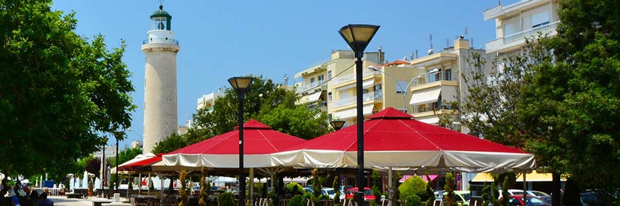
East Macedonia and Thrace is the northernmost of thirteen administrative regions of Greece and consists of the eastern part of Greek Macedonia and the Greek part of Thrace. The capital of the region is Komotini.
The historical areas of Macedonia include the regional areas of Drama, Kavala and Thasos; Thrace includes the areas Xanthi, Rodopi and Evros.
Alexandroupoli is located 14.5 km west of the mouth of the Maritsa/Evros/Meric river delta, 40 km from the Turkish border, 346 km east of Thessaloniki (via the new A2 via Egnatia motorway) and around 750 km northeast of the capital Athens. The nearest major cities are Komotini (around 60 km), the Turkish Edirne (around 140 km), the Bulgarian Kardzhali (around 170 km) or the Bosphorus metropolis Istanbul (around 300 km).
The start of construction of the Constantinople – Edirne railway line of the Oriental Railway in 1870, with a branch on the lower reaches of the Mariza towards the Aegean Sea, initiated the development of the city. The city was founded in 1871 under the name Dedeağaç as a port near the mouth of the Mariza River in the Ottoman Vilâyet Edirne.
The port has become a transshipment point for arms deliveries to NATO member states Greece, Bulgaria and Romania. Since the start of the Russian invasion of Ukraine on February 24, 2022, its importance has only increased. Greece and the US extended their military cooperation agreement for five years in October 2021.
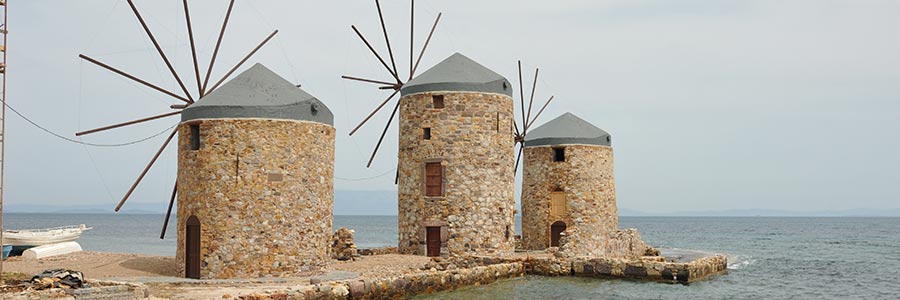
With 3,054 islands, the Republic of Greece manages around 82 percent of all islands in the Mediterranean, but its area is only just under a quarter of the Mediterranean islands and only around 19 percent of the Greek land area.
Almost all Greek islands are located in the Ionian Sea or the Aegean Sea, whose late medieval Italian name arcipelago became the term for archipelagos par excellence. They are roughly divided into the archipelagos of the Ionian Islands in the sea of the same name, while according to ancient tradition the islands of the Aegean Sea are divided into the groups of the Cyclades and Sporades.
Mykonos is one of the most beautiful islands in Greece. With the typical white and blue houses, the famous windmills, the colourful harbours, the dream beaches and bays.
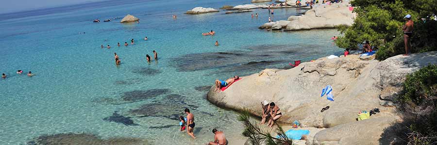
The peninsula of Halkidiki lies between the Thermaic and the Strymonian Gulf and extends in three finger-like headlands into the Aegean Sea: Kassandra (Pallene), Sithonia (peninsula) and Athos (Agion Oros). Between these headlands are two large bays of the Aegean Sea. Between Kassandra and Sithonia, the Toronian Gulf (Gulf of Kassandra) extends with its longitudinal axis to the northwest; also in the same direction the Singitic Gulf (Gulf of Agion Oros) between Sithonia and Athos.
Due to the peninsula's abundance of water, there is a great diversity of plants here, which can be divided into three types of vegetation: forests, maquis and some cultivated plants.
Resin is harvested from the bark of the Aleppo pine, related to the pine, which gives retsina its flavour. The sweet chestnut is mainly found in higher areas. Roasted chestnuts are a typical dish of the area. Eucalyptus trees, which pose a significant risk of forest fires, also appear, as do the plane trees and cypresses typical of all Mediterranean regions.
200,000-year old human remains of Homo heidelbergensis were found in the stalactite cave of Petralona. Ash remains from a fire were also found in the same cave, which is approximately 1.0 million years old. However, it is unclear whether this fire was caused by human hands or by chance.
The most important cities were Olynthos and Potidaia, the only Doric colony on the peninsula. After the Persian Wars in the middle of the fifth century BC, the entire region joined the Attic Sea League. 432 B.C. In the 4th century BC, a conflict developed between Athens and Corinth, or Sparta, over the autonomy of the city of Potidaia, which is seen as one of the triggers of the Peloponnesian War. Potidaea came into power in 431 BC from the Attic Sea League and was subsequently besieged and subsequently captured by Athens as part of the Peloponnesian War.
Entry to google maps Halkidiki: 40°19'42.5"N 23°36'15.8"E 40.328461, 23.604375
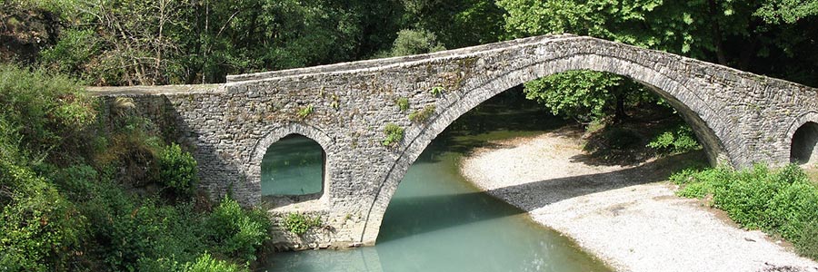
Epirus is a traditional geographic and modern administrative region in northwestern Greece. It borders the regions of West Macedonia and Thessaly to the east, West Greece to the south, the Ionian Sea and Ionian Islands to the west and Albania to the north. The region has an area of about 9,200 km2 (3,600 sq mi). It is part of the wider historical region of Epirus, which overlaps modern Albania and Greece but lies mostly within Greek territory.
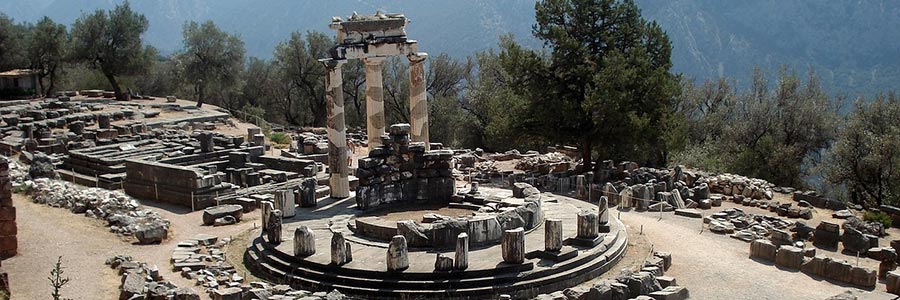
The municipality of Delfi was founded in 1997 by the merger of the previously independent municipalities Delfi and Chrisso. In the administrative reform in 2010, a single community was formed from the eastern half of the Fokida Prefecture, where Delfi became a municipality. This new municipality with the town of Amfissa as an administrative center corresponds almost exactly to the territory of the province of Parnassida which existed until 1997, but was named Delfi after its most famous landmark, the ancient sanctuary Delphi.
Serres is one of the seven regional districts of the Greek region of Central Macedonia, named after the main town of Serres. Serres includes the municipalities of Amfipoli, Emmanouil Pappas, Iraklia, Nea Zichni, Serres, Sindiki and Visaltia.
In ancient times, the territory of the Serres region belonged to the settlement and dominion of the Thracians. Within the framework of the Greek colonization between the 8th and 6th century BC, settlements were established, which were mainly located on the Aegean coast and served to control the extraction of ore in the Pangeo Mountains and the trade.
With the Roman empire division in 395 AD, the area of Serres fell to the East Roman and Byzantine empires. They kept the exclusive control up to the 6th century.
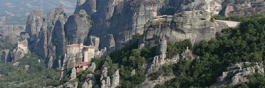
Thessaly is a historical landscape in northern Greece between Macedonia, Epeiros and Central Greece. Thessaly was once the settlement area of the tribe of Thessaloi.
It is bounded by the mountain ranges of Olympos in the north, the Pindos in the west, the Othrys in the south, and the Ossa in the east. In between, the fertile Thessalian plain stretches. The main rivers through the Thessalian plain are the Titarisios and the Pinios.
Trikala: Trikala is at the same location as the Homeric Trikka before, surmounted by a Byzantine fortress, which was built on a wooded hill overlooking the remains of an ancient acropolis. Homer mentions the city Trikka as the origin of Asklepios cult. In the region are also well known monasteries of Meteora!
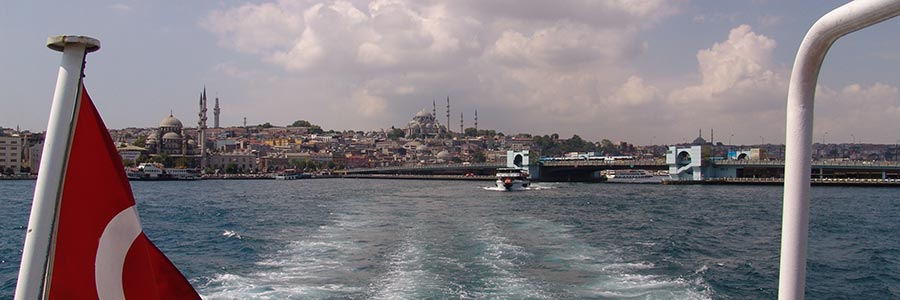
Since the founding of the republic in 1923 as the successor state to the Ottoman Empire, Turkey has been secular and Kemalist in orientation. The country's founder, Mustafa Kemal Atatürk, initiated a modernization of Turkey through social and legal reforms modelled on various European nation states.
The current President Recep Tayyip Erdoğan has been at the helm of the country since 2003. Since around 2012, he has led the country in an increasingly authoritarian manner. Freedom of expression and freedom of the press in particular are considered to be severely restricted. The currency and debt crisis triggered by its economic policies as well as high inflation have continued since 2018, which makes Turkey quite attractive from a tourist perspective.
The culture of today's Turkey is a fusion of the ancient Turkish nomadic culture of Central Asia and Siberia, the Greco-Roman era, the culture in the Ottoman Empire with its Byzantine, Persian, Arabic, Caucasian, Armenian and Kurdish influences, as well as the strong European direction since the founding of the Republic Ataturk. The cultural centre of the country is the metropolis of Istanbul.
With the political changes, the content of Turkish literature also changed. Early representatives include Fakir Baykurt, Sabahattin Ali, Sait Faik Abasıyanık and Yaşar Kemal, who put ordinary people at the centre of their work. With the turn to describing living conditions, social and political criticism of the state is inevitable. The state reacts with censorship and political violence. Authors like Nâzım Hikmet, Yaşar Kemal and Aziz Nesin spend many years in Turkish prisons because of the persecution of their publications. Kemal therefore referred to the prison as a “school of Turkish literature”.
Turkish cuisine has also influenced Greek and the rest of the Balkan cuisine - including etymology. For example, tzaziki comes from the Turkish cacık, and Ćevapčići comes from kabapcik. Yogurt also comes from Turkish Yoğurt. Doner kebab is made from beef, veal or poultry. In Turkey, but also in other countries, the kebab is also served on a plate.
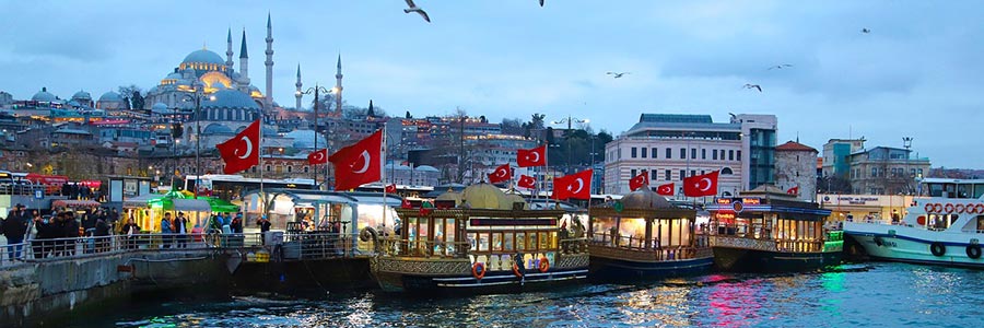
When someone goes on a trip, he can always talk. That's why I took my stick and hat and chose to travel (Matthias Claudius, 1740-1815)
Holiday trips are primarily intended for relaxation and leisure activities. When travelers plan the trip themselves, it is individual travel. Depending on your inclinations, interests and needs, there is a variety of vacation trips.
Beach, hiking and skiing holidays, for example, are primarily intended for recreational purposes, but also health, wellness and culinary trips. Sports and adventure trips are associated with active activities, as are study or educational trips for people with predominantly cultural needs.
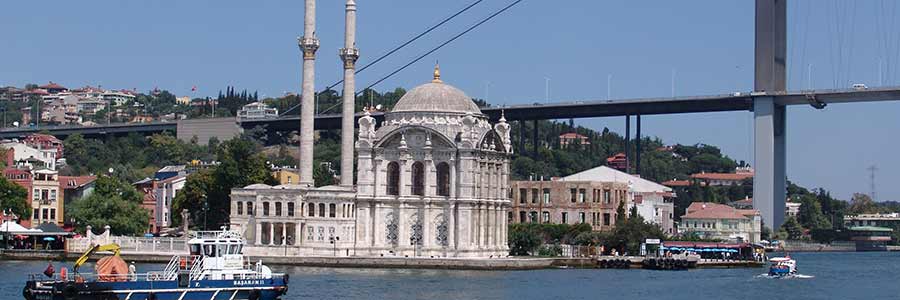
Located in northwestern Turkey, the Marmara region is the country's bridge and connection to Europe, with Turkey's largest city, Istanbul, at its heart. The area has been inhabited for thousands of years and is home to a variety of archaeological sites and relics from the past. The present offers everything from water sports to skiing, or even relaxing on the beach.
Tekirdağ on the Marmara Coast is famous for its local meatballs and raki. Edirne (Adrianople) near the Bulgarian border is a former Ottoman capital with many attractions. The long peninsula to the south leads to Gallipoli, the site of the 1915 landings, which is now dotted with First World War memorials. Ferries run to Gokceada, a mountainous island with semi-abandoned Greek villages.
Istanbul's industrial sprawl extends as far as Izmit. The landscape improves to the south: Iznik am See was ancient Nicaea, the site of Christianity's first and seventh ecumenical councils. Yalova, on the coast, is surrounded by green mountains dotted with thermal springs and waterfalls.
Çanakkale, on the shores of the Dardanelles, is the starting point for visiting ancient Troy and the beautiful island of Bozcaada. It is also the route to ancient Pergamum further south, and an alternative route to Gallipoli. The Marmara Islands lie in Turkey's "Inland Sea" and offer a wide range of resorts to remote escapes. Inland, Balikesir is basically just a transport hub. The highlight of this area is Bursa, a former Ottoman capital with much early imperial history and the nearby national park and ski resort of Mount Uludağ. The routes to the east lead back to Istanbul via Iznik.
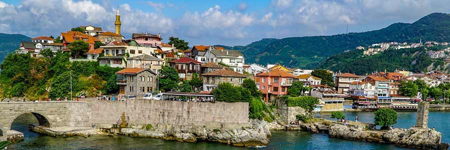
The ancient Greeks described the region on the Black Sea coast as a frightening and barbaric place far from the civilized world. The region became famous through the legend of Jason and the Golden Fleece. In the fourth century BC, the Black Sea coast was marked by rivalries and battles between Athens and the Persians. Remnants of Christian and especially Greek culture in the Black Sea region are the numerous Orthodox monasteries, the remains of which can be found in various cities along the coast and on mountain slopes.
For tourists, the Black Sea coast is considered an insider tip because the climate is wetter than in other regions of Turkey and fewer visitors explore the region. Nevertheless, diverse flora and fauna, deserted beaches and historical sites attract people to the region: in the town of Amasra, which lies on a peninsula, you can explore the ruins of a Byzantine castle and the Fatih Mosque. There is also a historical museum. Traditional wooden architecture can be found in the town of Bartin, west of Zonguldak. The so-called strawberry festival in spring gives visitors an insight into the local culture of the place. In the area of the small coastal town of Sile, various long sandy beaches can be visited. The Uzungöl is considered a picturesque mountain lake with fish restaurants on its banks.
Recently, the popularity of individual tourism and sustainable tourism in the mountains has been increasing. This is particularly true for the mountain ranges of the Kaçkar Mountains in the Black Sea region, which are ideal for hiking.
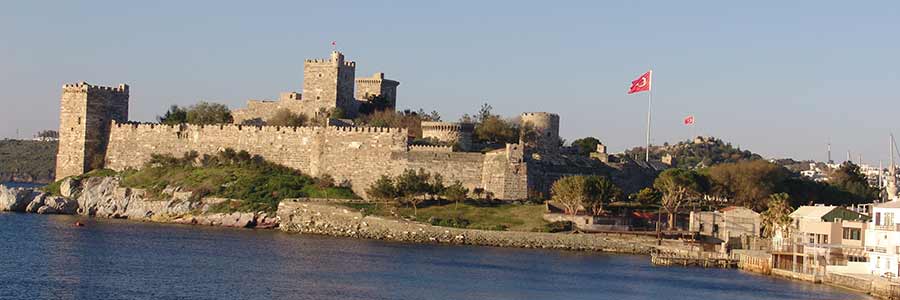
The Turkish Aegean is characterized by 2,808 kilometres of coastline and a variety of ancient sites. A history over 2000 years old awaits you here on the Turkish Aegean. Centrally located in this region is Izmir, Turkey's third largest city, which is also known as the "Pearl of the Aegean".
The ancient cities of Ephesus, Troy and Pergamum located here are world-famous. The cities of Marmaris and Bodrum are also located here with their beaches that invite you to relax.
The large city of Izmir, located directly on the coast, with the nearby seaside resorts of Cesme and Kusadasi is well known. The climate on the Turkish Aegean is significantly milder than on the Turkish Riviera. Popular travel months are May to October, and July is recommended for bathers.
Iztuzu Beach in Dalyan: Natural beauty. This jewel in Dalyan in the province of Mugla in the southern Aegean is considered one of the most beautiful beaches in Turkey and one of the most beautiful natural beaches in the world: it has already been officially named the most beautiful beach in Turkey.
The Blue Lagoon in Ölüdeniz is considered the place with the most beautiful beaches in Turkey. That's exactly why the seaside resort on the Lycian coast is probably one of the best travel destinations for sun-hungry tourists.
Most of the region's olive oil is produced in Ayvalık and Edremit. There are several sugar factories in Afyon, Kütahya and Uşak, although there is also a sulfur factory in Kütahya.
The city of Denizli is the region's main textile centre and exports most of its products abroad. Carpet weaving is particularly present in Demirci, Gördes, Kula, Simav and Uşak. There are significant deposits of marble in Afyon, so production facilities have been set up on site. Cotton weaving is widespread in Aydın, Denizli, İzmir, Nazilli and Uşak.
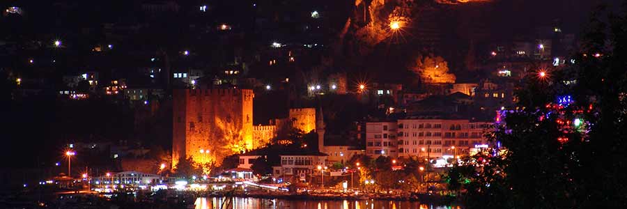
The Turkish Riviera is the southern coastal strip of Turkey and one of the most popular summer holiday destinations. The region is particularly popular among all-inclusive vacationers. Between sun, sea and beach, the region between Antalya and Alanya also has numerous ancient sights and natural spectacles to offer.
While the Turkish Riviera is flat and has long sandy beaches, the Aegean coast is characterized by mountainous landscapes and romantic bays.
The city of Antalya also has a beautiful old town to offer - this is called Kaleiçi. The clock tower is located on the edge of the old town, which is why we started our exploration tour from there. Near the clock tower is another attraction, the Yivli Minare - a mosque, which the locals often refer to as the city's landmark. The best views of this impressive structure are from nearby Republic Square. Other sights in the city include Hadrian's Gate, the marina and the Archaeological Museum.
If you are looking for peace and relaxation, Belek is ideal for it, it is also wonderful to hike in the pine forests around Belek. If you want to experience something more than Side has a lot more to offer.
Antalya, on the other hand, is known for its historical and cultural wealth, its magnificent beaches and its luxurious resorts.
Alanya is the epitome of a relaxed and carefree tourist attraction. The choice between Side and Alanya ultimately depends on your personal preferences. If you are interested in history and archaeology, Side might be a better choice. On the other hand, if you prefer a livelier holiday with beautiful beaches, Alanya might suit you better.
In Side, which is characterized by tourism, there are numerous restaurants and cafés as well as many colourful shops and souvenir shops that invite you to stroll around. In particular, the pretty old town and its ancient ruins, along with the picturesque beaches, are among the city's best-known and most popular sights.
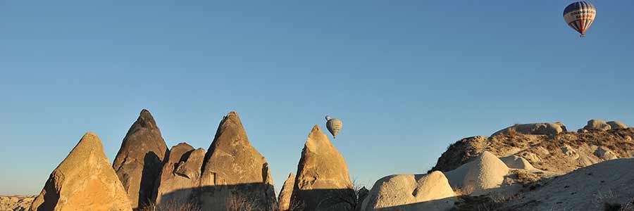
One of the more unknown regions is Central Anatolia (İç Anadolu), the actual historical heartland of the Turks. In terms of landscape, Central Anatolia is characterized not only by some wooded low mountain ranges, the Taurus Mountains in the southern part and the tuff landscapes of Cappadocia, but also by dry steppe areas of the inner Anatolian plateau. Central Anatolia is known for its hot summers (cold nights!) and frosty winters.
Worth seeing and of historical importance are the two former parliament buildings from the early republican period, which now serve as museums, and the old citadel in the city centre. The “Museum of Anatolian Civilizations (Anadolu Medeniyetleri Müzesi)”, known as the “Hittite Museum”, enjoys an international reputation as one of the most important archaeological museums in the world. Near the old town, in the Kocatepe district, rises the mighty Kocatepe Mochee, inaugurated in 1987.
A good 200 km south of the capital Ankara, the city of Konya is located on a plateau flanked by mountains up to 2,300 m high. The place, which was already populated in pre-Christian times, was the residence of the powerful Rum Seljuk sultans in the Middle Ages. Today Konya is known as a centre of conservative Islamic movements.
Eskişehir, surrounded by mountains and forests, is culturally influenced by its two major universities. The city, known for its meerschaum tradition (“Stone of Eskişehir”), boasts excellent cultural offerings such as opera performances, concerts and the annual “International Eskişehir Festival” as well as the “Kent Park” adventure park.
Until recently, the area's residents used the softness of the rock to build apartments, Christian religious buildings, storerooms and stables, as well as hiding places from marauding strangers. Over time, entire settlement complexes with up to 10,000 inhabitants emerged, some of which were connected by corridors. One of the most famous of these cave cities is Göreme, which was listed as a UNESCO World Heritage Site in 1985 and is located near Nevşehir.
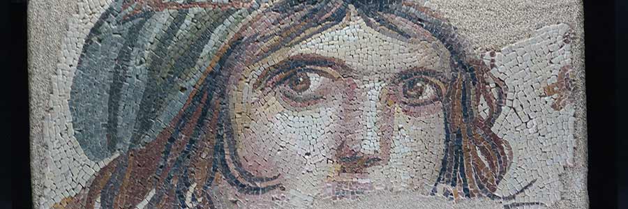
Southeastern Anatolia or Mesopotamia – a remote area in Turkey where you can find many different cultures, which are particularly noticeable in the musical styles: Arabic instrumental music, Syrian Orthodox church chants, Kurdish songs. A journey with many musical impressions and encounters, for example with the Kurdish singer Sakina Teyna, who talks about the sometimes harmonious, sometimes complicated coexistence of the ethnic groups.
Mesopotamia is the name given to the land between the two rivers Euphrates and Tigris. The name brings to mind a mythical past and ancient civilizations. But even today the region is still an area where many ethnic groups, languages, religions and cultures meet.
Southeastern Anatolia is primarily Kurdish, and you can also notice the Arab influence. But it is also the area of the Assyrians and Arameans, i.e. the followers of Syrian Christianity.
The Grotto of Abraham's Birth in Şanlıurfa, over which a large mosque was built, is one of the most important pilgrimage destinations in Islam. According to legend, Abraham was sentenced to death at the stake at the nearby carp basin because of his faith. However, the fire turned into water, the logs into fish, and Abraham was saved. Since then, the pool and the carp have been considered sacred and are visited by pilgrims not only from Islam, but also from Christianity and Judaism.
For centuries, the city of Mardin and the surrounding Tur Abdin region have been the territory of the Assyrians or Aramaeans, i.e. the Syrian Orthodox Christians, and a small community still lives here, which celebrates services every Sunday in the churches and monasteries and visits the historic buildings fills life.
Diyarbakir is the secret capital of the Turkish Kurds, perched on a hill on the banks of the Tigris. Dynamic, energetic, hospitable and full of life.
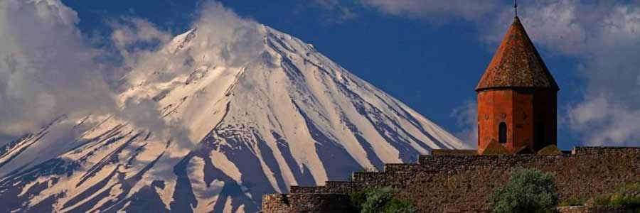
Eastern Anatolia borders the Black Sea to the north, Armenia, Azerbaijan and Iran to the east, Iraq to the south and Central Anatolia to the west.
The region is characterized by a variety of landscapes, including mountains such as the Taurus and Ararat, plains, river valleys and lakes. Some of the most famous cities in Eastern Anatolia are Van, Erzurum, Diyarbakır, Malatya and Elazığ.
The culture and history of this region are rich and diverse. Eastern Anatolia has been an important setting for various civilizations throughout history, including the Byzantine Empire, the Ottoman Empire, and earlier cultures such as Urartu. The region also has rich ethnic diversity as it is inhabited by various ethnic groups including Turks, Kurds, Armenians and Arabs.
Eastern Anatolia is rich in historical sites and ancient ruins. Places like Ani, an ancient Armenian capital, or Nemrut Dağı, a mountain with impressive monumental statues, offer fascinating insights into the region's history.
Due to its mountainous landscape, Eastern Anatolia is ideal for hiking and mountaineering. Mount Ararat, Turkey's highest mountain, is a popular challenge for mountaineers. There are also many other scenic hiking trails in the region.
The region is known for its pasta and desserts. "Manti", small dumplings with meat filling, are a popular specialty. Sweet dishes such as "Kadayıf" (fine pastries) and "Sütlaç" (rice pudding) are also widespread.
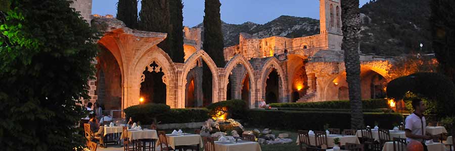
Cyprus is located in the northeast of the Levantine Sea. The distance to the south coast of Turkey is approx. 68 km and to the west coast of Syria approx. 95 km. Cyprus lies on the Anatolian Plate and is geographically counted as Asia. The arch of Cyprus extends from the southern edge of Cyprus to Rhodes as the plate border between the Anatolian and the African plates.
The island has been de facto divided since 1974. The south is dominated by the Republic of Cyprus, which continues to encompass the entire island under international law (except the British military bases Akrotiri and Dekelia). However, the northern part is under the control of the Turkish Republic of Northern Cyprus, which is only recognized by Turkey, which occupied this area militarily in 1974 after Greek coup leaders tried to establish Cyprus's connection to Greece.
Between the two areas is a buffer zone, which also divides the capital Nicosia as a “Green Line” (Green Line / yeşil) and is monitored and managed by the United Nations Peacekeeping Force in Cyprus (UNFICYP).
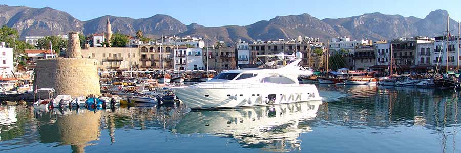
Kyrenia, in Turkish called Girne, is a port city with more than 33,000 inhabitants in the Turkish Republic of Northern Cyprus.
In the 10th to 9th centuries BC Chr. Keryneia became one of the nine city kingdoms in Cyprus. At that time the independent Keryneia was under the rule of an unnamed dynast who stood on the side of Antigonus I Monophthalmos against Ptolemy I in the Third Diadoch War. However, Seleucus I, an ally of Ptolemy, conquered the city in in 315 BC.
In 312 BC the dynastic system in Keryneia was dissolved by Ptolemy and the city and its territory were placed under the control of the Salamian king Nicocreon, a former comrade-in-arms of Alexander the Great before Tire and allies of Ptolemy.
The city received an aqueduct, possibly under the Roman emperor Claudius; the city is also mentioned in an inscription from the Flavian period. It is not certain whether it was civitas.
The city became known to archaeologists and ancient historians through the Kyrenia ship, which is to be seen in the city's Shipwreck Museum. The almost 15 m long ship sank by 300 BC.Under the Byzantine emperor Alexios I Komnenos, the castle was expanded as much as St. Hilarion and Kantara on the Karpas, because there was a fear in Constantinople that the island would be invaded by the Seljuks, who had already conquered large parts of Asia Minor.
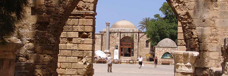
The former fishing settlement of Ammochostos, from which the town Famagusta emerged, became more important in the Byzantine period when the inhabitants of the neighbouring town of Constantia / Salamis to the north relocated here after raids by the Arabs, several earthquakes and the shipping of their port. Despite its favourable deep port, the place remained insignificant even by the Byzantines.
The upswing to the richest city in the eastern Mediterranean began in the 13th century after the Franconian crusader Guido von Lusignan, King of Jerusalem until 1192, bought the island of Cyprus in 1192 from the English King Richard the Lionheart during the Third Crusade. After Guido's death in 1194, his older brother Amalrich II took over.
The old town of Famagusta is surrounded by a largely original wall from the 16th century. It has a total length of more than 3500 meters. The current centre of the old town is the Lala Mustafa Pasha Mosque, which emerged from the St. Nicholas Cathedral shortly after the conquest by its rededication.
Nicosia belongs to the Republic of Cyprus in its entirety under international law, but since the occupation of Northern Cyprus by Turkish armed forces and the proclamation of the Turkish Republic of Northern Cyprus in November 1983, it has de facto no sovereignty over North Nicosia. Since then, the city has been divided by a "Green Line" (English Green Line, Turkish yeşil has), which is monitored by United Nations peacekeeping forces, the United Nations Peacekeeping Force in Cyprus (UNFICYP).
The almost five-kilometer-long Venetian fortress wall was built in 1567/1568 and encloses the old town in a star shape with eleven bastions. Five bastions are in the south (clockwise): Caraffa, Podocataro, Constanza, D'Avila, Tripoli, five in the north: Roccas (Turkish: Kaytazağa), Mula (Zahra), Quirini (Cephane), Barbaro (Musalla), Loredano ( Cevizli), the Flatro bastion (Sibeli) is finally divided, with border guards on both sides and a UN post.
We have collected countless photos from our travels since 2004, which help to convey a broad picture of all the impressions and feelings that we experienced during our travels. Now they can be seen by everyone in the blog and photo gallery Alaturka.Info ™ portal.
Impressions and discoveries of all cultures from the most diverse regions, which reflect the daily life of our time.

Life is the state that all living things have in common and that distinguishes them from dead matter.
Nobody knows 100% how life once arose on Earth. If a genetic program, its functionality and its development are assumed to be essential for living beings, then the beginning of life is the point in time at which molecules as carriers of the program and other auxiliary molecules for the realization, reproduction and adaptation of this program come together for the first time in such a way that a system bearing the characteristic properties of life emerges.
Health-related quality of life is a multi-dimensional concept that includes facts related to physical, mental, emotional and social functioning. A related concept of health-related quality of life is well-being, which assesses the positive aspects of a person’s life, such as positive emotions and life satisfaction.
Well-being - wellness programs mean spending less on medical costs. Participating in a wellness program reduces health insurance premiums, saves money on medical costs. Like businesses, health insurance companies offer customers incentives to use their wellness services.
Throughout the world, the demand for first class International Health Insurance has never been greater. As social health insurance services that could once be relied upon are no longer able to keep pace with the ever increasing
Flora or flora is the population of plant species in a particular region or the systematic description of their entirety.
The term comes from the Latin name Flora, the Roman goddess of flowers and youth. The plant world is opposed to the animal world or fauna, named after the Roman goddess Fauna. Flora generally also refers to organisms with an autotrophic diet (self-nutrition).
Fauna or animal world refers to the totality of all animals in an area or, in the narrower sense, all animal species in this area. The associated science is biogeography.
If the entire planet Earth is considered, the fauna includes all animal species, for example in palaeontology, where one speaks of a “fauna of the Cretaceous period”. The name is derived from the name of the Roman goddess of nature, Fauna. The equivalent of fauna in the plant kingdom is flora.
Here you will find top-class culinary delicacies from many regions that are exclusively for enjoyment (in the picture: warm apple strudel with beer ice cream, cherries and almonds).
As synonyms for culinary, we think of relishing, pleasure-loving, relishing, gourmet, indulgent, sensual, full of comfort and full of enjoyment; (elevated) lustful, sensual, sensual; simply delicious - enjoy it!
The term culture comes from the Latin "cultura" meaning "processing, care, agriculture" and, in the broadest sense, describes everything that humans create themselves, in contrast to nature that they have not created or changed. Cultural achievements are all formative transformations of a given material, as in technology or the fine arts, but also intellectual structures such as languages, morals, religion, law, economics and science.
The word literature is a derivation of the Latin word littera, the “letter,” which only became fashionable in the early modern period. The plural litterae acquired its own meanings as early as antiquity as “written material,” “documents,” “letters,” “learning,” “science(s).” In French and English, this meaning was retained in the terms lettres and letters as a synonym for “science”.
Theatre is the name for a scenic representation of an internal and external event as artistic communication between actors and the audience. The word theatre can also mean the building in which theatre is performed, or the process of performing theatre, or generally a group of people who make theatre, i.e. a theatre group.
The large theatres have sufficiently large side stages on which the sets and props for the various scenes of the ongoing play can be “hidden”. Nowadays, the backstage is seen in modern productions as a welcome opportunity to achieve great depth in the playing area. The upper stage, the Schnürboden (“stage sky”), is at least as high as the visible stage itself simply because of the Iron Curtain. Hanging up there are the curtains, stage sets, etc. that are needed when the stage is converted from one scene to the next. can be lowered using cable pulls. Near the stage you will find the artists' wardrobes as well as hand magazines for the daily needs of props and decorations.
In opera houses and multi-part theatres, the orchestra sits in the orchestra pit between the first row of seats and the stage ramp, which is usually lowered in musicals, operas and operettas. Large houses have revolving stages and also parts of the stage floor that can be lowered hydraulically. Because the auditorium is dark during the game, but the stage is illuminated with spotlights from the direction of the audience, the actors on stage are “blinded”. You don't see the audience. They play against the “fourth wall” created by the brightness of the en-face lighting.

Film is an art form that finds expression in the production of moving images using photography, camera and sound technology. As a rule, the images are projected onto a screen in the dark using a film projector or generated on a screen. Nowadays, cinema and television films are mostly coloured images that are set to music and accompanied by music. The original word for 'filming' is cinematography (from the Greek kinema, movement, cf. kinematics and -graphy, 'to record'), the analogue of photography, 'sound recording'. From this word, the expression cinema 'film theatre' develops as a shortening (light play 'work of film art', this word also represents a contemporary formation of the early years of film into acting).
For the actors significantly involved in the production of a film - in particular screenwriters, directors, actors, cameramen, production designers, costume designers, film editors, sound designers and film composers - the film is also a means of artistic expression and cultural activity. Certain films, especially “author's films”, have now become an integral part of high culture and are reviewed and analysed from an art historical perspective like other artistic works. The artistic forms of film include, in particular, experimental film.
 The ability of humans to distinguish musical sound events from other acoustic stimuli is one of the most complex achievements of the human brain.
Music takes place in society. It is in constant and mutual dependence and influence: it is influenced by social factors in its production, composition and performance, and in its reception it influences people and thus society. Music depends on the social roles of the people who invent it, sing and play it, listen to it, distribute it, collect it, buy it, prefer it or reject it; it is also dependent on the institutions that arise through music. Through ethical, aesthetic or other value judgments, it forms norms with regard to behaviour towards it. It is able to constitute and change social groups.
Music, like language, is an essential element of a culture and therefore an expression of the individual and collective identity of a society, community or group. Music is therefore the carrier of this cultural identity, the sensitive cultural memory and the grown cultural diversity of a community.
Musical environments lead to the formation of subcultures. They enable people to live out their cognitive and emotional designs in a fulfilling way. On the one hand, this applies to youth cultures such as punk, hip-hop or gothic, but on the other hand it also includes connoisseurs and lovers of early music, opera, etc. musical sub-areas. Subcultures represent communicative networks. Their members communicate by defining themselves not only primarily through a common taste in music, but also through clothing and lifestyle, group languages and joint music-accompanied activities such as music festivals.
 The word art, in its broadest sense, refers to any developed activity based on knowledge, practice, perception, imagination and intuition. In a narrower sense, this refers to the results of targeted human activity that are not clearly defined by functions. Art is a human cultural product, the result of a creative process. Until the 18th century, art, based on the ancient Greek techne, was also used as a synonym for the practice of a craft that contained this specialized knowledge, such as water art, mining art, garden art, or the masters. This use has been preserved in the expression “manufactured according to all the rules of art” and in the term architecture. Today, the word arts and crafts still means craft, the work made by hand.
The term religion comes from the Latin meaning conscientious consideration or care, originally meaning “the conscientious care in observing omens and regulations. Religion is therefore a collective term for a variety of different world views, the basis of which is the respective belief in certain transcendent supernatural, supernatural, supernatural powers and associated sacred objects, which cannot be proven in the sense of scientific theory, but only through individual intuitive experience.
Religious people believe in a power that is above them and to which they align themselves. They believe in God or something divine. God or the divine is very different from the human world. For religious people, religion offers a way to understand the world and orient themselves in life. People express their religious experience in worship and prayer, through meditation, singing, dancing and many other ceremonies. Many religions have established rules, commandments and religious behaviour that people should follow.

Education is the social interaction between people in which an adult systematically and purposefully attempts to develop or strengthen desired behaviour in an adolescent, taking into account the needs and personal characteristics of the child.
Clear rules and structures give your child support. They help him to understand the world better and to be able to predict and better understand the reactions of his surroundings. Understandable and comprehensible boundaries give your child security, support and orientation.
Without education, children do not have the tools to find their way in life. This begins with the ability to adequately establish contact with peers, find friends, learn the language and develop one's personality. Education is bonding.
Training includes the transfer of assets, skills and knowledge to a person of any age through a training institution, for example a state school, a university or a private company, from both an intellectual and a craft-technical perspective. As a rule, at the end of an institutional training there is a final examination for the graduate, who, after successful participation, receives a document that certifies the positive completion of the training and proves the skills he has acquired, for example a certificate in web programming, a doctorate in philosophy or a master's degree in the roofing trade. Training differs from the more general term education in its completion and purpose.
"Because history is not" exact science "- it is a humanistic discipline. Its main subject is people, and, as Thucydides said a long time ago, history is not about studying circumstances, but about people in circumstances. Anyone who forgets that because he is in love with his own special area of interest or is fascinated by the model-building activities and ideal types of behaviourists can only be described as simple-minded.”
- Gordon A. Craig, 1981 in Münster / Westphalia
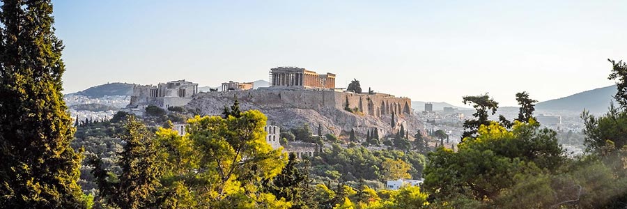
Classical antiquity differs from previous and subsequent epochs through common and consistent cultural traditions, the influence of which continues to be influential in many subject areas right up to modern times. It covers the history of ancient Greece, Hellenism and the Roman Empire. The Roman Empire politically unified the Mediterranean from the 1st century AD. Rome's cultural influence was primarily felt in the western part of the empire, while in the east the Greek-Hellenistic tradition (Byzantium) continued alongside oriental traditions until it was pushed back in the course of Islamic expansion (from 632 AD).
In a broader sense, antiquity also includes the history of the ancient Near Eastern civilizations of Egypt, Mesopotamia (Sumer, Akkad, Babylonia, Assyria), the Iranian region (Elam, Media, Persia) and Asia Minor (Phoenicia, Israel, Aram-Damascus). around the beginning of writing around 3500 BC. BC began. This larger period of about 3500 B.C. BC to the end of antiquity is preferably referred to as antiquity to distinguish it from the narrower concept of antiquity limited to the Greco-Roman world, or it is used in relation to the Middle East until its incorporation into the Macedonian-Greek sphere of influence under Alexander the Great ( around 330 BC) spoken by the Ancient Near East.
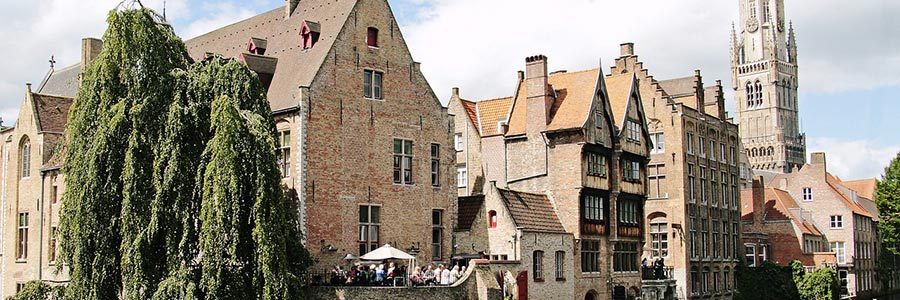
The term Middle Ages in European history refers to the period between ancient and modern times, for example from the 6th to the 15th centuries. In the Middle Ages, the political and cultural dominance of the Greco-Roman Mediterranean region was replaced by a new, almost Europe-wide world of Christian feudal states.
While the ancient core area was already Christian, in the Middle Ages the rest of the pagan regions of Europe were Christianized. In the early Middle Ages, the basic political order of later times developed. The subsequent high Middle Ages were characterized by the boom in business, science and culture. In the late Middle Ages the slow transition to early modern times took place.
Modernity historically refers to a change in numerous areas of life compared to tradition, caused by the Industrial Revolution, Enlightenment and secularization. In the history of philosophy, the beginning of modernity coincides with the skepticism of the thinkers of the Enlightenment (Montaigne, Descartes, Spinoza). Modernity, as part of the modern period, follows the early modern period and, depending on the definition, continues to the present or ended in the twentieth century.
From an art historical perspective, this is the era that reached its climax in the 20th century in Europe with the revolutionary works of the Fauves, Cubists, Futurists, Vorticists, Expressionists and Avant-Gardists, initially in painting, sculpture, new music and theater performances. Its end was forced in (Western) Europe by the National Socialists' seizure of power in Germany (see “degenerate art”, “degenerate music”). Few artists managed to further develop the aesthetics of modernism in the inner emigration.
Modern architecture encompasses a complex of styles, including architects such as Frank Lloyd Wright, Henry van de Velde, Le Corbusier, Ludwig Mies van der Rohe, Ernst May, Konrad Wachsmann and Oscar Niemeyer. The German Bauhaus stood out as the cultural nucleus of modernity. In Austria this applies in particular to the architect Adolf Loos and the architects and representatives of applied art who formed the Wiener Werkstätten.
Mythology, from the Greek "mythos" for "story, speech", refers to the entirety of the myths of a cultural area or a people, a region or a social group as well as their systematic presentation in literary, scientific or religious form.
Mythology also deals with the question of the origin of myths and their relationship to other narrative forms such as legend, legend or epic. Fairy tales in particular often contain elements of myths. The creation of myths is also the subject of psychology, especially the once modern ethnic psychology.
 Migrants are people who move from one place of residence or country to other places of residence or countries, with migrant workers comprising the largest group of migrants. Refugees are different from migrants in international law, those people whose status is regulated by the Geneva Refugee Convention. Recognized refugees within the meaning of the Convention are those who are persecuted because of their race, religion, nationality, political beliefs or belonging to a particular social group.
The main difference between refugees and migrants is that migrants in their country of origin are not threatened with persecution and can return to their homeland at any time. Some migrants also leave their homeland because of extreme poverty and need - but these people are basically not refugees according to the laws.
That is certainly formulated correctly and regulated by law, but does not really improve the life situation for the individual! Wealth (not just money) has to be distributed more equitably, this is the only way to solve problems related with migration!
![]()

Tourism is an important source of income. With 17 million tourists per year, Portugal is one of the most visited countries in the world, with the most popular destinations being the Algarve and the region around the capital, Lisbon.
Off the coast of the Algarve, Sétubal, and the Madeira and Azores archipelagos, there are opportunities to experience both dolphins and whales in the wild.
The palaces with parks near Sintra and Portugal's largest palace and monastery complex in Mafra were designed by the German architects von Eschwege and Ludwig.
Fifteen sites in Portugal are UNESCO World Heritage sites, including two in the Azores and one in Madeira.
Starting in the 17th century, the three German architects Kopke, Burmester, and Andresen made a decisive contribution to the development of port wine in the international marketing of port wine from the oldest wine-growing region, the Alto Douro.

Bosnia and Herzegovina consist of two historical regions, which bear no relation to the current division into entities: Bosnia and Herzegovina. The country's name, Bosnia, is derived from the Bosna River, which originates near the capital, Sarajevo.
Sarajevo and the surrounding area are home to numerous sights. The Latin Bridge, for example, was the starting point of the First World War, as it was here that the assassination attempt on Franz Ferdinand of Austria and his wife took place.
Also worth seeing are the entire old town of Baščaršija, with the Turkish water fountain Sebilj, and the Vijećnica, the city's old town hall.
Other attractions include the castle and fortress walls of Počitelj, the medieval castle of Travnik, the fortifications and Amphitheatre of Banja Luka, the lakes Blidinjsko jezero, Prokoško jezero and Šatorsko jezero, numerous medieval tombstones (stećci), especially in Herzegovina, rafting opportunities on the rivers Neretva, Una, Vrbas and Drina, and the Adriatic coastal town of Neum, which has the highest average annual temperature in the country.