")
")
")
Königsburg ruins and waterfall - stamps 41 and 42
- Written by Portal Editor

Today we have decided to visit the ruins of the Königsburg and the Königshütter waterfall in order, as announced, to fill our hiking pass with more stamps for the Harzer hiking pin.
Here it is stamping points 41 and 42 that can be combined very well. From our location, the Prahljust campsite in Clausthal-Zellerfeld, it is too far for a day hike, so we decide to complete part of the route with our e-bikes.
 In order not to lose too much time on the e-bikes on the meandering forest paths to Braunlage, we choose Landstrasse 242 for a quick journey this time, which means some traffic, but it is limited at this time of year. So after a good hour's drive we arrived in the centre of Braunlage. We “park” the e-bikes at a hotel on Elbingröderstrasse in order to start today’s hike from here. We leave Braunlage via the "Ramsenweg" and "Am Langen Bruch" in the direction of the Bremke stream, which also accompanies us for part of the way. Soon we will leave Lower Saxony and come to Saxony-Anhalt. We then walk another part of the way along the narrow country road in the direction of misery until we come across the path along the Spielbach, which we follow to the L 98 at Warmen Bode. Now we continue to the entrance to Königshütte, where after about 16 kilometres we meet our first destination for the day, the ruins of Königsburg with the stamp point 41 of the Harzer hiking nobility.
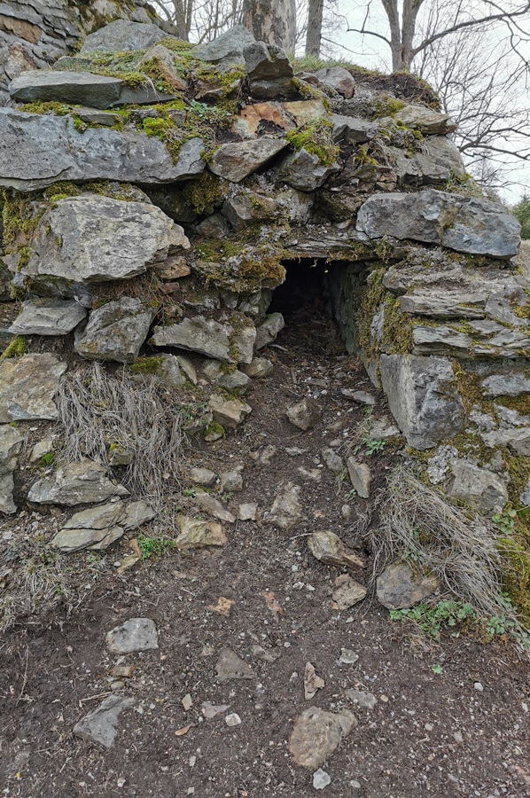
The castle ruins of Königsburg - stamp office 41 of the Harzer hiking nobility
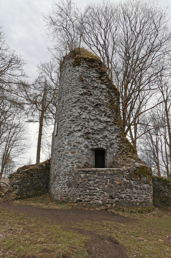 The ruins of Königsburg at Harz are the ruins of a hilltop castle south-east of Königshütte at an altitude of around 460 m. We reach the ruins via a fairly steep and today slippery path that leads us to the castle forecourt. There is also a slightly longer, not so steep path, but we were not aware of it at the time of the ascent. About 250 m north-east is the confluence of the Warm and Cold Bode and with good visibility from the ruins you have a good view of the Wurmberg and the Brocken.
The complex was first mentioned in a document as "castrum Königshof" in 1312, when Bishop Albrecht von Halberstadt bought the castle from the squire Heinrich von Botvelde. In 1324 there is another mention as "castrum Köningshof acqisivit", then it became quiet around the castle. In 1614 there was only one mention of the bergfried zum Königshofe, which from 1709 was only referred to as a royal castle. At that time the complex had already fallen into ruin.
 When Paul Höfer carried out extensive excavations between 1898 and 1901, he assumed that he had the long-sought Bodfeld Palatinate in front of him. He published several times about it. In 1931, advances in soil research proved this to be an error by Carl Schuchhardt and confirmed a little later by Paul Grimm, who stated that the finds, especially the pottery, are no older than the 13th century.
Although these research results from the 1930s were consistently recognized in scientific research, it is still advertised in Königshütte today that the Königsburg is the Jagdpfalz Bodfeld and one of the most historic places in the Harz Mountains. The castle complex still consists of a small round castle square with a bailey, tower hill, rampart and moat.
To the Königshütte waterfall – along the “Kalten Bode”
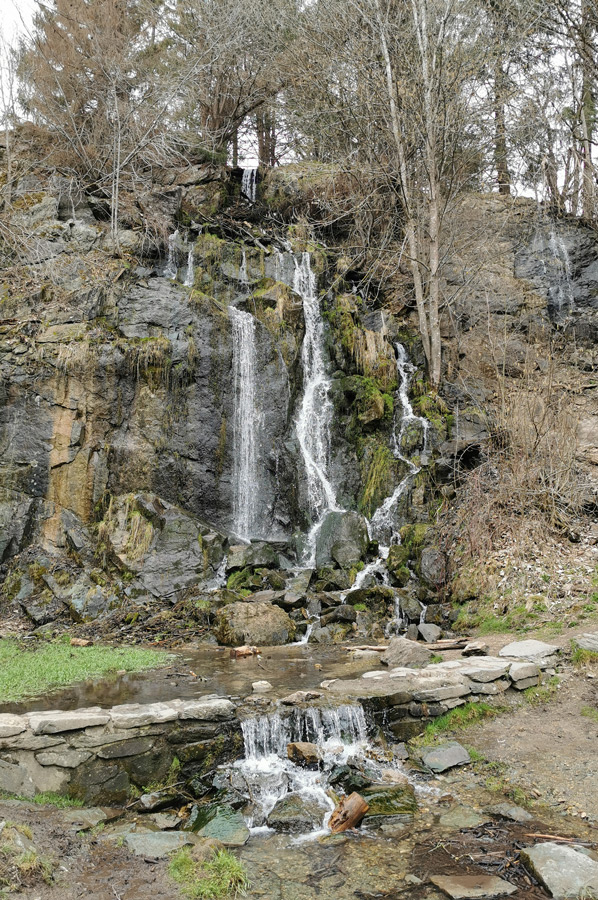
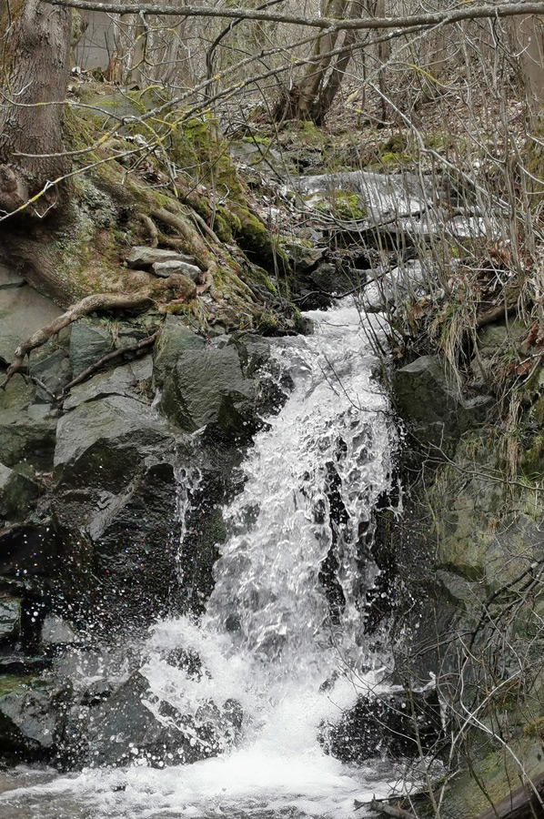
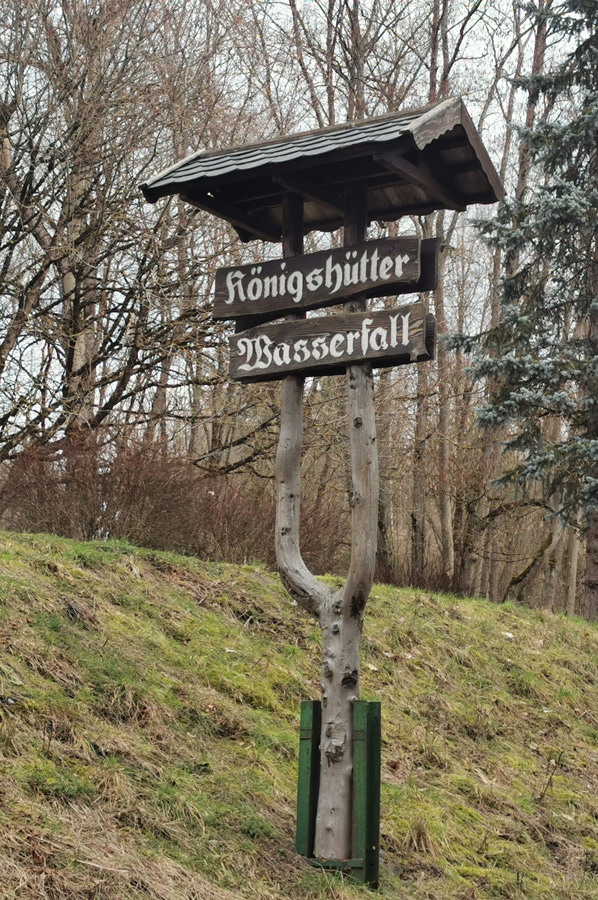 It is not far to our second destination, because the Königshütter waterfall, an artificial waterfall by the way, is located at the other end of the village of Königshütte. The Königshütte waterfall was created in connection with a former quarry in 1994. It is fed by water from a probably nameless ditch, which is created as a bifurcation of the Knesebeckkoppe, and pours out with a relatively small amount of water from a height of about 12 m in a drop over a rock edge. Its water flows into the Kalte Bode. Directly below the falls is a small green area with a rest area and barbecue area, which invites you to linger. There is also a stamp here, which is included as no. 40 in the system of stamps of the Harzer Wandernadel hiking nobility. The stamping point is below the waterfall at the rest area, where we meet a couple who are also hiking. We quickly get deep into conversations and a little later we reach the Mandelholztalsperre.
 Here the Kalte Bode flows through a small reservoir, which dams up the Kalte Bode as flood protection. The dam, which is probably only known locally as the almond wood dam, was built between 1952 and 1957 and consists of an earth dam with an integrated concrete control walkway, as we learned from our local hiking partners. In order to protect the crest of the dam from flooding, an overflow was installed south of it as flood relief. The last time the dam overflowed was during the flood in 1994.
At Mandelholz on the Wormke (at the back of the Mandelholz dam) there are also the remains of an older dam, the Mandelholz pond, which supplied the Mandelholz hut with water from 1612. The 1855 flood destroyed the dam and it was not rebuilt.
 Now, with the guidance of our hiking friends, whenever possible, we walk along the Kalten Bode back to Landstrasse 27 in misery, where the two of them have parked their vehicle. We receive an invitation to take it with us to Braunlage, since the country road is heavily and quickly travelled, and therefore dangerous because there is no really parallel hiking trail. We save about 6 kilometres of the way back on foot, because the further way to the Prahljust campsite with the e-bike is still ahead of us.
A hike of about 21 kilometres that brought us to worthwhile destinations and met nice people.
Please read as well:
Old St. Pauli-Elbtunnel and "Rote Flora" in Schanzenviertel
Sremska Mitrovica - beach area at the River Sava
-
 Hiking Waterfall and Castle Ruins
Hiking Waterfall and Castle Ruins
Hiking Waterfall and Castle Ruins
-
Hiking Waterfall and Castle Ruins
Hiking Waterfall and Castle Ruins
-
Hiking Waterfall and Castle Ruins
Hiking Waterfall and Castle Ruins
-
Hiking Waterfall and Castle Ruins
Hiking Waterfall and Castle Ruins
-
Hiking Waterfall and Castle Ruins
Hiking Waterfall and Castle Ruins
-
Hiking Waterfall and Castle Ruins
Hiking Waterfall and Castle Ruins
-
Hiking Waterfall and Castle Ruins
Hiking Waterfall and Castle Ruins
-
Hiking Waterfall and Castle Ruins
Hiking Waterfall and Castle Ruins
-
Hiking Waterfall and Castle Ruins
Hiking Waterfall and Castle Ruins
-
Hiking Waterfall and Castle Ruins
Hiking Waterfall and Castle Ruins
-
Hiking Waterfall and Castle Ruins
Hiking Waterfall and Castle Ruins
-
Hiking Waterfall and Castle Ruins
Hiking Waterfall and Castle Ruins


https://www.alaturka.info/en/bicycle-travelling-e-bike-camping/6034-koenigsburg-ruins-and-koenigshuette-waterfall-stamps-41-and-42#sigProIde83cdcede3