")
")
")
Along the Eleonorenhütte to the Hanskühnen cliff
- Written by Portal Editor

Another e-bike tour was coming up and once again we chose the Prahljust campsite in Clausthal-Zellerfeld as a starting point. We have organized tours through the Harz from here several times, sometimes by e-bike, sometimes on foot.
We were always off-road, but in some areas we were happy to be using relatively off-road bikes.
First approach point Braunseck-Hütte
 After leaving the campsite, we immediately turned right towards the Bärenbrucher Teich, a combined cycle-hiking forest path that leads over the dam of the Bärenbrucher Teich past Herzhausen's boathouse to stamp point 137. There is a small shelter here with a wonderful view of the ponds. Until we reach the Braunseck refuge, we cross a few waterways, all of which belong to the Upper Harz water shelf. For hikers it should be mentioned that stamp point 138 of the Harz hiking pin is located at Braunseck.
At the Braunseckhütte the forest paths fork, so the orientation towards Riefensbeek-Kammschlacken should initially serve as a rough direction. Several forest paths of different lengths lead down into the town and further down along the Söse. If you would like to add another stopover to your tour, we recommend walking around the Sösetalsperre, which can be reached after just a few kilometres on the L 498. But now back to today's tour.
Permanent climb to the Eleonorenhütte
 At the fork in the Söse, just before the Sonneneck guesthouse, you continue on an asphalted section towards the Eleonorenhütte.
After just a few hundred meters the road forks again, we turn right and follow the signs to the hut, from now on it goes continuously uphill. After about 3 kilometres we turned left at another fork: roughly heading “Auf dem Acker”.
It then continues in a large arc up to the Hanskühnenburg cliff, although the last 500 meters are a bit difficult to navigate because there was a lot of loose scree and a lot of water making it difficult to navigate the path at this point.
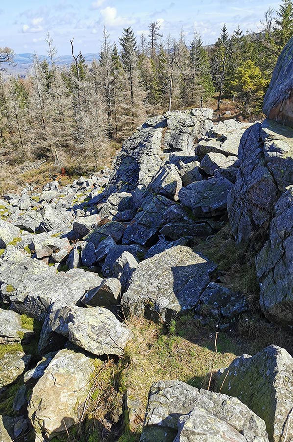 On the "Acker" ridge there are around a dozen rock cliffs made of quartzite rock that characterize the landscape; one of these striking rock formations is the Hanskühnenburg cliff.
It is located directly on the crest of the long mountain ridge. The cliff is located on the grounds of the Harz National Park and only about 300 meters from the Hanskühnenburgbaude. The Hanskühnenburg cliff is surrounded on all sides by countless large and small boulders. These scree slopes make the area difficult to access.
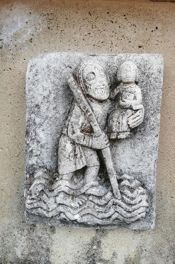
The rock formation owes its name to a legend: Hans the Bold, a knight, is said to have owned a castle on this ridge. Legend has it that he kidnapped a beautiful maiden there.
Stopover on our tour - Hanskühnenburgklippe
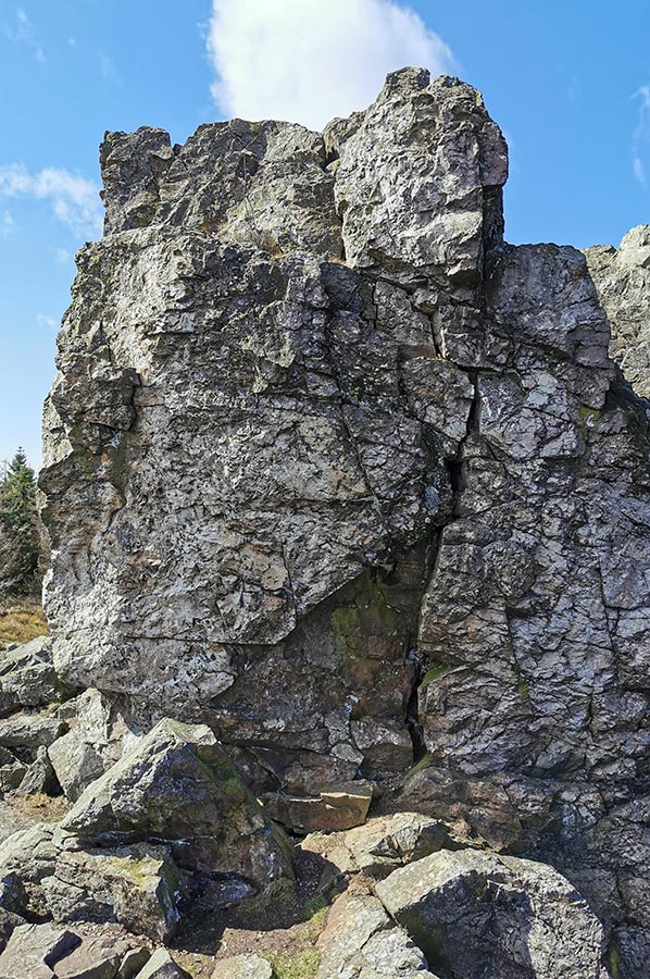 The Virgin sent fervent prayers to heaven to regain her freedom. Their prayers were heard and the knight's doom. A terrible storm came and caused the castle and knights to sink into the ground. What remained was a square boulder eight meters high, which is called the Hanskühnenburg rock.
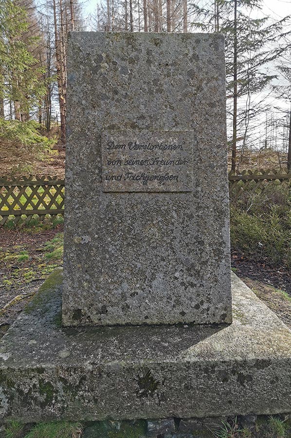
This legendary rock formation, in the middle of a fabulously beautiful landscape, was reason for Johann Wolfgang von Goethe to visit as early as 1784. With the emerging economic factor of tourism at the end of the 19th century, the Harz Club built a lookout tower and a managed refuge, which were inaugurated in 1889. However, the wooden tower could not cope with the weather conditions and had to be demolished in 1912. In the years 1913 to 1914, the Harz Club built a stone tower at the same location.
After an extensive tour, we drive about 300 meters further to Hanskühnenburg, despite still having enough charge, as we can also recharge the batteries of our e-bikes here. It's too easy to get lost and then you're faced with the problem of steep inclines. We also treated ourselves to a small second breakfast.
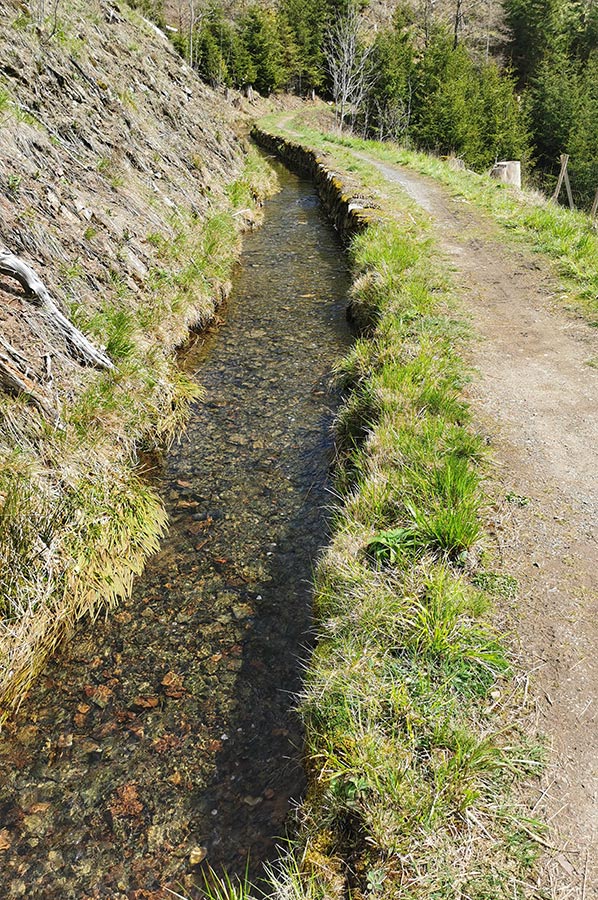
Drive along the ditches of the Upper Harz water shelf
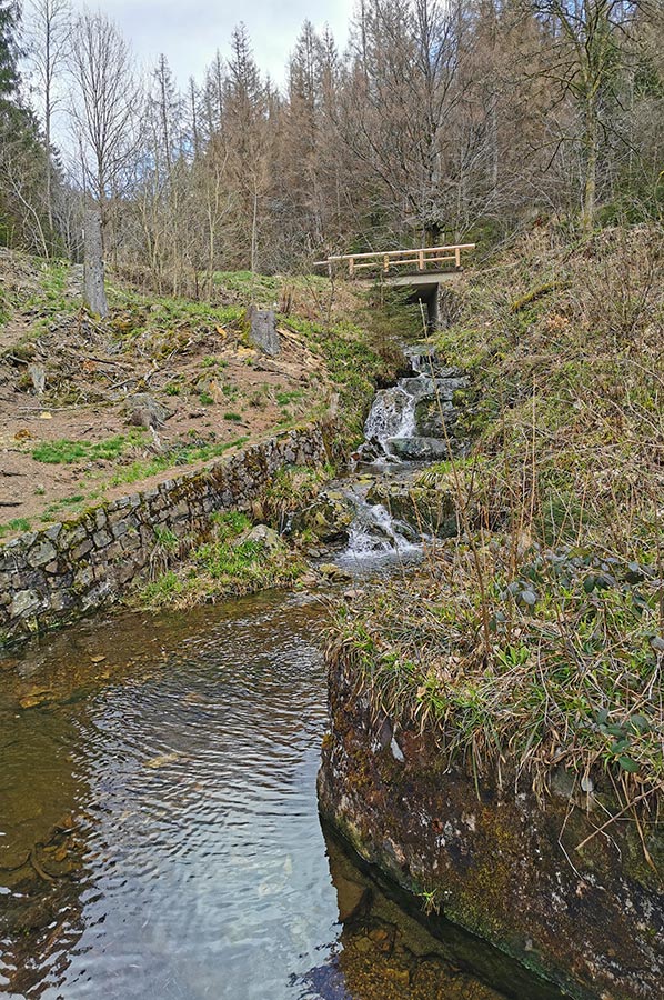 The Upper Harz water shelf or the Upper Harz water management is a system for diversion and storage of water that was mainly created from the 16th to the 19th century, which at that time drove water wheels in the mines of the Upper Harz mining industry. It is considered the world's most important pre-industrial mining water management system. The systems built to generate hydropower have been protected as a cultural monument since 1978. On July 31, 2010, the buildings were declared a UNESCO World Heritage Site by the UNESCO World Heritage Committee under the name Rammelsberg Mine, Old Town of Goslar and Upper Harz Water Management as an extension of the existing World Heritage Site “Rammelsberg Mine and Old Town of Goslar” because of their uniqueness and large size.
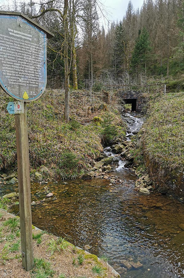 These narrow waterways were not only used for mining at the time, but when used for tourism they also form an excellent network of paths for cyclists and hikers. Maintenance alone always required paths along the waterways, which are ideal for day trips without major inclines or declines. The facilities themselves will largely continue to be operated, with the main purpose being to maintain a historical cultural landscape, nature conservation, tourism and bathing operations. From a water management perspective, some reservoirs still have a purpose in flood protection and drinking water production. They extend over an area of around 200 square kilometres in the Lower Saxony part of the Harz, with most of the buildings in the Clausthal-Zellerfeld, Hahnenklee, Sankt Andreasberg, Buntenbock, Wildemann, Lautenthal,schulenberg, Altenau and Torfhaus areas.
 So, we first go down the serpentine road onto the forest road, which we have already driven on several times, until just before the junction with the B242 at the Magdeburgerhütte we turn left in a large arc to the large weir. By the way, the Hammerstein cliff is very close by, but it can only be reached on foot and is therefore not an option for us today.
Starting directly from the weir, we use the path along the Morgenbrodstaler Graben, which leads back to the B 242, which is much more pleasant than using the main road. Shortly before the junction with the B 242 we change the side of the ditch and now drive parallel to the Große Söse and later to the Kleine Söse to the country road 498 to the junction with the B 242. We reach the Dammgraben, which has already been mentioned several times, on which we will complete the remaining part of the Take the path parallel to the B 242 back to the campsite.
A great bike tour that we can only recommend. We covered around 68 kilometres for this circular route.
Please also read:
Hike Bad Grund – Albert Tower and World Forest
Hike to the ancient city of Kyaneai in Lycia
-
 Bike-Tour to Hanskühnenburgklippe / Harz
Bike-Tour to Hanskühnenburgklippe / Harz
Bike-Tour to Hanskühnenburgklippe / Harz
-
Bike-Tour to Hanskühnenburgklippe / Harz
Bike-Tour to Hanskühnenburgklippe / Harz
-
Bike-Tour to Hanskühnenburgklippe / Harz
Bike-Tour to Hanskühnenburgklippe / Harz
-
Bike-Tour to Hanskühnenburgklippe / Harz
Bike-Tour to Hanskühnenburgklippe / Harz
-
Bike-Tour to Hanskühnenburgklippe / Harz
Bike-Tour to Hanskühnenburgklippe / Harz
-
Bike-Tour to Hanskühnenburgklippe / Harz
Bike-Tour to Hanskühnenburgklippe / Harz
-
Bike-Tour to Hanskühnenburgklippe / Harz
Bike-Tour to Hanskühnenburgklippe / Harz
-
Bike-Tour to Hanskühnenburgklippe / Harz
Bike-Tour to Hanskühnenburgklippe / Harz
-
Bike-Tour to Hanskühnenburgklippe / Harz
Bike-Tour to Hanskühnenburgklippe / Harz
-
Bike-Tour to Hanskühnenburgklippe / Harz
Bike-Tour to Hanskühnenburgklippe / Harz
-
Bike-Tour to Hanskühnenburgklippe / Harz
Bike-Tour to Hanskühnenburgklippe / Harz
-
Bike-Tour to Hanskühnenburgklippe / Harz
Bike-Tour to Hanskühnenburgklippe / Harz
-
Bike-Tour to Hanskühnenburgklippe / Harz
Bike-Tour to Hanskühnenburgklippe / Harz
-
Bike-Tour to Hanskühnenburgklippe / Harz
Bike-Tour to Hanskühnenburgklippe / Harz
-
Bike-Tour to Hanskühnenburgklippe / Harz
Bike-Tour to Hanskühnenburgklippe / Harz
-
Bike-Tour to Hanskühnenburgklippe / Harz
Bike-Tour to Hanskühnenburgklippe / Harz
-
Bike-Tour to Hanskühnenburgklippe / Harz
Bike-Tour to Hanskühnenburgklippe / Harz
-
Bike-Tour to Hanskühnenburgklippe / Harz
Bike-Tour to Hanskühnenburgklippe / Harz


https://www.alaturka.info/en/bicycle-travelling-e-bike-camping/6453-along-the-eleonorenhuette-to-the-hanskuehnen-cliff#sigProId1eccf8e75c