Warften, Wurten or Hallig - ancient mounds on North Sea
- Written by Portal Editor

It is not wrong to claim that the far north is so "flat" that you can see on Friday who is coming to visit on Sunday. An interesting phrase that, like many sayings in our everyday language, will certainly also contain a grain of truth.
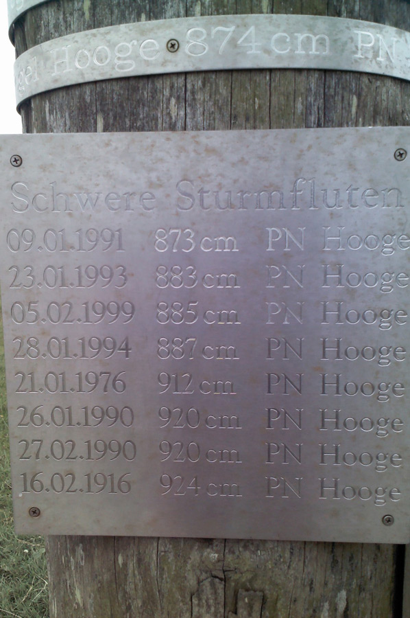
Whenever there are sayings of this kind, the question of the settlement history on the "flat" land arises for us at the same time, especially with regard to protection against storm surges. This is due in particular to the knowledge that the ebb and flow of tides still play a major role in shaping the country and that dykes were not built on a larger scale until the 11th century. Our visits to Dangast, but also to Neustadtgödens, had already hinted at the problems of settlement in the north, so we especially remembered the level marks of the storm surges. So how were the settlers able to settle in the fertile marshlands?
Protection of people and animals during storm surges
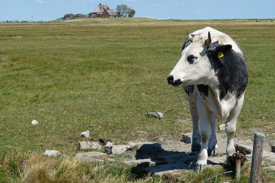
 Basically a question that is quite easy to answer if you remember your own childhood and building beach castles: you simply fill up a hill. And in fact, this "technology" was used quite intensively to colonize the flat coastal zones. At first there were artificially raised settlement mounds for individual farms, later there were also extensive settlement mounds heaped up from earth, which were large enough for small village structures and thus served to protect people and animals from storm surges. Depending on the region in which one is staying, these artificial mounds were called Warft, Warf, Warften, Wurt, Terpe or Wierde. So it is not surprising that these terms can still be found in some place names: Sengwarden, Fedderwarden or Eckwarden.
Archaeological investigations of mounds and mounds
 Archaeological investigations of terps and mounds have shown that the first of these mounds, which are so important for survival in the marshes near "Lander unter", were laid out as early as 300 BC. The Roman travel chronicler Pliny already reported in his Naturalis historia about the Chauken people who lived along the North Sea coast 2000 years ago:
“In the north we have seen the tribes of the Chauken, who are called the greater and the lesser. Twice in the space of each day and night the sea pours out there in great motion over an infinite expanse, revealing a perpetual strife of nature in a region where it is doubtful whether it belongs to land or to sea. There a pitiable people dwell in high mounds of earth raised with their hands according to the measure of the highest flood. In their built huts they are like seafarers when the water covers the land around them, and shipwrecked when it has receded and their huts lie there alone like stranded ships. From their huts they hunt for fish that have stayed behind. They are not allowed to keep cattle like their neighbors, nor even to fight with wild animals, since there is no bush. They weave ropes from reeds and rushes to make nets for fishing. And drying the mud they grasped with their hands in the wind rather than in the sun, they warm their food and their limbs stiffened by the north wind with earth (meaning using peat for fuel). They only drink rainwater, which is collected in pits in the forecourt of the house.” – Pliny: Naturalis historia XVI 1, 2-4
Northwest German sea marshes near the sea as the first settlements
 Research has been able to prove that the height of the sea level changed again and again for epochs over time, sometimes there are times of high-water levels, then again low water levels.
It can be said today that around the turn of the century there was a phase of relatively low sea level, as a result of which settlers in many places settled far and wide in the north-west German sea marshes near the sea.
With the storm surge levels rising again, it became clear that the settlement courtyards had to be raised in order not to be drowned in the floods.
 The first terps were created, mostly made of manure and clay in a circular shape, on which the residential building was then placed.
Mostly only about a meter above ground level, these mounds offered at least a certain protection against flooding.
The further elevation created Hof- or Kernwurten scattered along the sea coast.
In the 2nd and 3rd centuries AD, larger hilltop villages were formed from the merger of several individual hills to form a village wurt, mostly on areas 4 meters higher than the surrounding area.
Resettlement of the coastal area by Frisians and Saxons
 After many of these old mounds were mostly abandoned again in the 4th and 5th centuries, the Lower Saxon and Schleswig-Holstein coastal areas were resettled by Frisians and Saxons in the 7th century.
Flat settlements arose again during a phase of low sea level, which in the 9th century had to be raised to Wurten again because the sea level rose again.
During the 1st millennium terps were made with manure and possibly covered with kleisodes, since the 11th century terps were mainly made of clay and the resulting mounds offered until then the only protection against storm surges. To this day, they are the only flood protection on the Halligen.
Warf villages in the municipality of Krummhörn
 The municipality of Krummhörn offers a large collection of old mound villages in East Friesland, particularly through the village of Rysum. In Friesland there are numerous Wurten in Wangerland, such as Minsen. Wurtendörfer have a structure similar to that of a Rundlingsdorf inland. Their courtyards are arranged in a circle on the hill and face outwards at the foot of the wurt. A circular route leads around the Wurt. Footpaths radiate outwards from the center of the facility, continuing as field paths in the hallway.
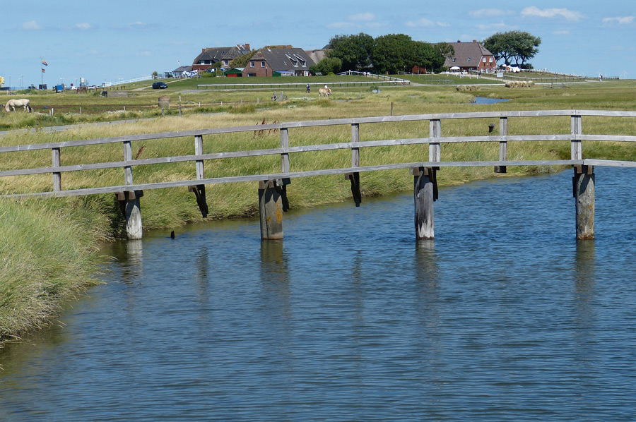
Since the entire hill acts like a sponge, there is a pond-like depression in all settlements as a rainwater collection point, the so-called Fething. From this, the residents drew drinking water for the cattle. Before the period of dike construction, seawater washed over Wurten, so that no wells could be dug outside the Wurt. The drinking water for the residents was collected in a special tank, the so-called sood, into which rainwater from the roofs was channeled. A well-preserved Wurtendorf in Wangerland is the village of Ziallerns near Hohenkirchen. It was placed under monument protection in 1937, so that the old structure of the paths and courtyards was preserved.
The village of Ziallerns near Hohenkirchen
 We also use our stay in Friesland to visit the mound village of Ziallerns, which we reach about halfway between Jever and Carolinensiel. Even from afar you can clearly see the height of the village that stands out from the landscape. A narrow ring road leads around the entire village, which we initially drive around accordingly. The residential buildings, some of which are modern, stretch along the driveway, but always face the terp hill. Then we park the vehicle and explore the village on foot. Narrow footpaths that rise noticeably towards the center cross the village, in the center of which there is also the rainwater collection point that every Wurt has. In a former workers' house there is a Wurten information center representative of the many similar villages in the Wangerland. It is quite impressive when you consider that the people of his day relied solely on the height of the village hill to weather storm surges.
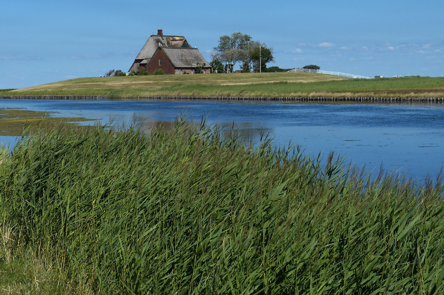
Elevated village square with church
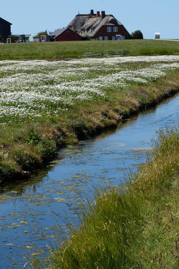
The Warfendorf Wüppels is also in the Wangerland. Around the village square are the church, school, village inn, workhouse, sexton's house and pastor's office. In northern Germany, one often finds the church on the highest point of the terp, which at that time was also the last point of refuge for people during storm surges (see the churches in Cleverns or Sillenstede). On the Halligen, which are at most protected by a summer dyke, terps are still indispensable today. The terp with the largest area is the Hanswarft on the Hallig Hooge with three hectares. The youngest terp is the Neupeterswarft on Langeneß, which was completed in 1896 after five years of construction; however, it has been abandoned since 1962 when the residential building there was destroyed in a storm surge.
Please read as well:
Wadden area hike to bird protection island on Minsener Oldeoog
Jeverland memorial at Upschloot - Cleverns
-
 Artificial Hills for Villages and Churches in the North
Artificial Hills for Villages and Churches in the North
Artificial Hills for Villages and Churches in the North
-
Artificial Hills for Villages and Churches in the North
Artificial Hills for Villages and Churches in the North
-
Artificial Hills for Villages and Churches in the North
Artificial Hills for Villages and Churches in the North
-
Artificial Hills for Villages and Churches in the North
Artificial Hills for Villages and Churches in the North
-
Artificial Hills for Villages and Churches in the North
Artificial Hills for Villages and Churches in the North
-
Artificial Hills for Villages and Churches in the North
Artificial Hills for Villages and Churches in the North
-
Artificial Hills for Villages and Churches in the North
Artificial Hills for Villages and Churches in the North
-
Artificial Hills for Villages and Churches in the North
Artificial Hills for Villages and Churches in the North
-
Artificial Hills for Villages and Churches in the North
Artificial Hills for Villages and Churches in the North
-
Artificial Hills for Villages and Churches in the North
Artificial Hills for Villages and Churches in the North
-
Artificial Hills for Villages and Churches in the North
Artificial Hills for Villages and Churches in the North
-
Artificial Hills for Villages and Churches in the North
Artificial Hills for Villages and Churches in the North


https://www.alaturka.info/en/germany/lower-saxony/5995-warften-wurten-or-hallig-ancient-mounds-on-north-sea?layout=default#sigProId1337fada72