")
")
")
Sithonia - sandy beaches on the second finger of Halkidiki
- Written by Portal Editor

Looking for locations for Campers and holiday travelers one often hears of the three fingers of Halkidiki peninsula, namely Kassandra, Sithonia and Athos.
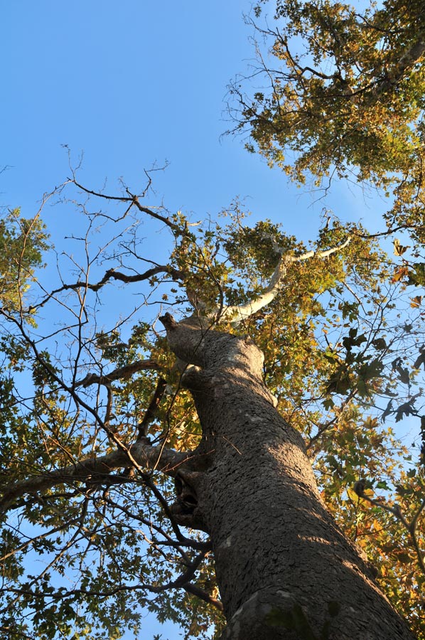
From its special, almost mythical reputation, the third finger Athos is benefiting most, probably due to the fact as an Orthodox monastery or monastic peninsula, which shall only be visited by male visitors, who in addition require a "visa". From Kassandra the traveler knows to report as a more noisy tourist destination, where large hotel complexes unite with holiday atmosphere and nightlife. If you like it more quiet, Sithonia copes much better, especially the densely forested, mountainous landscape contributes to the overall impression of an almost unspoiled nature.
To the west, Sithonia is bordered by the Toronean Gulf
 The area of the peninsula Sithonia municipality extends from the southern Mid Central Country Chalkidiki with the territory of the village Metangitsi along the Sithonia peninsula to the south and takes the peninsula in its entire surface. In the West, Sithonia stretches from Kassandra's gulf to the east ending with the Gulf of Singiti. In the north, the municipality of Sithonia bordering with the townships Nikiti, Agios Nikolaos and Metangitsi to the municipality of Polygyros, in the northeast with the municipality of Sithonia municipality.
Agios Nikolaos forms the border with the district of Panagia and the municipality Aristotelis. The eastern and southeastern municipality are formed by district Agios Nikolaos: it forms the Gulf of Singiti to the east and the southeast coast.
 The municipality Sithonia entirely includes the Isthmus Sithonia with its area, which is characterized by a hilly landscape. To the north, towards the central land of Chalkidiki, Mount Vrachoto rises with 492 m height and separates the municipalities Metangitsi in the north and Agios Nikolaos in the south. The municipality Metangitsi located in a hilly valley, which runs from northwest to southeast until the sea. The municipality area located south of the Isthmus of Sithonia is dominated by the ridge of Itamos with about 808 - 811 m height.
This is the central mountain range of the Sithonia Peninsula in its longitudinal axis from northwest to southeast. Its highest point is the summit of Astrapokammeno Pefko with 817 m of height, the second highest peak in the municipality is the south-southeast of the village of Vourvourou located mountain Karvounas with 567 m.
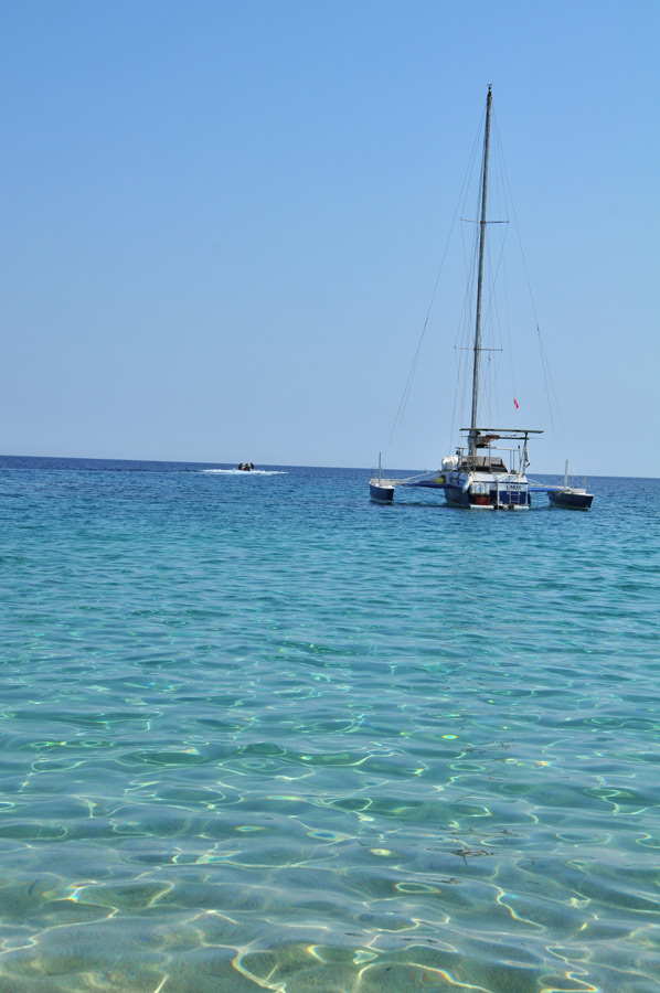
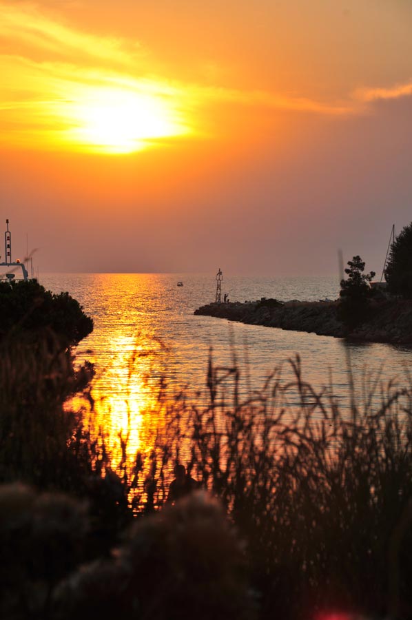
 The shorelines of the community are divided rich: Apart from open beaches with extensive sand or gravel beaches there are rather secluded bays. A significant part of the coast, especially at the coast of the Gulf of Singiti is formed by cliffs. The municipality Sithonia include a plurality of islands: In the bay of Vourvourou in the Gulf of Singiti you find the islands of Diaporos, Agios Isidoros, Ambelitsi and Kalomonisia.
Something northwest between Cape Ritsos and Livari Peninsula the Island Kalogria is in a separated bay. In the Gulf of Toroneos a few kilometers off the coast of Neos Marmaras lies the island Kelyfos. All islands are, due to official sources, uninhabited, except the island Spalathronisia south of Neos Marmaras.
And some additional historical background information's
 The modern municipality of Sithonia has been inhabited by settlers since the Paleolithic era. In ancient times, around the 7th century BC people from the city Chalkis settled on Evia island and founded the cities Singos and Galepsos. Singos was located on the territory of today's municipal district Agios Nikolaos, Galepsos on the territory of today's municipal district Neos Marmaras. The cities Singos and Galepsos belonged to the original Chalcidian settlement area as the rest of the peninsula Sithonia was occupied between 479 BC to 480.
The Persian king Xerxes I, in his campaign against the Greek city-states, especially Athens, had taken the territory of the present municipality of Sithonia and recruited soldiers from Singos and Galepsos for his campaign. After the Persian defeat 479 BC and the withdrawal of the Persian army from what is now Greece, the cities Singos and Galepsos joined the Delian League and were thus under the hegemony of Athens. In the tribute lists of the Delian League, the city Singos was paying to the Federal Treasury of the Confederacy for the period 452/451 BC. The city Gale (Galepsos) paid from 436 BC payments to the federal treasury.
 Ahead of the Peloponnesian War, the cities Singos and Galepsos withdrew from the Delian League: they had previously formed an alliance with the city Potidaia, which has become a point of conflict between the hegemony of Athens on the one hand and Sparta on the other hand. The Macedonian king Perdiccas, after the exit of Chalcidian cities from the Delian League, recommended a merger of the population of some cities to one major city (Synoikismos, Anoikismos). The cities Galepsos (Gale) and Singos, under this "cooperation development", lost the majority of their population to the now considerably grown Olynthos. In Peloponnesian War of 431 BC, today municipality was the scene of fighting between Athens and Sparta. In 425 BC the Athenians succeeded in conquering Singos and Galepsos. In 421 BC, within the Peace of Nicias, they looked for possibility of a return of Olynthos emigrant / resettlers population: this was - if at all - only possible to a very limited extent. Both of the cities Galepsos and Singos historical notes said, that they lost most of population in 421 BC.
 The area of the ancient cities and the church of Sithonia was then part of Federal Chalcidian government under the leadership of the town Olynthos. The defeat of the federal Chalcidian towns and Olynthus in the First Olynthian War between 382-379 BC changed the membership of today's municipal area to Chalcidian Federation. The Second Olynthian War during 350-348 BC ended with the defeat and dissolution of Chalcidian Federation and the destruction of the town Olynthos:... The victorious Kingdom of Macedonia under Philip II took control of the entire peninsula of Halkidiki and thus also on the territory of the present municipality Sithonia.
Sithonia – Sandy Beaches on the Second Finger of Halkidiki - more details
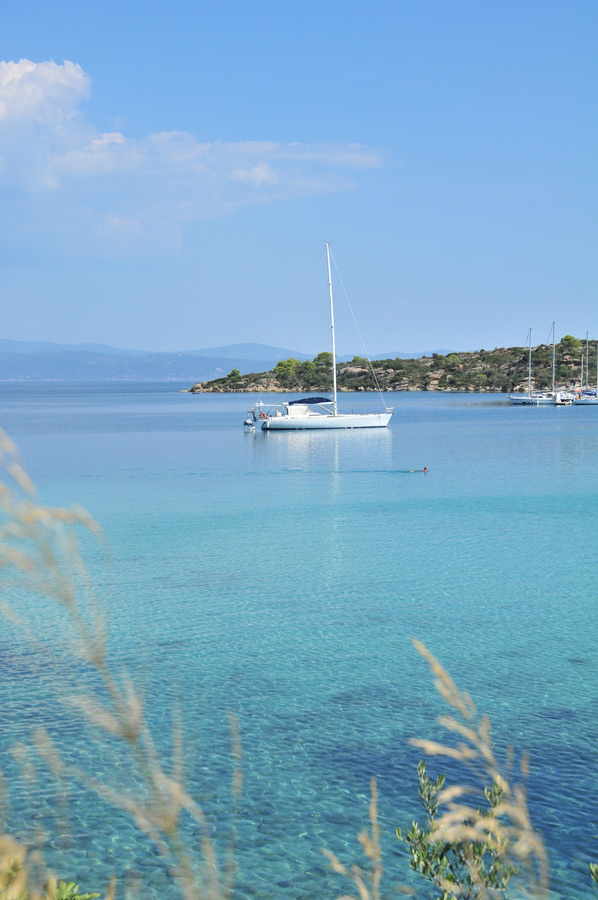
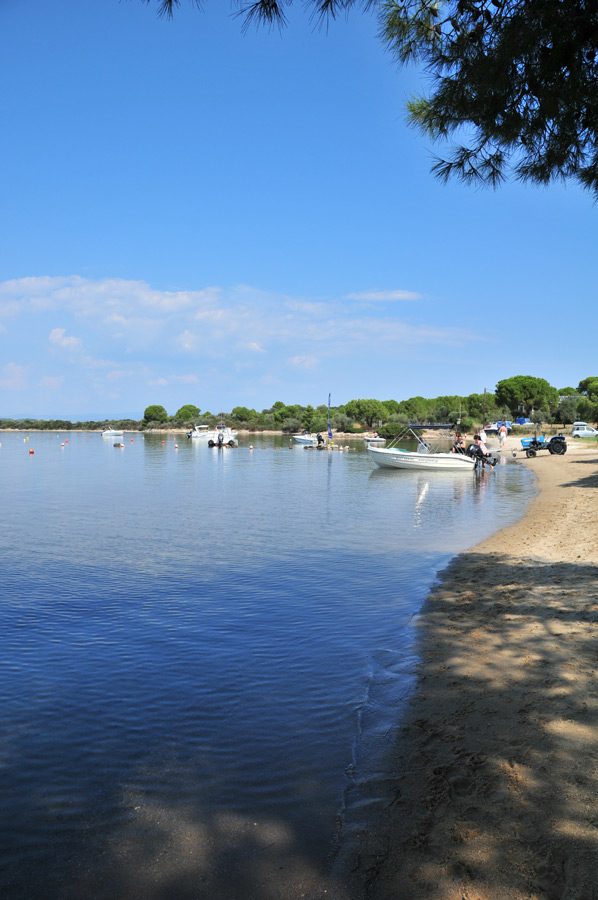
 Nestled between the Kassandra and Athos peninsulas, Sithonia is the hidden gem of Halkidiki, Greece. Known for its unspoiled beaches, lush green landscapes, and crystal-clear turquoise waters, Sithonia offers a tranquil escape for nature lovers and beachgoers alike. Unlike its more developed neighbor Kassandra, Sithonia remains less crowded and more authentic, making it ideal for a serene holiday experience.
Why Visit Sithonia?
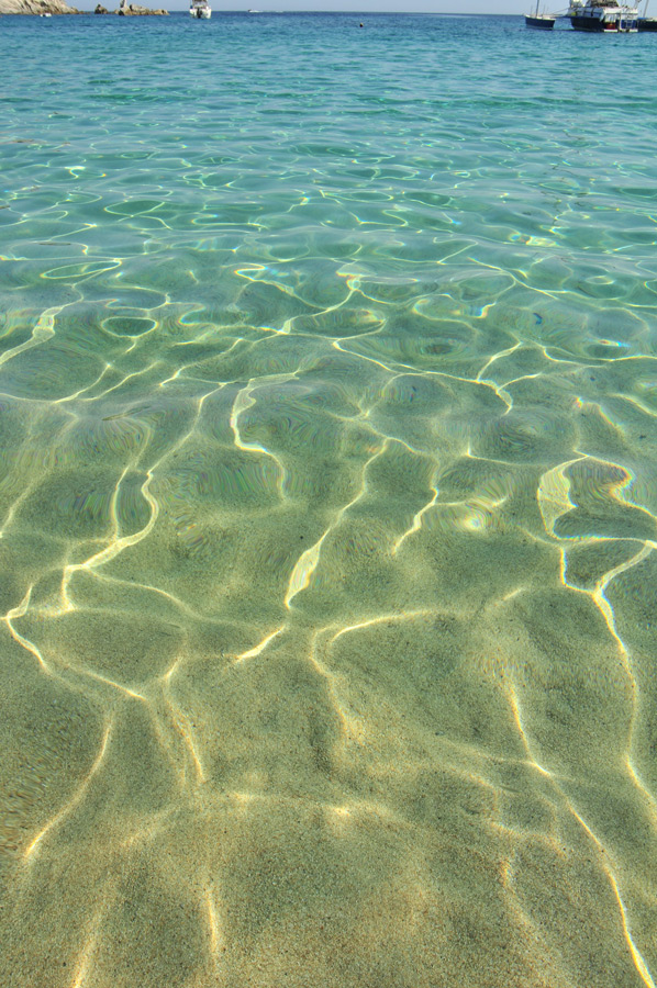
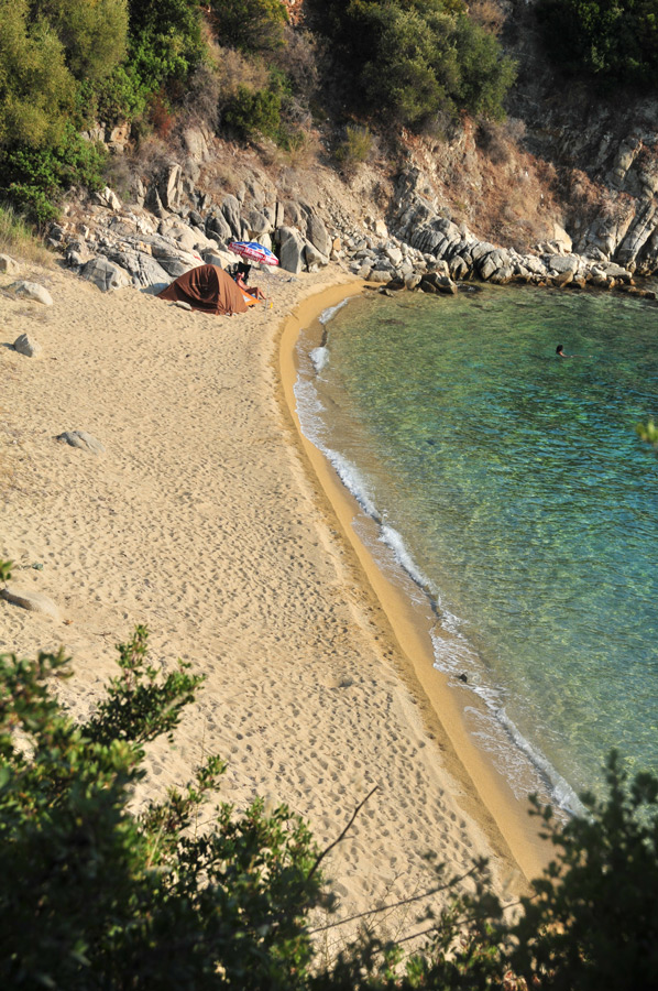
- Natural Beauty: Sithonia boasts a rugged coastline with countless hidden coves, pine-covered hills, and some of the clearest waters in the Aegean Sea.
- Laid-back Atmosphere: Perfect for those seeking peace, privacy, and a break from mass tourism.
- Adventure Opportunities: Hiking trails, snorkeling spots, and boat tours add excitement to the relaxing beach life.
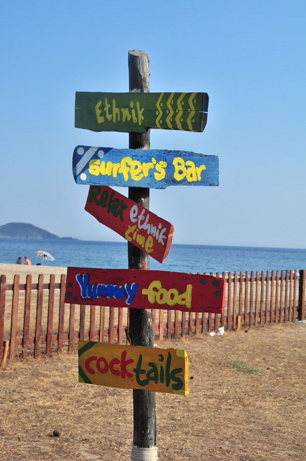
- Charming Villages: Explore traditional Greek villages like Nikiti, Sarti, and Neos Marmaras with local tavernas and hospitality.
Top Beaches in Sithonia
Kavourotrypes Beach
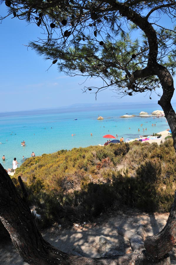 Also known as Orange Beach, this spot features a series of tiny bays framed by white rocks and pine trees. The emerald water and natural rock formations make it one of the most photographed places in Halkidiki.
Vourvourou
A unique blend of sea and forest, Vourvourou is ideal for kayaking and island hopping. Don’t miss a boat ride to Diaporos Island for secluded swimming spots.
Sarti Beach
With the majestic Mount Athos as a backdrop, Sarti Beach combines golden sands with a lively atmosphere, water sports, and beach bars.
Karidi Beach
 Shallow waters and fine sand make Karidi Beach a family favorite. Surrounded by pine trees, it feels like a tropical paradise.
Things to Do in Sithonia
- Rent a boat and explore the uninhabited islands around Vourvourou.
- Snorkel in the crystal-clear waters of Spathies or Agios Ioannis.
- Visit Parthenonas, a restored mountain village offering panoramic views and traditional stone houses.
- Hike through Itamos forest for a refreshing nature experience.
When to Visit Sithonia
 The best time to visit Sithonia is between May and September, when the weather is warm and sunny. July and August are peak months, while June and September offer fewer crowds and pleasant temperatures.
How to Get There
Sithonia is about a 90-minute drive from Thessaloniki International Airport (SKG). Renting a car is recommended to fully explore the peninsula, as public transportation is limited.
Accommodation Options
Sithonia offers a wide range of accommodation, from beachfront resorts and family-run guesthouses to eco-camping sites and luxury villas. Popular areas to stay include:
- Nikiti – for families and convenience.
- Neos Marmaras – for nightlife and activities.
- Sarti – for beach lovers and mountain views.
Final Thoughts
 Sithonia is a slice of Greek heaven that promises both relaxation and adventure. Its unspoiled nature, diverse beaches, and authentic charm make it a top choice for those who want to experience the true spirit of Halkidiki without the crowds. Whether you're sunbathing on a quiet beach or exploring traditional villages, Sithonia welcomes you with open arms.
FAQs About Sithonia
1. Is Sithonia suitable for families with kids?
Yes, many beaches like Karidi and Vourvourou have shallow, calm waters perfect for children.
2. Are there any organized tours available?
Yes, you can find boat tours, snorkeling excursions, and cultural trips around the peninsula.
3. Can I get by without renting a car?
It’s possible, but a car offers much more freedom to explore hidden beaches and remote villages.
4. Is Sithonia expensive?
Compared to other Greek destinations, Sithonia offers great value for money, especially for accommodation and dining.
Please read as well:
Kalamitsi - harbor, diving-station & bay on Sithonia
Halkidiki - just summer paradise with ancient past
-
 Sithonia Beaches & Landscape
Sithonia Beaches & Landscape
Sithonia Beaches & Landscape
-
Sithonia Beaches & Landscape
Sithonia Beaches & Landscape
-
Sithonia Beaches & Landscape
Sithonia Beaches & Landscape
-
Sithonia Beaches & Landscape
Sithonia Beaches & Landscape
-
Sithonia Beaches & Landscape
Sithonia Beaches & Landscape
-
Sithonia Beaches & Landscape
Sithonia Beaches & Landscape
-
Sithonia Beaches & Landscape
Sithonia Beaches & Landscape
-
Sithonia Beaches & Landscape
Sithonia Beaches & Landscape
-
Sithonia Beaches & Landscape
Sithonia Beaches & Landscape
-
Sithonia Beaches & Landscape
Sithonia Beaches & Landscape
-
Sithonia Beaches & Landscape
Sithonia Beaches & Landscape
-
Sithonia Beaches & Landscape
Sithonia Beaches & Landscape
-
Sithonia Beaches & Landscape
Sithonia Beaches & Landscape
-
Sithonia Beaches & Landscape
Sithonia Beaches & Landscape
-
Sithonia Beaches & Landscape
Sithonia Beaches & Landscape
-
Sithonia Beaches & Landscape
Sithonia Beaches & Landscape
-
Sithonia Beaches & Landscape
Sithonia Beaches & Landscape
-
Sithonia Beaches & Landscape
Sithonia Beaches & Landscape


https://www.alaturka.info/en/greece/halkidiki/3340-sithonia-sandy-beaches-on-the-second-finger-of-halkidiki#sigProIddba957e989