")
")
")
Nigde - the Hittite town of Nahita
- Written by Portal Editor

Whenever you travel to the Cappadocia region, you shouldn't just pass by Niğde, so strong is the progress in the city and so strong are the changes in the entire region.
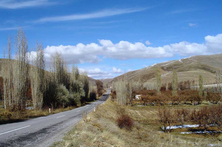
Niğde is surrounded on three sides by the Taurus Mountains with the highest peak in the region of Hasan Dağı and the Melendiz River.
To the west lies the Emen plain (Beyşehir district in Konya province), which opens into the vast Konya plain. This is extremely fertile volcanic soil that gives Niğde rich agriculture, especially apples and potatoes.
Due to the altitude and the mountains, the province has a dry and cold climate with large amounts of snow and cold north winds in winter and practically no precipitation in summer.
The area has been known since the Neolithic Age 8,000-5,500 BC. It was inhabited by the excavations of burial mounds in the Bor district and the tin mines in the Çamardı-Keste district. The Hittites later settled here for a period from about 1000 years to about 800 BC. Niğde, the Nahita of the Hittites, lies in a valley on the old trade route through Anatolia to the Mediterranean. In the foundation of a church in Andaval (today Aktaş northeast of Niğde) a fragment of a stele of Saruwanis, ruler of Nahitiya from the 8th century BC, was found.
The Castle of Nigde owes its early form to the Seljuks
The Alaeddin Mosque is from the same period. The Sungur Bey Mosque and the Hüdavend Hatun-Kümbet, the latter a classic example of Anatolian tomb architecture, also date from the 14th century and Mongolian rule. The Ak madrasah from the 15th century is now an archaeological museum. Eski Gümüs, a Byzantine monastery with a columned church and very well-preserved frescoes from the 10th and 11th centuries, is located 10 km behind the city.
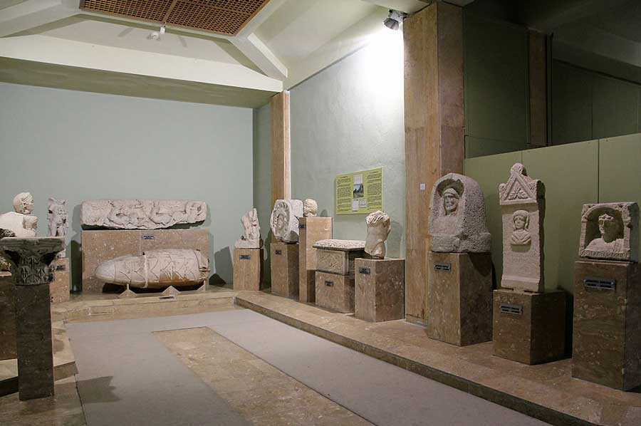
The Niğde Museum has exhibits from the Roman, Byzantine, Stone and Bronze Ages, including the stele of the weather god found near the castle hill in today's Dışarı Camii. In the village of Küçükköy, about eight kilometres to the northwest, lies the church of Küçükköy with partially preserved frescoes. The name Niğde developed from the ancient Nakita or Nahita and was first noted as na-hi-ti-ia in a Luwian inscription by King Saruanis of Andava.
Then came the Assyrians and Phrygians, Greeks, Persians, Alexander the Great and the Romans, who built the city of Tyana with its palaces and fountains.
The Roman rule from the eastern capital Byzantium lasted until the conquest by the Seljuks in 1166. In the old town there is a citadel, which was built by Kaykobad I (1219–1237) and restored around 1470. It consists of a large octagonal Seljuk tower and a clock tower.
South of the citadel is the Alaeddin Mosque from 1223 and a covered fountain Hatıroğlu Çeşmesi from 1267 in the arch of which the representation of a woman's face is hidden. (Representations of people are actually forbidden in Islam). The bazaar dates from the 17th century, next to it is the Sungur Bey Mosque, which was built in 1335 by the Mongol governor Seyfeddin Sungur and rebuilt in the 18th century.
Up to the beginning of the 13th century Niğde was one of the largest cities in Anatolia and an impressive number of mosques and tombs date from this period. The area belonged to the Ottoman Empire since 1471 and to the Turkish Republic from 1923.
The city's cultural modernization continues
 In Niğde there are some church ruins from the Byzantine period and a number of Seljuk and Ottoman buildings. The Seljuks built Niğde into a fortress.
Niğde benefits from lush agriculture (the apples are especially famous) and its location between the affluent provinces of Konya in central Anatolia and Adana on the Mediterranean. The tourist attractions of Cappadocia and the Kayseri and Nevşehir airports are in close proximity.
Like apples, potatoes, cabbage, cereals and beetroot are important agricultural goods. There are also dairy and meat industries, as well as beekeeping and more and more fish farms.
Climbing and trekking in summer - skiing in winter
 The mountains Aladağ and Bolkar in the Taurus Mountains are well-known winter sports areas and popular climbing and trekking areas in summer. Aladağ has one of the most popular climbing routes that can be reached from the villages of Demirkazık and Çukurbağ in Çamardı. The Bolkar has a seven kilometre long ski slope, a crater lake and is known for its abundant flowers in spring.
Niğde has many old churches, mosques and underground cities built into the rocks, including Eski Gümüş, the ancient city of Tyana and some Roman aqueducts in the Bor district. There are also warm mineral springs.
So it is definitely worth planning the Niğde region during a trip to Cappadocia, because the Niğde Archaeological Museum is also located in the capital. There are also some warm mineral springs. In the village of Küçükköy, about eight kilometers northwest of the capital, lies the church of Küçükköy with partially preserved frescoes. In the south of the Altunhisar district lies the settlement hill Kınık Höyük, which was inhabited from the Bronze Age to the Middle Ages and contains the remains of a citadel from the late Hittite period.
Please read as well:
Short stop at the Rhinefall next to Schaffhausen
Roman Scupi - first settlement in the history of Skopje