")
")
")
Cistern "Illos" in Akkale, the "White Castle" near Kizkalesi
- Written by Portal Editor

Kumkuyu, the modern Turkish name of the ancient settlement area of the semi-nomadic Tirtar ethnic group, is located in the south of Erdemli County on the D-400 highway, about 15 kilometres southwest of the district town of the same name and about 50 kilometres southwest of the provincial capital Mersin.
Also known as Tirtar or Akkale (White Castle), the collection of a residential palace, a well-preserved complex cistern complex and a church ruin is located only about 10 kilometres from the gates of Kizkalesi.
About seven kilometres northeast of the well-known Roman city of Elaiussa Sebaste, which is located in the centre of Ayaş, we turn off the D-400 coastal road onto a signposted road to the right, which leads into the ruins of Akkale / Tirtar.
To the ruins of Akkale
 The ruin complex is located on land that gently slopes towards the water, about 300 meters from the sea. The small bay that once formed the harbour is now partly silted up. This bay, which had space for a maximum of two galleys, must therefore be interpreted as a private harbour belonging to the domain. So far, little has been developed for tourism, but the twilight sleep of these ruins will hopefully soon come to an end. A large marina is under construction there, which will ensure lively life in this area in the next few years and perhaps also contribute to the preservation of Akkale.
From an architectural point of view, the ruins of Akkale are dated to the early Byzantine period, at the latest to the 5th century AD. There is also agreement among archaeologists that it must have been a palace with an associated domain. Friedrich Hild and Hansgerd Hellenkemper, the German Byzantium researcher and former director of the Roman-Germanic Museum in the city of Cologne, assume that the builder was a Byzantine named Illos, whose name can be read in an inscription above the door of the bathing complex. The same name Illos also appears as the founder of the restoration of the water pipeline that once ran from Lamos via Elaiussa Sebaste to Korykos. The owner of Akkale was probably the Eastern Roman general Illos († 488), a rival of the emperor Zeno.
The Lamos from Rough Cilicia
 Three kilometres northeast, the Lamos River, which was important in ancient times and is now called Limonlu Çayı, which once formed the border between Plain Cilicia (Kilikia Pedias) and Rough Cilicia (Kilikia Tracheia), flows into the sea. The Akkale ruin complex may also have been supplied by a branch line from this aqueduct, although no traces of this have been found so far. Semavi Eyice, a Turkish art historian whose specialty is Byzantine art and the art history of Istanbul, believes it is possible that Akkale was the royal seat of the Roman client king Archelaus of Cappadocia. He resided in nearby Elaiussa Sebaste around the birth of Christ. Eyice explains the numerous crosses and other Byzantine features as the continued use and extensions of the buildings from the Christian period.
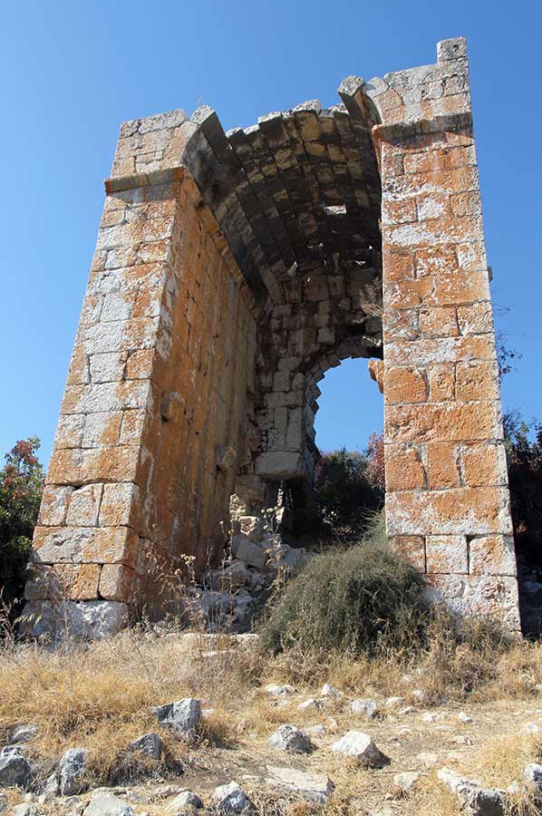
The once multi-storey building with an area of around 55 × 65 meters can be seen as the main building or palace of the Akkale complex. It consists of two wings to the east and west, between which there are several formerly vaulted halls on the ground floor with a width of around 26 meters. The side wings also have various barrel-vaulted rooms and a high, open arch as a facade on the south side facing the sea. The north end of the eastern wing is equipped as a stairwell with a round spiral staircase. Unfortunately, the west wing is more damaged. Little remains of the south facade between the side wings, but the north facade is still almost complete. Inside you can see nine arched niches, four of which have a window.
In the ruins of Akkale Palace
 On the outside, in the upper area of the north wall, a row of consoles has been preserved, which must have once supported a gallery or balcony running around three sides. The living rooms must have been located on the upper floor, of which almost nothing else has been preserved, while the ground floor was probably used as a horreum (various storage rooms). Mainly grapes were pressed and wine was made here in the region, which, along with olive oil, was one of the basis for the region's wealth at that time. How important wine production must once have been can be clearly seen by visiting the Alahan Monastery, whose walls contain a large number of wine engravings and depictions of wine.
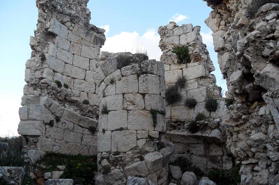
Semavi Eyice interprets a walled square in the west of the main building with several troughs as a press for oil or grapes. Between the cross building and the cistern there are underground, barrel-vaulted rooms from west to east, probably a substructure for a building that is no longer preserved. Further remains of the wall can be seen in the east and north of the complex, as well as on the sea side. All are badly destroyed and overgrown with plants and bushes.
Huge cistern complex in well-preserved condition
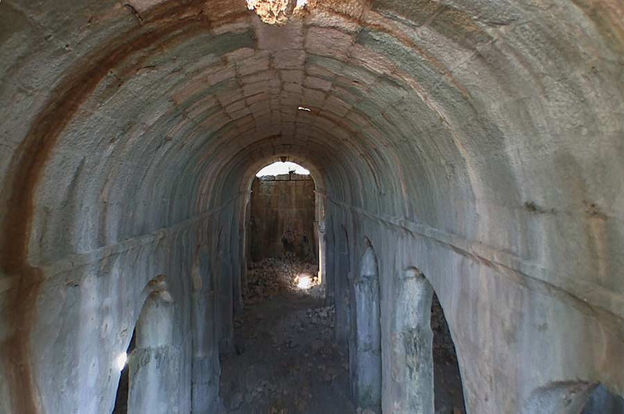 The really special thing about Akkale is the huge, completely preserved cistern, which alone makes a visit worthwhile. Like the surrounding towns, it was fed by the Lamos River via aqueducts and water pipes. Its external dimensions are 33 × 20 meters, the interior is around 30 meters long, 15 meters wide and 10 meters high. The structure is partly carved into the rock and is largely made of carefully crafted stone. The northwest wall is considerably thicker than the other walls, the southeast wall facing the sea is reinforced on the outside with buttresses. The narrow sides are reinforced up to the barrel base, creating a corridor on the outside. A staircase leads up to this on the southwest wall and from there a staircase leads into the interior. The interior is divided into three barrel-vaulted naves, which are separated from each other by two rows of six columns each. The lower part of the columns is carved out of the rock, the upper part is brick. The interior walls are covered with waterproof plaster. There are two windows installed on the access side, as well as on the opposite narrow side. There is an outflow opening near the stairs, from where a path and a 15-centimeter-wide canal lead towards the bank, through which another, smaller cistern was supplied.
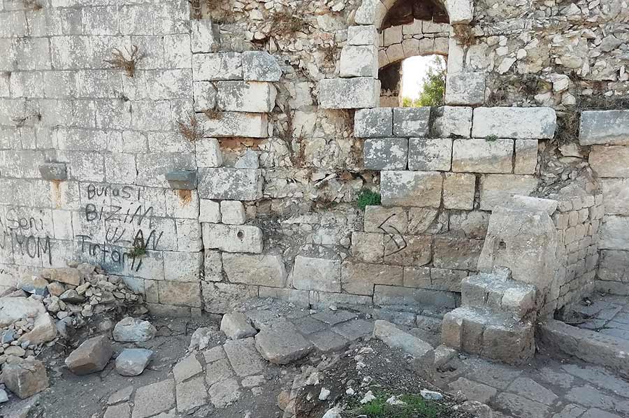
At the southwest corner of the cistern lies a badly dilapidated complex of ruins, which is generally identified as a bathing complex. It has a door in the east, on the lintel of which the inscription "Illos", which is difficult to read, is carved. Behind this door was a room with an apse, behind it two smaller rooms with exedra on the narrow sides and in the corners. Regularly spaced dowel holes in the walls suggest signs of past marble cladding.
About ten meters northeast of the main building is an externally almost square structure with a footprint of 9.4 × 10.0 meters. The interior has a floor plan in the shape of a Greek cross. In the corners of the cross there are four small windowless rooms with barrel vaults, each of which has access from the arms of the cross. The cross is vaulted by a cross dome with pendentives. The central part of the dome rises high into the upper floor and rests on corner pillars with Corinthian capitals; the cross arms are also barrel-vaulted. Cross medallions can be seen on the four keystones of these vaults at the transition to the central dome. There is a window in each of the western and eastern arms; the entrance was probably in the dilapidated south front. Remains of another eight rooms can be seen above the arms of the cross and the corner rooms. The only one of these rooms that has been preserved shows that it was connected to the others by doors. We couldn't see any traces of stairs or an entrance to the upper floor. One can only speculate about the function of the building; Hellenkemper and Hill point out similarities with various grave buildings from the Roman-Byzantine period.
Research history of Akkale
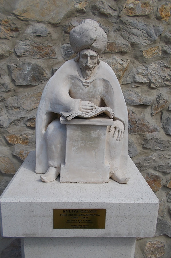 In the 9th century, the Arab Ibn Chordadhbeh describes in his Kitāb al-Masālik wa l-Mamālik a place called Iskandarīya four miles east of Sebaste, which was already in ruins. It cannot be clarified whether this is to be equated with Akkale. In his travelogues in the 17th century, Evliya Çelebi describes numerous ruins around Korykos, but does not specifically mention Akkale. The first western foreigner to visit the place was the British captain Francis Beaufort, who explored the Cilician coast on behalf of the Admiralty in 1811–12. He describes the harbour, cisterns and buildings. In 1818, Charles Leonard Irby and James Mangles toured Cilicia and provided a description of the ruins. Léon de Laborde visited Akkale in 1826, which he thought was a monastery. In 1859, the German geographer Carl Ritter called the Akkale complex a “remarkable complex”. In 1906 Gertrude Bell visited the site and particularly examined the cross-shaped building, of which she also provided photographs. Semavi Eyice published an essay on Akkale in 1986, and in 1987 Gilbert Dagron and Denis Feissel gave a reading of the inscription above the bathhouse door. Finally, Friedrich Hild and Hansgerd Hellenkemper travelled to Cilicia and Isauria from 1968 to 1989 and also described the Akkale building complex. Archaeological excavations have not yet been carried out.
Coordinates: 36° 31′ 44″ N, 34° 13′ 22″ E
Please read as well: