")
")
")
Hike along the Kaiserweg from Billroda to Lossa
- Written by Portal Editor

The view out of the window on Sunday morning was good enough to collect our backpack and go on another hike to explore the region around Billroda.
The signage “Kaiserweg”, which we had previously known as a long-distance hiking trail from the Harz Mountains to Kyffhäuser, was too much attractive. Here too, according to the signs, should be an appropriately titled hiking trail, we were excited.
The "Kaiserweg" (green triangle was selected as a marker) runs through the Kuhtal, first parallel to the main hiking path, then branches off towards Bucha, continues through the attractive forest area "Dead Man" to Zeisdorf, then along the Klefferbach to Lossa along the Lossa river to Billroda and finally to Kläfferberg (300.4m).
Billroda - name ending indicates a forest cleaned village
 Today's hike begins on the outskirts of Billroda, directly at the signs to the Kaiserweg. Despite the name ending in Roda and a lot of forest in the immediate vicinity, Billroda did not emerge as a clearing village. The first mention of the place as "Bilreht" certainly helps, but it dates back to 1148. The ending -ried indicates reed, reed bed, wet area, which can still be found today, we refer in this connection to our article: Auenlandschaft - a walk along the Lossa!
From 1911 to 1913 the "Burggraf" and "Bernsdorf" shafts were built, in which potash was mined. The resulting potash wells in the area caused the railway to be built from Laucha to Kölleda. However, in April 1924 the shaft stopped working again.
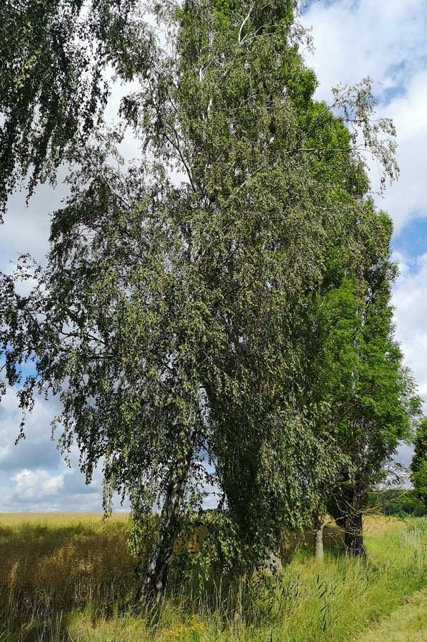
The dirt road, here part of the "Kaiserweg", at the end of Billroda is shaded by tall trees that accompany us on the gentle climb up to the forest.
First huge fields, then mixed forest
 We cross the railway tracks of the old railway line and follow the forest path to the left towards Lossa. Through dense deciduous forest and easy up and down, often with the old railway line in view, progress is rapid. Two fawns are startled by our steps, but are not really afraid, because they stay at a safe distance.
On the way we come across a large number of high ring walls, whose access was still concrete, we suspect old anti-aircraft positions from the Second World War. Here we will have to do a little more research to clarify.
Then the forest clears, there are numerous fruit trees, especially cherries, which seem to be waiting for us with splendid fruits in the centre of the village of Lossa. After negative initial experiences with worms in the cherries, we try carefully, but are then enthusiastic about the quality. Simply delicious. We are happy to accept the hands turning red.
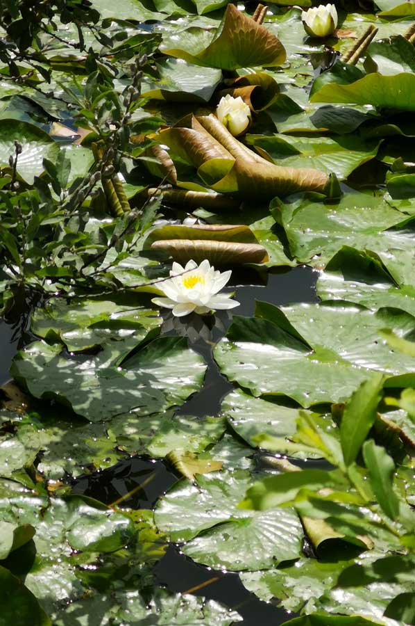
Three ponds in the centre of Lossa
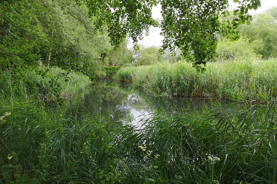 The village of Lossa stretches along the Lossa stream, the valley of which deepens into the plateau. Lossa takes the name of the stream that springs directly above the village, the name of which comes from the Low German word las = salmon and means salmon brook. Hard to imagine today that there should have been salmon here. There are three ponds on its course above the village. The village, first called Lazs in 1255, appears in the Atonement Treaty in 1346 as Zcu der Laz. Lossa consists of two parallel street villages and is built according to the ladder system of two parallel main streets on both sides of the stream with five cross-connections. Lossa "uff der Fyn" (1506) counted a total of 29 obsessed men in 1525, the other courtyards were idle. In 1519 the parish was able to build a new church. However, the current building dates from the 19th century. At the inn there is a medieval expiatory cross made of sandstone.
At the beginning of the 19th century, Lossa was one of the most populous villages on the Finn. The number of inhabitants rose when in 1913 the potash shaft "Reichskrone" began to be mined, which was connected to Lossa station by a field railway. Since the closure of the mining business in Lossa in 1922, the development of the place has stagnated. Lossa is now a well-kept place, which is connected to the federal road B 176. Lossa also has a connection to the "Finnewanderweg".
We circle the three ponds, use a bench at the upper pond for our lunch and then return to the forest for the way back to Billroda.
Please read as well:
Stolberg - one of the pearls of Southern Harz
Aquileia - youngsters learning to ring the bell
-
 Hiking Kaiserweg from Billroda to Lossa
Hiking Kaiserweg from Billroda to Lossa
Hiking Kaiserweg from Billroda to Lossa
-
Hiking Kaiserweg from Billroda to Lossa
Hiking Kaiserweg from Billroda to Lossa
-
Hiking Kaiserweg from Billroda to Lossa
Hiking Kaiserweg from Billroda to Lossa
-
Hiking Kaiserweg from Billroda to Lossa
Hiking Kaiserweg from Billroda to Lossa
-
Hiking Kaiserweg from Billroda to Lossa
Hiking Kaiserweg from Billroda to Lossa
-
Hiking Kaiserweg from Billroda to Lossa
Hiking Kaiserweg from Billroda to Lossa
-
Hiking Kaiserweg from Billroda to Lossa
Hiking Kaiserweg from Billroda to Lossa
-
Hiking Kaiserweg from Billroda to Lossa
Hiking Kaiserweg from Billroda to Lossa
-
Hiking Kaiserweg from Billroda to Lossa
Hiking Kaiserweg from Billroda to Lossa
-
Hiking Kaiserweg from Billroda to Lossa
Hiking Kaiserweg from Billroda to Lossa
-
Hiking Kaiserweg from Billroda to Lossa
Hiking Kaiserweg from Billroda to Lossa
-
Hiking Kaiserweg from Billroda to Lossa
Hiking Kaiserweg from Billroda to Lossa
-
Hiking Kaiserweg from Billroda to Lossa
Hiking Kaiserweg from Billroda to Lossa
-
Hiking Kaiserweg from Billroda to Lossa
Hiking Kaiserweg from Billroda to Lossa
-
Hiking Kaiserweg from Billroda to Lossa
Hiking Kaiserweg from Billroda to Lossa
-
Hiking Kaiserweg from Billroda to Lossa
Hiking Kaiserweg from Billroda to Lossa
-
Hiking Kaiserweg from Billroda to Lossa
Hiking Kaiserweg from Billroda to Lossa
-
Hiking Kaiserweg from Billroda to Lossa
Hiking Kaiserweg from Billroda to Lossa
-
Hiking Kaiserweg from Billroda to Lossa
Hiking Kaiserweg from Billroda to Lossa
-
Hiking Kaiserweg from Billroda to Lossa
Hiking Kaiserweg from Billroda to Lossa
-
Hiking Kaiserweg from Billroda to Lossa
Hiking Kaiserweg from Billroda to Lossa


https://www.alaturka.info/en/germany/saxony-anhalt/5134-hike-along-the-kaiserweg-from-billroda-to-lossa#sigProId7d353690b9