")
")
")
Venice - tidal range causes high tide at St. Mark's Square
- Written by Portal Editor

On our way, following the A57 to Aquileia, which was accompanied by really heavy rain showers, we passed the junction to Venice, where a stopover that was not previously planned took place.
In advance we had looked for an open campsite on the coast in the camping guide (after our experience with closed campsites on Lake Garda). And lo and behold, there were two such places: one right at the exit of the motorway towards Venice, the second called Camping Fusina a little below Venice, but located directly on the sea.
 So far, without any experience of getting to and from Venice, we intuitively chose Fusina, a good decision, as it turned out a little later. At first somewhat depressing, the SS309 led through a huge industrial area, where there were almost doubts about the right choice. Then finally the industrial facilities gave way, a small, nameless village was crossed, and we reached Via Moranzani, which led to the campsite. Very friendly reception with an immediate explanation of the situation and first indications for further travel to Venice let us immediately forget the rain tour, now in November there were only a few guests, so that there was the free choice with regard to the parking space, too. We were quickly set up and explored the place a little more.
The meeting with Silvia and Anselm
 As is often the case, this expedition was the right decision, because we met the couple Silvia and Anselm from Northern Germany who had just arrived too and who had also made a stopover here on their way from Sicily.
We were quickly absorbed in a conversation, learned this way that the two had already been to Venice several times and both showed great interest in our project, so we decided to go on an excursion together the next day, in view of the continuation of our conversations to compete in Venice.
Now the right choice of the place became clear, because it was just a few meters to the take-off of the passenger ferry that brought us to Zattere next to the Rio de S. Trovaso in the centre of Venice, the day ticket for 13, - € and back . It couldn't get any better.
 The next day, Anselm noticed the high water level as soon as we arrived, which was already partially flooding the promenade and, what we did not know at the time, the tidal range had just begun.
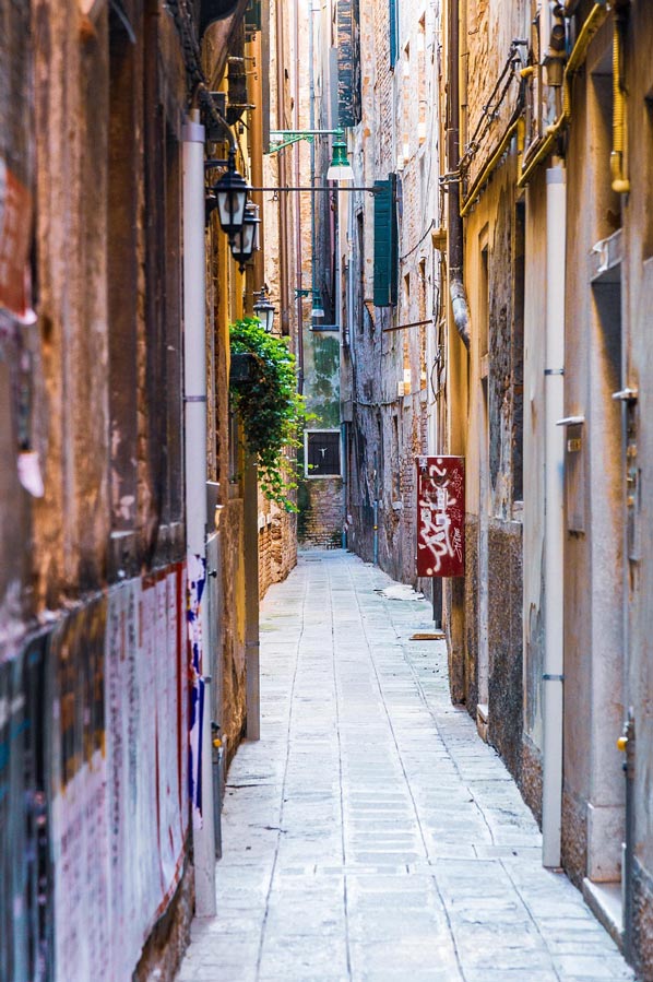
We continued our exploration through Venice in the direction of the Ponte dell Accademia, as we were naturally drawn to Piazza San Marco, the famous St. Mark's Square. Of course, photos were taken along the way, insights into alleys and shops were sought and the first, somewhat intrusive street vendors who offered some kind of rubber over boots, were clearly rejected.
Clever businesspeople, as it turned out a little later, because from the openings of the St. But more on that later.
Venice - a city founded on wooden stilts
 The locations of the Venetian lagoon were built on millions of wooden stakes that were rammed underground during the centuries.
It was discovered earlier that under the mud deposits there was solid clay soil, the "caranto", and that buildings could be erected on piles that were driven into this layer.
The so-called "Zattaron", a kind of pontoon made of two layers of larch planks, which were reinforced with bricks, rested on this first level. The foundation walls and finally the above-ground masonry are supported by the Zattaron.
In order to save weight, the buildings themselves were built from light, hollow clay bricks, the so-called "Mattoni".
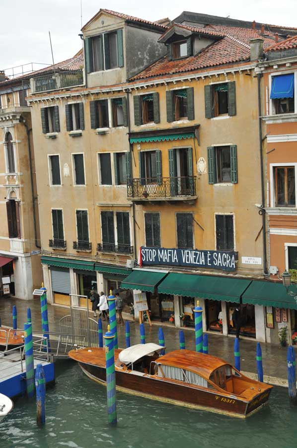
 Many buildings, as we were able to find out during the tour, are in poor condition, despite visible efforts. Reasons for this are, on the one hand, the continuously rising water level, which makes most of the lower floors uninhabitable. On the other hand, since the end of the Venetian Republic, maintenance measures on buildings and canals have been neglected.
The flow behaviour of ebb and flow was also adversely affected by the dredging of deep fairways for the overseas ships heading for the port of Marghera, so that the foundations were also undermined.
Later that evening, we were on our way back to the campsite, we were able to experience one of these huge vacation steamers pushing its way through the main canal. Certainly, an attraction for every passenger, but bad for the city, that's our impression.
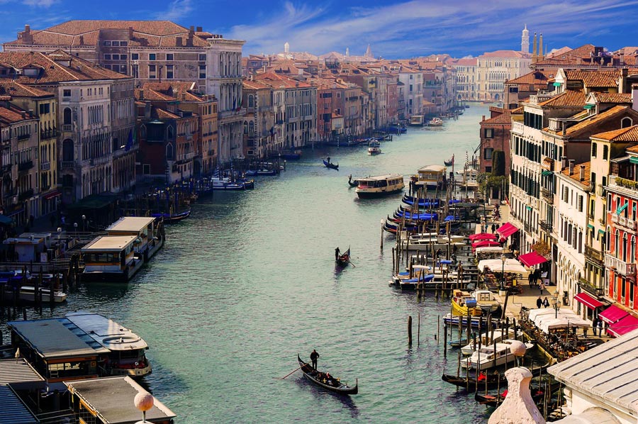
 Venice has around 175 canals with a total length of around 38 kilometres. The main traffic artery is the Grand Canal, and there are also many waterways outside the historic centre. The tide difference used to be 60 centimetres. A system of water regulation ensured a constant circulation that purified the city and the water.
The canals were originally designed to be about 1.85 m deep. From the end of the 18th century, however, they were no longer cleaned until the 1990s. In addition, numerous canals have been filled in or shut down since the 18th century, which can often be read from the name “rio terà”.
The broad Via Garibaldi, for example, was created by filling in a canal, and in 1776 the Rio de le Carampane was filled in.
Venice - the city of bridges
 There are, you hear and be amazed, 398 bridges in the city. Until about 1480 they were mostly made of wood, later they were replaced by stone bridges. In the meantime just two of them are without a railing, one of them is the Devil's Bridge (Ponte del Diavolo) on the island of Torcello, the other opens up a private house in Cannaregio. Many were built very flat in order to make them accessible for horses and carts. The Rialto Bridge was the only bridge crossing the Grand Canal until the middle of the 19th century. In the meantime, three more have been added, namely the Ponte degli Scalzi near the station, which replaced a previous iron bridge from 1856 in 1932, and the aforementioned Ponte dell'Accademia, which was built in 1854 and was replaced in 1933. A fourth bridge, the Ponte della Costituzione, was inaugurated in 2008. This bridge connects Piazzale Roma with the bank (Fondamenta S. Lucia) east of the Santa Lucia train station.
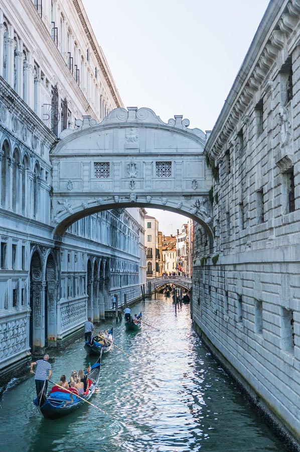
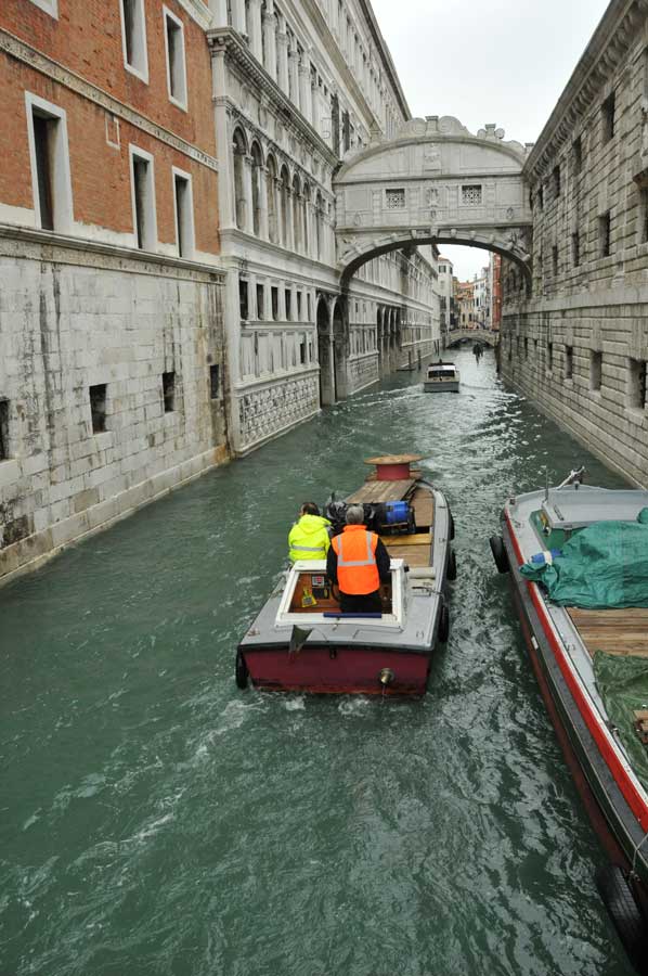
One of the most famous bridges, the Bridge of Sighs (Ponte dei Sospiri), connects the former state prisons on the ground floor, the so-called Pozzi, with the Doge's Palace. The straw bridge (Ponte della Paglia), which spans the Rio di Palazzo at the Doge's Palace, is named in this way because the boats loaded with straw dock there. Other bridges are named after the spanned Rio, a nearby palace or church, often after a saint. The name Ponte storto, which appears ten times in Venice, refers to a bridge that crosses a Rio diagonally.
 The first settlements from which Venice developed were on alluvial land that was created by the deposits of the Brenta and other rivers and streams in northern Italy. The lagoon formed from around 4000 BC.
These river sediments cover a lower Pleistocene layer of clay and sand that is between 5 and 20 meters thick. During the last ice age, the sea level was 120 m below the level of 2012, but rose up to 5000 BC. at 110 m. Since then, the water level has continued to rise slowly with strong fluctuations.
The lagoon covers an area of about 550 km² and is delimited from the Adriatic by about 60 km long sandbanks. Just about three percent of this area is covered by islands, the rest consists of mudflats and marshland, the so-called barene, which encompass over 90 km², then about 92 km² of fishing grounds, the Valli da pesca.
The Barene are criss-crossed by natural canals, which are called Ghebi here. Around 1900 the Barene covered more than 250 km². In contrast to the often flooded Barene, the Velme, shallows, have little vegetation because they only appear when the water level is very low.
 Around AD 400, Venice was still around 1.9 m below sea level in 1897. From the High Middle Ages, the lagoon was subject to profound changes, such as the diversion of tributaries in order to regulate the water level and avoid silting up. Since the early 20th century, numerous canals have been deepened and widened, bringing significantly more salt water into the lagoon and increasing current speeds.
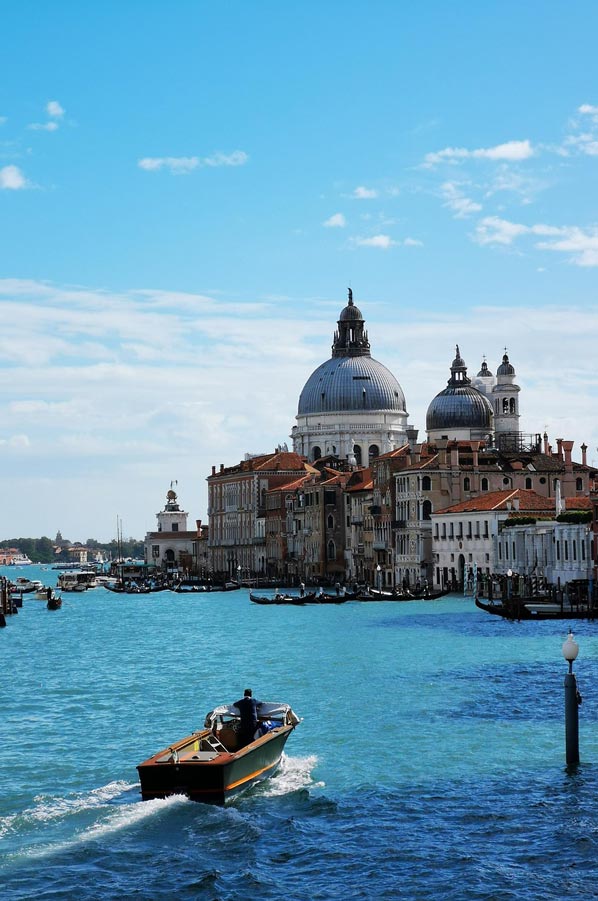
Venice was the capital of the Republic of Venice until 1797 and one of the largest European cities with over 180,000 inhabitants. Until the 16th century it was one of the largest trading cities, through which trade between Western Europe and the Eastern Mediterranean was settled. Venice had most of the world's merchant and warships at the time. Their nobility profited from the trade in luxury goods, spices, salt and wheat.
Venice developed into the largest financial centre and dominated a colonial empire that stretched from northern Italy to Crete and at times to Cyprus. After French and Austrian rule between 1798 and 1866, Venice became part of Italy. In the years 1965 to 1970, the city reached the highest population with almost 370,000 inhabitants, which has since declined by around 100,000 inhabitants.
UNESCO World Heritage Site - how much longer?
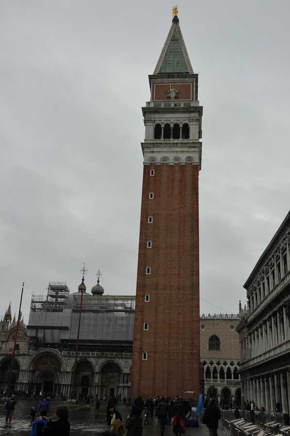
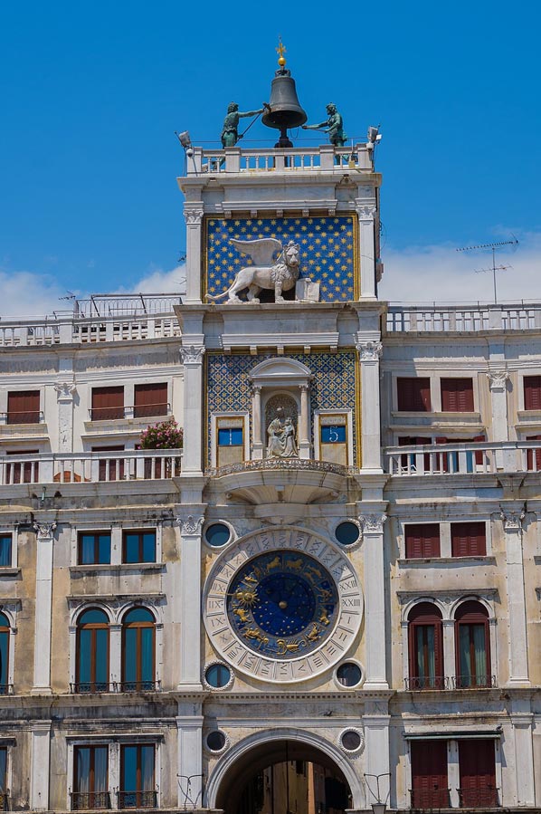
 Venice and its lagoon have been on the UNESCO World Heritage List since 1987. Venice has been a source of inspiration for artists on many occasions, and the city has become one of the most popular tourist cities in the world. This is especially true for the world-famous St. Mark's Square, the former centre of power and representation of the city.
The largest square in the city, 175 m long and up to 82 m wide, is characterized by the adjacent state buildings, in particular the Doge's Palace and the Procuraties. There are also libraries and museums, the Markuskirche and the Campanile, but also four large cafes.
Despite the advanced season now in November, we were able to get a certain impression of the crowds that flow through the city in the course of one day. More and more people were to be found in the narrow streets. And to come back to the clever street vendors, some of the alleys were absolutely impossible to walk without the "super boots", despite the flood paths. No wonder, then, that the price of the fashionable boots had tripled from the berth to the city centre.
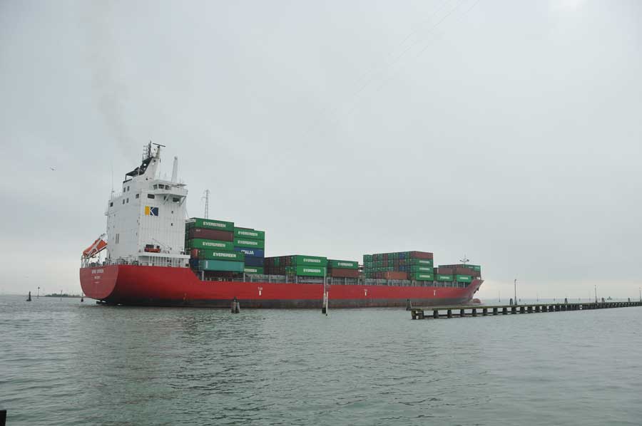
A wake-up call from a container ship
 We owe it to our two Venice connoisseurs that we got to the Rialto Bridge with dry feet without these fashionable accessories, where our paths parted for the rest of the day. Some errands meant that Silvia and Anselm still wanted to go to the train station, while we wanted to explore the city further. When it got dark we started our way back, which meant that the boat tour to the campsite really took place at night. We had spent an eventful day and an adventurous night drive through the Gulf of Venice.
The next morning, a huge container ship woke us up with its ship's horn, which seemed almost within reach. Only now did we realize that we were camping directly and very close to a heavily frequented main traffic route for shipping. The morning turned out to be extremely interesting considering the different types of ships, especially when the Greece ferry maneuvered backwards to the unloading station. Around noon we then continued our tour towards Aquileia.
Venice: Tidal Range Causes Flooding – A Fascinating Natural Phenomenon - more details
 Venice – the city of canals, gondolas, and palazzi – has a world-famous problem: the tidal range, which leads to flooding in St. Mark's Square, especially in autumn and winter. This natural phenomenon is both fascinating and disturbing. In this article, you'll learn why St. Mark's Square is regularly flooded, how locals deal with it, and what you should be aware of as a visitor.
What does "tidal range" mean in Venice?
The tidal range describes the difference between high tide (high tide) and low tide (ebb). In Venice, this difference is clearly noticeable due to its unique geographical location in the Venetian Lagoon – especially during strong winds from the Adriatic.
Why is St. Mark's Square particularly affected?
St. Mark's Square is one of the lowest points in Venice. It can be flooded with a tidal range of just 80–90 cm. The cobblestones disappear, the water reflects the basilica – an impressive, yet challenging sight.
Acqua Alta – When the Water Comes
 "Acqua Alta" is the term used in Venice for the phenomenon of high water levels. It usually occurs between October and January when the following factors coincide:
• Strong southeast wind ("sirocco")
• Full moon or new moon (spring tide)
• Low air pressure
• Rising sea levels
Historical Background of the Floods
The lagoon city has been threatened by water for centuries. The worst Acqua Alta occurred in 1966, when the water level reached 194 cm – large parts of the old town were underwater.
How often is St. Mark's Square flooded?
In some years, there are more than 60 flood days. Thanks to modern monitoring, the population can now be warned early. Sirens and digital displays signal the water level in real time.
The Role of Climate Change
Rising sea levels due to climate change have significantly increased the risk. Forecasts predict that Venice could be several meters below sea level by 2100 if no countermeasures are taken.
MO.S.E. – The Flood Protection Project for Venice
 The city's response to the flooding is called MO.S.E. (Modulo Sperimentale Elettromeccanico) – a system of mobile barriers that separates the lagoon from the open sea during high tides. It has been used regularly since 2020 and has successfully prevented St. Mark's Square from flooding several times.
Living with the Flood: Everyday Life for Venetians
For many locals, Acqua Alta is part of everyday life. They know the paths that stay dry, wear waterproof shoes or rubber boots, and rely on mobile walkways that are placed across the squares. Despite all the inconveniences, they love their city – with or without water.
Tourism Despite Flooding
Ironically, the flooding attracts many tourists. Selfies with wet feet, reflections in St. Mark's Square, or a stroll through the flooded alleys are all Instagram-worthy experiences. Most attractions remain open – with elevated entrances if necessary.
Best time to travel to avoid flooding
If you want to avoid Acqua Alta, it's best to travel between May and September. During this time, the weather is milder, the risk of flooding is lower, and you can explore the city with dry feet.
What to do if you're in Venice during Acqua Alta?
 Don't panic! Follow these tips:
• Pay attention to sirens and indicator boards
• Bring rubber boots or waterproof overshoes
• Avoid low-lying alleys
• Use the mobile wooden walkways
• Apps like Hi!Tide Venezia provide live updates
Practical tips for visitors
- Choose accommodations with high ground floors
- Pack electronic devices in a waterproof manner
- Store maps and city plans digitally
- Visit sights early, before water levels rise
Photography and the Experience of High Tide
 Spectacular photo opportunities arise, especially at high tide: reflections of the basilica, people on piers, fog, and water combine to create a truly special image. Anyone interested in photography shouldn't miss this opportunity.
Future Perspectives: Venice and the Rising Sea Level
Venice is struggling. Despite the Mediterranean Sea (MOSE), tourism, and international interest, the city remains vulnerable. But it also shows that culture, technology, and nature can be combined – with decisive action.
Conclusion
Venice is a city of contrasts – breathtakingly beautiful, but vulnerable. The tidal range and the phenomenon of Acqua Alta are as much a part of the city as the gondolas and the carnival. Those who adapt to this will experience a side of Venice that is as fascinating as it is unique.
FAQs
 1. What exactly is Acqua Alta?
Acqua Alta is the name given to the high water that regularly floods parts of Venice during high tides.
2. How can I prepare for high tide as a tourist?
Do your research in advance, bring rubber boots, and use local apps to check the water level.
3. When is the best time to experience Acqua Alta?
Between October and January – especially during a full moon and southeasterly winds.
4. How does the MO.S.E. system work?
Folding barriers seal off the lagoon from the open sea when high tide is imminent.
5. Do attractions remain open during high tide?
Usually yes – access is then via walkways or alternative entrances.
Please read as well:
The Saale Bridge in Bad Kösen - not just a monument
From Vienna State Opera to Ephesos Museum at Hofburg
-
 Venedig Canal Grande
Venedig Canal Grande
Venedig Canal Grande
-
Caffee Florian
Caffee Florian
-
Rio di Palazzo mit der Seufzerbrücke
Rio di Palazzo mit der Seufzerbrücke
-
Piazzetta
Piazzetta
-
Family home in Venice
Family home in Venice
-
Ponte di Rialto Brücke
Ponte di Rialto Brücke
-
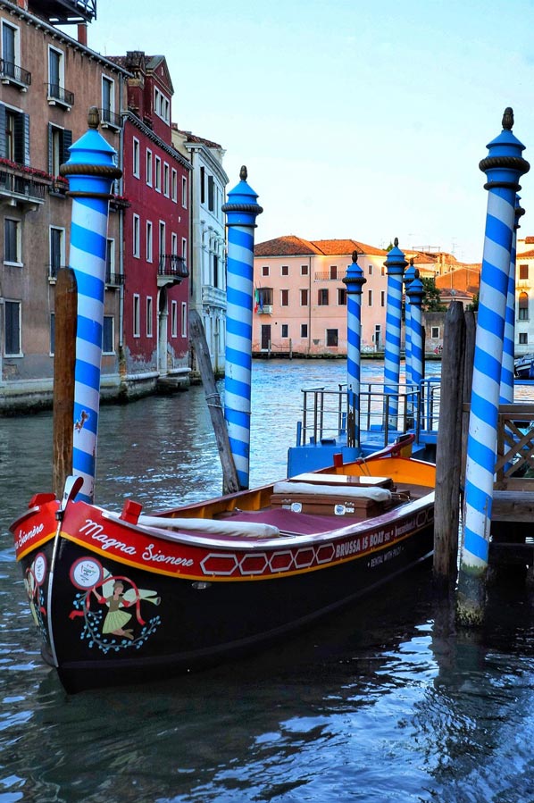
Typical "car" of Venice
Typical "car" of Venice
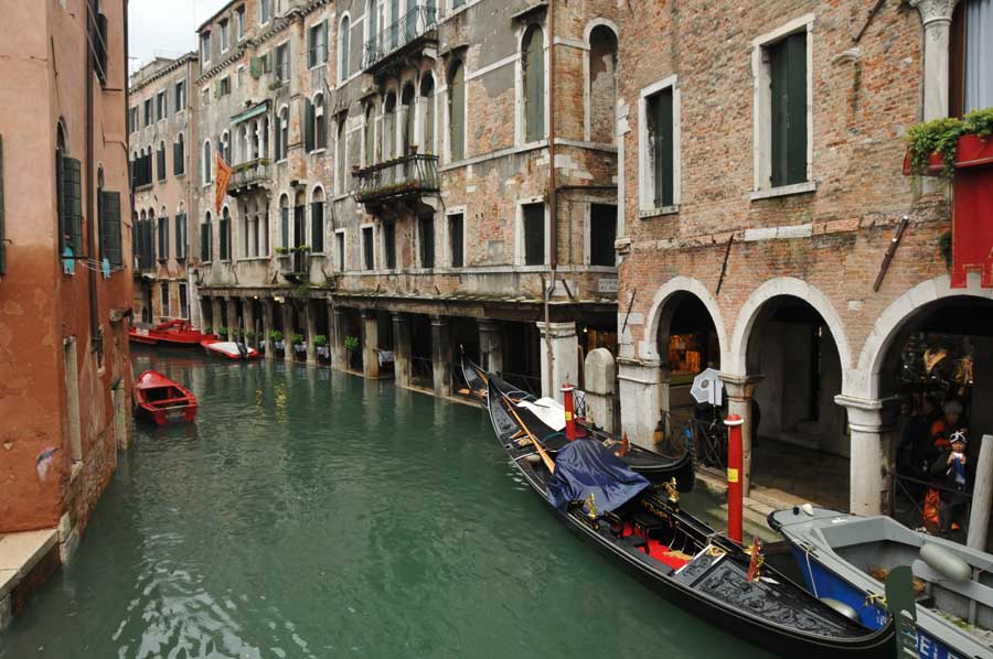
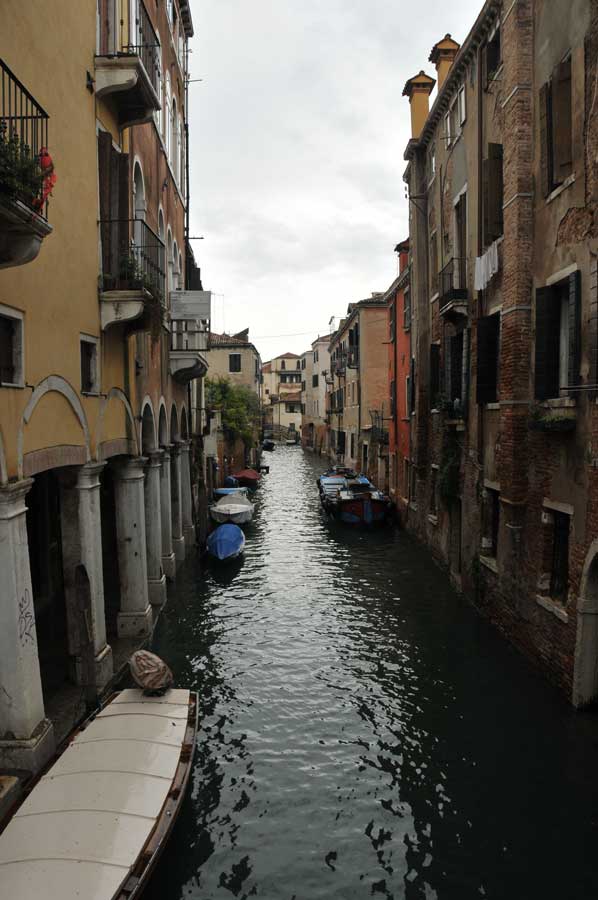
-
Typical "road" in Venice
Typical "road" in Venice
-
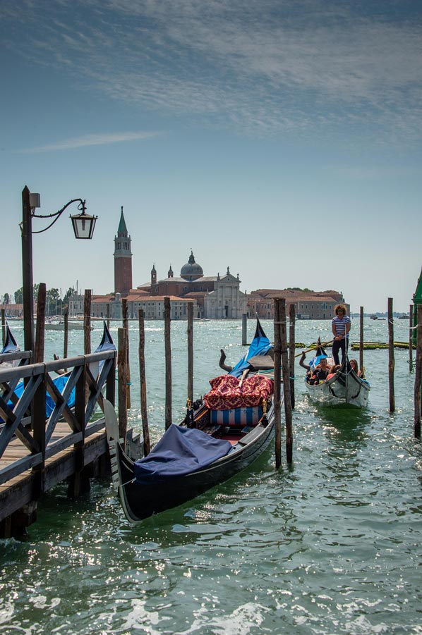
San Giergio Maggiore
San Giergio Maggiore


https://www.alaturka.info/en/italy/venedig/5154-venice-tidal-range-causes-high-tide-at-st-mark-s-square#sigProIdb01f8e7726