")
")
")
Day hike to the idyllic mountain village of Garnbach
- Written by Portal Editor

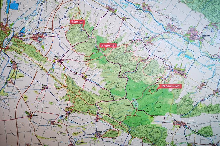
We had packed our backpacks with some provisions and something to drink quite early in the morning, because today we were going to the small mountain village of Garnbach near Wiehe, a distance of around 14 kilometres plus the return journey.
The starting point was again the “Kaiserweg” path at the outskirts of Billroda up to the Finne forest, foothills of the “Hohen Schrecke”, then always parallel to the Lossa stream to the tunnel of the railway underpass, then on the forest path to the village community center in the town of Lossa.
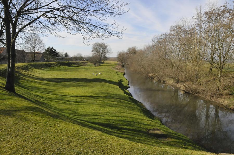
Lossa river – a branch of the Unstrut
 The Lossa is also a 43 km long, right-hand tributary of the Unstrut in Saxony-Anhalt and Central Thuringia. It rises at the western end of the area of the former municipality of Lossa in the Burgenland district in Saxony-Anhalt. The source is in the Finne, a mountain range on the edge of the Thuringian Basin.
It initially flows south through Rastenberg, Hardisleben, Mannstedt, then west through Guthmannshausen, Olbersleben and Großneuhausen. The Lossa flows into the Unstrut near Leubingen and shares the riverbed with it until Griefstedt, where it in turn divides into a left arm of the Unstrut and a right arm of Lossa. Both rivers finally flow together behind Gorsleben.
 By the way, there is a lot to discover here in the region for fans of old disused railway lines and their tunnels and bridges. The only thing worth mentioning here is the impressive Schnecktal Bridge of the former Finne Railway.
We chose this route along the Lossa because the actual forest path was still very wet and heavily worn by forestry workers' vehicles. Since we have already described the first part of this route in our article “Hike on the Kaiserweg”, we will save ourselves further details now. It was about 14 kilometres to get to the mountain village of Garnbach, which should be hiked away from country roads if possible. So, we reached the town of Lossa a little later coming out of the forest at the former village community centre.
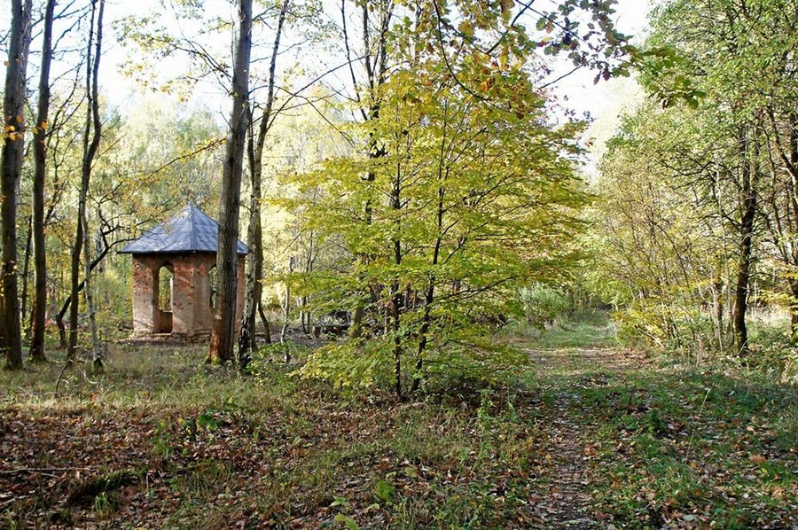
To the forest chapel behind Lossa on the way to Garnbach
 The road through Lossa has been closed for some time now due to the construction work that is now almost completed. We prefer to walk along the edge of the village behind the long gardens.
At the exit of the town we come across the L 217, which we now follow for a few hundred meters, then turn left onto the path “Lossaer Straße”, a cobblestone street that is still in its old condition and which leads to the former Lossa shooting range and the so-called forest chapel. After about 2 kilometres the cobblestone road ends, turns into a gravel forest path and after about 4 kilometres we reach a junction to the forest chapel, which we followed.
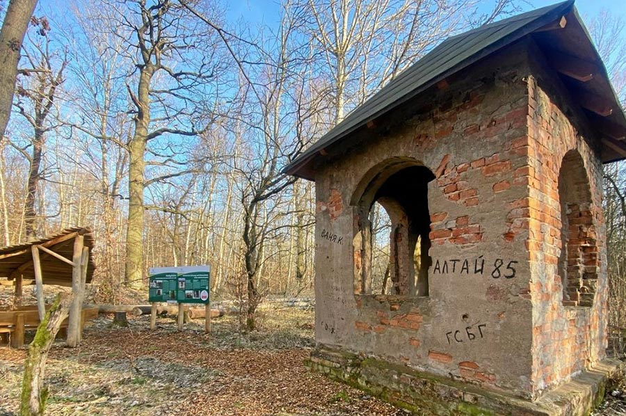 The so-called “Russian Chapel” is a small square building with chapel-like window shapes in the middle of the forests of the Hohe Schrecke.
This chapel was most likely never used for church services. The building got its name from the locals because of the Russian graffiti on the walls. The building was probably part of the shooting range that was located here in the 1950s.
It is no longer possible to reconstruct what specific purpose the building once served.
 The Hohe Schrecke was already used for military purposes before 1945. Since 1941 there has been a target practice area on the southern edge of the Hohe Schrecke behind the town of Lossa. It was used to provide practical training for combat aircraft crews in shooting with on-board weapons. The training area was used, among others, by the Langensalza pilot school.
The Hohe Schrecke was a restricted military area for over 40 years. No extensive military manoeuvres have taken place on the site since 1960 at the latest. The forest with its old trees and particularly dense crowns served as camouflage for the secret bunkers.
So, nature was largely left to its own devices. This enabled a unique natural area to be created in the Hohe Schrecke.
Passing Rabenswald to Garnbach
 Back on the main hiking trail, a little later we reach a large forest intersection, which we follow turning right towards Rabenswald. At this point it is also possible to continue the hiking and cycling path towards Heldrungen to the moated castle or to the impressive suspension bridge.
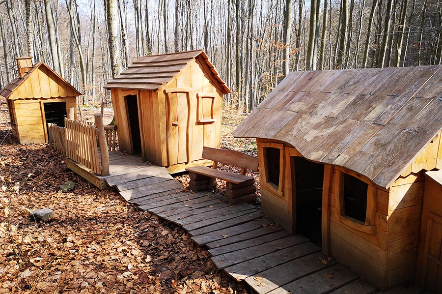
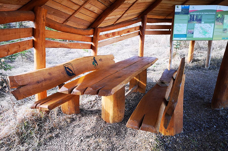
Surrounded by beautiful beech forests, we now head towards the Rabenswald family circular hiking trail, which we have already described in a separate article. An approximately 2.5-hour forest circular route with numerous stops, which has been specially designed for families with children, offers wonderful adventure opportunities for young and old, not least because of the forest school and the suspension bridge. Here we use the forest school's table and benches for a little picnic before we continue on the path to Garnbach.
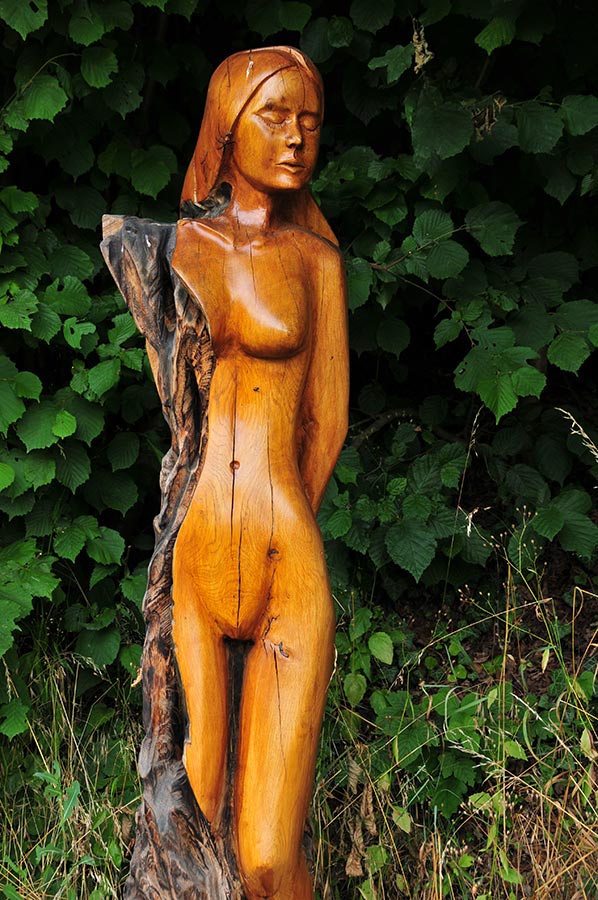
 Another stopover is the sculpture workshop just before Garnbach, where masters of chainsaw technology saw out and exhibit wooden figures, and courses are also offered for those interested.
We reached our destination Garnbach after a good three and a half hours, then chose an alternative route for our return, which forms our way back far above the town of Wiehe. After about 8 hours we reached our starting point again. A wonderful but also strenuous hike as there were some inclines to be overcome. The destinations described are always worth a hike or bike ride.
Were we able to arouse your interest?
Please also read:
Vevčani - mountain village at the foot of the Jablanica mountains