")
")
")
Kruja - Our tour through the impressive fortress
- Written by Portal Editor

Kruja - After the visit of the Skanderbeg Museum which is inside the fortress of Kruja, a tour of the castle grounds and the local buildings should follow, in spite of the threatening dark sky, which was part wise looking like strong rain could appear, but we were lucky.
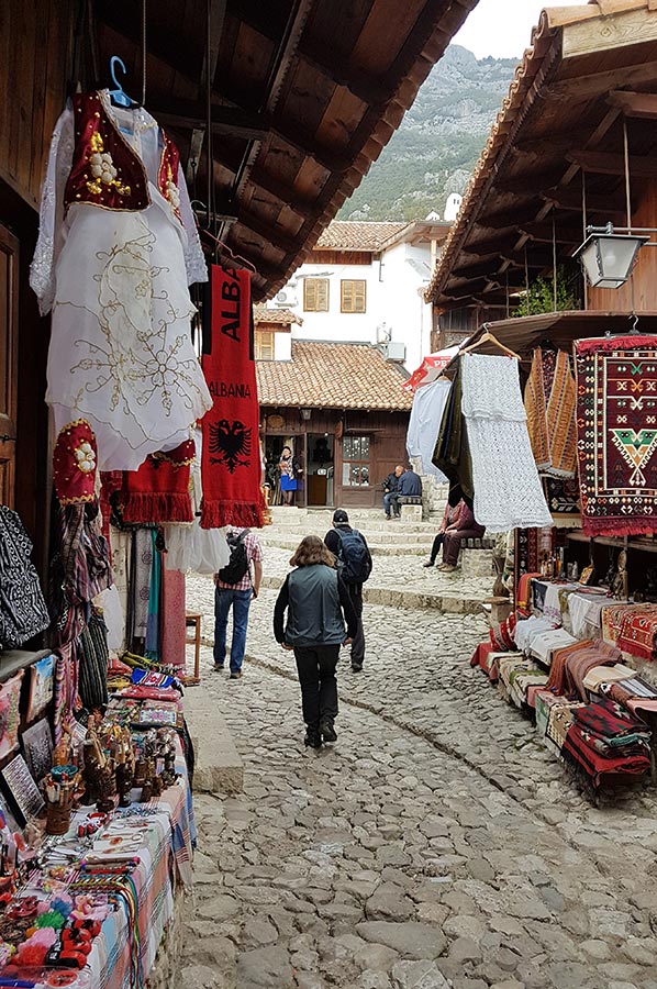
The fortress Kruja joins the center of Kruja to the south with the bazaar, we have published a blog about it. The castle is located on a steeply sloping rock block, which slopes slightly from east to west like the surrounding terrain.
Climbing the castle of Kruja
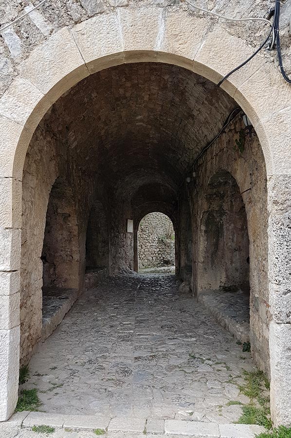
 Through the steep cliffs on all sides there were only two accesses to the fortress. In the west, the fortress below the rock wall is a small kennel, which can be reached by a narrow aisle between Tekke and Hamman.
There is a source from which the name of the city of Kruja derives.
The castle mountain has been inhabited since the 4th or 5th century and was fortified with walls by the 12th century.
As a result, the fortress saw various owners, including the Thopia and from 1415 the Ottomans. In 1443 the Albanian national hero Skanderbeg took over the castle without a fight.
The fortress of Kruja was besieged three times - in the years 1450, 1466 and 1467 - by large Ottoman armies until it fell at the fourth siege in 1478, ten years after the death of Skanderbeg.
 The Turks erected various houses in the Ottoman style, and the fortifications were also largely renovated, so that Ottoman buildings can be even seen today.
An earthquake in 1617 caused damage to the rock walls in the southeast area, which also destroyed the castle wall of Kruja above.
According to Machielkiel, the fortress was dragged by the Ottomans in revolts against the Tanzimat in 1831; the historian Baki Dollma declares the year 1855 for the same story.
In the Toptani house, a large and elaborately designed Ottoman mansion from 1764, the sub-prefecture, the court and the prison of Kruja were located until the Second World War.
Other important sights besides the restaurants are:
 Remains of churches were found in the south-west and north-east. The chapel in the south-west is from the 9th century. It is east of the Tekke.
The church in the upper part of the castle Kruja behind the great tower, which the archaeologists call the Acropolis, was probably built in the first half of the 15th century. The ruins of a small chapel, dating back to the 12th century, were found.
Right next to the main entrance are the ruins of the Sultan Mehmed Fatih Mosque, which in the short period between conquest of the plant and the death of Sultan Mehmed II must have been established in 1481, where a church used to be.
After the mosque was probably destroyed by the Ottomans in 1831, a completely new mosque was built under Sultan Mahmud II in 1838.
 From the mosque, disintegrated after the Second World War, only the foundation walls and the lower part of the minaret are preserved. The latter, however, was already destroyed in a storm during 1917. The mosque served as a church until 1937.
During the Second World War ammunition was stored in Kruja.The Turkish bath in the west of the complex was probably already built in the 15th century.
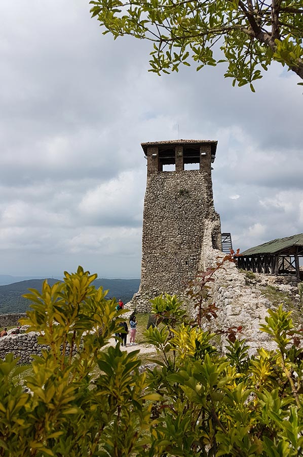
On the highest point of the fortress in the north-east is a Sahat Kula.
The clock tower, which is also called kulla e orës, was reconstructed from a military tower in the 17th century and is still strongly reminiscent of a defense building.
The tower is 15 meters high.
 The bell was donated in 1903 by a priest from Laç.
The Bektashi Dollmatek at the south-western end of the plant bears the inscription in 1788.
The ethnographic museum was housed in a large manor house from Ottoman times.
Remains of various houses of Kruja as well as other restored houses from Turkish time are collected here.
Please read as well:
Skanderbeg - Albanian myth and desire for freedom
Ascent to Petrela - coffee break in the castles garden
-
 Kruja Castle Buildings around the Museum
Kruja Castle Buildings around the Museum
Kruja Castle Buildings around the Museum
-
Kruja Castle Buildings around the Museum
Kruja Castle Buildings around the Museum
-
Kruja Castle Buildings around the Museum
Kruja Castle Buildings around the Museum
-
Kruja Castle Buildings around the Museum
Kruja Castle Buildings around the Museum
-
Kruja Castle Buildings around the Museum
Kruja Castle Buildings around the Museum
-
Kruja Castle Buildings around the Museum
Kruja Castle Buildings around the Museum
-
Kruja Castle Buildings around the Museum
Kruja Castle Buildings around the Museum
-
Kruja Castle Buildings around the Museum
Kruja Castle Buildings around the Museum
-
Kruja Castle Buildings around the Museum
Kruja Castle Buildings around the Museum
-
Kruja Castle Buildings around the Museum
Kruja Castle Buildings around the Museum
-
Kruja Castle Buildings around the Museum
Kruja Castle Buildings around the Museum
-
Kruja Castle Buildings around the Museum
Kruja Castle Buildings around the Museum
-
Kruja Castle Buildings around the Museum
Kruja Castle Buildings around the Museum
-
Kruja Castle Buildings around the Museum
Kruja Castle Buildings around the Museum
-
Kruja Castle Buildings around the Museum
Kruja Castle Buildings around the Museum
-
Kruja Castle Buildings around the Museum
Kruja Castle Buildings around the Museum
-
Kruja Castle Buildings around the Museum
Kruja Castle Buildings around the Museum
-
Kruja Castle Buildings around the Museum
Kruja Castle Buildings around the Museum
-
Kruja Castle Buildings around the Museum
Kruja Castle Buildings around the Museum
-
Kruja Castle Buildings around the Museum
Kruja Castle Buildings around the Museum
-
Kruja Castle Buildings around the Museum
Kruja Castle Buildings around the Museum
-
Kruja Castle Buildings around the Museum
Kruja Castle Buildings around the Museum
-
Kruja Castle Buildings around the Museum
Kruja Castle Buildings around the Museum
-
Kruja Castle Buildings around the Museum
Kruja Castle Buildings around the Museum
-
Kruja Castle Buildings around the Museum
Kruja Castle Buildings around the Museum
-
Kruja Castle Buildings around the Museum
Kruja Castle Buildings around the Museum
-
Kruja Castle Buildings around the Museum
Kruja Castle Buildings around the Museum


https://www.alaturka.info/en/albania/tirana/3939-our-tour-through-the-impressive-fortress-of-kruja#sigProId5ad23c7b60