")
")
")
Iotape - Ruined City on a beautiful Bay close to Alanya
- Written by Portal Editor

Iotape - today Aydap İskelesi - is one of the most easily accessible ancient cities in the Alanya area of ancient Rough Cilicia (Kilikia Tracheia, today Aydap İskelesi). It lies 33 km from the city, almost perpendicular to the coastal road from Alanya to Gazipasa.
It was founded, like nearby Antiochia on the Kragos River, by Antiochus IV of Commagene (38-72 AD) and named after his daughter after Claudius entrusted him with control of Rough Cilicia in 41 AD.
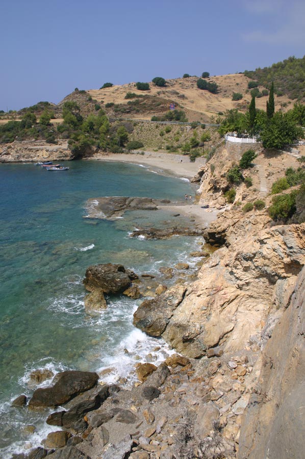 The road cuts the ancient city in two, so the ruins are directly visible from the road. The city's location is typical for this region. A steep slope drops down to the sea, forming two bays. Despite the fertile land stretching to the east and west, the soil in this area is rocky. Nevertheless, terracing makes it possible to cultivate bananas over a considerable area.
It is known that the city of Iotape minted its own coins during the era beginning with Emperor Trajan (98-117 AD) and lasting until the reign of Valerian (253-260 AD). One side of these coins features a bust of the emperor, while the other depicts the gods Apollo and Perseus, as well as the goddess Tyche. The rather high rocky promontory extending towards the sea was the acropolis of the ancient city. The city walls, built for defense, give this area the appearance of a fortress, but the buildings they once enclosed are in such a poor state that it is impossible to locate their foundations.
Iotape - In the Valley of the Acropolis
 In the valley that connected the acropolis to the mainland, an ancient, columned street can still be found. In some places, the bases of statues are still visible, indicating that the street was once adorned with statues. Inscriptions provide information about successful athletes from Iotape and charitable citizens. The religious buildings were likely located to the east of the acropolis, spread around the bay. The first building that catches the eye here is the basilica. Its south facade faces the street. The basilica is a rectangular structure with three naves. Brick, rough-hewn stones, and mortar were used in its construction. Another small, single-nave church is located to the northwest of the basilica. This church has two entrances. In one of the niches is a fresco depicting Aios Georgios Stratelates. Unfortunately, the fresco is badly damaged.
 Next to these religious buildings, we find a structure that likely served as a public bath. The bathhouse's sewage system can still be seen today. Research has shown that wastewater was discharged into the sea via a main canal and connecting side channels. Drinking water was obtained through an aqueduct and drawn from four cisterns. South of the road to Gazipasa, the remains of a temple can be seen. The temple is built on a platform measuring 8 x 12.5 meters. According to the inscription on the south wall, it was erected by Marcus Pompey between 111 and 114 AD. The Iotape necropolis lies on the hills to the north and east. Many tombs were destroyed when the land was terraced for banana plantations. However, some tombs are still recognizable. Besides the Hereon tombs, these include tombs with vaulted burial chambers. With its natural beauty, the town is ideal for a day trip.
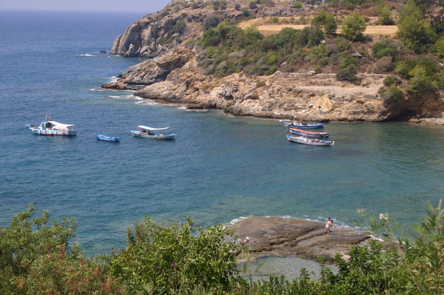
One bay ahead is a small but beautiful beach with a slightly pebbly shoreline and a small restaurant.
Please also read:
Colyabrassos - helenestic settlement next to Alanya
Syedra - Ancient City on the way to Gazipasa