Bastei Bridge – A Hike in Saxon Switzerland
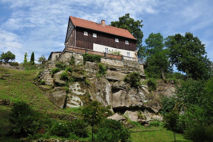
Bastei Bridge – Setting out from Kamenz, we took a day trip to Saxon Switzerland, the famous sandstone mountain range located southeast of Dresden, known for its bizarre rock formations along the Elbe River.
The name "Saxon Switzerland" originated in the 18th century after two Swiss artists, Adrian Zingg and Anton Graff, were appointed to the Dresden Academy of Art in 1766. "From their new adopted home, they looked eastward and saw a mountain range lying about a day's march away.
It presented a strangely flattened panorama, lacking distinct peaks […]." The two artists were reminded of their homeland the Swiss Jura by the landscape; in their correspondence, they began referring to the area as "Saxon Switzerland" to distinguish it from their native land.
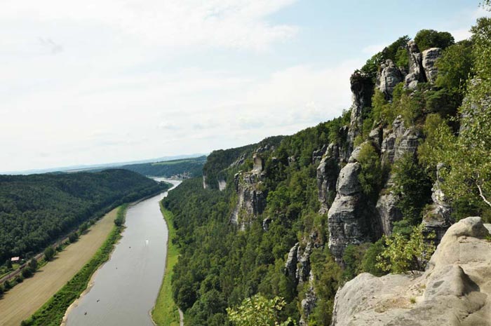
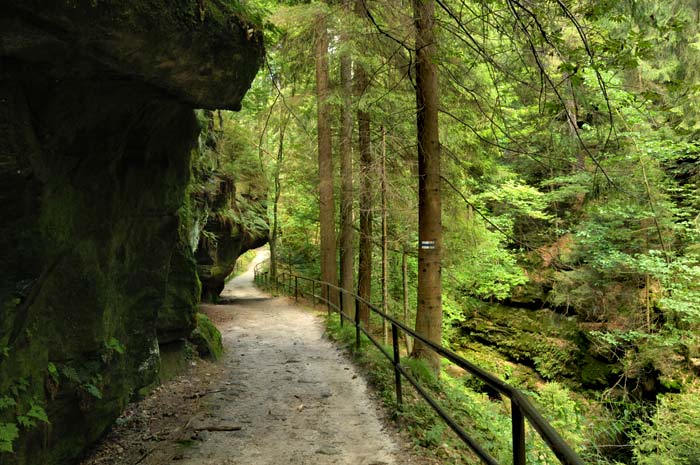
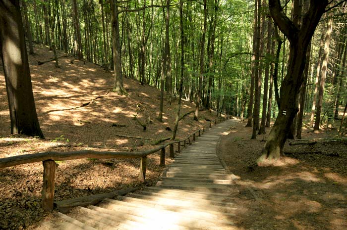
To the east, Saxon Switzerland transitions into the Lusatian Highlands, while to the west, it gives way to the Ore Mountains. The adjacent Czech section of the Elbe Sandstone Mountains is known as Bohemian Switzerland. The highest point in Saxon Switzerland is the Großer Zschirnstein, at 562 meters above sea level. We hiked through the so-called "Höllenschlund" (Hell's Gorge) in the Rathener Grund valley between Rathen and Wilden following the trail markers (visible here on the tree) toward the rock fortress.
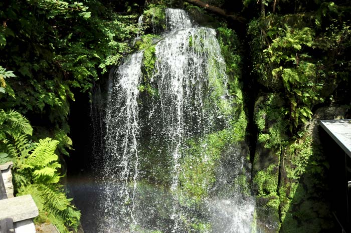
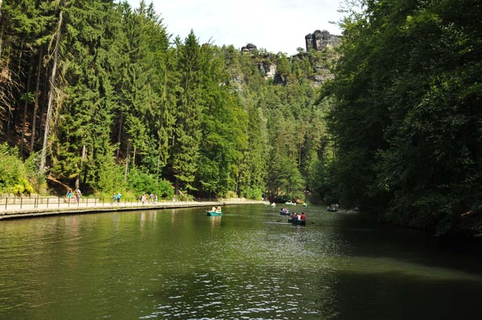
A small stream ran parallel to the hiking trail, accompanying us as we descended through the Höllental valley. At a rest hut, the stream water scarce during the height of summer was artificially dammed; every ten minutes, the water was released from the reservoir as a small waterfall, delighting the hikers. Further down the valley, a small reservoir known as Amselsee had formed, used by day-trippers for pedal boating and rowing. At the weir itself, one could spot plenty of magnificent trout belonging to the adjacent fish farm. In the background, the towering rock formations of the Bastei are clearly visible.
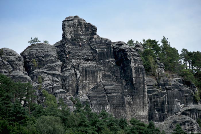
Even from a distance, one can see rock climbers pursuing their sport in large numbers across the Elbe Sandstone Mountains. Countless routes some requiring traverses while hanging make the area around the rock fortress a popular destination for sports climbers. Climbing here follows the "Saxon Rules," established in the early 20th century as the world's first regulations of their kind. Ropes and protection points, such as rings, may be used solely for safety, not for upward movement.
Aids common in other climbing areas such as chalk, nuts, or camming devices are prohibited here; instead, climbers use knots and slings. With only three exceptions, climbing on large rock massifs is forbidden; it is generally permitted only on designated free-standing climbing peaks of which there are, however, over 1,100.
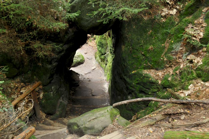
The hiking trails in Saxon Switzerland are generally well-maintained, allowing even inexperienced hikers to enjoy a rewarding journey; the ever-changing views of the landscape and its magnificent deciduous forests are particularly captivating.
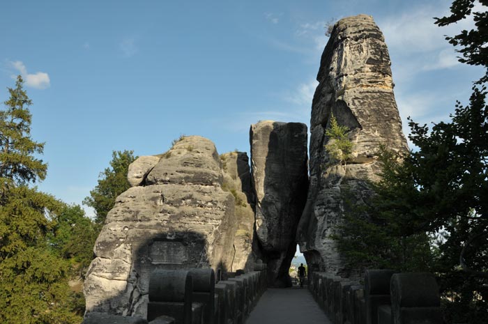
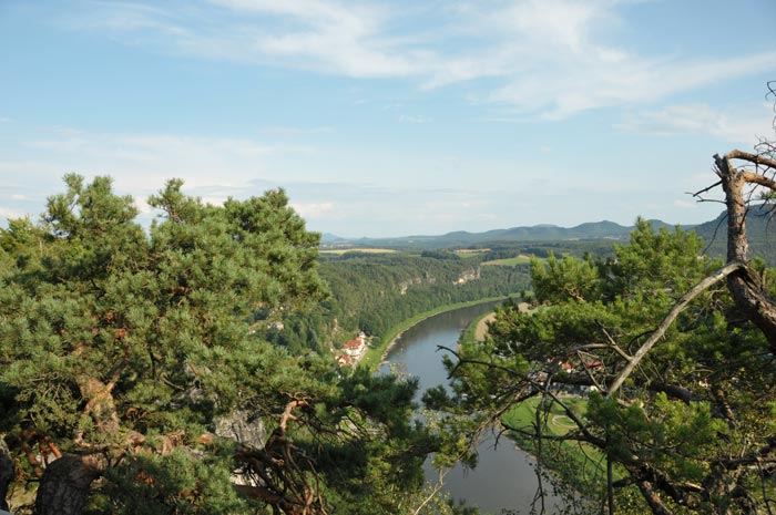
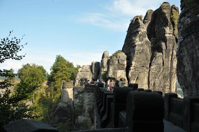
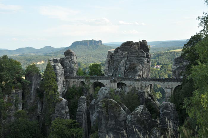
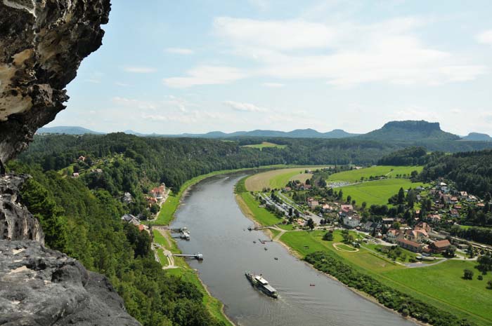
Finally, the ascent to the rock fortress is complete, offering the first view down to the Elbe River, where a paddle steamer is making its way toward the landing stage. Swimmers could even be seen in the river, taking breaks on the sandbanks and gravel beaches during their canoe trips to enjoy a refreshing dip in the Elbe. An impressive structure that serves as a landmark for Saxon Switzerland to this day: the Bastei Bridge. A pivotal moment for the region's development occurred in 1826. That year, the first permanent building offering dining and accommodation was constructed next to the Neurathen rock castle, based on designs by Gottlob Friedrich Thormeyer. At the same time, an initial wooden bridge named the "Bastei Bridge" was built across the deep ravines of the "Mardertelle" gorge; it connected the Bastei with the outlying rock ridge featuring the "Steinschleuder" and "Neurathener Felsentor" rock formations. In 1851, due to steadily increasing visitor numbers, this wooden bridge was replaced by the sandstone structure that stands today. Spanning the 40-meter-deep "Mardertelle" gorge with seven arches, the bridge measures 76.5 meters in length. By the end of the 19th century, the Bastei had firmly established itself as the premier excursion destination in Saxon Switzerland.
The narrow passage leading across the Bastei Bridge to the Neurathen rock castle is still considered a remarkable feat of engineering today. The origins of the adjoining Neurathen rock castle built on the northern border of the Kingdom of Bohemia remain obscure, though archaeological finds suggest the site was inhabited as early as the Bronze Age. Historians believe it was established around 1245 as part of efforts by Henry the Illustrious to secure the border of the Margraviate of Meissen against Bohemia.
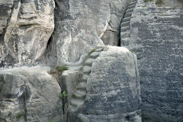
Ancient steps hewn directly into the sandstone rock remain clearly visible. Settlers utilized the towering sandstone cliffs as a natural fortress, allowing them to control trade along the Elbe River. Visitors can explore the castle ruins including beam slots, rock-hewn chambers, a cistern, and stone projectiles from medieval slings or catapults via a dedicated walking circuit. A reconstructed stone-throwing engine was installed at the site in 1986. Artifacts recovered during excavations, particularly pottery, are also on display.
The impressive height of the rock castle, rising majestically above the banks of the Elbe, is striking.
The river and the associated shipping traffic can be seen for a great distance in both directions.
The Bastei is one of the most distinctive viewpoints in Saxon Switzerland. As early as 1819, August von Goethe praised the vista: "Here, where one looks straight down into the Elbe from sheer rock faces, where the Lilienstein, Königstein, and Pfaffenstein lie picturesquely grouped a short distance away, the eye beholds a panorama that defies verbal description." The descent into the Höllental also reveals the true splendour and diverse forms of the rock formations known as the Schwedenlöcher; shaped by wind and weather over millennia, they now form part of an impressive network of hiking trails.
An impressive excursion is drawing to a close; back at the vehicle, the plan is to head to the banks of the Elbe in Dresden this evening, where the annual film festival showcases current cinematic highlights. The silhouette of the Old Town in the background of the giant screen makes for a spectacular setting something we highly recommend for the future.
Bastei Bridge coordinates: 50° 55′ 13″ N, 14° 8′ 36″ E.
Please also read:
Ahrweiler – A tour of the Old Town
Isola della Cona – A hike through the Isonzo Nature Park on the peninsula