")
")
")
Peaks of the Balkans – hike through the Albanian Alps
- Written by Portal Editor

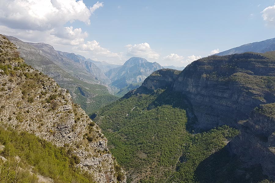
Peaks of the Balkans - During our stay at Camping Legjenda in Shkoder “long” years ago, we took tours into the Cem Valley, which runs almost parallel to the border mountains between Albania and Montenegro.
At that time, we followed the course of the river on the road that was paved in 2014 to Tamarë, where we finally came across the first signpost for the newly established hiking trail “Peaks of the Balkans”. Here we had also reached the end of the newly asphalted road.
New border crossing between Montenegro and Albania
 Since the end of 2016, the road from Han i Hotit via Tamarë and the Qafa e Bordolecit pass to Vermosh has been paved throughout, while the last 500 meters to the border crossing at Gusinje only have a water-bound surface. This road surface consists of a mineral mixture of broken natural stone material - chippings and gravel. When properly installed and maintained, water-bound surfaces lead to sufficient precipitation infiltration and therefore have a lower runoff coefficient than asphalt surfaces.
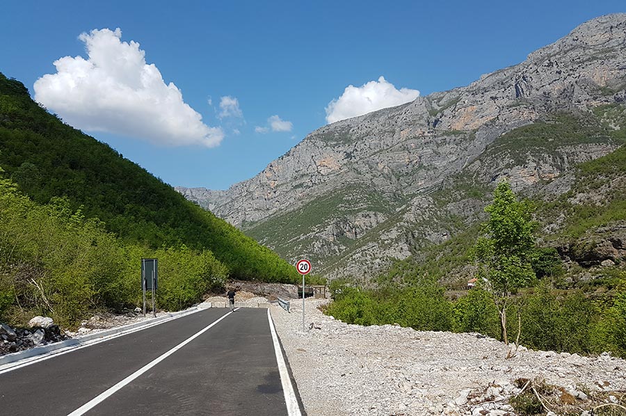 In many nature parks, such as here in Kelmend, they are the preferred form of paving accessible paths, as they can create a more natural impression. If light-coloured stone material is also used, such surfaces heat up significantly less than dark asphalt surfaces. In addition, the slightly softer surface is considered to be easier on the joints for hikers and also for horses, whose hooves are less stressed. Completely ecological approaches that were implemented here in Albania too.
 In 2021, the long-awaited Grabom border crossing between Albania and Montenegro was opened around nine kilometres downstream. The new border crossing not only brings Podgorica closer to Kelmend, but also opens a faster connection from the Montenegrin capital to Plav, which means that Kelmend and thus also the “Peak of the Balkans” hiking trail are now easier to reach from Podgorica International Airport.
Peaks of the Balkans - beautiful Hiking Route
 Peaks of the Balkans is a 192-kilometer-long long-distance hiking trail in the Prokletije Mountains, better known as the Albanian Alps. It takes you through Albania, Kosovo and Montenegro over ten daily stages, but they are all quite demanding, so it may make sense to include intermediate stages if you are not an experienced long-distance hiker.
 The relatively new hiking trail was preceded by efforts to bring the populations of the various Prokletije countries closer together and to break down borders. In particular, the Balkans Peace Park Project had sought to reopen the old pastoral and trading routes across the border. The German Society for International Cooperation (GIZ) has been working on the development of mountain tourism in Theth since 2006 and promoted the marking of hiking trails and the publication of corresponding maps and hiking guides.
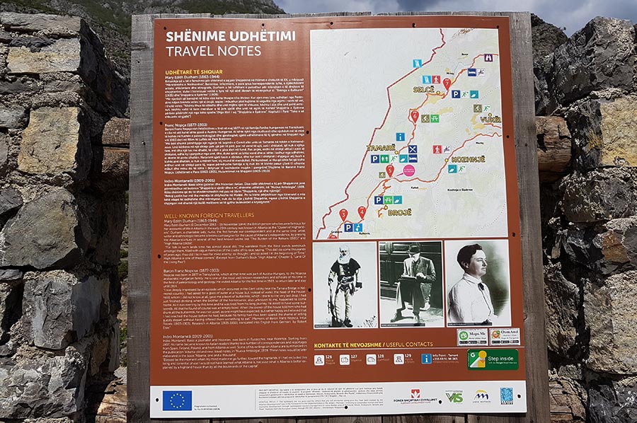
Peaks of the Balkans - Route of the individual routes
Some of the hiking trails run through developed valleys, but some are also very secluded in high alpine regions, where only simple alpine huts are available for overnight accommodation. The paths are therefore only recommended for experienced mountain hikers. The path partly leads through nature reserves such as Theth National Park, Valbona Valley National Park, Bjeshkët e Nemuna National Park, Lumi i Gashi Nature Reserve and Prokletije National Park. Here are the individual stages:
Theth (Albania) – Qafa e Valbonës – Rragam – Valbona: 13.9 km
Valbona – Cerem: 19.8 km
Çerem – Alp Dobërdol: 15.64 km
Dobërdol (Albania) – Tromeđa – Alp Milishevc (Kosovo): 18.2 km
Milishevc – Rugova Gorge – Reka e Allagës: 16.24 km
Reka e Allagës – Pepaj – Drelaj – Dugaiva – Kuqishta (Čakor Pass): 23.26 km
Kuqishta (Kosovo) – Babino Polje (Montenegro): 15.8 km
Babino Polje – Hrid – Plav: 20.31 km
Plav – Bor (mountain) – Grlata – Vusanje: 27.4 km
Vusanje (Montenegro) – Qafa e Pejës (Albania) – Theth: 21.35 km
 In addition to Theth, entry is also possible in other easily accessible places such as Valbona, Plav, Vusanje and Peja. If there are several stages, due to their length, it is advisable to divide them into several parts of the day, although, as already mentioned, accommodation is not always available. So, it can definitely make sense to book a guided tour.
Border crossings do not take place at official border crossings. The necessary documents must inevitably be obtained in advance. The trail markings are white-red-white in Albania, red-white-red in Kosovo and a red circle with a white centre in Montenegro.
Introductory hike from Tamarë to Koshnje and beyond
 Once again on the road in the Balkans, we drove from Podgorica via Grabom to Tamarë again, as to acclimatize we first wanted to take a hike to the Hotel-Restorant Pepushaj (about 12.6 kilometres) to spend the night, and then to the Valbona Valley where we initially decided on the route from Valbona to Cerem. But more on that later.
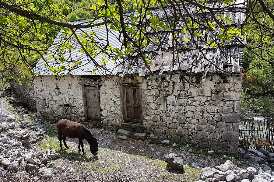
Tamarë is a small village and also the administrative centre of the Kelmend region. The town with around 500 residents has a school, a health centre, a tourist information centre, a church and a small “pedestrian zone in the centre”, which was newly created in 2016, particularly to promote tourism in the region.
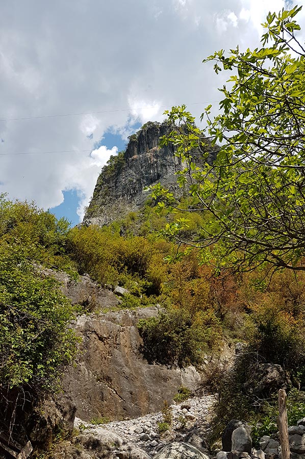
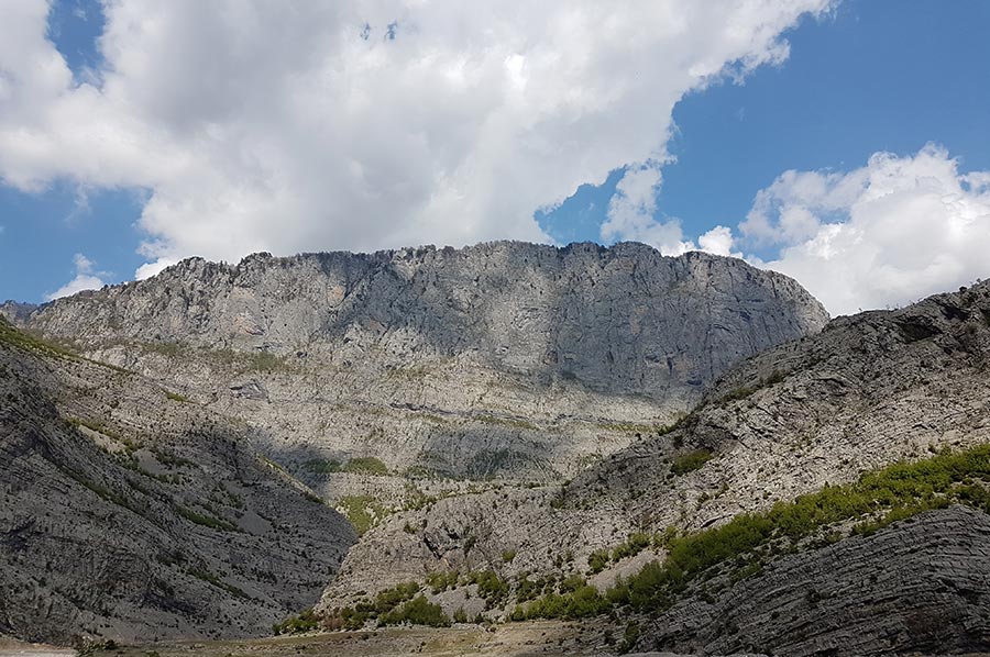
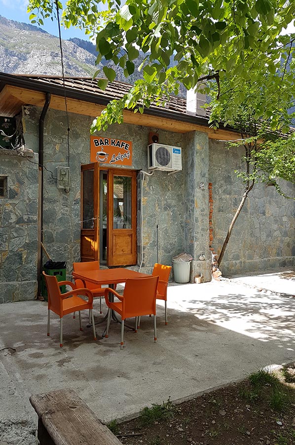 Tamara lies in the deep valley of the Cem River at an altitude of around 250 meters. In the northwest, the valley rises within around two kilometres to an altitude of 1,500 meters to a ridge on which the border with Montenegro runs. In the south, right above the city, a 593-meter-high rock rises, the beginning of a mountain range that reaches well over 1000 m above sea level. A. increases. There are various caves in the karst mountains around Tamara, so you can easily spend a few days there. And we can only recommend the grilled trout on site.
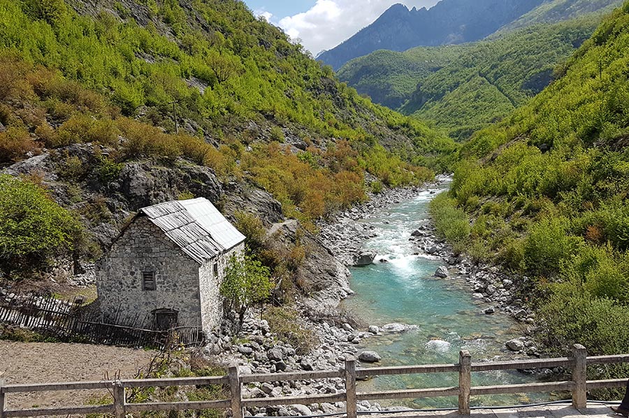
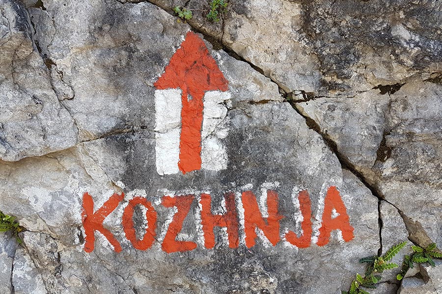
 After our delicious lunch we should then head towards the hotel, first to the fork in the road at the bridge over the Cem River. The path is well marked and there are a few photo points along the way. Depending on the season, the transition over the suspension bridge is particularly exciting. The climbs are ok, so they are good training for the larger height differences in the Valbona Valley. We reach our accommodation for the night after a good 4 hours of hiking.
Please also read:
The Athos Monasteries Chalkidiki and the Hesychasm Dispute
Bauhaus Museum – art, crafts and industry at start of the 1920s