")
")
")
Gazipaşa - Selinus, Iotape and Emperor Trajan
- Written by Portal Editor

Gazipaşa - Selinus (also Selinous, Greek: Σελινοΰς) was an ancient city in Rough Cilicia (Kilikia Tracheia) on the southern coast of Asia Minor (near the modern city of Gazipaşa in Turkey, 9 km east of the ancient city of Iotape).
Little is known about the city's history up to the Roman period. In 197 BC, it was conquered by Antiochus III. In 117 AD, the Roman Emperor Trajan died there on his return from the war against the Parthians. The city was renamed Traianopolis after him, but in late antiquity, when it was the seat of a bishop, it reverted to its original name.
Gazipaşa - The Historical Significance of Selinus
 In 269, the Persians conquered the city, and in the 5th century, it was affected by the Isaurian uprisings. The city is situated on a hill at the mouth of the Selinus River (now the Musa Çay) and expanded into the plain during Roman times.
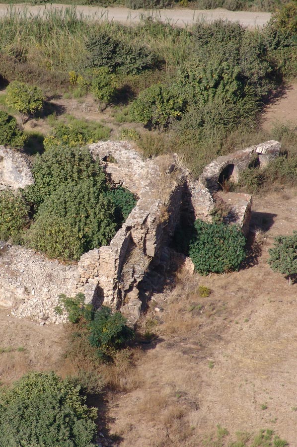
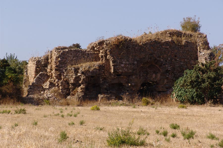
Remnants of the city wall, an aqueduct, and a theater have been preserved. A building standing in a colonnaded square (the so-called Şekerhane Kiosk), referred to as Trajan's Cenotaph, is likely Seljuk in its current form but probably stands on the site of the cenotaph, a Corinthian-order structure from which numerous spolia were reused.
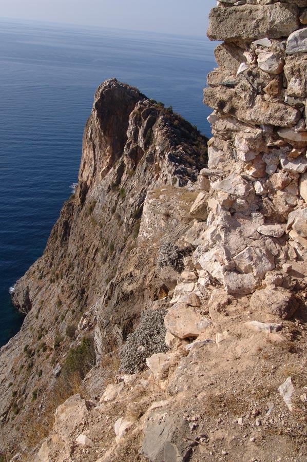
The well-preserved castle on the acropolis is a 12th-century Armenian fortress.
Source: www.wikipedia.de
Regarding the historical figure of Trajan:
Marcus Ulpius Traianus (born September 18, 53 AD in Italica; died August 8, 117 AD in Selinus, Cilicia) was Roman Emperor from January 98 to 117 AD. Trajan is one of the so-called Adoptive Emperors. Through the conquest of Armenia, Mesopotamia, and especially the Dacian Kingdom, the Roman Empire reached its greatest extent under his rule.
Source: www.wikipedia.de
 Returning to the gravel path, you reach the castle hill of the Lesser Armenian fortress in a few minutes. The access route to the upper ruins and the gate consists of wide steps.
From the gate of the upper main castle onward, there is no longer a proper path. To reach the top of the rock face (fenced with a metal grate), you have to climb over many boulders. Good footwear is definitely recommended for this hike.
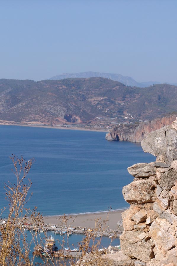
Returning to the gravel path, you reach the castle hill of the Lesser Armenian fortress in a few minutes. From the upper ruins, there is a breathtaking view over the main beach towards the coastal road (towards Alanya) and to the east towards the second beach with its stone slabs. The ascent and descent, including a short break, takes about an hour.
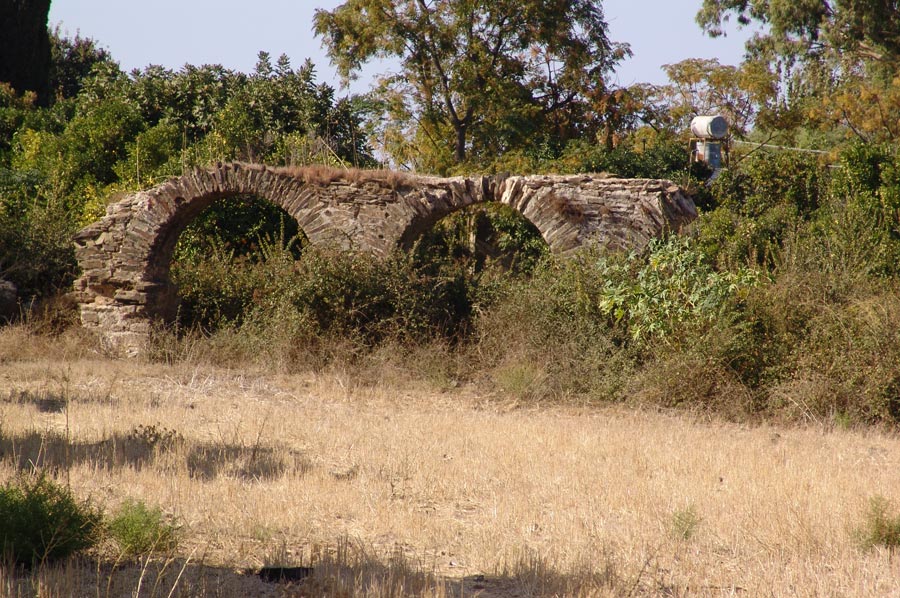
Gazipasa - We return to the bridge.
 If you drive along the road from the bridge along the castle hill (i.e., away from the town), you will reach the Mus Deniz resort on the left and, after about 1.5 km, the second large beach of Gazipasa. The beach stretches for about 2 km eastward from the castle hill of the Malayan fortress to the small metal lighthouse. There is a small restaurant (lokanta) on the beach side of the castle hill.
The beach here is beautifully sandy. Towards the lighthouse, the beach changes in texture and structure. Here we find only huge, stacked slabs of stone. Presumably, the old harbor was located here.
I always call this spot the "bathtub," and indeed, this section of the beach is used for all sorts of swimming exercises. There's a spot with a formation of slabs of stone extending into the sea. Between this formation and the beach is a bay (similar to a pool) approximately 20 meters wide and 70 meters long, with access to the sea on one side. On one side, you can swim and dive calmly thanks to the slab formation.
 If you're at the seaward side of the slab formation, the spray of the rough sea splashes over you. We now return to the Mermaid's Crossing. There we see a large brown sign for Lamus. The sign points to the
Taurus Mountains. Lamus is practically forgotten today. The town is neither well-known nor do many people know how to get there. Years ago, Polish archaeologists unearthed a few stone sarcophagi. Coins are also said to have been found there. Years ago, an elderly Turkish man living in the mountains led a small group of us there.
After several hikes in the mountains, I never found the way back. Regarding the historical background of Lamus:
The town is documented as a polis during the Roman Imperial period and was fortified with a city wall during the reign of Emperor Gallienus (foundation inscription).
 In Late Antiquity and the Byzantine period, it was a bishopric. In the 12th century, it is recorded as Lamaws, part of the Kingdom of Lesser Armenia. Source: www.wikipedia.de
From the intersection, the coastal road leads east towards Anamur (approx. 80 km). After about 10 km (turn right) you will reach the ancient ruined city of Nephesis (Nephelion), and after another 10 km (turn right) the ancient city of Antochia ac Cragum (today Güney). All of these places you can see next to Gazipaşa
Yours sincerely, Detlef Heinzel
Please also read: