")
")
")
Mut - We're going via Ermenek across the Toros Mountains!
- Written by Portal Editor

Mut - The XCTurkey Competition is calling us to Mut and Karaman once again. Early this morning, we decide not to take the usual route via Manavgat towards Seydesehir, but instead to cross the Taurus Mountains from Demirtas.
Now, at the end of April, the route should be completely free of snow and ice, so we set off around 8:00 AM.
 We drive into the mountains near Demirtas, initially heading towards Sapadere Canyon.
Shortly before the fork in the road leading to the canyon, we turn left, drive through the town, and after another 12 kilometres, we reach a fork in the road with no signs whatsoever.
We drive back to the last building and learn that the road across the Taurus Mountains is still impassable from here due to a number of landslides caused by the snowmelt.
The only option is to take the old Konya Pass road towards Taskent until the junction with the D340 highway, then turn right towards Mut and Mersin.
However, there's only one forest track, which we have to use to reach the pass road towards Konya. The weather: wet, cold, and at times very foggy, as you can clearly see in the pictures.
 The slopes along the first part of the route, which offer a magnificent view into the Dim Valley, are breathtaking. Without any paving, the road winds along cliffs and overhangs that will make any driver's heart race.
Consequently, there's very little traffic on this not entirely safe route. We soon reach the Yaila Valley near Gökbel, close to Yalci, where many Alanya residents spend the summer.
Small houses, mostly empty now, dot the valleys. During the hot summer months, people not only live here but also cultivate gardens extensively. Besides numerous varieties of fruit, vegetables are the main crop, which are then transported to and sold at the weekly markets along the coast.
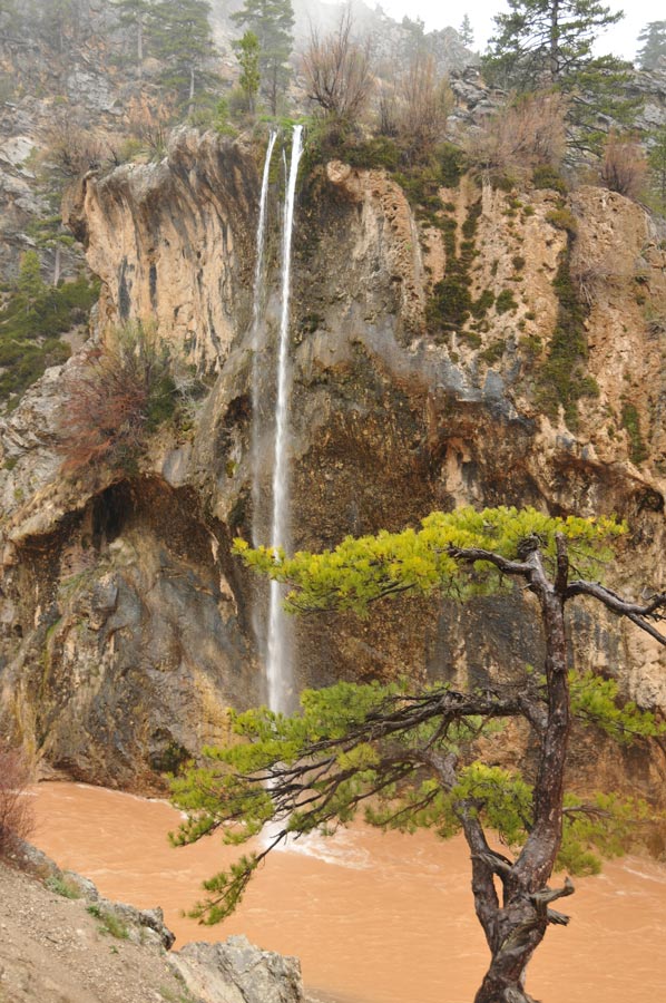
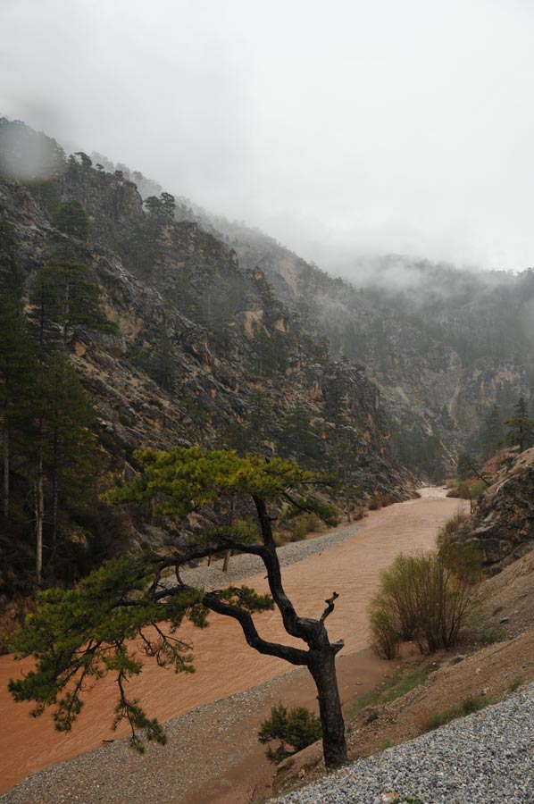
A multitude of fruit trees are in full bloom, and the usually small streams have become raging torrents.
 After the Yaila valleys, we have to tackle another mountain pass near Camici, which climbs to an altitude of 1,925 meters. Here, there is still plenty of snow covering the slopes of this now treeless region. And it's cold here, hard to believe: the thermometer reads 3°C despite the glorious sunshine and being only 55 kilometres from the beach.
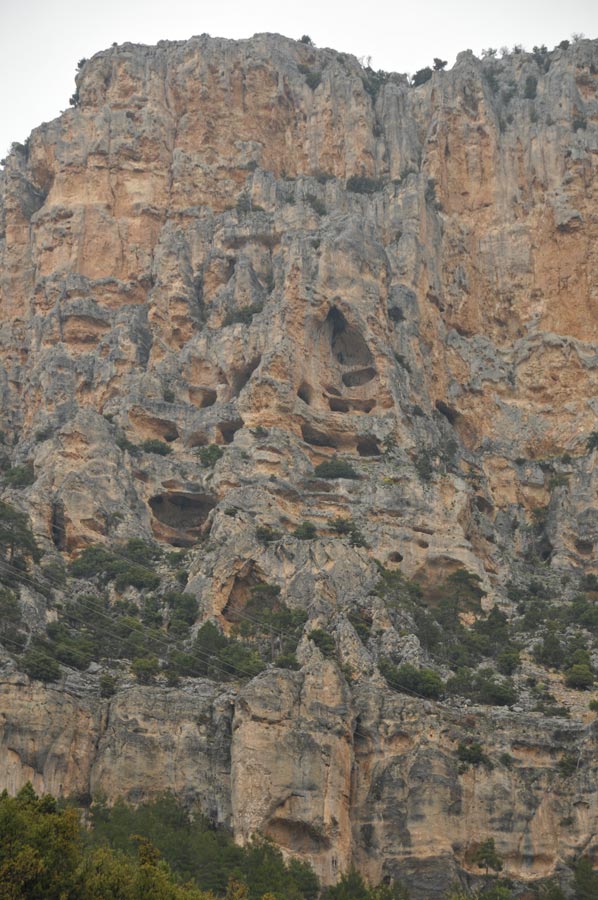
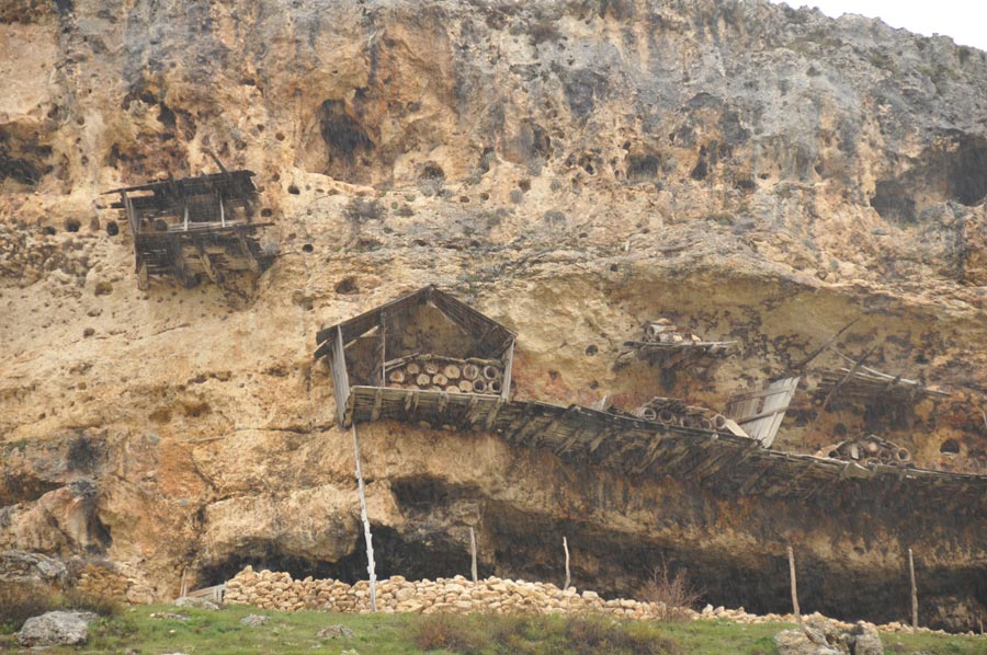
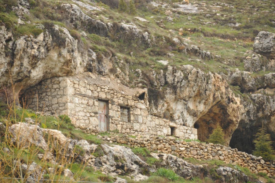
A little later, we reach the aforementioned Mersin-Taskent road junction, where we turn right towards Mut/Mersin. The road winds its way south for kilometres along steep mountain slopes. Then the landscape and the colours of the stones change; the much softer rock material allowed the prehistoric settlers here to create dwellings similar to those found in Cappadocia: homes and storage areas carved into the rock. We repeatedly encounter such settlements along the roadside.
From here, we are accompanied by an increasingly wide stream, which is eventually dammed to form a reservoir just before Ermenek. The road climbs steadily, offering us a magnificent view of the turquoise lake far below in the valley.
The Ermenek Dam was built in 2009
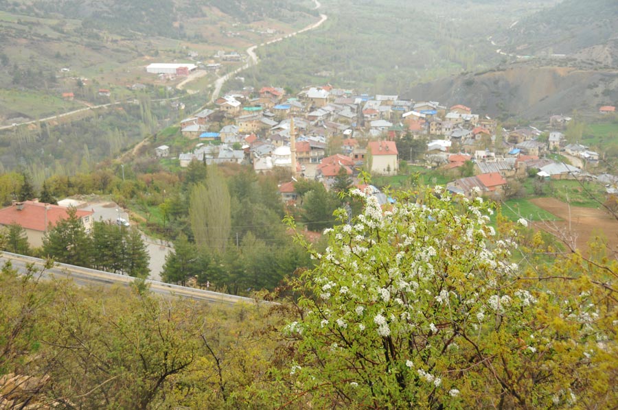 A little later, we arrive in Ermenek and are fascinated by the multitude of medieval buildings that form the town centre. The place seems almost forgotten by time. Unfortunately, our limited time doesn't allow us to stay today, but we've already decided to return soon for a more extensive tour of the town, complete with a detailed report.
Ermenek, a small town with approximately 10,600 inhabitants today, lies at an altitude of about 1,200 meters at the confluence of the two headstreams of the Göksu River. The Ermenek Dam was built in 2009. In antiquity, the town was part of the region of Isauria and was named after the Roman general Germanicus, from whom the original name Germanicapolis is derived.
 Ermenek was under Roman and later Byzantine rule. The name Germanicopolis changed to Germanig under the Armenian Rubenid dynasty in the 12th century. In 1228, the Ottoman Seljuks of Rum, under their ruler Kaikobad I, conquered Ermenek. After the decline of the Seljuks of Rum, Ermenek became part of the Karaman principality. Over time, the name changed from Germanig to Ermenek. In the 15th century, the Karamans were defeated by the Ottomans, and Ermenek became part of the Ottoman Empire.
We continue our journey through extensive forests, with frequent glimpses of the Göksu Nehri River flowing below in the valley. It's a beautiful stretch of land we're driving through. More rocks to the left reveal an immense number of cliff dwellings and storage sites high up on the mountain. This is a point we'll discuss later in Mut, exploring which ethnic groups settled here in prehistoric times.
Mut is known for its successful apricot cultivation
 The terrain now slopes steadily downwards, and the forest gradually gives way to orchards, which will accompany us all the way to the town of Mut. Mut is known for its successful apricot cultivation, with apricots traded throughout Turkey. A little later, we're back at Kaymakam Mustafa Sahin's house, and the topic of fruit comes up again. In the truest sense of the word, though not in the form of fruit as one might expect, but as a stylized logo, as they are currently preparing a label that will adorn the region's products in the future. We are presented with a selection of existing ideas and asked to give our feedback. We'll see what comes of it.
Our discussions are progressing well, and everything seems to be well-prepared. No questions regarding accommodations, and the launch sites are also well-organized. We discuss further details and then head off to the hotel. At the end of the conversation, we are given a shell from Kaymakam, which was unearthed during drilling operations at a depth of approximately 1,800 meters and about 100 kilometres from the sea. How old might this shell be?
Please also read:
Free Climbing in Mut - Two Climbers Show Their Skill
Kahramanmaraş and the specialities of the region
-
 Passing Ermenek on the way to Mut
Passing Ermenek on the way to Mut
Passing Ermenek on the way to Mut
-
Passing Ermenek on the way to Mut
Passing Ermenek on the way to Mut
-
Passing Ermenek on the way to Mut
Passing Ermenek on the way to Mut
-
Passing Ermenek on the way to Mut
Passing Ermenek on the way to Mut
-
Passing Ermenek on the way to Mut
Passing Ermenek on the way to Mut
-
Passing Ermenek on the way to Mut
Passing Ermenek on the way to Mut
-
Passing Ermenek on the way to Mut
Passing Ermenek on the way to Mut
-
Passing Ermenek on the way to Mut
Passing Ermenek on the way to Mut
-
Passing Ermenek on the way to Mut
Passing Ermenek on the way to Mut
-
Passing Ermenek on the way to Mut
Passing Ermenek on the way to Mut
-
Passing Ermenek on the way to Mut
Passing Ermenek on the way to Mut
-
Passing Ermenek on the way to Mut
Passing Ermenek on the way to Mut
-
Passing Ermenek on the way to Mut
Passing Ermenek on the way to Mut
-
Passing Ermenek on the way to Mut
Passing Ermenek on the way to Mut
-
Passing Ermenek on the way to Mut
Passing Ermenek on the way to Mut
-
Passing Ermenek on the way to Mut
Passing Ermenek on the way to Mut
-
Passing Ermenek on the way to Mut
Passing Ermenek on the way to Mut
-
Passing Ermenek on the way to Mut
Passing Ermenek on the way to Mut


https://www.alaturka.info/en/turkey-country/riviera/7109-mut-ermenek-toros-mountains#sigProIdd9a8957952