")
")
")
Cilician Gate – Once a Difficult Passage
- Written by Portal Editor

Cilician Gate - a term surely familiar to many travelers to Turkey is, in the literal sense, a natural geographical feature: a mountain pass that so effectively separated the coast from the Anatolian Highlands that, in times past, traversing it was possible only with the utmost difficulty.
We have travelled several times along the highway currently under construction between Mut and Silifke (European Route E90), passing through the Cilician Gate without paying any particular attention to the significance of the location yet there is a wealth of noteworthy facts surrounding it.
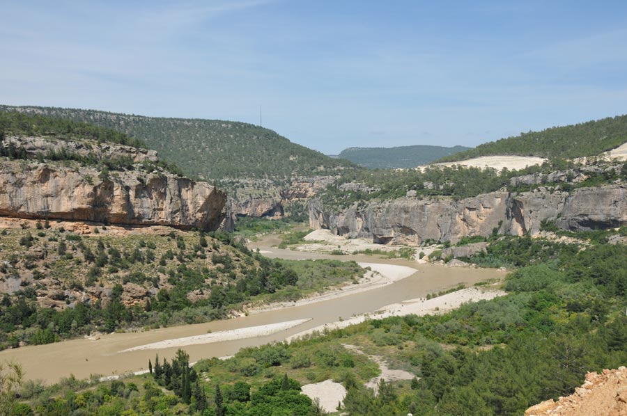
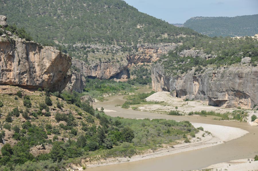
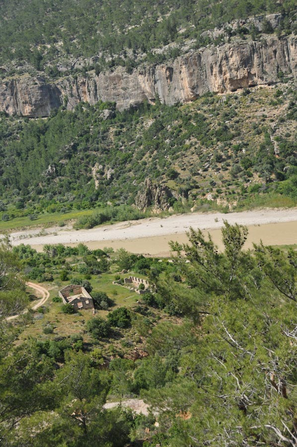 Thousands of years ago, the Gökoluk River (known today as the Göksu) carved a path for itself toward the Mediterranean Sea. In doing so, it began eroding channels through the mountain channels that, over the ensuing millennia, were utilized by early nomadic humans seeking to reach the Anatolian hinterland.
Initially, these were merely steep, rocky mountain trails; later, however, they became passable for riding and pack animals, thereby enabling the transport of goods from the coast into the interior.
In antiquity, this path was widened, thereby acquiring strategic importance for the armies marching in both directions from Anatolia or Syria on campaigns of conquest. The Cilician Gate thus emerged as a landmark of critical military-strategic significance.
Greek settlers, compelled to pass through this location during their migrations, named it *Kilikia Pylai* meaning, quite literally, the "Gates of Cilicia."
Later, the Crusaders adopted the term *Porta Judae* a name referencing the ultimate objective of their campaigns while the Arabs, advancing in the opposite direction, referred to the site as *Darb as-Salama*. In his work *Anabasis*, the historian and philosopher Xenophon describes the March of the Ten Thousand through Cilicia, and Alexander the Great marched directly from the Cilician Gates into the Battle of Issus.
 It was not until the era of Roman rule that the pass road was further expanded and renovated most notably by the Roman Emperor Caracalla, who was also responsible for the installation of milestones along the route.
Now designated as the *Via Tauri*, the significance of the Cilician Gates both as a Roman road and as a military route steadily increased. A great number of Roman-era milestones have been discovered, particularly at the presumed site of the ancient settlement of Podantos.
Saint Paul of Tarsus utilized the Cilician Gates to reach the Anatolian interior during his travels, while Emperor Barbarossa met his end here, perishing in the river's currents during his crusade to Jerusalem.
 When, in 1833, the Egyptian Viceroy Ibrahim Pasha went to war against the Ottoman rulers, he used the Cilician Gates to transport his cannons and field artillery into the Anatolian hinterland but only after having the existing paths widened and improved to allow passage for his pack camels.
When construction of the legendary Baghdad Railway began in the early 19th century, the Cilician Gates proved to be perhaps the greatest challenge for the predominantly German engineers who spearheaded the project's planning.
 Since the railway tracks could not simply follow the ancient trade routes, a series of viaducts and tunnels had to be constructed engineering feats that can still be admired today. If you wish to incorporate a train journey into your travel plans, consider riding at least a segment of this legendary railway which once stretched from Istanbul (Constantinople) to Baghdad by boarding at Karaman. Shortly after its opening in 1918, the railway as it wound its way through the Cilician Gates was once again utilized for military purposes to transport Ottoman troops to the front lines in Mesopotamia.
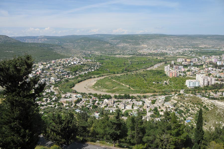
To this day, the Cilician Gates known in Turkey as *Gülek Boğazı* represent the most important link between the Mediterranean Sea and the Anatolian Plateau. Today, this landscape lies within the province of Mersin, and the southern entrance to the Cilician Gates begins approximately 44 kilometers north of Tarsus. The Turkish name derives from the formerly Armenian village of Gogulak (also known as Gugulak), which is situated right at the entrance to the pass.
Please also read:
Railways in the Ottoman Empire and in Turkey