")
")
")
Delme Aue and Hike to Grosse Höhe
- Written by Portal Editor

Delme Aue - Actually, the visit to Bremen should lead to a birthday celebration party within the normal range of cake and coffee, but it turned out quite differently.
The day before still a shopping course was planned, arriving at Bremen, the "program change" resulted in a hike, not only because initially timid erupting sun rays, a hike to the airfield Grosse Höhe and to Delme Aue, shortly called Adelheide was put into practise.
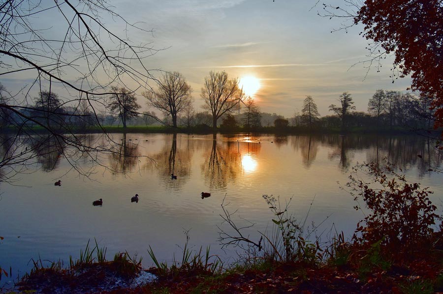
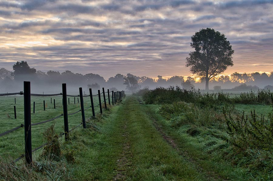 After a morning coffee, our interest in going shopping was blown away and so the decision quickly was done to drive through Delmenhorst towards Wildeshausen to take a long walk along the "Grosse Höhe" until the floodplain landscape of the Delme river. The Delme is a just 46 km-long watercourse south-west of Bremen, which springs in Twistringen, then crosses the city center underground and passing Harpstedt where it flows through the city of Delmenhorst. On the outskirts of Bremen the Delme leads into the Ochtum river, a left-hand tributary of the Weser river. At its flow path, the Delme river overcomes a height difference of almost 50 meters, so a strong flow rate arises for the basically flat region. The Delme Aue thus forms something like a frame around the area of Grosse Höhe, where an airfield for gliders is operated today.
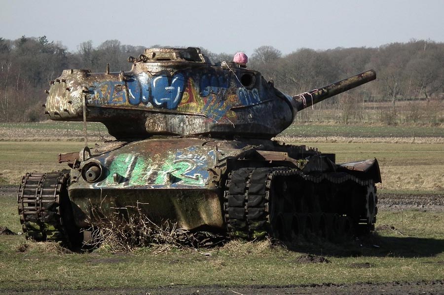
 What had happened: Within the general upgrading the NSDAP party in 1934 had set up a military training ground airfield in the South of the city Delmenhorst. Here on Grosse Höhe the party organization "NS Fliegerkorps" had organized a centre for training of pilots by gliders. As early as April of 1935, construction work began on the establishment of a military airfield. It emerged as the usual buildings, divided into administrative, flight operations and accommodation areas. Nine hangars constituted to be the largest buildings of the airport. Numerous accommodation blocks have been built too. The runway was not fixed, the flight operation was carried out on the turf. Directly adjacent to the southwest of the airfield, there was the training area "Grosse Höhe".
 Nearly on the top, an ammunition depot in bunkers has been set up, which now serves as nesting and breeding area for bats and birds.
The Bremen-based company "Weser Flugzeugbau" owned a factory airfield in Lemwerder, from were the dive bomber Junkers Ju 87 assembled at the airfield for final works. The Group Focke-Wulf, also based in Bremen, moved its prototypes to the airbase in June 1941 to deprive them from the growing threat by bombing. To deceive the enemy aerial reconnaissance a mock airfield has been created about six kilometers to the West at Uhlhorn.
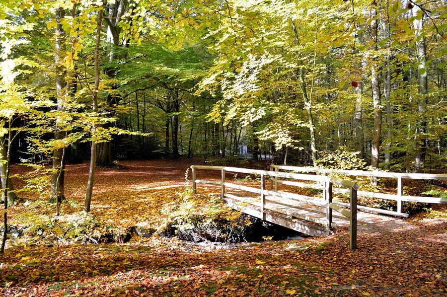
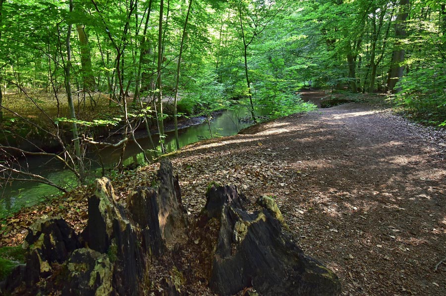 In the large area of the airfield, nature appears, part wise looking untouched. Trees that are broken or fallen by the storm are not taken away, decomposed on the forest floor, constitute obstacles to the stroller, which again creates new paths. Herein the reason probably is to see that this is to designate a majority of the routes with natural paths, which makes the region more attractive, just a worthwhile destination for a short hike on the outskirts of Delmenhorst and Bremen, which extended Wildeshausen nature park with species-rich mixed forests, alleys, fields crisscrossed with hedgerows and sand dunes waiting for the hikers. Juicy meadows with small villages and rivers such as the Hunte river that meander through the countryside. There are also ecologically valuable swamp lands.
 The countryside next to Hunte river between Wildeshausen and Oldenburg is one of the most beautiful and ecologically important areas at the Hunte. At Delme Aue you will discover the undulating ground relief again, which was created after the last ice age by dunes of sands carried by the winds and provides habitat for about 40 species of breeding birds. Sandpiper, Kingfisher and Sand Martin are the most striking, you can watch from a boat or the shore. Others, such as the gray wagtail and nightingale you can listen to. They live in forests and thickets shore. Hikers and walkers love the signposted "Huntepadd" and recommend a circular route connecting all aspects of this unique landscape with the historic center of Dötlingen.
Please read as well:
Snow across the country - Turkey experienced winter
Hike across the route E4 from Litichoro to Prionia
-
 Airfield Grosse Höhe & Delme River
Airfield Grosse Höhe & Delme River
Airfield Grosse Höhe & Delme River
-
Airfield Grosse Höhe & Delme River
Airfield Grosse Höhe & Delme River
-
Airfield Grosse Höhe & Delme River
Airfield Grosse Höhe & Delme River
-
Airfield Grosse Höhe & Delme River
Airfield Grosse Höhe & Delme River
-
Airfield Grosse Höhe & Delme River
Airfield Grosse Höhe & Delme River
-
Airfield Grosse Höhe & Delme River
Airfield Grosse Höhe & Delme River
-
Airfield Grosse Höhe & Delme River
Airfield Grosse Höhe & Delme River
-
Airfield Grosse Höhe & Delme River
Airfield Grosse Höhe & Delme River
-
Airfield Grosse Höhe & Delme River
Airfield Grosse Höhe & Delme River
-
Airfield Grosse Höhe & Delme River
Airfield Grosse Höhe & Delme River
-
Airfield Grosse Höhe & Delme River
Airfield Grosse Höhe & Delme River
-
Airfield Grosse Höhe & Delme River
Airfield Grosse Höhe & Delme River
-
Airfield Grosse Höhe & Delme River
Airfield Grosse Höhe & Delme River
-
Airfield Grosse Höhe & Delme River
Airfield Grosse Höhe & Delme River
-
Airfield Grosse Höhe & Delme River
Airfield Grosse Höhe & Delme River


https://www.alaturka.info/en/germany/lower-saxony/3148-hike-to-grosse-hoehe-and-delme-aue#sigProId349e29e8d5