Oricum – Ancient Ruins near Vlora
South of the modern Albanian port city of Vlora once lay a thriving ancient city called Oricum, which served as a vital harbour for the entire region of Illyria. It is a highly recommended destination for those interested in Greco-Roman cultural heritage while visiting the Vlora area.
Oricum was once the largest city in the region; located just 42 kilometres from Apollonia, it enjoyed a direct connection to the later Roman road network most notably the Via Egnatia.
Founding and Archaeological Discoveries at Oricum
 Some historical sources point to a mythical founding of Oricum by Greek settlers, said to have taken place as early as the 8th century BC. Other excavation findings suggest an even earlier origin, linked to the Euboeans a people who, as early as the 10th century BC, played a leading role in maritime trade and Greek colonization across the Mediterranean. However, the oldest artifacts discovered in Oricum to date protocorinthian pottery shards date back to the 6th century BC. Numerous other finds also indicate a connection to the island of Corfu. The Euboeans were the ancient inhabitants of the Greek island of Euboea, specifically from the powerful ancient city-states (poleis) of Chalcis and Eretria.
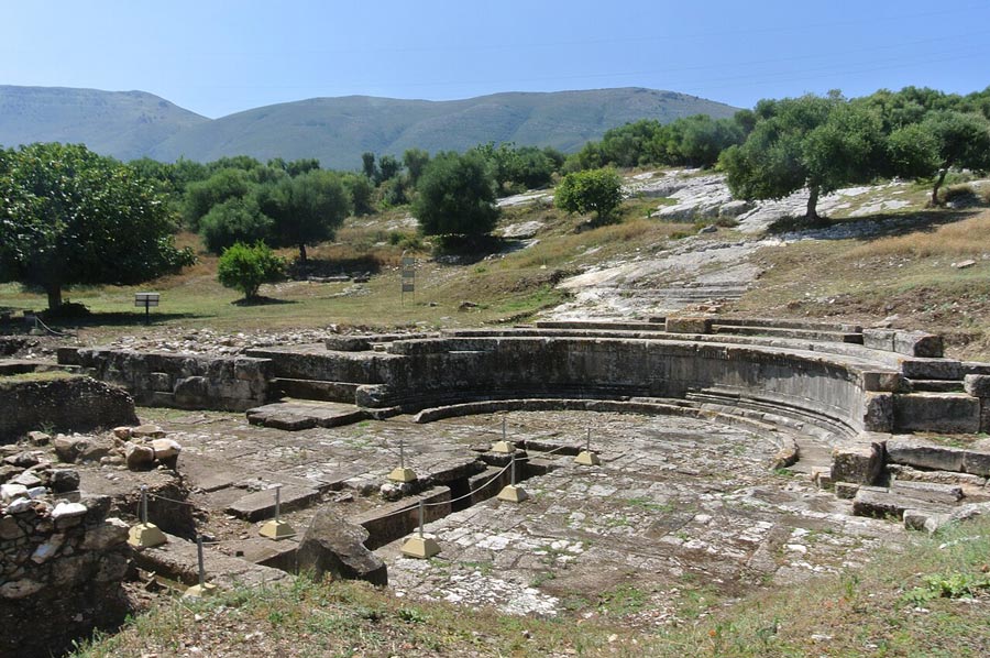
Photos 1 and Photo 2 from ElisabetaGramatiko - Eigene Werke, CC BY-SA 4.0,
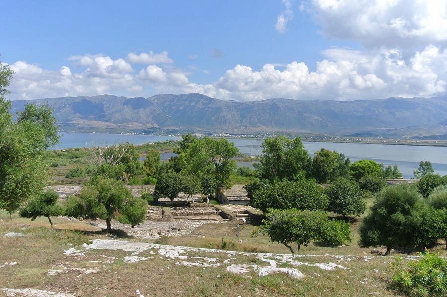
The earliest structures in Oricum were built on a 20-meter-high hill, situated on a narrow headland between the sea and a lagoon. The lagoon behind the city was also utilized as a harbor. At the city’s highest point stood a fortress or, more accurately, an acropolis covering an area of five hectares. Remains of the city fortifications and residential buildings have been preserved, among other features; there are also numerous stairways that provide access to the settlement mound from several sides.
The location of ancient Oricum was identified as early as the 19th century by various explorers from Western Europe. In 1926, the Italian archaeologist Luigi Ugolini who led excavations at Butrint and Phoinike visited the site. In 1958, a 1st-century theatre was discovered; however, excavations in 2013 led to the reinterpretation of this structure as a water-collection facility dating back to the 2nd century BC. Further west, on the slopes of the Karaburun Peninsula, a necropolis was discovered.
The archaeological sites are not always easily accessible to visitors, as they are located within the grounds of the Pashaliman military base.
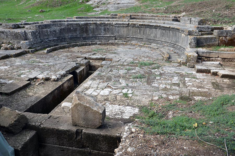 A monumental fountain (nymphaeum) previously mistaken for a theatre also served as a cistern with a diameter of 10 meters. As there were no nearby sources of drinking water, the city relied on collecting rainwater.
Photo 3 from Pasztilla aka Attila Terbócs - Own work
Below this lies a temple that has yet to be excavated, and at some distance stands an altar dedicated to Dionysus. A large portion of the city now lies underwater; from a helicopter, the outlines of buildings can be seen beneath the surface, indicating that the coastline in the area of the port of Oricum has gradually submerged into the sea.
Remains of walls have been discovered around the city, with evidence suggesting they were repaired during the Byzantine period.
Regarding the highest office in Oricum, local archaeologists believe it was held by either a prytanis or a strategos. The prytan is an institution of Epirote origin, while the title "strategos" points to the influence of nearby Corfu.
Oricum was repeatedly a significant theatre of war.
During the First Macedonian War, Philip V captured the city in 214 BC. In the Roman Civil War between Caesar and Pompey, Caesar occupied the city in 48 BC. The destruction caused during this and subsequent conflicts likely led to the gradual decline of Oricum. Because of its sheltered harbor at the southern end of the deep Bay of Vlora, the site remained a coveted military asset from antiquity well into the modern era.
In the Byzantine period, a small harbour called Ericho was located near the ancient city. During the Ottoman era, the harbour became known as Paşaliman ("Harbour of the Pasha"). Nearby stands the Church of Marmiroi, which dates back to the reign of the Byzantine Emperor Theodore I. The church features a small main chamber measuring 6 by 9 meters, as well as a dome with a diameter of approximately 3 meters, which rests upon four Roman arches. Fragments of typical Byzantine wall paintings can be found on the interior walls.
Please read as well:
Bochum – Headframe and Mining Museum
A Hike from the Goseck Circular Ditch Enclosure to the Manor Estate